All the Mountains, Peaks, Tops and Hills in The Cruachan and Glen Lochy Hills area of Scottish Region 3: Scottish Region 3: Loch Leven to Connel Bridge, Strath of Orchy and Glen Lochy on a Google Map
The Cruachan and Glen Lochy Hills area of Scottish Region 3: Loch Leven to Connel Bridge, Strath of Orchy and Glen Lochy region is the area enclosed by an imaginary line connecting:
- Loch Etive to Loch Tulla via Glen Kinglass, Loch Dochard & Abhainn Shira to Loch Tulla to the North
- Loch Tulla to Tyndrum via the A82 to the East
- Tyndrum to Taynuilt via the A85 through Glen Lochy, Dalmally, Loch Awe, The River Awe and The Pass of Brander to the South
- Taynuilt to Glen Kinglass via Loch Etive to the West
If you include all the Munros, the Corbetts, the Grahams, the Donalds, the Murdos, the Marilyns, the Bridgets (Hills), and all the Mountains, Tops, Peaks and Hills with a Trig Point on them there are 20 tops to climb, bag & conquer and the highest point is Ben Cruachan at 1,126m (3,696ft).
To see these Mountains, Peaks, Tops and Hills displayed in different ways - see the options in the left-hand column and towards the bottom of this page.
![]() Your Personal Bagging Record for The Cruachan and Glen Lochy Hills area of Scottish Region 3: Loch Leven to Connel Bridge, Strath of Orchy and Glen Lochy
Your Personal Bagging Record for The Cruachan and Glen Lochy Hills area of Scottish Region 3: Loch Leven to Connel Bridge, Strath of Orchy and Glen Lochy
LOG ON and RELOAD this page to show which Mountains, Peaks, Tops and Hills you have already climbed, bagged & conquered [. . . more details]
NB. If a Google Map does not appear below, or the icons do not respond, click here to refresh the page. If that doesn't work, try deleting your browser's cache.
View these 20 Mountains, Peaks, Tops and Hills:
- On a Downloadable PDF you can Print or Save to your Phone#
- On an Interactive Google Map (loads faster)
- On an Interactive Google Map with a list of tops below it.
(makes it easier to locate a particular top) - On a Detailed List in:
Alphabetical Order | Height Order - On one page with 'yet-to-be-bagged' listed 1st & then 'already-bagged' tops listed 2nd in:
Alphabetical Order | Height Order - On one page with 'already-bagged' tops listed 1st & then 'yet-to-be-bagged' tops listed 2nd in:
Alphabetical Order | Height Order
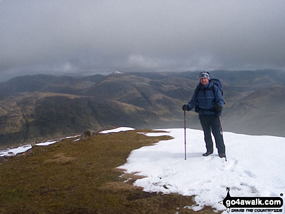 The summit of Ben Cruachan in Loch Leven to Connel Bridge, Strath of Orchy and Glen Lochy
Photo: Clint Trigg
Is there a Mountain, Peak, Top or Hill missing from the above google map or list?


