A Google Peak Bagging Map of The Pentland Hills area of Scottish Region 27: The Scottish Borders a fully detailed list
The Pentland Hills area of Scottish Region 27: The Scottish Borders region is the area enclosed by an imaginary line connecting:
- Glasgow to Musselburgh via the Forth and Clyde Canal and the Firth of Forth, Queensferry and Edinburgh to the North;
- Musselburgh to Blyth Bridge via the A701 and Leadburn to the South East
- Blyth Bridge to Larkhall via the A721, Elsrickle, Carnwrath and Carluke to the South;
- Larkhall to Glasgow via the River Clyde to the South West
If you include all the Munros, the Corbetts, the Grahams, the Donalds, the Murdos, the Marilyns, the Bridgets (Hills), and all the Mountains, Tops, Peaks and Hills with a Trig Point on them there are 10 tops to climb, bag & conquer and the highest point is Scald Law at 579m (1,900ft).
To see these Mountains, Peaks, Tops and Hills displayed in different ways - see the options in the left-hand column and towards the bottom of this page.
![]() Your Personal Bagging Record for The Pentland Hills area of Scottish Region 27: The Scottish Borders
Your Personal Bagging Record for The Pentland Hills area of Scottish Region 27: The Scottish Borders
LOG ON and RELOAD this page to show which Mountains, Peaks, Tops and Hills you have already climbed, bagged & conquered [. . . more details]
See this list in: Alphabetical Order
| Height Order‡
To reverse the order select the link again.
Mountain, Peak, Top or Hill:
Bagged

![]()
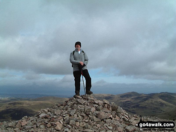
1. Scald Law
579m (1,900ft)
Scald Law is on interactive maps:
A downloadable go4awalk.com PDF Peak Bagging Map featuring Scald Law will be available soon. |

![]()
2. East Cairn Hill
567m (1,861ft)
East Cairn Hill is on interactive maps:
A downloadable go4awalk.com PDF Peak Bagging Map featuring East Cairn Hill will be available soon. |

![]()
3. West Cairn Hill
562m (1,844ft)
West Cairn Hill is on interactive maps:
A downloadable go4awalk.com PDF Peak Bagging Map featuring West Cairn Hill will be available soon. |
![]()
4. Mount Maw
536m (1,759ft)
Mount Maw is on interactive maps:
|
![]()
5. Black Mount
516m (1,694ft)
Black Mount is on interactive maps:
A downloadable go4awalk.com PDF Peak Bagging Map featuring Black Mount will be available soon. |
![]()
6. Black Hill (Pentland Hills)
501m (1,644ft)
Send it in and we'll publish it here.
Black Hill (Pentland Hills) is on interactive maps:
A downloadable go4awalk.com PDF Peak Bagging Map featuring Black Hill (Pentland Hills) will be available soon. |
![]()
7. Allermuir Hill
493m (1,618ft)
Allermuir Hill is on interactive maps:
A downloadable go4awalk.com PDF Peak Bagging Map featuring Allermuir Hill will be available soon. |
![]()
8. Mendick Hill
451m (1,480ft)
Mendick Hill is on interactive maps:
A downloadable go4awalk.com PDF Peak Bagging Map featuring Mendick Hill will be available soon. |
![]()
9. Cairnpapple Hill
312m (1,024ft)
Cairnpapple Hill is on interactive maps:
A downloadable go4awalk.com PDF Peak Bagging Map featuring Cairnpapple Hill will be available soon. |
![]()
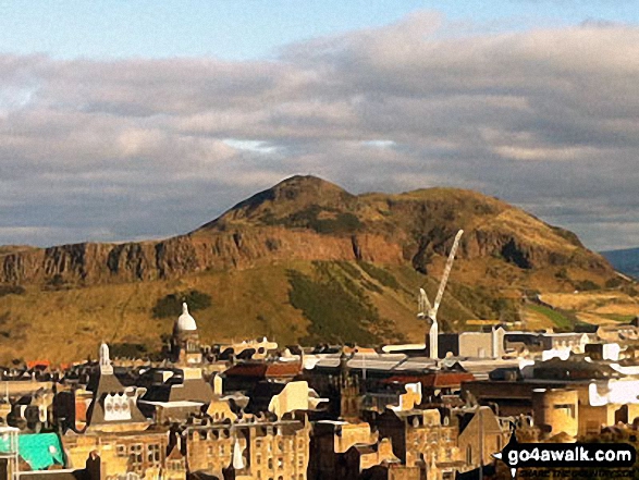
10. Arthur's Seat
251m (824ft)
Arthur's Seat is on interactive maps:
A downloadable go4awalk.com PDF Peak Bagging Map featuring Arthur's Seat will be available soon. |
View these 10 tops:
Is there a Mountain, Peak, Top or Hill missing from the above google map or list?
Let us know an we will add it to our database.

To contribute to go4awalk.com or to contact us about anything at all - see Talk To Us.
For help see Help.
go4awalk.com and go4awalk.co.uk are registered trademarks of TMDH Limited.
Copyright © 2000-2026 TMDH Limited. All rights reserved.
Copyright Terms & Conditions Privacy Statement
A - Z Walks Home Log On/Accounts Photo Gallery Walk Ideas and Collections Fell Facts Hill Skills Walking Questions and Answers Your Stories News Competitions Product Reviews/Gear Tests Walking Gear Guides Peaks and Mountains Peak Bagging Find New Walking Friends Camping GPS Waypoints for Walking Contents Walk Search Talk To Us go4awalk.com Help Free Example Walks Newsletter


