A fully detailed list of all the Mountains, Peaks, Tops and Hills in The Isle of Skye, Scottish Region 17: The Inner Hebrides (Western Isles) (Page 2 of 2)
If you include the Marilyns, the Bridgets (Hills), and all the Mountains, Tops, Peaks and Hills with a Trig Point on them there are 48 tops to climb, bag & conquer and the highest point is Sgurr Alasdair at 992m (3,256ft).
To see these Mountains, Peaks, Tops and Hills displayed in different ways - see the options in the left-hand column and towards the bottom of this page.
LOG ON and RELOAD this page to show which Mountains, Peaks, Tops and Hills you have already climbed, bagged & conquered [. . . more details]
Page 2 of 2 Go to page: 1 2 |
See this list in: Alphabetical Order
| Height Order‡
To reverse the order select the link again.
Mountain, Peak, Top or Hill:
Bagged
31. An Cruachan (Skye)
435m (1,428ft)
An Cruachan (Skye) is on interactive maps:
A downloadable go4awalk.com PDF Peak Bagging Map featuring An Cruachan (Skye) will be available soon. |
32. Beinn na Greine
417m (1,369ft)
Beinn na Greine is on interactive maps:
A downloadable go4awalk.com PDF Peak Bagging Map featuring Beinn na Greine will be available soon. |
33. Ben Tianavaig
413m (1,355ft)
Ben Tianavaig is on interactive maps:
A downloadable go4awalk.com PDF Peak Bagging Map featuring Ben Tianavaig will be available soon. |
34. Beinn Bhac-ghlais
408m (1,339ft)
Beinn Bhac-ghlais is on interactive maps:
A downloadable go4awalk.com PDF Peak Bagging Map featuring Beinn Bhac-ghlais will be available soon. |
35. Sithean Bhealaich Chumhaing
393m (1,289ft)
Send it in and we'll publish it here.
Sithean Bhealaich Chumhaing is on interactive maps:
A downloadable go4awalk.com PDF Peak Bagging Map featuring Sithean Bhealaich Chumhaing will be available soon. |
36. Biod Mor
384m (1,260ft)
Biod Mor is on interactive maps:
A downloadable go4awalk.com PDF Peak Bagging Map featuring Biod Mor will be available soon. |
37. Arnaval
369m (1,211ft)
Arnaval is on interactive maps:
A downloadable go4awalk.com PDF Peak Bagging Map featuring Arnaval will be available soon. |
38. Ben Meabost
346m (1,136ft)
Ben Meabost is on interactive maps:
A downloadable go4awalk.com PDF Peak Bagging Map featuring Ben Meabost will be available soon. |
39. Beinn Chreagach (Skye)
328m (1,076ft)
Send it in and we'll publish it here.
Beinn Chreagach (Skye) is on interactive maps:
A downloadable go4awalk.com PDF Peak Bagging Map featuring Beinn Chreagach (Skye) will be available soon. |
40. Beinn Bhreac (North Skye)
327m (1,073ft)
Send it in and we'll publish it here.
Beinn Bhreac (North Skye) is on interactive maps:
A downloadable go4awalk.com PDF Peak Bagging Map featuring Beinn Bhreac (North Skye) will be available soon. |
41. Biod an Athair
314m (1,030ft)
Biod an Athair is on interactive maps:
A downloadable go4awalk.com PDF Peak Bagging Map featuring Biod an Athair will be available soon. |
42. Beinn nan Carn
301m (988ft)
Beinn nan Carn is on interactive maps:
A downloadable go4awalk.com PDF Peak Bagging Map featuring Beinn nan Carn will be available soon. |
43. Sgorach Breac
299m (981ft)
Sgorach Breac is on interactive maps:
A downloadable go4awalk.com PDF Peak Bagging Map featuring Sgorach Breac will be available soon. |
44. Cruachan-Glen Vic Askill
296m (968ft)
Send it in and we'll publish it here.
Cruachan-Glen Vic Askill is on interactive maps:
A downloadable go4awalk.com PDF Peak Bagging Map featuring Cruachan-Glen Vic Askill will be available soon. |
45. Sgurr na h-Iolaire
292m (958ft)
Sgurr na h-Iolaire is on interactive maps:
A downloadable go4awalk.com PDF Peak Bagging Map featuring Sgurr na h-Iolaire will be available soon. |
46. Ben Geary
284m (932ft)
Ben Geary is on interactive maps:
A downloadable go4awalk.com PDF Peak Bagging Map featuring Ben Geary will be available soon. |
47. Meall a' Mhaoil
284m (932ft)
Meall a' Mhaoil is on interactive maps:
A downloadable go4awalk.com PDF Peak Bagging Map featuring Meall a' Mhaoil will be available soon. |
48. Sgurr nan Caorach
281m (923ft)
Sgurr nan Caorach is on interactive maps:
A downloadable go4awalk.com PDF Peak Bagging Map featuring Sgurr nan Caorach will be available soon. |
Page 2 of 2 Go to page: 1 2 |
View these 48 Mountains, Peaks, Tops and Hills:
- On an Interactive Google Map (loads faster)
- On an Interactive Google Map with a list of tops below it.
(makes it easier to locate a particular top) - On a Detailed List in:
Alphabetical Order | Height Order - On one page with 'yet-to-be-bagged' listed 1st & then 'already-bagged' tops listed 2nd in:
Alphabetical Order | Height Order - On one page with 'already-bagged' tops listed 1st & then 'yet-to-be-bagged' tops listed 2nd in:
Alphabetical Order | Height Order
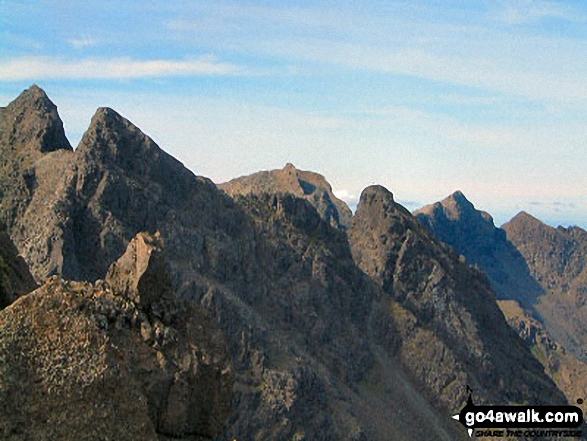
 Sgurr Alasdair in The Inner Hebrides (Western Isles)
Photo: Ronnie Clayes
Is there a Mountain, Peak, Top or Hill missing from the above google map or list?
Let us know an we will add it to our database.


