The Mountains, Peaks, Tops and Hills in The Mamores area of Scottish Region 4: Scottish Region 4: Fort William and Loch Linnhe to Loch Ericht with all the tops you are yet to climb first & then the ones you have already bagged second.
The Mamores area of Scottish Region 4: Fort William and Loch Linnhe to Loch Ericht region is the area enclosed by an imaginary line connecting:
- Fort William to Achriabhach via Glen Nevis to the North East
- Achriabhach to Corrour Station via Water of Nevis and Abhainn Rath to the North
- Corrour Station to Rannoch Station via the railway to the East
- Rannoch Station to Onich via Black Water, Loch Leven, Glencoe, North Ballachulish & Loch Linnhe to the South
- Onich to Fort William via Loch Linnhe to the West
If you include all the Munros, the Corbetts, the Grahams, the Donalds, the Murdos, the Marilyns, the Bridgets (Hills), and all the Mountains, Tops, Peaks and Hills with a Trig Point on them there are 24 tops to climb, bag & conquer and the highest point is Binnein Mor at 1,130m (3,709ft).
To see these Mountains, Peaks, Tops and Hills displayed in different ways - see the options in the left-hand column and towards the bottom of this page.
![]() Your Personal Bagging Record for The Mamores area of Scottish Region 4: Fort William and Loch Linnhe to Loch Ericht
Your Personal Bagging Record for The Mamores area of Scottish Region 4: Fort William and Loch Linnhe to Loch Ericht
LOG ON and RELOAD this page to show which Mountains, Peaks, Tops and Hills you have already climbed, bagged & conquered [. . . more details]
Scroll down this list of mountains, peaks, tops & hills below and tap/click on each name (in blue) to locate it on the map above.
See this list in: Alphabetical Order | Height Order‡
To reverse the order select the link again.
Top yet to be climbed, bagged & conquered:
Bagged

![]()
1. Binnein Mor
1130m (3709ft)
Munro, Murdo and Marilyn
See more details, photos, trip reports and easy-to-follow walks up Binnein Mor
![]()
2. Sgurr a' Mhaim
1099m (3607ft)
Munro, Murdo and Marilyn
See more details, photos, trip reports and easy-to-follow walks up Sgurr a' Mhaim

![]()
3. Na Gruagaichean
1056m (3466ft)
Munro and Murdo
See more details, photos, trip reports and easy-to-follow walks up Na Gruagaichean

![]()
4. Na Gruagaichean (North West Top)
1041m (3417ft)
Murdo
See more details, photos, trip reports and easy-to-follow walks up Na Gruagaichean (North West Top)
![]()
5. Am Bodach (Mamores)
1032m (3387ft)
Munro, Murdo and Marilyn
See more details, photos, trip reports and easy-to-follow walks up Am Bodach (Mamores)
![]()
6. Sgurr Eilde Mor
1010m (3315ft)
Munro, Murdo and Marilyn
See more details, photos, trip reports and easy-to-follow walks up Sgurr Eilde Mor
![]()
7. Sgor an Iubhair (Sgurr a' Mhaim)
1001m (3285ft)
Murdo
See more details, photos, trip reports and easy-to-follow walks up Sgor an Iubhair (Sgurr a' Mhaim)
![]()
8. Stob Ban (Mamores)
999m (3279ft)
Munro, Murdo and Marilyn
See more details, photos, trip reports and easy-to-follow walks up Stob Ban (Mamores)
![]()
9. Stob Choire a' Mhail (Sgurr a' Mhaim)
990m (3249ft)
Murdo
![]()
10. An Gearanach
982m (3223ft)
Munro, Murdo and Marilyn
See more details, photos, trip reports and easy-to-follow walks up An Gearanach
![]()
11. Stob Coire a' Chairn
982m (3223ft)
Munro and Murdo
See more details, photos, trip reports and easy-to-follow walks up Stob Coire a' Chairn
![]()
12. Sgor Eilde Beag (Binnein Mor)
956m (3138ft)
Murdo
See more details, photos, trip reports and easy-to-follow walks up Sgor Eilde Beag (Binnein Mor)
![]()
13. Binnein Beag
943m (3095ft)
Munro, Murdo and Marilyn
See more details, photos, trip reports and easy-to-follow walks up Binnein Beag
![]()
14. Mullach nan Coirean
939m (3082ft)
Munro and Murdo
See more details, photos, trip reports and easy-to-follow walks up Mullach nan Coirean
![]()
15. Mullach nan Coirean (South East Top)
917m (3010ft)
Murdo

![]()
16. Leum Uilleim
906m (2974ft)
Corbett and Marilyn
See more details, photos, trip reports and easy-to-follow walks up Leum Uilleim

![]()
17. Mam na Gualainn
796m (2612ft)
Corbett, Marilyn and Trig Point
See more details, photos, trip reports and easy-to-follow walks up Mam na Gualainn
![]()
18. Glas Bheinn (Mamores)
792m (2599ft)
Corbett and Marilyn
See more details, photos, trip reports and easy-to-follow walks up Glas Bheinn (Mamores)

![]()
19. Beinn na Cloiche
646m (2120ft)
Graham and Marilyn
See more details, photos, trip reports and easy-to-follow walks up Beinn na Cloiche
![]()
20. Tom Meadhoin
621m (2038ft)
Graham and Marilyn
See more details, photos, trip reports and easy-to-follow walks up Tom Meadhoin

![]()
21. Beinn na Gucaig
616m (2021ft)
Graham, Marilyn and Trig Point
See more details, photos, trip reports and easy-to-follow walks up Beinn na Gucaig

![]()
22. Doire Ban
566m (1858ft)
Marilyn
See more details, photos, trip reports and easy-to-follow walks up Doire Ban
![]()
23. Bidhein Bad na h-Iolaire
528m (1733ft)
Marilyn
See more details, photos, trip reports and easy-to-follow walks up Bidhein Bad na h-Iolaire

![]()
24. Druim na h-Earba
288m (945ft)
Marilyn and Trig Point
See more details, photos, trip reports and easy-to-follow walks up Druim na h-Earba
Mountain, Peak, Top or Hill already bagged:
Bagged
![]() Your Personal Bagging Record for The Mamores area of Scottish Region 4: Fort William and Loch Linnhe to Loch Ericht
Your Personal Bagging Record for The Mamores area of Scottish Region 4: Fort William and Loch Linnhe to Loch Ericht
LOG ON and RELOAD this page to show which Mountains, Peaks, Tops and Hills you have already climbed, bagged & conquered [. . . more details]
View these 24 Mountains, Peaks, Tops and Hills:
- On a Downloadable PDF you can Print or Save to your Phone#
- On an Interactive Google Map with a list of tops below it.
(makes it easier to locate a particular top) - On a Detailed List in:
Alphabetical Order | Height Order - On one page with 'yet-to-be-bagged' listed 1st
& then 'already-bagged' tops listed 2nd in:
Alphabetical Order | Height Order - On one page with 'already-bagged' tops listed 1st
& then 'yet-to-be-bagged' tops listed 2nd in:
Alphabetical Order | Height Order
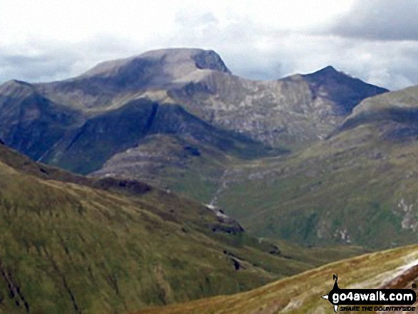 The view from Binnein Mor in Fort William and Loch Linnhe to Loch Ericht
Photo: John Dyason
Is there a Mountain, Peak, Top or Hill missing from the above google map or list?


