The Mountains, Peaks, Tops and Hills in Scottish Region 6: Scottish Region 6: The West Mounth - Blair Atholl to Braemar and Blairgowrie with all the tops you have already bagged first & then the ones you are yet to climb second.
Scottish Region 6: The West Mounth - Blair Atholl to Braemar and Blairgowrie region is the area enclosed by an imaginary line connecting:
- Kingussie to Kincraig via the A9 through Loch Insh to the North West
- Kincraig to Braemar via the River Feshie, Glen Geldie, Geldie Burn, the River Dee & Linn of Dee to the North East
- Braemar to Kinclaven via the A93, Spittal of Glen Shee, Glen Shee, Cray, Bridge of Cally, Blairgowrie and Rattray to the East
- Kinclaven to Dunkeld via the River Tay to the South;
- Dunkeld to Dalnacardoch Lodge via the A9 though Pitlochry, Killiecrankie & Blair Atholl to the South West
- Dalnacardoch Lodge to Kingussie via Edendon Water, Loch na t-Seilich, Glen Tromie and Drumguish to the West
If you count only the Grahams there is 1 top to climb, bag & conquer which is called Blath Bhalg at 641m (2,104ft).
To see these Mountain, Peak, Top or Hill displayed in different ways - see the options in the left-hand column and towards the bottom of this page.
![]() Your Personal Bagging Record for Scottish Region 6: The West Mounth - Blair Atholl to Braemar and Blairgowrie
Your Personal Bagging Record for Scottish Region 6: The West Mounth - Blair Atholl to Braemar and Blairgowrie
LOG ON and RELOAD this page to show which Mountains, Peaks, Tops and Hills you have already climbed, bagged & conquered [. . . more details]
Scroll down this list of mountains, peaks, tops & hills below and tap/click on each name (in blue) to locate it on the map above.
See this list in: Alphabetical Order‡ | Height Order
To reverse the order select the link again.
Mountain, Peak, Top or Hill already bagged:
Bagged
Top yet to be climbed, bagged & conquered:
Bagged

![]()
1. Blath Bhalg
641m (2104ft)
Graham
See more details, photos, trip reports and easy-to-follow walks up Blath Bhalg
![]() Your Personal Bagging Record for Scottish Region 6: The West Mounth - Blair Atholl to Braemar and Blairgowrie
Your Personal Bagging Record for Scottish Region 6: The West Mounth - Blair Atholl to Braemar and Blairgowrie
LOG ON and RELOAD this page to show which Mountains, Peaks, Tops and Hills you have already climbed, bagged & conquered [. . . more details]
View these 1 Mountain, Peak, Top or Hill:
- On an Interactive Google Map (loads faster)
- On an Interactive Google Map with a list of tops below it.
(makes it easier to locate a particular top) - On a Detailed List in:
Alphabetical Order | Height Order - On one page with 'yet-to-be-bagged' listed 1st & then 'already-bagged' tops listed 2nd in:
Alphabetical Order | Height Order - On one page with 'already-bagged' tops listed 1st & then 'yet-to-be-bagged' tops listed 2nd in:
Alphabetical Order | Height Order
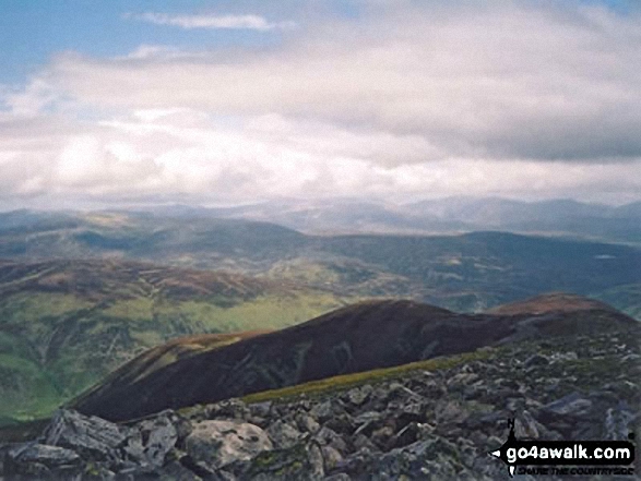 The view from Beinn a' Ghlo (Carn nan Gabhar) in The West Mounth - Blair Atholl to Braemar and Blairgowrie
Photo: Peter Swan
Is there a Mountain, Peak, Top or Hill missing from the above google map or list?


