The Mountains, Peaks, Tops and Hills in The Mamores area of Scottish Region 4: Scottish Region 4: Fort William and Loch Linnhe to Loch Ericht with all the tops you have already bagged first & then the ones you are yet to climb second.
The Mamores area of Scottish Region 4: Fort William and Loch Linnhe to Loch Ericht region is the area enclosed by an imaginary line connecting:
- Fort William to Achriabhach via Glen Nevis to the North East
- Achriabhach to Corrour Station via Water of Nevis and Abhainn Rath to the North
- Corrour Station to Rannoch Station via the railway to the East
- Rannoch Station to Onich via Black Water, Loch Leven, Glencoe, North Ballachulish & Loch Linnhe to the South
- Onich to Fort William via Loch Linnhe to the West
If you count only the Grahams there are 3 tops to climb, bag & conquer and the highest point is Beinn na Cloiche at 646m (2,120ft).
To see these Mountains, Peaks, Tops and Hills displayed in different ways - see the options in the left-hand column and towards the bottom of this page.
![]() Your Personal Bagging Record for The Mamores area of Scottish Region 4: Fort William and Loch Linnhe to Loch Ericht
Your Personal Bagging Record for The Mamores area of Scottish Region 4: Fort William and Loch Linnhe to Loch Ericht
LOG ON and RELOAD this page to show which Mountains, Peaks, Tops and Hills you have already climbed, bagged & conquered [. . . more details]
Scroll down this list of mountains, peaks, tops & hills below and tap/click on each name (in blue) to locate it on the map above.
See this list in: Alphabetical Order‡ | Height Order
To reverse the order select the link again.
Mountain, Peak, Top or Hill already bagged:
Bagged
Top yet to be climbed, bagged & conquered:
Bagged

![]()
1. Beinn na Cloiche
646m (2120ft)
Graham
See more details, photos, trip reports and easy-to-follow walks up Beinn na Cloiche
![]()
2. Beinn na Gucaig
616m (2021ft)
Graham
See more details, photos, trip reports and easy-to-follow walks up Beinn na Gucaig
![]()
3. Tom Meadhoin
621m (2038ft)
Graham
See more details, photos, trip reports and easy-to-follow walks up Tom Meadhoin
![]() Your Personal Bagging Record for The Mamores area of Scottish Region 4: Fort William and Loch Linnhe to Loch Ericht
Your Personal Bagging Record for The Mamores area of Scottish Region 4: Fort William and Loch Linnhe to Loch Ericht
LOG ON and RELOAD this page to show which Mountains, Peaks, Tops and Hills you have already climbed, bagged & conquered [. . . more details]
View these 3 Mountains, Peaks, Tops and Hills:
- On a Downloadable PDF you can Print or Save to your Phone#
- On an Interactive Google Map (loads faster)
- On an Interactive Google Map with a list of tops below it.
(makes it easier to locate a particular top) - On a Detailed List in:
Alphabetical Order | Height Order - On one page with 'yet-to-be-bagged' listed 1st & then 'already-bagged' tops listed 2nd in:
Alphabetical Order | Height Order - On one page with 'already-bagged' tops listed 1st & then 'yet-to-be-bagged' tops listed 2nd in:
Alphabetical Order | Height Order
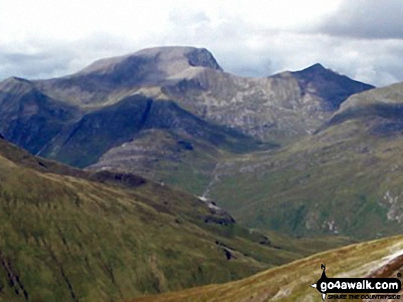 The view from Binnein Mor in Fort William and Loch Linnhe to Loch Ericht
Photo: John Dyason
Is there a Mountain, Peak, Top or Hill missing from the above google map or list?


