Scotland - a fully detailed list of all the Mountains, Peaks, Tops and Hills (Page 38 of 41)
If you count only the Marilyns there are 1218 tops to climb, bag & conquer and the highest point is Ben Nevis at 1,344m (4,411ft).
To see these Mountains, Peaks, Tops and Hills displayed in different ways - see the options in the left-hand column and towards the bottom of this page.
LOG ON and RELOAD this page to show which Mountains, Peaks, Tops and Hills you have already climbed, bagged & conquered [. . . more details]
Page 38 of 41 First Previous 31 32 33 34 35 36 37 38 39 40 Next Last |
See this list in: Alphabetical Order
| Height Order‡
To reverse the order select the link again.
Mountain, Peak, Top or Hill:
Bagged
1111. Largo Law
290m (952ft)
Largo Law is on interactive maps:
A downloadable go4awalk.com PDF Peak Bagging Map featuring Largo Law will be available soon. |
1112. Beinn Akie
288m (945ft)
Beinn Akie is on interactive maps:
A downloadable go4awalk.com PDF Peak Bagging Map featuring Beinn Akie will be available soon. |
1113. Druim na h-Earba
288m (945ft)
Druim na h-Earba is on interactive maps:
A downloadable go4awalk.com PDF Peak Bagging Map featuring Druim na h-Earba will be available soon. |
1114. Bainloch Hill
287m (942ft)
Bainloch Hill is on interactive maps:
A downloadable go4awalk.com PDF Peak Bagging Map featuring Bainloch Hill will be available soon. |
1115. Brown Carrick Hill
287m (942ft)
Brown Carrick Hill is on interactive maps:
A downloadable go4awalk.com PDF Peak Bagging Map featuring Brown Carrick Hill will be available soon. |
1116. Norman's Law
285m (935ft)
Norman's Law is on interactive maps:
A downloadable go4awalk.com PDF Peak Bagging Map featuring Norman's Law will be available soon. |
1117. Ben Geary
284m (932ft)
Ben Geary is on interactive maps:
A downloadable go4awalk.com PDF Peak Bagging Map featuring Ben Geary will be available soon. |
1118. Meall a' Mhaoil
284m (932ft)
Meall a' Mhaoil is on interactive maps:
A downloadable go4awalk.com PDF Peak Bagging Map featuring Meall a' Mhaoil will be available soon. |
1119. Saxa Vord
284m (932ft)
Saxa Vord is on interactive maps:
A downloadable go4awalk.com PDF Peak Bagging Map featuring Saxa Vord will be available soon. |
1120. Fitful Head
283m (929ft)
Fitful Head is on interactive maps:
A downloadable go4awalk.com PDF Peak Bagging Map featuring Fitful Head will be available soon. |
1121. Linton Hill
282m (926ft)
Linton Hill is on interactive maps:
A downloadable go4awalk.com PDF Peak Bagging Map featuring Linton Hill will be available soon. |
1122. Sgurr nan Caorach
281m (923ft)
Sgurr nan Caorach is on interactive maps:
A downloadable go4awalk.com PDF Peak Bagging Map featuring Sgurr nan Caorach will be available soon. |
1123. Li a Deas (South Lee)
281m (922ft)
Send it in and we'll publish it here.
Li a Deas (South Lee) is on interactive maps:
A downloadable go4awalk.com PDF Peak Bagging Map featuring Li a Deas (South Lee) will be available soon. |
1124. Roineabhal (Roinebhal) (Lewis)
281m (922ft)
Send it in and we'll publish it here.
Roineabhal (Roinebhal) (Lewis) is on interactive maps:
A downloadable go4awalk.com PDF Peak Bagging Map featuring Roineabhal (Roinebhal) (Lewis) will be available soon. |
1125. Scalla Field
281m (922ft)
Scalla Field is on interactive maps:
A downloadable go4awalk.com PDF Peak Bagging Map featuring Scalla Field will be available soon. |
1126. Greabhal
280m (919ft)
Greabhal is on interactive maps:
A downloadable go4awalk.com PDF Peak Bagging Map featuring Greabhal will be available soon. |
1127. Knock of Crieff
279m (915ft)
Knock of Crieff is on interactive maps:
A downloadable go4awalk.com PDF Peak Bagging Map featuring Knock of Crieff will be available soon. |
1128. Windy Hill (Isle of Bute)
278m (912ft)
Send it in and we'll publish it here.
Windy Hill (Isle of Bute) is on interactive maps:
A downloadable go4awalk.com PDF Peak Bagging Map featuring Windy Hill (Isle of Bute) will be available soon. |
1129. Hill of Garvock
277m (909ft)
Hill of Garvock is on interactive maps:
A downloadable go4awalk.com PDF Peak Bagging Map featuring Hill of Garvock will be available soon. |
1130. Beinn Ruigh Choinnich
276m (906ft)
Send it in and we'll publish it here.
Beinn Ruigh Choinnich is on interactive maps:
A downloadable go4awalk.com PDF Peak Bagging Map featuring Beinn Ruigh Choinnich will be available soon. |
1131. Mid Hill (Ward Hill)
275m (903ft)
Send it in and we'll publish it here.
Mid Hill (Ward Hill) is on interactive maps:
A downloadable go4awalk.com PDF Peak Bagging Map featuring Mid Hill (Ward Hill) will be available soon. |
1132. Tom nam Fitheach
275m (903ft)
Tom nam Fitheach is on interactive maps:
A downloadable go4awalk.com PDF Peak Bagging Map featuring Tom nam Fitheach will be available soon. |
1133. Carnan (Mingulay)
273m (896ft)
Carnan (Mingulay) is on interactive maps:
A downloadable go4awalk.com PDF Peak Bagging Map featuring Carnan (Mingulay) will be available soon. |
1134. Cnoc Mor
269m (883ft)
Cnoc Mor is on interactive maps:
A downloadable go4awalk.com PDF Peak Bagging Map featuring Cnoc Mor will be available soon. |
1135. Ben Raah (Beinn Ra)
267m (876ft)
Send it in and we'll publish it here.
Ben Raah (Beinn Ra) is on interactive maps:
A downloadable go4awalk.com PDF Peak Bagging Map featuring Ben Raah (Beinn Ra) will be available soon. |
1136. Brimmond Hill
266m (873ft)
Brimmond Hill is on interactive maps:
A downloadable go4awalk.com PDF Peak Bagging Map featuring Brimmond Hill will be available soon. |
1137. Beinn a' Bhaillidh
265m (870ft)
Beinn a' Bhaillidh is on interactive maps:
A downloadable go4awalk.com PDF Peak Bagging Map featuring Beinn a' Bhaillidh will be available soon. |
1138. Cnoc Reamhar
265m (870ft)
Cnoc Reamhar is on interactive maps:
A downloadable go4awalk.com PDF Peak Bagging Map featuring Cnoc Reamhar will be available soon. |
1139. Knockdolian
265m (870ft)
Knockdolian is on interactive maps:
A downloadable go4awalk.com PDF Peak Bagging Map featuring Knockdolian will be available soon. |
1140. Ardsheal Hill
263m (863ft)
Ardsheal Hill is on interactive maps:
A downloadable go4awalk.com PDF Peak Bagging Map featuring Ardsheal Hill will be available soon. |
Page 38 of 41 First Previous 31 32 33 34 35 36 37 38 39 40 Next Last |
View these 1218 Mountains, Peaks, Tops and Hills:
- On an Interactive Google Map (loads faster)
- On an Interactive Google Map with a list of tops below it.
(makes it easier to locate a particular top) - On a Detailed List in:
Alphabetical Order | Height Order - On one page with 'yet-to-be-bagged' listed 1st & then 'already-bagged' tops listed 2nd in:
Alphabetical Order | Height Order - On one page with 'already-bagged' tops listed 1st & then 'yet-to-be-bagged' tops listed 2nd in:
Alphabetical Order | Height Order
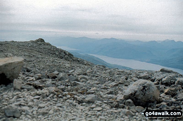
 The summit of Ben Nevis in Loch Leven to Connel Bridge, Strath of Orchy and Glen LochyScotland
Photo: John Reed
Is there a Mountain, Peak, Top or Hill missing from the above google map or list?
Let us know an we will add it to our database.


