Walk Photographs and views from British Walks published during 2011


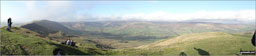
Cribyn and Pen y Fan in the snow from near Brecon


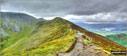
The path leading to Gordale Scar near Malham


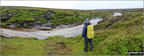
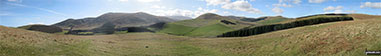
The path towards Malham Tarn below Great Close Scar

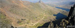
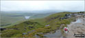
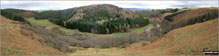
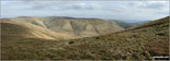
Watlowes Valley from Comb Hill

The limestone pavement on the top of Malham Cove

Malham Village from the top of Malham Cove


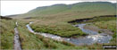
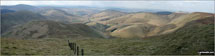
The River Wharfe near Grassington

The River Wharfe near Grassington

The River Wharfe Weir near Grassington


Having my picnic on a hazy day up The Roaches

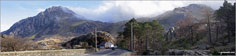
Walking towards Mam Tor on land slipped road

Kinder Scout and The Vale of Edale on the way up to Mam Tor summit

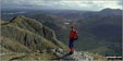
Hangliders off Lord's Seat (Rushup Edge) from Mam Tor


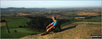
Hangliders soaring above Lord's Seat (Rushup Edge) viewed from Mam Tor

Castleton, Hope and The Hope Valley from the ridge between Mam Tor and Hollins Cross


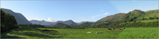
The Langdale Pikes (left), Rossett Pike (foreground left) and Esk Pike (right) from Esk Hause

Looking South along the Trotternish Ridge from near the Quiraing

The Prison taken from the base of the Needle at the Quiraing on Trotternish


The Memorial on the top of Coombe Hill

A Chiltern Gentian (I believe) on Coombe Hill

Entrance to the recently reopened Litton Tunnel on the Monsal Trail

In the recently reopened Litton Tunnel on the Monsal Trail

The other end of the recently reopened Litton Tunnel on the Monsal Trail

The recently reopened Litton Tunnel on the Monsal Trail

Jane, Holly, William and Gnasher Bishop on the top of Snowdon


Me and my pup Cocoa 'Mountain Dog' on top of Ben Nevis for the 1st time!!!

On the top of Sgurr nan Gillean in The Cuillin Hills

Near Angletarn Pikes with Ullswater and Place Fell in the background

Helping out with path repairs in the Lakes


My wife Mary and I on Winshield Crags - the highest point on Hadrian's Wall

Me on top of a fairly windy Grisedale Pike

On the summit of Ingleborough during last Yorkshire Three Peaks walk

On the shore of Innominate Tarn near Hay Stacks (Haystacks)

My son Harvey on top of the trig point on Holyhead Mountain


My wife Donna near the top of Mount Snowdon


Scafell re-visted. Me, my dog and my mates passing Styhead Tarn on the way up to Scafell Pike


Jenny and Brenda climbing out of Ennerdale via Loft Beck

Castle Drogo on the Teign Valley Estate

Me looking a bit bedraggled and windswept on Cow Hill overlooking Fort William


My daughter on top of Cat Bells (Catbells) with her daddy!


My husband and son on top of Worms Head/Penrhyn-Gwyr

Me and my daughter on Pen y Fan

Me taking a photo from Baggy Point


Doddington Church with the Bluebells in bloom


Doddington Church in the spring

Doddington Bridge in a poor state of repair

Doddington Bridge warning notice


Thakeham Halt Welcomes Walkers

Huge Anchor on a garden in Thakeham


Spurn Head is a Nature Reserve dogs are not allowed


The old lighthouse, Spurn Head

The old lighthouse, Spurn Head

The newer lighthouse, Spurn Head

The old and newer lighthouse, Spurn Head

Life Boat Station Jetty at the end of Spurn Head

The current lighthouse on Spurn Head


The Cairn at the top of Coire na Tulaich on Buachaille Etive M�r

Buachaille Etive Mor (Stob Dearg) summit cairn

Cairn on the top of Feadan Ban (Buachaille Etive Mor)

Cairn on the summit of Stob Na Doire (Buachaille Etive Mor)

Cairn on Stob Na Doire (Buachaille Etive Mor)

On Ullock Pike on the way up to Skiddaw


All on Pike of Blisco (Pike o' Blisco) in The Langdale Valley


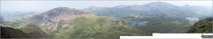
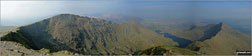
Glaslyn (bottom), Llyn Llydaw and Y Lliwedd (right) from the top of The PYG/Miners' Track, Snowdon

My son Aaron on the summit of Lad Law (Boulsworth Hill) during our first hike together

Mupe Rocks from near Lulworth Cove


Me, my Wife and Billy the dog after a 12k hike to the summit of Lose Hill (Ward's Piece)

On Ringing Roger (Kinder Scout) with the Edale Valley beyond

On Grindsbrook overlooking the Great Ridge

A beautiful October morning On Grindsbrook

My wife and Billy the dog on Grindslow Knoll (Kinder Scout)

My man and his dog on Grindslow Knoll (Kinder Scout)

Me and my wife on Grindslow Knoll (Kinder Scout)

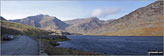
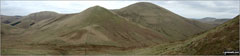
Whiteside (left), High Stile and Red Pike (Buttermere) (right) across the Vale of Lorton

Mellbreck across the Vale of Lorton

My husband on the summit of Snowdon

Fellbarrow and Low Fell (right) across the Vale of Lorton

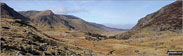
Descending in to the Grwyne Fawr Valley from Pen y Gadair Fawr in The Black Mountains

Me on Winhill Pike (Win Hill) with Ladybower Reservoir in the background

My husband just before tackling Sstriding Edge on Helvellyn


On the summit of Grisedale Pike

Tintagel Head from near Merlin Caves

Looking down on Bassenthwaite Lake

The Runaway Ramblers on top of Hay Stacks (Haystacks)

The Runaway Ramblers on Helvellyn

The Jubilee Walkers on top of Blackstone Edge above Littleborough

The Jubilee Walkers on top of Mam Tor

The Jubilee Walkers on Nicky Nook above Scorton

Me at the top of Cat Bells (Catbells)


My daughter enjoying the view near Aira Force

The Family Griffiths at Creswell Craggs

On Dumyat in the Ochils near Stirling

Me, Paul and Andy on top of Snowdon

My son and his little friend on Higher Slade in Torrs Park, Ilfracombe


My son and his cousin at a Longbarrow near Silbury Hill at dusk

Rob and Fraser on the 'Xmas Tree' Llech Ddu Spur, Carnedd Dafydd

Me and work mates atop Ben Lomond

Me at the top of Glastonbury Tor


My husband and me on Vicars Allotment, Skipton Moor


Great view from Cat Bells (Catbells)

Wonderful view over Derwent Water from Cat Bells (Catbells) and the walk across the top of the fell

Christmas Day on top of Helvellyn

My partner, Dave, doing his Shackleton impression on Mynydd Llangatwg


Chris on top of Kinder Low (Kinder Scout)

Sat up Corley Rocks near Corley Ash

My mate on top of Ivinghoe Beacon

This is my husband Dave on the top of Snowdon

This is my son Jack at the top of Robins Wood Hill, Robinswood Hill Country Park


Getting to the top of Glastonbury Tor

Overlooking Derwent Water to Cat Bells (Catbells) from near Walla Crag


Enjoying a snack after the climb to the top of Win Green (Wingreen)

Me, my fella and two of the kids at the top of Snowdon


Me and the children at the top of Hound Tor

Hubby by the Golden Jubilee beacon at the top of Robins Wood Hill, Robinswood Hill Country Park

The Elvy family on top of the tower at Dinefwr Castle in Dinefwr Park, Llandeilo

Standing right on the tip of Lands' End

Me on top of Roseberry Topping with Great Ayton and The Cleveland Hills in the background

Me on top of Roseberry Topping with Great Ayton and The Cleveland Hills in the background

On Mount Toubkal, The High Atlas Mountains, Morocco

Sunset along The River Otter near Honiton

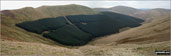
Rivington Reservoir from the path up Rivington Pike


Pool at the entrance to The Lydhurst Estate, Warninglid

Entrance to The Lydhurst Estate, Warninglid


Leith Hill and the North Downs from the top of Holmbury Hill

Looking South from the top of Holmbury Hill


Thatched Cottage in Hildersham

On Harcamlow Way (Roman Road) near Gunners Hall

Water Tower on Rivey Hill near Linton


The Crown Inn, Little Missenden

Lower Park House, Little Missenden

Shardeloes Lake, Little Missenden


Unusual Way Marker Post in Little Missenden

Jill Windmill (The Jack and Jill Windmills) above Clayton

Clayton and The South Downs from The Jack and Jill Windmills

Wolstonbury Hill from The Jack and Jill Windmills above Clayton

Signpost pointing to Hassocks near The Jack and Jill Windmills above Clayton

Jack and Jill Pub Sign, Clayton


Entrance to Clayton Church bedecked in flowers


Approaching The Jack and Jill Windmills above Clayton

Jack Windmill (of The Jack and Jill Windmills) above Clayton

Jill Windmill (of The Jack and Jill Windmills) above Clayton

Red Pike (Buttermere) summit from Lingcomb Edge with Pillar prominent across Ennerdale


Mellbreak, Crummock Water and Grasmoor from the summit of Red Pike (Buttermere)

Great End, Scafell Pike and Sca Fell from near the summit of Red Pike (Buttermere)


Elidir Fawr from Y Garn (Glyderau)

Mynydd Perfedd and Foel-goch from Y Garn (Glyderau)

Pen yr Ole Wen and Pen yr Helgi Du from Bwlch y Cywion

Y Garn (Glyderau) from Bwlch y Cywion

Y Garn (Glyderau) from Bwlch y Cywion

Glyder Fach and Y Garn (Glyderau) from Foel-goch summit

Elidir Fawr and Cwm Dudodyn from Foel-goch

Pen yr Ole Wen across Nant Ffrancon from Foel-goch

Llyn Ogwen and Tryfan from Foel-goch

Tryfan, Glyder Fach and Glyder Fawr from Foel-goch summit cairn


Carnedd y Filiast (Glyderau) summit


Elidir Fawr across Marchlyn Mawr Reservoir from Carnedd y Filiast (Glyderau) summit


Croesor Quarry from Rhosydd Quarry

Croesor Quarry from Rhosydd Quarry

One of the many huge chasms at Rhosydd Quarry

Moel-yr-hydd from Rhosydd Quarry

Cnicht and Rhosydd Quarry from Moel-yr-hydd

Moel-yr-hydd from Moelwyn Mawr (North Top)


Moelwyn Bach from Bwlch Stwlan

Craigysgafn and Moelwyn Mawr from Bwlch Stwlan

Craigysgafn and Moelwyn Mawr from Moelwyn Bach


Mynydd Drws-y-coed (The Nantlle Ridge) and Y Garn (Moel Hebog) (right) from Rhyd Ddu

Mynydd Mawr (Llyn Cwellyn), Craig y Bera and Moel Eilio (Llanberis) from Y Garn (Moel Hebog)


Mynydd Mawr (Llyn Cwellyn) above Craig y Bera from Y Garn (Moel Hebog)

Llyn Nantlle Uchaf, Dyffryn Nantlle and the shoulder of Mynydd Mawr from Y Garn (Moel Hebog)


The Nantlle Ridge - Mynydd Drws-y-coed (left) and Trum y Ddysgl from Y Garn (Moel Hebog) summit
Mynydd Drws-y-coed (The Nantlle Ridge) and Trum y Ddysgl from Y Garn (Moel Hebog)


Llyn Nantlle Uchaf through a gap in the crags on Mynydd Drws-y-coed

Trum y Ddysgl from Mynydd Drws-y-coed

Y Garn (Moel Hebog) & The Nantlle Ridge from Mynydd Drws-y-coed summit


Trum y Ddysgl & The Nantlle Ridge from Mynydd Drws-y-coed

Mynydd Mawr (Llyn Cwellyn) from Trum y Ddysgl - with Moel Eilio (Llanberis) (beyond right)


Moel Hebog, Moel Lefn and Moel yr Ogof from the top of Trum y Ddysgl

Moel Hebog, Moel Lefn and Moel yr Ogof from Trum y Ddysgl with Bwlch-y-Ddwy-elor bottom left

Craig Cwm Silyn and Mynydd Tal-y-mignedd

Mynydd Tal-y-mignedd summit obelisk

Trum y Ddysgl from Mynydd Tal-y-mignedd summit

Craig Cwm Silyn & Craig Pennant from Bwlch Dros-bern

Craig Pennant from Bwlch Dros-bern

Mynydd Tal-y-mignedd from Bwlch Dros-bern

Garnedd-goch summit trig point

On Bwlch Dros-bern between Mynydd Tal-y-mignedd and Craig Cwm Silyn

Mynydd Graig Goch and Llyn Cwm Dulyn from Garnedd-goch

The Craig Cwm Silyn summit ridge from Garnedd-goch

Moel Lefn towers over Blaen-pennant in Cwm Trwsg from the lower slopes of Craig Cwm Silyn

The ruins at Blaen-pennant in Cwm Trwsg

Path through Beddgelert Forest


Beddgelert & Nantgwynant from the lower slopes of Moel Hebog

Yr Aran & Nant Colwyn from Moel Hebog


Approaching the summit of Moel Hebog

Beddgelert from the summit of Moel Hebog during a brief break in the mist


Moel yr Ogof from Bwlch Meillionen

Nant Colwyn from the bwlch between Moel yr Ogof and Moel Lefn


Mount Snowdon through a gap in the mist from Garnedd Ugain (Crib y Ddysgl)


Kacey at Sgwd yr Eira - the four waterfalls walk


Moel Dyrnogydd from Crimea Pass (Bwlch y Gorddinan)

Allt-fawr (Moelwyns) and Iwerddon (Allt-fawr) from Crimea Pass (Bwlch y Gorddinan)

Allt-fawr (Moelwyns) from Iwerddon (Allt-fawr)

Iwerddon (Allt-fawr) and Llyn Iwerddon from Allt-fawr (Moelwyns)


Gloddfa Ganol Slate Mine and Blaenau Ffestiniog from Allt-fawr (Moelwyns)

Moel Druman and Llyn Conglog from Allt-fawr (Moelwyns)


Allt-fawr (Moelwyns) and Moel Druman from Ysgafell Wen summit cairn

Ysgafell Wen (North Top) summit cairn

Ysgafell Wen (North Top) and Llynnau'r Cwn from Ysgafell Wen (Far North Top)


Ruined farmhouse on Moel Fleiddiau

Afon Lledr below Moel Fleiddiau


Moel Penamnen and Moel Farlwyd from Moel Dyrnogydd


Slag heap towering over houses in Blaenau Ffestiniog

Gerreg Ddu (Trefeini) towering above the houses in Blaenau Ffestiniog

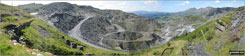
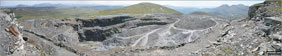
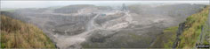
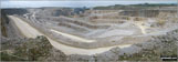
Maen-offeren Quarry, Blaenau Ffestiniog

Entrance to Maen-offeren Quarry, Blaenau Ffestiniog

Blaenau Ffestiniog from Maen-offeren Quarry

Climbing through Maen-offeren Quarry, Blaenau Ffestiniog

The Arenigs (Arenig Fawr & Arenig Fach) from Maen-offeren Quarry, Blaenau Ffestiniog

The path up through Maen-offeren Quarry, Blaenau Ffestiniog

In Maen-offeren Quarry, Blaenau Ffestiniog

Machinery in Maen-offeren Quarry, Blaenau Ffestiniog

Arenig Fawr and Arenig Fach from Maen-offeren Quarry, Blaenau Ffestiniog

Moelwyn Bach, Craigysgafn and Moelwyn Mawr from Maen-offeren Quarry, Blaenau Ffestiniog


Drum House at the top of a disused incline in Maen-offeren Quarry

Drum House at the top of a disused incline in Maen-offeren Quarry


On Moel Bowydd above the Drum House at the top of a disused incline in Maen-offeren Quarry

Moelwyn Bach, Craigysgafn and Moelwyn Mawr beyond the water leat on Moel Bowydd


Remains of the upper Drum House and incline on Moel Bowydd


Slate 'fence' near the upper Drum House and incline on Moel Bowydd

Moel Penamnen from Moel Bowydd


Carnedd Moel Siabod from Moel Penamnen


Manod Mawr (North Top), Manod Mawr and Manod Bach from Moel Penamnen


Y Ro Wen from Foel-fras (Moelwyns)

Manod Mawr (North Top) from Foel-fras (Moelwyns)

Manod Mawr (North Top) summit cairn


Manod Mawr beyond the huge Graig-ddu Slate Quarry from Manod Mawr (North Top)


Manod Mawr from Manod Bach summit cairn

Manod Bach's twin summit cairns

Moel-yr-hydd and Blaenau Ffestiniog from Nant Dwr-oer

The former Festiniog Mountain Railway Ticket Office, Blaenau Ffestiniog

Outside Blaenau Ffestiniog Tourist Information Centre

Harrison Stickle and Pike of Stickle (Pike o' Stickle) framed by cloud whilst ascending Green Gable


Craig Fach, Llyn Llydaw (top) and Glaslyn (bottom) from Snowdon (Yr Wyddfa)


Llyn Llydaw and Y Lliwedd from the summit of Snowdon (Yr Wyddfa)

Crib Goch, Craig Fach and The PYG Track from the summit of Mount Snowdon (Yr Wyddfa)

The Black Horse Inn at Climping Beach

Path Junction near Atherington

The River Arun from the Sliding Bridge at Littlehampton

The River Arun from the Sliding Bridge at Littlehampton

The famous 'Arun View' and The River Arun from the Sliding Bridge at Littlehampton

Littlehampton Harbour and The River Arun

Wreck deep in the mud in Littlehampton Harbour

Shipwreck in Littlehampton Harbour

The Lighthouse at the entrance to Littlehampton Harbour

The Entrance to Littlehampton Harbour


Groyne or Breakwater at Climping Beach

The River Wear south of Wolsingham

On The Weardale Way looking towards Elephant Trees


Wolsingham North Moor summit trig point

Track across Wolsingham North Moor

Looking south down Tunstall Reservoir

Looking North from Tunstall Reservoir dam


Path leading to the River Lune Viaduct


The North end of Grassholme Reservoir


View SW from Grassholme Bridge

View SE from Crossthwaite Common

Currick on Crossthwaite Common


Brick Barn detail at Burcote House


The River Severn from High Rock

Bridgnorth and The River Severn from High Rock


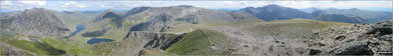
Llyn Clyd, Llyn Ogwen, Llyn Idwal and Tryfan from Y Garn (Glyderau)


Glyder Fach and Glyder Fawr from Y Garn (Glyderau)

Glyder Fawr from Y Garn (Glyderau)

Crib Goch and Garnedd Ugain from Y Garn (Glyderau)

Llyn Ogwen, Llyn Idwal and Tryfan from Y Garn (Glyderau)

Foel Goch (Snowdon), Moel Eilio and Llanberis from Y Garn (Glyderau)

Moel Eilio, Llyn Pardarn and Llanberis from Y Garn (Glyderau)

Pen yr Ole Wen and Llyn Ogwen from Y Garn (Glyderau)

Y Garn (Glyderau) summit cairn with Crib Goch and Garnedd Ugain in the distance


Elidir Fawr from Y Garn (Glyderau)

The Cloud (Bosley Cloud) from The Macclesfield Canal

Cooling my feet in a hill top pool on the summit of The Cloud (Bosley Cloud)

Croker Hill from The Cloud (Bosley Cloud)

Information Wheel on the summit of The Cloud (Bosley Cloud)

The Cheshire Plain from the summit of The Cloud (Bosley Cloud)

Jodrell Bank and The Cheshire Plain from the summit of The Cloud (Bosley Cloud)

Carl Side (left), Long Side, Longside Edge, Derwent Water and Dodd (Skiddaw) from Ullock Pike

Longside Edge, Long Side and Ullock Pike summit with Bassenthwaite Lake beyond from Carl Side

Derwent Water and The Newlands Fells from The White Stones on Carl Side


Descending Carl Side towards the White Stones with a fine view of Derwent water

Blencathra or Saddleback under a blanket of snow from Skiddaw

Frozen Fence on a snow covered Skiddaw

Approaching Kinder Plateau at Fairbrook Naze (Kinder Scout) via Fair Brook

The River Kinder flowing towards the waterfall at Kinder Downfall on the Kinder Scout Plateau

The River Kinder flowing through the peat hags on The Kinder Scout Plateau
Kinder Reservoir from The Pennine Way on The Kinder Scout Plateau near Kinder Downfall
The River Ashop in Ashop Clough with The Kinder Scout Plateau above


Mitchin Hole Cave, Bacon Hole and Deep Slade from Pwlldu Head

Looking down to The Bristol Channel from Pwlldu Head

Mitchin Hole Cave, Bacon Hole and Deep Slade with Penmaen rising in the distance from Pwlldu Head

The Bristol Channel from Pwlldu Head

The Bristol Channel from Pwlldu Head


Carnedd Moel Siabod from Dolwyddelan

Woodland by Afon Bwlch y Groes near Dolwyddelan

Carnedd Moel Siabod from the lower slopes of Drosgol (Bwlch y Groes)

Carnedd Moel Siabod from Afon Bwlch y Groes on the lower slopes of Drosgol (Bwlch y Groes)

Y Ro Wen from Afon Bwlch y Groes on the lower slopes of Drosgol (Bwlch y Groes)

Drosgol (Bwlch y Groes) from Bwlch y Groes

Afon Bwlch y Groes on the lower slopes of Drosgol (Bwlch y Groes)

Drosgol (Bwlch y Groes) summit

Snowdon (Yr Wyddfa) (in the left distance) and Carnedd Moel Siabod from Drosgol (Bwlch y Groes)


Footpath near Ty Mawr Wybrnant

Ty Mawr Wybrnant from the lower slopes of Foel Felen

Carnedd Moel Siabod towers above Dolweddelan from the lower slopes of Foel Felen


Temperature Inversion seen from on top of The Wrekin

Unusual cloud formation seen while doing The Three Peaks in May

Andy and Roman at Pen-y-Pass before our expedition up Mount Snowdon

The Llanberis Valley from the PYG Track, Mount Snowdon

On the PYG Track climbing Mount Snowdon

Climbing the PYG Track up Mount Snowdon

Looking back to Pen-y-Pass from the PYG Track up Mount Snowdon

Mount Snowdon (left in distance) and Crib Goch from Craig Fach

Roman standing in the summit of Craig Fach with Glyder Fawr forming the horizon

Andy and Nell negotiating a tricky section of the PYG Track up Mount Snowdon. Tess waits her turn.


We made it! Sara and Tess on the summit of Snowdon


Fantastic view from Clogwyn Station on the Llanberis Path down Snowdon


Nearing Llanberis on the Lanberis Path down Mount Snowdon

Cauldcleuch Head (left) and Muckle Land Knowe (right) from Millstone Edge (Tudhope Hill)


Looking North from just below Fire Beacon Point


The River Valency approaching Boscastle


Pen y Benar above Afon Lledr, Dolwyddelan


Afon Cwm Penamnen near Dolwyddelan

Carreg Alltrem above Afon Cwm Penamnen near Dolwyddelan


Y Ro Wen under a blanket of cloud above Gwyndy-newydd near Dolwyddelan

Ty'n-y-cwm in Cwm Penamnen near Dolwyddelan

Ty'n-y-cwm in Cwm Penamnen from Pen y Bryn-melyn

Autumn colours in Cwm Penamnen

The lower slopes of Moel Penamnen from Cwm Penamnen

Clogwyn yr Hicia from Cwm Penamnen


West Haddon with the Daffodils in Bloom

Small Lake in the conversation area near Foxhill Farm, West Haddon

The Railway Line near Watford (of Watford Gap Services fame)

Watford Church (of Watford Gap Services fame)

The Jurassic Way passing under the railway near Watford (of Watford Gap Services fame)


Fairlands Valley Park, Stevenage

Ducks in Fairlands Valley Park, Stevenage

The Lake in Fairlands Valley Park, Stevenage

Woodland in Fairlands Valley Park, Stevenage

Fairlands Valley Park, Stevenage


The St Cuthbert's Way heading up on to Wooler Common near Waud House, Wooler

Waud House on The St Cuthbert's Way above Wooler

Waud House on The St Cuthbert's Way with Wooler beyond from Kenterdale Hill

The St Cuthbert's Way entering Woodland on Kenterdale Hill


The Carey Burn Valley from near Switcher Wood

Descending into The Carey Burn Valley with Langlee Crags opposite from near Switcher Wood

Careyburn Bridge across Carey Burn


Carey Burn from Careyburn Bridge

Harthope Burn near Careyburn Bridge

Harthope Burn near Careyburn Bridge

The Carey Burn Valley from The High Level Route above Colgate Water through Happy Valley

Happy Valley from The High Level Route above Colgate Water
Happy Valley from The High Level Route above Colgate Water

Happy Valley from The High Level Route above Colgate Water

Some inquisitive locals in North Middleton

The substantial footbridge over Coldgate Water at Colgate Mill

Coldgate Water at Colgate Mill

Coldgate Water Ford at Colgate Mill

Wooler Water near Earle Mill, Wooler


Tower Hill Information Plaque, Wooler


St. Ninian's Catholic Church, Wooler

The Car Park Charges board at Pen y Pass

The Pyg Track Information Board


The Pyg Track on the way up Mount Snowdon

The Pyg Track route up Mount Snowdon from Pen-y-Pass

Walking The Pyg Track route up Mount Snowdon from Pen-y-Pass

The Pyg Track - so far so good!

Up, up and up The Pyg Track heading for Snowdon

Nearing the summit of Mount Snowdon

Near the summit of Mount Snowdon

Coldwall Bridge, near Thorpe, Dove Dale

Bunster Hill from near Coldwall Bridge, Thorpe, Dove Dale

Weir on The Lower River Dove near Coldwall Bridge, Thorpe, Dove Dale


The Lower River Dove from Ilam Bridge, Ilam, Dove Dale


The St Cuthbert's Way near Kirk Yetholm

Staerough Hill from The St Cuthbert's Way near Kirk Yetholm

Waun-oer and Cadair Idris (in the background on the right) from Cribin Fawr

Long Side Edge, Skiddaw and Little Dodd (Skiddaw) from Hursthole Point, Bassenthwaite Lake

Long Side Edge, Skiddaw and Little Dodd (Skiddaw) from Hursthole Point, Bassenthwaite Lake


Hare Law, Coldburn Hill, College Valley, Blackhaggs Rigg, Black Hag and Sinkside Hill from Hethpool


Newton Tors and Hare Law towering above Hethpool from White Hill (Hethpool)

Easter Tor from White Hill (Hethpool)

Great Hetha from White Hill (Hethpool)

Newton Tors, Hare Law and Hethpool from East Laddie's Knowe


Great Hetha from East Laddie's Knowe

Easter Tor, Newton Tors and Hare Law from Black Bog (Haddon Hill)

Easter Tor, Newton Tors and Hare Law from the footbridge over Black Bog (Haddon Hill)


Easter Tor, Newton Tors and Hare Law with Elsdonburn Farm in the valley below from Ring Chesters

A couple of abandoned cars behind the sheepfold below Ring Chesters

Eccles Cairn with Coldsmouth Hill in the background

The Pennine Way on the English/Scottish Border near Eccles Cairn

Eccles Cairn and Coldsmouth Hill from Maddie's Well

Trowupburn Farm with Madam Law beyond

College Burn in College Valley

College Burn in College Valley

The view from Raw Head (Rawhead)

The view from Raw Head (Rawhead)


Detail on Raw Head (Rawhead) Trig Point

Beeston Castle from fields near Wharton's Lock on The Shropshire Union Canal

Wharton's Lock on The Shropshire Union Canal

Wharton's Lock on The Shropshire Union Canal with Beeston Castle in the background

The Shropshire Union Canal from Wharton's Lock

The entrance to Beeston Castle

Beeston Castle from near Peckforton Woods


The Peckforton Hills from Peckforton Woods

Durham Edge (Abney Moor) from Burton Bole End (Abney Moor)

Grouse shooting butt on Burton Bole End (Abney Moor)

Kinder Scout, Mam Tor and Lose Hill (Ward's Piece) from Burton Bole End (Abney Moor)

Shatton Moor from Burton Bole End (Abney Moor)

Llyn Celyn from the lower slopes of Arenig Fawr near Pant-yr-Hedydd

Arenig Fawr from near Pant-yr-Hedydd

Arenig Fawr above Llyn Arenig Fawr


Llyn Arenig Fawr Dam outflow with Arenig Fawr (Moel Yr Eglwys) itself in the background

Llyn Arenig Fawr from the upper slopes of Arenig Fawr (Moel Yr Eglwys)

On the upper Arenig Fawr (Moel Yr Eglwys) ridge

Finally approaching the Arenig Fawr (Moel Yr Eglwys) summit

Memorial on Arenig Fawr (Moel Yr Eglwys) summit

Arenig Fawr (Moel Yr Eglwys) summit

Arenig Fawr (South Top) from Arenig Fawr

Arenig Fawr (South Top) summit cairn with Moel Llyfnant beyond

Moel Llyfnant summit cairn with Arenig Fach in the distance


Arenig Fach from a rusting fence roll on the lower slopes of Moel Llyfnant

Ruin on the lower slopes of Moel Llyfnant

Foel Boeth (Arenigs) summit cairn


Bwlch y Bi summit with Arenig Fach in the distance

Heading back to the car along a former railway line across Dol Benlas

Arenig Fawr and Arenig Fawr (South Top) from the bridge over Afon Amnodd-bwll

Moel Llyfnant from the bridge over Afon Amnodd-bwll


Bradwell from Durham Edge (Abney Moor)

Durham Edge (Abney Moor) summit trig point

Crossing Bretton Brook on Abney Moor

Spring Flowers on Abney Moor above Great Hucklow

Former pumping station for Bretton Brook above Great Hucklow


Moel y Parc from The Offa's Dyke Path near Bodfari

On The Offa's Dyke Path near Bodfari

The Offa's Dyke Path waymark above Bodfari

Moel y Parc from The Offa's Dyke Path on the summit of Cefn Du

The Offa's Dyke Path on Moel Maenefa


Caerwys Animal Pound Information Plaque


Moel y Parc from near Maes-mynan Hall

Sand pit/lake near Maes-mynan Hall


High Neb (Stanage Edge) summit trig point

Looking South West along Stanage Edge from High Neb (Stanage Edge)

Looking North along Stanage Edge from High Neb (Stanage Edge)

On Stanage Edge near High Neb (Stanage Edge)

High Neb (Stanage Edge) from Moscar Moor

Stanage Edge (Stanage Edge) from Moscar Moor

Bamford Edge, Bamford Moor with Stanage Edge (Stanage Edge) in the distance

Bamford Edge on Bamford Moor with Lose Hill (Ward's Piece) prominent beyond


South along Bamford Edge, Bamford Moor

Winhill Pike (Win Hill) and Bamford Edge from the lower slopes of Bamford Moor

Stanage Edge (Stanage Edge) and Hathersage from the lower slopes of Bamford Moor


Bristly Ridge and Glyder Fach from Llyn Ogwen
Tryfan, Bwlch Tryfan, Bristly Ridge and Glyder Fach from Llyn Ogwen

Y Garn (Glyderau) from Llyn Ogwen

Foel-goch (Glyderau) and Mynydd Perfedd from Llyn Ogwen

Y Garn (Glyderau) (far left), Foel-goch (Glyderau) and Carnedd y Filliast from Llyn Idwal

Ogwen Cottage, Nant Ffrancon and the shoulder of Pen yr Ole Wen from Llyn Idwal

Tarras Water from near Tarras Lodge

Tarras Water from near Arkleton Cottage


Rocks on the ridge between Arkleton Hill and Linns Knowe

Beacon North East of Arkleton Hill

Pike Fell summit with Roan Fell in the distance

Gate and pool near the summit of Pike Fell


Roan Fell from Pike Fell summit

Scawd Bank from near Pike Fell summit

The bealach at Ludsgill Sware between Pike Fell and Scawd Bank

Watch Hill from Byrecleuch Burn

Watch Knowe and Scawd Bank from the circular sheepfold beside Byrecleuch Burn at Hawknest Rig

Byrecleuch Burn near Lodgegill Farm

On the summit of Ivinghoe Beacon - one end of The Ridgeway

The Ridgeway and The Ivinghoe Hills from Ivinghoe Beacon

Ivinghoe Beacon from The Ridgeway on Steps Hill

Incombe Hole and The Chiltern Hills from The Ridgeway on Steps Hill


Canadian Geese on the shore of The Mere, Ellesmere

Canadian Geese on the shore of The Mere, Ellesmere

Ellesmere from across The Mere


The Shropshire countryside from near Ellesmere Point

The Shropshire countryside from near Ellesmere Point

The Shropshire countryside near Ellesmere Point


The Shropshire Countryside near Lea Wood


The Somerset countryside from Hadborough Plantation


The enclosed sunken track between Haddon Farm and Bury

The enclosed sunken track between Haddon Farm and Bury


The River Haddeo in Hartford Bottom

Fence sculpture at Hartford Lodge


Danger Sign on the edge of Hindlow Quarry


The High Peak Trail near Hurdlow (Sparklow)

Hurdlow (Sparklow) station on The High Peak Trail

Methodist Chapel, Earl Sterndale


The Offa's Dyke Path sign at Bwlch Penbarras
Looking South West towards Snowdonia from The Offa's Dyke Path at Bwlch Penbarras
The shoulder of Foel Fenlli and a distant Snowdonia from The Offa's Dyke Path above Bwlch Penbarras

Moel Famau from The Offa's Dyke Path above Bwlch Penbarras

The Offa's Dyke Path approaching the summit of Moel Famau

Foel Fenlli and Bwlch Penbarras from The Offa's Dyke Path on the summit of Moel Famau

Moel Dywyll, Moel Llys, Moel Arthur and The Offa's Dyke Path from the summit of Moel Famau

Moel Famau summit trig point, Jubilee Tower and The Offa's Dyke Path

Jubilee Tower and The Offa's Dyke Path on the summit of Moel Famau

Foel Fenlli from The Offa's Dyke Path on the summit of Moel Famau

Moel Dywyll from The Offa's Dyke Path North of Moel Famau

The larger beacon or cairn on the summit of Moel Dywyll on The Offa's Dyke Path

The smaller beacon or cairn on the summit of Moel Dywyll on The Offa's Dyke Path

Moel Famau (centre) from the twin summit cairns on Moel Dywyll on The Offa's Dyke Path
Moel Arthur from the summit of Moel Llys-y-coed on The Offa's Dyke Path

Garth the summit of Moel Llys-y-coed on The Offa's Dyke Path

Moel Llys-y-coed summit with Moel Arthur beyond just off The Offa's Dyke Path

Tractor at Bwlch Arthur on The Offa's Dyke Path


Irrigation Channel near Plas Newydd Farm


Dyserth Waterfall (Rhaeadr Dyserth)

Restored machinery on the North Wales Path near Dyserth

Stream above Dyserth Waterfall (Rhaeadr Dyserth) from the North Wales Path, Dyserth

Marian Ffrith from near Grove Mill Cottage, Dyserth

Prestatyn from The Offa's Dyke Path above Crag y Fran, Prestatyn

Prestatyn from The Offa's Dyke Path above Crag y Fran, Prestatyn

The sun breaks through the clouds from The Offa's Dyke Path above Crag y Fran, Prestatyn

The sun breaks through the clouds from The Offa's Dyke Path above Crag y Fran, Prestatyn

Prestatyn from The Offa's Dyke Path above Crag y Fran, Prestatyn

Prestatyn from The Offa's Dyke Path above Crag y Fran, Prestatyn

The Offa's Dyke Path waypoint, Prestatyn

The end (or start) of The Offa's Dyke Path, Ffrith Beach, Prestatyn

The end (or start) of The Offa's Dyke Path, Ffrith Beach, Prestatyn

The end (or start) of The Offa's Dyke Path, Ffrith Beach, Prestatyn

Ffrith Beach, Prestatyn at the end (or start) of The Offa's Dyke Path

The Sett Valley Trail near Hayfield

Lantern Pike from The Sett Valley Trail near Hayfield

The River Sett under a blanket of Water Lilies beside The Sett Valley Trail near Hayfield

The Pennine Bridleway at the start of the climb up Lantern Pike

On The Pennine Bridleway heading for Lantern Pike


The Pennine Bridleway on Lantern Pike


Lantern Pike summit with Mill Hill (Ashop Head), Kinder Scout and Chinley Churn and Hayfield beyond

Cown Edge Rocks from near Rowarth


Farmland near Rowarth with Kinder Scout in the background

Public Footpath No 55 sign near Rowarth

Kinder Scout from Cown Edge Rocks


Footbridge over Hollingwood Clough


Dod Hill (Teviothead) and Linhope Burn from Linhope Farm on the A7 between Carlisle and Hawick


Comb Hill (Langhope Height) and The Mosspaul Hotel from the lower slopes of Lightning Hill


Millstone Edge (Tudhope Hill) and Tudhope Hill from Lightning Hill

Skelfhill Pen from Lightning Hill

Lightning Hill from Wether Law (Teviothead)

Skelfhill Pen and Crummiecleuch Rig from Wether Law (Teviothead)

Tudhope Hill from Millstone Edge (Tudhope Hill)

Skelfhill Pen from Crummiecleuch Rig

Millstone Edge (Tudhope Hill) summit

Tudhope Hill from Millstone Edge (Tudhope Hill)
Cauldcleuch Head, Muckle Land Knowe and Crossbow Hill from Millstone Edge (Tudhope Hill)

Tudhope Hill summit trig point

Tudhope Hill from Little Tudhope Hill


Carlin Tooth (Teviothead) and Wisp Hill from Little Tudhope Hill summit

Linhope Farm, Linhope Burn and Lightning Hill from Little Tudhope Hill

Carlin Tooth (Teviothead), Ellson Fell (behind) and Sunhope Hass (below) from Little Tudhope Hill


Lightning Hill and Linhope Burn from Sunhope Hass


Climbing Carlin Tooth (Teviothead) from Sunhope Hass

Little Tudhope Hill and the shoulder of Tudhope Hill from Sunhope Hass
Ellson Fell and Castlewink from Bye Hill summit with Wisp Hill in the distance

Ellson Fell and Castlewink from Bye Hill summit

Bye Hill and Carlin Tooth (Teviothead) from Dod Hill (Teviothead) summit

Little Tudhope Hill , Tudhope Hill and Sunhope Hass from Dod Hill (Teviothead)

Ellson Fell and Castlewink from Dod Hill (Teviothead)

Linhope Farm from Dod Hill (Teviothead)

Lightning Hill from Linhope Burn

Lane leading to Linmere Visitor Centre

Locked! Barrier on the track leading to Eddisbury Hill Fort from Linmere Visitor Centre

Eddisbury Hill Fort Outer Ditch

The Cheshire Plain from Eddisbury Hill Fort

Eddisbury Hill Fort Excavations

Eddisbury Hill Fort Excavations

Eddisbury Hill Fort Excavations

Eddisbury Hill Fort Excavations

Communications Mast on the top of Hangingstone Hill (Eddisbury Hill)

Hangingstone Hill (Eddisbury Hill) trig point (and concrete water tower)

On Hangingstone Hill (Eddisbury Hill)

Sculpture and standing stones on the summit of Hangingstone Hill (Eddisbury Hill)

Scuplture on the summit of Hangingstone Hill (Eddisbury Hill)

Sculpture and standing stone on the summit of Hangingstone Hill (Eddisbury Hill)

Blakemere Moss, Delamere Forest

Blakemere Moss, Delamere Forest

Blakemere Moss, Delamere Forest

Blakemere Moss, Delamere Forest

Billinge Hill summit trig point


Walking through Woodland below Cadair Ifan Goch


Woodland in Ainsdale Nature Reserve

The Fisherman's Path through Ainsdale Nature Reserve


Footoath through the dunes on Ainsdale Sands


Ullswater in all its autumn glory from the Ullswater Steamer

Ullswater, Place Fell (right - distance) and Hartsop Dodd (right - mid-distance) from Caudale Head

The Ullswater Water Steamer docked at Glenridding with Place Fell in the background

The Railway Line near Holford Moss

The Cheshire Countryside near Holford Hall

The Cheshire Countryside near Holford Hall


The Cheshire Countryside near Holford Hall

The Cheshire Countryside near Royd Wood

The River Bollin near Coppice Farm

The River Bollin near Coppice Farm

M56 Motorway near Ryecroft Farm

Cheshire Country Lane near Royd Wood, Plumley

The River Bollin near Ross Mill

The River Bollin near Ross Mill

Cheshire Lane near Higherhouse Farm


Small lake on Siddington Heath

Cheshire Countryside near Capesthorne Hall

To contribute to go4awalk.com or to contact us about anything at all - see Talk To Us.
For help see Help.
go4awalk.com and go4awalk.co.uk are registered trademarks of TMDH Limited.
Copyright © 2000-2026 TMDH Limited. All rights reserved.
Copyright Terms & Conditions Privacy Statement
A - Z Walks Home Log On/Accounts Photo Gallery Walk Ideas and Collections Fell Facts Hill Skills Walking Questions and Answers Your Stories News Competitions Product Reviews/Gear Tests Walking Gear Guides Peaks and Mountains Peak Bagging Find New Walking Friends Camping GPS Waypoints for Walking Contents Walk Search Talk To Us go4awalk.com Help Free Example Walks Newsletter


