Walk Photographs and views from British Walks published during 2009

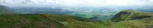
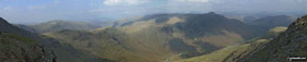
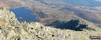
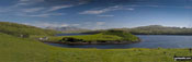
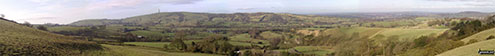
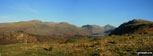
Kinder Scout beyond Kinder Reservoir

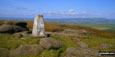
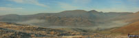
Kinder Low (Kinder Scout) from The Pennine Way near The Edge (Kinder Scout)

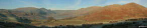
The River Kinder at the top of Kinder Downfall

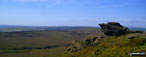
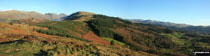
The Pennine Way on Kinder Low (Kinder Scout)


Stockghyll Force on the way up to Wansfell Pike from Ambleside

Winderemere reaching into the town of Ambleside (and cutting it off) from Wansfell Pike

Looking up to the summit of Wansfell Pike

Snow capped Ben Lawers and Loch Tay from Kenmore

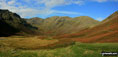
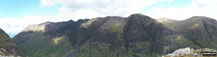
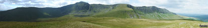
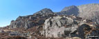
Craig Cwm Sere and Cribyn from Pen y Fan

Deep Snow on Harrison Stickle and Pavey Ark from Stickle Tarn

Snow on Harrison Stickle across a frozen Stickle Tarn

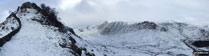
Stickle Tarn under a blanket of snow


Looking towards Stoney Middleton from Curbar Gap

Looking down on Calver from Curbar Gap

Baslow Edge from Curbar Gap with a storm approaching from South

The South Downs Way in East Sussex
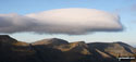
*Sunrise over Gallt Yr Ogof from Tryfan

Great Carrs and Swirl How under a dusting of snow from Greenburn Beck

Climbing Wetherlamd from Little Langdale

Approaching the summit of Wetherlam

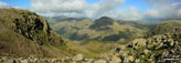
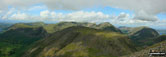
Pike of Blisco (Pike o' Blisco), Pavey Ark and the Langdale Pikes from Wetherlam Edge

Crinkle Crags with snow dusting from Wetherlam Edge

Helvellyn (centre left) and Seat Sandal (right) above The Pass of Dunmail Raise from Helm Crag


The Howitzer on Helm Crag with Helvellyn and The Pass of Dunmail Raise beyond


Carl 'Mozzer' Morris on the summit of Winhill Pike (Win Hill) during a blizzard

Jimbles, Langy, Big Truck & Mozzer on the summit of Winhill Pike (Win Hill) during a blizzard

Deep snow on Winhill Pike (Win Hill) summit

Heavy snow on the descent down Winhill Pike (Win Hill)

Big Truck and Jimbles in heavy snow on the descent down Winhill Pike (Win Hill)

Heavy snow on the descent down Winhill Pike (Win Hill)

Descending Winhill Pike (Win Hill) towards Yorkshire Bridge in heavy snow

'Mozzer' Morris on Winhill Pike (Win Hill) in heavy snow

Icy sign post on Winhill Pike (Win Hill) in heavy snow

Tramping through the Winhill Pike (Win Hill) woods in heavy snow


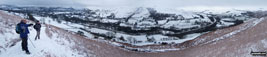
Ladybower Reservoir from Wiseman Hey Clough Woods, Winhill Pike (Win Hill) in heavy snow

Deep Clough in Wiseman Hey Clough Woods, Winhill Pike (Win Hill) in heavy snow

The Vale of Edale from Hope Bank, Winhill Pike (Win Hill) under a blanket of heavy snow


Brown Knoll (Edale) from near Upper Booth

The Pennine Way near Upper Booth

Large cairn at the top of Jacob's Ladder (Edale) on The Pennine Way

Brown Knoll (Edale) summit trig point

The Vale of Edale from the summit of Lord's Seat (Rushup Edge)

Rainbow and Mam Tor from Lord's Seat (Rushup Edge)

Lord's Seat (Rushup Edge) from Rushup Edge


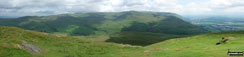
Black Hill (Soldier's Lump) from Royd Edge

The Cock Crowing Stone on Meltham Moor

Meltham across Meltham Moor from West Nab


Looking down on the footbridge over Hey Sike Clough, Horseley Head Moss

The footbridge over Hey Sike Clough, Horseley Head Moss

Wessenden Reservoir from Horseley Head Moss

Blakeley Reservoir and Butterley Reservoir from Horseley Head Moss

Butterley Reservoir from Horseley Head Moss

Old Sluice Gate Workings on Binn Moor

My mate Mike inpspecting Drainwater Workings on Binn Moor

The Wessenden Valley from Binn Moor

Butterley Reservoir and Marsden from Binn Moor

The (now suddenly full) Drainwater Ditch on Binn Moor with Shooters Nab beyond

Drainwater Ditch near Deer Hill Reservoir

Longaford Tor and Upper West Dart Valley from above Wistman's Wood


Near Burnley Hall, East Somerton

Pond at Low Road, East Somerton

Winterton Downs National Nature Reserve


East Somerton with the windfarm in the background


Low Road, East Somerton, lookng towards Winterton

Dunstanburgh Castle from Craster Harbour

Dunstanburgh Castle from Cushat Stiel

Dunstanburgh Castle from Embleton Bay

Atkinson Pike and Sharp Edge from Mousthwaite Comb


Bowscale Fell across the summit rim of Bannerdale Crags

Bannerdale from between The Tongue and the sunlit east ridge of Bannerdale Crags

White Pike at the head of the forest path adjacent to the River Lickle

Views from Kenfig Hill Nature Reserve

Views from Kenfig Hill Nature Reserve

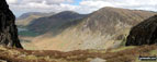
Kirk Fell and Mosedale from Dore Head having just climbed up from Wasdale and heading for Yewbarrow


River Inny just before Laneast


Roadside waterfall near Laneast


Bridge over The River Inny at Gimblett's Mill

Friendly observer at Trenarrett


Views from Kenfig Hill Nature Reserve

Views from Kenfig Hill Nature Reserve

Views from Kenfig Hill Nature Reserve

Views from Kenfig Hill Nature Reserve

Views from Kenfig Hill Nature Reserve

Views from Kenfig Hill Nature Reserve

Views from Kenfig Hill Nature Reserve

Views from Kenfig Hill Nature Reserve

Views from Kenfig Hill Nature Reserve


Path up through the forest from Llyn Celyn

Nant y Coed in spate on the lower slopes Carnedd y Filiast (Arenigs)

Nant y Coed in spate on the lower slopes Carnedd y Filiast (Arenigs)

Nant y Coed in spate on the lower slopes Carnedd y Filiast (Arenigs)

Carnedd y Filiast (Arenigs) summit

Cairn just to the North of the summit of Carnedd Llechwedd-llyfn

Carnedd Llechwedd-llyfn summit cairn


Fence crossing between Llechwedd-llyfn summit cairn and Foel-boeth (Llyn Celyn)

Foel-boeth (Llyn Celyn) summit cairns


Foel-boeth (Llyn Celyn) summit cairns


Rocky Coast between Looe and Talland Bay

Heading inland from Talland Bay


Bottom of Tom Gill Falls near Tarn Hows

Yew Tree Tarn in the rain - lots of rain!


Great Langdale Beck at Elterwater


View west from the road at High Park

Stone Arthur, Great Rigg and Heron Pike above Greenbank from Stang End

Slater Bridge, Little Langdale

Wetherlam from Little Langdale


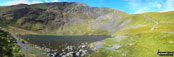
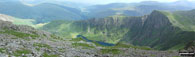
Stickle Tarn, Great Langdale and Lingmoor from Pavey Ark, The Langdale Pikes

Grisedale with Birks beyond from near the Hole-in-the-wall between Birkhouse Moor and Helvellyn

Striding Edge and Helvellyn above Red Tarn from the col between Swirral Edge and Catstye Cam

Haweswater Reservoir from Mardale Head


View from Cinquefoil Hill on the Yorkshire Wolds Way

Place Fell above Brothers Water from The Kirkstone Pass

The Wain Stones near Bleaklow Head (Bleaklow Hill)

Plane Wreckage near The Wain Stones, Bleaklow Head (Bleaklow Hill)


Llyn Llydaw from the summit of Mount Snowdon (Yr Wyddfa)

Barry Harbour taken from Cold Knap Point


Lake Coniston under a temperature inversion from the car park at Walna Scar Road


Flat Holm (left) and Steep Holm from Cold Knap Point


Cold Knap Point from Barry Island

Black Crag (Pillar), Wind Gap, Pillar and Looking Stead (Pillar) above Mosedale from Wasdale Head


Yoke, Ill Bell, Froswick above Kentmere Reservoir from Harter Fell (Mardale)

Black Grag (Pillar), Wind Gap, Pillar and Looking Stead (Pillar) above Mosedale from Wasdale Head

Cribyn and Craig Cwm Sere from Pen y Fan

A moody looking Great Gable from Great End's north ridge close to Custs Gully

An impressive looking Great Gable from near the summit of Broad Crag

Lingmell Crag from across Piers Gill


Rough Crag beyond Blea Water from above Blea Water Crag between High Street and Mardale Ill Bell

A break in the wall offers this view down towards Hartsop from the Straits of Riggindale


Speaking Crag across Haweswater Reservoir from Rowantreethwaite Beck

Mardale Head and Haweswater Reservoir from Rowantreethwaite Beck

View west from Carey Burn Bridge

View from the path above Carey Burn Bridge

Watch Hill and Hart Heugh from the path above Carey Burn Bridge


Carey Burn near Broom Crook Plantation


View north from Black Hill (Whitley Common)

View from Black Hill (Whitley Common)

Looking over Gilderdale Bridge


Knott Head above Little Langdale Tarn from near Slater Bridge Bridge, Little Langdale


Fell Foot Bridge, Little Langdale

Coniston Water from the summit of Great Carrs

Black Sails and The Furness Fells from the summit of Swirl How

Cold Pike from the summit of Little Carrs


Cold Pike (left) and Pike of Blisco (Pike o' Blisco) from the summit of Great Carrs

Wet Side Edge and Greenburn Reservoir from the summit of Great Carrs

Little Carrs from Hell Gill Pike, Wet Side Edge


Greenburn and Wetherlam from Swirl How


Wet Side Edge and Greenburn from Swirl How

Plane Wreck Memorial on the summit of Great Carrs


The Langdale Pikes from the summit of Wetherlam

View from Dare Valley Country Park near Aberdare

View from Dare Valley Country Park near Aberdare

View from Dare Valley Country Park near Aberdare

View from Dare Valley Country Park near Aberdare

View from Dare Valley Country Park near Aberdare

Me at Steyning Round Hill Trig Point

Hay Bale Stack on The South Downs Way where it crosses Steyning Round Hill

The South Downs Way marker post on Steyning Round Hill


Top of the steps down to Consall Forge

Bottom of the steps down to Consall Forge from Consall

The Caldon Canal at Consall Forge

Old Lime Kilns and The Caldon Canal at Consall Forge

River Churnet Weir at Consall Forge

Old Lime Kilns at Consall Forge

The Caldon Canal in the Churnet Valley


Distance marker on the towpath of The Caldon Canal

Bridge at Lock 16 on The Caldon Canal


Swing Bridge on The Caldon Canal

The Caldon Canal near Cheddleton

Bridge on The Caldon Canal near Cheddleton

The Caldon Canal from Basford Bridge, Cheddleton

Leigh Place Pond near Godstone

Bridge at Glebe Water near Godstone


Leigh Place Pond near Godstone


Sculpture on the summit of Leith Hill

Tower on the summit of Leith Hill


Brewerstreet Farmhouse, Bletchingley


Redhill to Tonbridge Main Railway Line where it passes under the M23, South Nutfield

Entrance gate to Betchworth Churchyard

Musical bench in Betchworth Churchyard


Lock 15 on The Caldon Canal near Cheddleton

Weir on The River Wye near Rowsley

The Lost Valley of Glen Coe from Lost Valley Buttress, Bealach Dearg
The Aonach Eagach Ridge from Bidean Nam Bian


Walking along Esp Lane, Barnoldswick

En-route to Weets Hill from Barnoldswick


A sprinkling of snow on Pen y Fan from Corn Du

Snow on Pen y Fan seen from Corn Du

On Hay Stacks with High Crag (left), Crumock Water and Grasmoor (right) in the distance

Approaching Cadair Idris via The Fox's Path from Llyn y Cadair

Cyfrwy and Llyn y Cadair from the summit of Cadair Idris

The shelter on the summit of Cadair Idris

Mynydd Moel from the summit of Cadair Idris

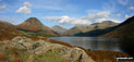
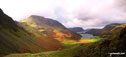
Buttermere, with Fleetwith Pike straight ahead and Hay Stacks (Haystacks) to the right

Nant Gihirych from the lay by at Pont Gihirych


Fan Brycheiniog summit trig point


Fan Brycheiniog from Fan Foel summit cairn

Picws Du (Bannau Sir Gaer) from Fan Foel

Picws Du (Bannau Sir Gaer) from Bwlch Blaen Twrch

Llyn y Fan Fach from Picws Du (Bannau Sir Gaer) summit

Llyn y Fan Fach from Waun Lefrith (Bannau Sir Gaer)

Picws Du (Bannau Sir Gaer) from Waun Lefrith (Bannau Sir Gaer) summit cairn

Carreg Yr Ogof summit trig point

Garreg Las (Twyn Swnd) summit cairns


Standing stones at Dan-yr-Ogog, Glyntawe

Moel Gornach (Garreg Lwyd) summit trig point in mist

Waterfalls en-route to Fan Gyhirych

Another Waterfall with Fan Gyhirych towering above


Cray Reservoir and Pont Gihirych from the upper slopes of Fan Gyhirych

Cairn in the summit of Fan Gyhirych

Fan Gyhirych summit trig point

Bwlch y Duwynt with Yr Allt (Forest Fawr) beyond from Fan Gyhirych


The Afon Senni Valley from Fan Nedd


Yr Allt (Forest Fawr) from Fan Nedd


Heol Senni (Fan Bwlch Chwyth) summit trig point

Yr Allt (Forest Fawr) summit cairn

Railway Bridge spanning the path up Cefn yr Ystrad from Pontsticill Reservoir

Old Quarry sign on the lower slopes of Cefn yr Ystrad

Cefn yr Ystrad summit trig point


Brecon Mountain Railway Steam Engine


The Vale of Ewyas from The Offa's Dyke Path on Black Mountain (South Top)

Black Mountain (South Top) summit cairn


Twmpa (Lord Hereford's Knob) and Gospel Pass from Hay Bluff

Twmpa (Lord Hereford's Knob) summit cairn


Darren Lwyd from Blacksmith's Anvil

Descending back to Capel-y-ffin from Blacksmith's Anvil


Pen y Garn (Bryn Garw) summit trig point and shelter

Esgeiriau Gwynion summit cairn with the Aran Fawddwy ridge in the distance


The view along the top of Simonside

Path up to Arnison Crag from Patterdale


Place Fell from near Dubhow in Patterdale


The path from Fairfield to Hart Crag

On Hartsop above How summit - my last Wainwright

Mungrisdale from the lower slopes of Souther Fell

Bannerdale Crags (mid-ground) and Blencathra (or Saddleback) from Souther Fell


Sharp Edge from Mousthwaite Comb

Bannerdale Crags from Brunt Knott (Blencathra) below Sharp Edge

Sharp Edge from Scales Tarn, Blencathra (or Saddleback)

Scales Tarn from the start of Sharp Edge, Blencathra (or Saddleback)

Negotiating Sharp Edge, Blencathra (or Saddleback)

Sharp Edge in, Blencathra (or Saddleback)

On Sharp Edge, Blencathra (or Saddleback)

Walking along Sharp Edge, Blencathra (or Saddleback)

Tackling Sharp Edge, Blencathra (or Saddleback)

Climbing Sharp Edge, Blencathra (or Saddleback)

Sharp Edge in all its glory, Blencathra (or Saddleback)

Scales Tarn from Atkinson Pike at the top of Sharp Edge, Blencathra (or Saddleback)

Sharp Edge from Atkinson Pike, Blencathra (or Saddleback)

Sharp Edge and Scales Tarn from Atkinson Pike, Blencathra (or Saddleback)

Hall's Fell Ridge from Hallsfell Top, Blencathra or Saddleback

Knowe Crags and The Blencathra or Saddleback Ridge from Hallsfell Top

Approaching Knowe Crags, Blencathra or Saddleback

Gategill Fell Top with Knowe Crags beyond from Hallsfell Top, Blencathra or Saddleback

Gategill Fell, Threlkeld and The Glendermackin Valley from Blencathra or Saddleback


Skiddaw from Hallsfell Top summit cairn, Blencathra or Saddleback

Atkinson Pike and the top of Sharp Edge from Hallsfell Top summit cairn, Blencathra or Saddleback


Skiddaw from Hallsfell Top, Blencathra or Saddleback

Atkinson Pike at the top of Sharp Edge, Blencathra or Saddleback

Mungrisdale Common from Atkinson Pike, Blencathra or Saddleback

Sharp Edge from Foul Crag, Blencathra or Saddleback

Mungrisdale Common summit cairn

View from the top of Bannerdale Crags


Bowscale Fell from Bannerdale Crags


Mungrisdale from Bowscale Fell


Old Steam Roller on Slipper Hill

Stepping Stones over Swinden Water


Mary Jones' Chapel, Llanfihangel-y-pennant

Mary Jones' Memorial, Llanfihangel-y-pennant

Tarrenhendre from Bryn-Eglwys Quarry

Tarren y Gesail summit trig point and cairn

Mynydd Rhyd-galed (left) and Foel y Geifr with The Dovey Estuary beyond from Tarren y Gesail

Tarren y Gesail from Foel y Geifr summit cairn

Mynydd Rhyd-galed from Pant Gwyn (Tarrenhendre)

Temperature inversion on Tarrenhendre seen from Mynydd Rhyd-galed

Tarrenhendre from Mynydd Rhyd-galed summit


Waterfall in Bryn-Eglwys Quarry

Cyfrwy from The Pony Path up Cadair Idris (Penygadair)

Llyn y Gadair from The Pony Path up Cadair Idris (Penygadair)

Cadair Idris (Penygadair) from The Pony Path

Cadair Idris (Penygadair) summit shelter

Cadair Idris (Penygadair) summit trig point

Cyfrwy from Cadair Idris (Penygadair)

Craig Cwm Amarch from Cadair Idris (Penygadair)

Cadair Idris (Penygadair) from Cyfrwy summit cairn

Cadair Idris (Penygadair) from Cyfrwy

Mynydd Moel from Cadair Idris (Penygadair)


Dumyat summit memorial and beacon


Dumyat trig point and summit beacon
Bridge of Allan, Stirling, The Forth River and Alloa from the summit of Dumyat
The Ochill Hills from the summit of Dumyat


Logie Kirk Info Sign, Bridge of Allan

Bwlch y Groes from Moel y Cerrig Duon

Moel y Cerrig Duon summit cairn


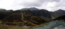
The Afon Dyfi Valley from Bwlch y Groes


Foel Hafod-fynydd summit cairn with Aran Fawddwy looming beyond

The Ben Cruachan Massif and Loch Etive from Glen Etive

Stob Dubh (Glen Etive) and The River Etive from Glen Etive

Beinn Fhionnlaidh from Sgor na h-Ulaidh

Ben Starav, Loch Etive, Beinn Trilleachan behind Beinn Fhionnlaidh (East Top) from Sgor na h-Ulaidh


Allt na Muidhe and Meall Mor from Sgor na h-Ulaidh

Corr na Beinne from Sgor na h-Ulaidh

Mist closing in on Sgor na h-Ulaidh from Corr na Beinne

View down a steep gully from the summit of Sgor na h-Ulaidh

Aran Benllyn from Llanuwchllyn


Erw y Ddafad-ddu summit with Aran Fawddwy beyond


Aran Fawddwy and Creiglyn Dyfi from Drws Bach

Aran Fawddwy from Drysgol (Aran Fawddwy)


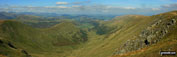
Longsleddale from the summit of Goat Scar

Green Gable and Windy Gap from Great Gable

Haweswater Reservoir from Gatescarth Pass

Borrowdale and Styhead Pass from the slopes of Great Gable above Sty Head


Edale Moor (Kinder Scout) Trig Pillar


On Crookstone Knoll (Kinder Scout)

The Snake Pass from Crookstone Knoll (Kinder Scout)

Win Hill (Winhill Pike) and Stanage Edge from a lone tree on Crookstone Hill


Lady Booth Brook and Edale Youth Hostel


Heather in bloom on Stanton Moor


Looking towards The Grouse Inn from White Edge (Big Moor)

Looking north along Froggatt Edge

Looking south from Froggatt Edge towards Calver

Rocks on Froggat Edge, looking south


Corus Iron Ore Terminal, South Gare


Nine Ladies Stone Circle (and a Druid)

Nine Ladies Stone Circle from Ther King Stone


The path out of Sheepwalk Wood


The cliffs and beach at Nash Point


The new lighthouse at St Donat's Bay

The old lighthouse at St Donat's Bay


Whitesands Bay, St David's Head, The Pembrokeshire Coast Path

Carn Llidl from St David's Head, The Pembrokeshire Coast Path

Wild ponies on St David's Head, The Pembrokeshire Coast Path

High Point near Martin's Haven, The Pembrokeshire Coast Path

Skomer Island from The Deer Park, The Pembrokeshire Coast Path

Raggle Rocks and Marloes Sands from Gateholm Island, The Pembrokeshire Coast Path

Castle from Hepburn Wood Forestry Car Park

The Cheviot Hills from Hepburn Wood

Looking West North West from Hepburn Wood

Approaching Ros Castle (Ross Castle)


Hepburn Crags from Hepburn Wood


Armboth Fell summit with The Helvellyn massif beyond

Armboth Fell summit with High Tove beyond

High Tove summit with High Seat (Ashness Fell) beyond

A Summer Evening in June on Salford Quays


Binsey Trig Point and cairn with The Uldale Fells (Brae Fell, Great Sca Fell and Knott) beyond

The footbridge over Afon Llia at Blaen Llia Picnic Area

The large cairn near the summit of Fan Llia

The tiny cairn marking the true summit of Fan Llia

The tiny cairn on the summit of Fan Dringarth


Craig Cerrig-gleisiad summit cairn

Sheepfold/ruin on Gorllwn onthe way to Fan Fawr


Ystradfellte Reservoir from Fan Fawr with Fan Llia rising beyond


Ystradfellte Reservoir with Fan Llia beyond

Fan Fawr and Ystradfellte Reservoir from the upper slopes of Cwm Dringarth

Tor y Foel beyond Talybont Reservoir from the lower slopes of Twyn Du (Waun Rydd)

Waun Rydd from the lower slopes of Twyn Du (Waun Rydd)

Carn Pica above Twyn Du (Waun Rydd)

Waun Rydd summit cairn with Corn Du and Pen y Fan (The Brecon Beacons) in the background

The duck pond in Thornton-le-Dale

Field path near Thornton-le-Dale


Pretty cottage in Thornton-le-Dale

Dalby Beck in Thornton-le-Dale

Lady Lumley's Almhouses in Thornton-le-Dale


The Cheshire Plain from The Roaches


Ben Cruachan from Beinn Lora summit trig point

The River Duddon at Birks Bridge

Grey Friar, Great Carrs from the slopes of Harter Fell (Eskdale)

Climbing Harter Fell (Eskdale)


Rhobell Fawr summit trig point

Dduallt (Arenigs) summit cairn


Irton Fell summit cairn with Whin Rigg in the background

Greathall Gill between Irton Pike and Whin Rigg


Wast Water from Whin Rigg summit


Yewbarrow from Illgill Head summit cairn


The Quiraing on the lower slopes of Meall na Suiramach

The Needle on The Quiraing on the lower slopes of Meall na Suiramach

Sron Vourlinn from The Quiraing on the lower slopes of Meall na Suiramach

Looking down to The Table in The Quiraing on the lower slopes of Meall na Suiramach


Gars-Bheinn in The Cuillin Hills from near Coruisk Memorial Hut on the shores of Loch Scavaig

Bla Bheinn (Blaven) from the west side of Camasunary Bay


The Cuillin Hills across Loch Scavaig from Elgol

One the towers of Derwent Reservoir Dam

Ladybower Reservoir from Lockerbrook Heights


Winhill Pike (Win Hill) from Lockerbrook Heights

Margery Hill and Howden Moor beyond Howden Reservoir from Lockerbrook Heights


Looking down on The Tower at Alport Castles with the Ashop Valley beyond

The River Alport in Alport Dale


Derwent Reservoir from Hagg Side above Ladybower Reservoir

Cushat Stiel between Craster and Dunstanburgh Castle


Looking South to Clennell Hill from Alwindale

The River Alwin at Kidland Forest


The River Alwin and Alwindale with Rookland Hill and Clennell Hill beyond from Clennell Street

The view from Alwinton Car Park


Rothbury from Rothbury Terrace

Looking North East to the Cheviot Hills from Glitteringstone

Looking West from Glitteringstone

Looking West from Glitteringstone

Looking South West to Simonside from Glitteringstone

Ladybower Reservoir from Whinstone Lee Tor


Wainwrights unnamed 'perfect mountain tarn' between Glaramara and Allen Crags

Wild Camping at Loch Lundie between Invergarry and Fort Augustus in the Great Glen


St Michaels Chapel on the summit of Skirrid Fawr (Ysgyryd Fawr)

The Black Mountains from the summit of Skirrid Fawr (Ysgyryd Fawr)


Climbing the Llanberis Path up Mount Snowdon

Llanberis and Llyn Peris from the Llanberis Path on Mount Snowdon
Grasmoor, Robinson and Fleetwith Pike and Buttermere from Hay Stacks (Haystacks)
Hay Stacks (Haystacks) from Dubs Quarry on Fleetwith Pike

The summit of Lad Law (Boulsworth Hill)

Pendle Hill from the summit of Lad Law (Boulsworth Hill)
Pendle Hill (right) on the horizon from the summit of Lad Law (Boulsworth Hill)
Rock sculptures on the summit of Lad Law (Boulsworth Hill)

Rock sculptures on Lad Law (Boulsworth Hill)


On the summit of Great Hetha in the College Valley

James on Hedgehope Hill with The Cheviot in the background

Myself and James on Hedgehope Hill summit

Climbing Pen-y-Ghent on The Yorkshire Three Peaks Challenge

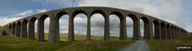
Ribblehead Viaduct with Whernside beyond

Ingleborough from Chapel-le-Dale

Some of the team at Ribblehead Viaduct on The Yorkshire Three Peaks Challenge


The team in Horton in Ribblesdale


Bridge over The River Derwent, Baslow Village

Chatsworth House from the Stand Wood Ornamental Waterfall, Chatsworth Park

Baslow Village from Chatsworth Park


The Harbottle Hills from Harbottle Castle

The Drake Stone in the Harbottle Hills

The view east from Drake Stone in the Harbottle Hills

Harbottle from the Drake Stone in the Harbottle Hills

Harbottle Lake from the Drake Stone in the Harbottle Hills

West Wood in the Harbottle Hills

Lord's Seat (Coquetdale) from West Wood

Silverton Hill (Coquetdale) from West Wood


The North Sea north of Craster


The North Sea north of Craster

The front facade of Dunstanburgh Castle

The North Sea north of Craster

The seaward end of Dunstanburgh Castle

The North Sea north of Craster

The North Sea north of Craster


The River Aln Estuary, Alnmouth Bay

The River Aln Estuary, Alnmouth Bay

Marden Rocks, north of Alnmouth Bay

Duchess Bridge of the River Aln, Alnmouth Bay


Looking north to Cullernose Point

Looking north from Black Nose Point


Rachael on the summit of Seatallan

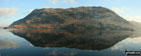
Fleetwith Pike reflected in Buttermere

The south ridge of Tryfan from the top of Bristly Ridge, Glyder Fach


Swinescar Pike and Grasmere from Great Castle How


Pavey Ark and-Harrison Stickle from Silver How

Loughrigg from the slopes of Silver How

The Coniston Range from Great Castle How


Donald Campbell Memorial, Coniston


Donald Campbell's Grave, Coniston

The Dog House, The Monk Coniston Estate, Coniston


Black Down (Hardy Monument) summit tower

The West Mendip Way through Black Rock Nature Reserve

The West Mendip Way through Long Wood Nature Reserve

Beacon Batch summit trig point


Martinstown (or Winterborne St Martin) church


Chesil Beach at West Bexington


Arenig Fawr (South Ridge Top) summit

Arenig Fawr from Llyn Celyn near Pant-yr-Hedydd

Arenig Fach from Llyn Arenig Fawr

Llyn Arenig Fawr with Arenig Fawr (Moel Yr Eglwys) beyond

Bryn y Dyfrgi above Llyn Arenig Fawr

Bwlch Blaen-y-nant above Llyn Arenig Fawr

Old fence posts on Arenig Fawr (Moel Yr Eglwys)

Arenig Fawr (Moel Yr Eglwys) summit trig point and memorial plaque

Arenig Fawr (South Top) summit cairn

The path down the Arenig Fawr (Moel Yr Eglwys) ridge summit

Carreg y Diocyn summit with Arenig Fawr beyond

Moel Llyfnant summit with Arenig Fawr in the background

Foel Boeth (Arenigs) summit with Moel Llyfnant in the background


Former railway line near Dol Benlas


Nant y Coed on the slopes of Carnedd y Filiast (Arenigs)


Carnedd y Filiast (Arenigs) summit

Carnedd Llechwedd-llyfn summit cairn

Arenig Fach from Afon Celyn (Afon Gelyn)

Arenig Fach summit trig point and shelter


Foel Goch (Arenigs) summit cairn, trig point and obelisk


Pen y Bwlch Gwyn from Garnedd Fawr

The huge rock on the lower slopes of Pen y Bwlch Gwyn

Pen y Bwlch Gwyn summit cairn with Lake Bala in the background

Merrivale Firing Range Warning sign


Great Staple Tor from Roos Tor

Merrivale from Great Staple Tor


Stone Rows near Yellowmeade Farm


Beware - Ducks! sign in Foolow


White Hill (Forest of Bowland) trig point

Beacon on White Hill (Forest of Bowland)


Rock formations at Knottend Well with Whernside on the horizon

Crutchenber Fell (Bowland Knotts) summit trig point


Wendover Woods (Haddington Hill) trig point

Stone clapper bridge at Postbridge

Rhinog Fawr across Tremadog Bay from Criccieth

Looking West from Criccieth Castle


Rhinog Fawr across Tremadog Bay from Criccieth Castle


Rhinog Fawr across Tremadog Bay from Criccieth

Carn Dearg (Monadhliath Mountains) summit

Weirs on a very cold day in Lathkill Dale

Frost and freezing mist in Lathkill Dale

Storm approaching over Lake Iseo from Monte Isola


The Berwyn Hills from Coed y Llan near Llanfyllin

Beacon Ring (Long Mountain) from Fferm Cefn Gaer near Llanfyllin

Green Hall Hill above Llanfyllin from Bron-y-Gaer (Llanfyllin)

Allt y Gader from Fferm Cefn Gaer near Llanfyllin

Beacon Ring (Long Mountain) from Bron-y-Gaer (Llanfyllin)

Simon Hoyle on Sgorr nam Fiannaidh (Aonach Eagach) looking along the Aonach Eagach ridge

Me & my shadow approaching Great Rigg in the snow

Morecambe Bay from the summit of Scafell Pike


Illgill Head (left), Wast Water and Middle Fell (right) from Scafell Pike

The footbridge over Helvellyn Gill at The Swirls Car Park, Thirlmere

Walkers on Swirral Edge from the summit of Helvellyn


Red Tarn (Helvellyn) and Striding Edge from Helvellyn summit

Clouds rolling in over Fairfield (left), Dollywaggon Pike and Nethermost Pike from Helvellyn

Loch Brandy and The Snub from above Green Hill (Glen Clova)

Narrowdale Farm with Narrowdale Hill from Narrow Dale

Tom with Corrie of Bonhard in background from Boustie Ley (Ben Tirran)

Tom on the summit of Ben Reid (Ben Tirran)


Wordsworth's Grave in Grasmere Church Graveyard


Widop Reservoir from Clough Head Stones


Walkers beside the River Dove in Wolfscote Dale

Iron Tors with Coldeaton Bridge and Dove Dale below from Gipsy Bank

Descending Gipsy Bank towards Coldeaton Bridge and Dove Dale

Wolfscote Dale from Narrow Dale

The trail along Overdale towards Gipsy Bank in Bloom

The Old Cheese Shop in Hartington


Symonds Knott and Sca Fell from Scafell Pike

lllgill Head (left), Wast Water and Seatallan from Lingmell

Wast Water from the summit of Sca Fell

Scafell Pike, Mickledore and Sca Fell at sunset from Wasdale

Wast Water and the Lingmell Ridge from Lingmell

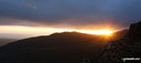
Wasdale Head at sunrise from Lingmell

Lingmell Crag from Middleboot Knotts

Mickledore at Sunset from Wasdale


Climbing towards the col between Broad Crag and Great End


Seathwaite and Borrowdale beyond Styhead Tarn from Lingmell

Ill Crag (left) with Broad Crag below Scafell Pike from Great End summit

Piers Gill with Lingmell (near left) and Kirk Fell (centre) and Great Gable (right) on the horizon

Holding on to the Trig point on Scafell Pike summit

Scafell Pike summit from Ill Crag

Derwent Water from Great End summit

A crowded Scafell Pike summit from the summit of Sca Fell

Ill Crag summit with Scafell Pike beyond


Sellafield from Broad Crag summit

The shoulder of Great Gable (left) and Styhead Tarn from Lingmell

Great Gable from Middleboot Knotts


Brim Fell End reflected in Levers Water

Levers Water and Boulder Vally from Levers Hawse

Innominate Tarn with Great Gable (top right) from Hay Stacks (Haystacks)

Buttermere from near Blackbeck Tarn on the Hay Stacks (Haystacks) ridge

Hay Stacks (Haystacks) from Gatesgarth

Harrison Stickle from Stickle Tarn (The Langdale Pikes)

Great Knott, Shelter Crags (Crinkle Crags) and Bow Fell (Bowfell) from Red Tarn (Langdale)

Red Tarn (Langdale) with Great Knott, Shelter Crags (Crinkle Crags) and Bow Fell (Bowfell) beyond


Mickleden and Great Langdale from Crinkle Crags

The Langdale Pikes - Pike of Stickle (left) and Loft Crag (centre right) from The Band

Looking back to the Langdales from Redacre Gill


Crinkle Crags, Bow Fell (Bowfell) and The Band from Redacre Gill

Climbing Pike of Blisco (Pike o' Blisco) via Redacre Gill

Crinkle Crags and Bow Fell (Bowfell) from Pike of Blisco (Pike o' Blisco)

Pike of Blisco (Pike o' Blisco) summit cairn

Cold Pike, Little Stand and Browney Gill from Pike of Blisco (Pike o' Blisco)


Crinkle Crags and Bow Fell (Bowfell) from Pike of Blisco (Pike o' Blisco)

The Langdale Pikes from near Red Tarn (Langdale)

The Langdale Pikes and The Band from Great Knott

Crinkle Crags from Great Knott

Crinkle Crags (South Top) summit

Pike of Blisco (Pike o' Blisco) from Crinkle Crags (South Top)


Crinkle Crags (Long Top) summit

Bow Fell (Bowfell) and Shelter Crags from Crinkle Crags (Long Top)

Bow Fell (Bowfell) and Shelter Crags from Crinkle Crags (Gunson Knott)

Bow Fell (Bowfell) from Shelter Crags


Sca Fell (centre left), Mickledore, Scafell Pike and Ill Crag from Three Tarns

Cambridge Crag and Bowfell Buttress from The Climbers' Traverse below Bow Fell (Bowfell)

Bowfell Buttress from The Climbers' Traverse below Bow Fell (Bowfell)

Views from The Climbers' Traverse below Bow Fell (Bowfell)

Rock formations on The Climbers' Traverse below Bow Fell (Bowfell)

On The Climbers' Traverse below Bow Fell (Bowfell)

View from The Climbers' Traverse below Bow Fell (Bowfell)

The famous waterspout on The Climbers' Traverse below Bow Fell (Bowfell)

Approaching The Great Slab below Bow Fell (Bowfell)

The Great Slab below Bow Fell (Bowfell)

On the Great Slab below Bow Fell (Bowfell)

Sunshine on the Great Slab below Bow Fell (Bowfell)

Bow Fell (Bowfell)'s Great Slab

Rossett Pike and Black Crags from the top of Great Slab below Bow Fell (Bowfell)

Looking down the Great Slab below Bow Fell (Bowfell) to Great Landdale and the Langdale Pikes

Shelter Crags, Gunson Knott and Crinkle Crags from Bow Fell (Bowfell)

Rock formations on Bow Fell (Bowfell)


The Schil from the Pennine Way at Black Hag (Hethpool)

Little Spango from Spango Hill


Glendyne Burn from Willowgrain Hill

Hen Hole on the Pennine Way near Auchope Cairn


Scafell Pike from Pen (Eskdale)

Harter Fell (Eskdale) and Eskdale from the summit of Pen (Eskdale)
Looking up the Daear Ddu Ridge towards Carnedd Moel Siabod from Llyn y Foel
Looking down the Daear Ddu Ridge to Llyn y Foel from Carnedd Moel Siabod
Bowscale Fell from Carrock Fell


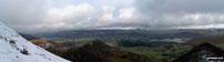
Castleton under a temperature inversion from Mam Tor


Mist drifting over Castleton the Hope Valley from Mam Tor
Water-cum-Jolly Dale from the footbridge across the River Wye weir at Cressbrook

Wild Garlic in Cressbrook Dale

Carpet of Wood Anemone in Cressbrook Dale

Miller's Dale from the bridge at Miller's Dale Station

On the Monsal Trail - crossing the bridge at Miller's Dale Station

The River Wye in Water-cum-Jolly Dale

Spring buds in Water-cum-Jolly Dale


The trail through Tansley Dale

The trail across fields towards Tideswell


The footbridge at the Miller's Dale end of Monk's Dale


The unused Miller's Dale bridge east of Miller's Dale Station from the The Monsal Trail

The steps down to Giant's Castle Bridge over the River Bollin in Styal Country Park

Norcliffe Church, Styal Country Park

Styal Cross, Styal Country Park

Quarry Bank Mill, Styal Country Park


Battle of Stow Memorial, West of Donnington


The Duck Pond in Moreton-in-Marsh


Moreton-in-Marsh Police Station


Folly in Chastleton House Gardens

Chastleton Church through the gates of Chastleton House


Path leading to Cornwell Church


The famous Adlestrop station nameplate


Black Lake in the middle of Lindow Common

Broom in bloom on the banks of Black Lake, Lindow Common


Field path to Swanwick Hall Farm, Goostrey

Bridle Way through the grounds of Peover Hall


Sun dial by Peover Hall Church


Lake in the grounds of Peover Hall


Stone 'mushrooms' in the grounds of Peover Hall


Black and white Timber house in Swettenham

Approaching the summit of The Cheviot


Hedgehope Hill from the boggy summit of Comb Fell


My new boots on Great Hetha near Hethpool

The Mamores featuring An Gearanach (left) and Sgurr a' Mhaim (right) from the summit of Ben Nevis

Carlin Tooth (Teviotdale) and Tudhope Hill from Ellson Fell

Temperature inversion from the summit of Ben Ledi in the snow


Tamond Heights and Roan Fell from Castlewink


Bellbeaver Rigg (Tynehead Fell) from Tyne Head

The River Kinder being blown 'up' Kinder Downfall

Looking up Whitecombe Beck from the footbridge below Horse Back Crag

Stainton Pike beyond Rowantree Force from Waberthwaite Fell


Forces Falls, Swindale Beck (Swindale Common)


The River Noe in The Vale of Edale

Lose Hill (Ward's Piece) and Back Tor (Hollins Cross) from Small Clough


Edale End and The Vale of Edale


Mam Tor from Hollins Cross during a temperature inversion

Frozen tree on the slopes of Back Tor (Hollins Cross) viewed from Hollins Cross


Climbing Lose Hill (Ward's Piece) during a winter temperature inversion

Lone Tree near Long Houses, Seathwaite, Duddon Valley

On White Nancy near Macclesfield

On White Nancy above Bollington
Elterwater in the grip of winter

Barrel Inn at Bretton Mount over looking Waterfall Farm, Eyam Edge and the White Peak area

Higger Tor form Nether Bretton


Stanage Edge, Higger Tor and Millstone Edge from Bole Hill

Derwent Water, Keswick, and Walla Crag from Bleaberry Fell summit cairn

Waterstein Head across Moonen Bay from Neist Fhiadhaich
Gesto Bay and Loch Harport from the entrance to Loch Beag with The Cuillin Hills in the distance

Oxenhope Station (The Keighley and Worth Valley Railway)

My wife and daughter on Kinder Scout

The Keighley and Worth Valley Railway at Oxenhope Station


Thornton Moor Reservoir from the Bronte Way near Cobling Farm

Thornton Moor Reservoir from the Bronte Way near Sunny Bank

Oxenhope Moor from the Bronte Way near Sunny Bank

White House Farm with Fremington Edge beyond

The track up to Whitehouse Farm from High Fremington

Gibbon Hill and Harkerside Moor with Reeth in the valley below from Fremington Edge

Calver Hill from Fremington Edge
Arkengarthdale and Langthwaite from Fremington Edge

Reeth from the lower slopes of from Fremington Edge

Down through the spoil heaps of Fell End Lead Mine at the NW end of Fremington Edge


The Bridge over the River Arkle at Langthwaite


Rock strewn and narrow Skelgate Lane

Reeth the summit of Calver Hill
Croker Hill from The Hanging Gate above Pot Lords

Croker Hill from the Gitstone Trail on the summit of Wincle Minn

The ruined Mareknowles Farm above Greasley Hollow

Looking over Greasley Hollow and Mareknowles Farm from the Gritstone Trail on Wincle Minn

Looking SE from Cessbank Common

Greasley Hollow from the ruined Mareknowles Farm

The Roaches, Hen Cloud and the Staffordshire Moorlands from the Gritstone Trail on Wincle Minn

Shutlingsloe from Cessbank Common

The Cheshire Plain with Jodrell Bank in the distance from the Gritstone Trail on Croker Hill

Row of riverside houses beside Liddle Water in Newcastleton


Carby Hill (Caerba) from Sorbietrees

Bridge over Liddle Water in Newcastleton

Newcastleton War Memorial in Douglas Square

Langholm and Eskdale from Whita Hill


The River Esk in Langholm where it meets Ewes Water

Daffodils on the banks of Ewes Water


Padstow Harbour with the tide out


Harbour Light Tea Garden, Boscastle

The River Valancy in Boscastle Harbour

Bridge over the River Valancy in Boscastle Harbour

'Boat Seat' in Boscastle Harbour


Boscastle Harbour from Penally Hill


Mike (go4awalk.com editor) practising his crampons and ice-axe technique in the snow on Whernside

Mike (go4awalk.com editor) in the snow on Whernside

Ingleborough covered in snow from Blea Moor Tunnel

Snow on Barrow and Outerside from Coledale Hause

Frozen pond on Black Hill (Westernhope Moor) Upper Weardale

Practising my crampon and ice-axe technique in the snow on Whernside

Practising my ice-axe and crampons technique in the snow on Whernside

Practising my ice-axe and crampon technique in the snow on Whernside

On the summit of Whernside in the snow

On the summit of Whernside in the snow

Practising my ice-axe arrest technique Whernside in the snow

Practising my ice-axe arrest technique Whernside in the snow

The steps up on to the A591 from the former Keswick Railway Line

Castlerigg Stone Circle above Keswick


Looking into the Fairfield Horseshoe from the old intake below the summit of Latterbarrow

On the summit of Finsthwaite Heights

Looking down on High Dam from Finsthwaite Heights

High Dam below Finsthwaite Heights

Boretree Tarn on Finsthwaite Heights


Gummer's How from Staveley Fell

The view north from Bigland Barrow (North Top)

The Langdale Pikes from a frozen Tarn Hows

Dollywagon and Fairfield from Tarn Hows

Helm Crag from the path from Allan Bank to Silver How

Pavey Ark and Langdale Pikes from Silver How

Me beside a very wet Silver How Summit cairn

Grasmere Lake, Loughrigg and Windermere in the distance from Silver How

Approaching Chrome Hill on the footpath between Hollinsclough and Glutton Bridge

Chrome Hill on the footpath between Hollinsclough and Glutton Bridge

View west along the Valley from the access drive to Ball Bank House Farm


Looking North East to Chrome Hill from where the footpath joins the road into Hollinsclough

East North East to Parkhouse Hill from where the footpath joins road into Hollinsclough

North East to Chrome Hill from where the footpath joins road into Hollinsclough

Looking West back to Chrome Hill from the footpath into Glutton Bridge

Looking back down the lane from just before Ball Bank House Farm

Chrome Hill from the footpath between Hill Top Farm and Wilshaw (Moseley)

West from the road before Hill Top Farm

Parkhouse Hill from the footpath East of Moor Side Farm

South South West from the road before Hill Top Farm


South from the road before Hill Top Farm

Looking North from the footpath East of Moor Side Farm with Booth Farm in the middle distance

Looking South from the footpath into Glutton Bridge

Looking South East just before Ball Bank House Farm

Looking West along the valley from the access drive to Ball Bank House Farm

Pen-y-ghent from the west near Horton in Ribblesdale


Loch Brandy and The Snub from Green Hill (Glen Clova)

On Green Hill (Glen Clova) above Loch Brandy

The Cobbler (Ben Arthur) from Beinn Narnain, looking over the hills surrounding Loch Long

Ardgoil from Beinn Narnain, looking South


Skiddaw from Rowling End - with Swinside in the foreground

Swinside, Keswick, Latrigg and Blencathra (or Saddleback) from Rowling End


Dudderwick and Rough Crag (Riggindale) from Mardale Head car park in the snow

The Rigg and Haweswater Reservoir from Mardale Head car park in the snow

Steep ascent to Swine Crag in the snow
Swine Crag, Riggendale, Kidsty Pike and Kidsty Howes in the snow

Blea Water with mist shrouding High Street beyond from Dudderwick in the snow

Rough Crag (Riggindale) summit in the snow


Looking back to Kidsty Howes and Haweswater from Rough Crag (Riggindale) summit in the snow

Kidsty Pike from Rough Crag (Riggindale) summit in the snow


Me on the summit of High Street in the snow

A distant Lake Windermere from the summit of High Street in the snow

Birker Fell (Eskdale) crags from Eskdale


Harter Fell (Eskdale) from Eskdale

Harter Fell (Eskdale) summit trig point

The view from Harter Fell (Eskdale) summit

Crags on the summit of Harter Fell (Eskdale)

On the summit of Harter Fell (Eskdale)


Bassenthwaite Lake from Dodd (Skiddaw) Summit

Derwent Water and the Newland Fells from Dodd (Skiddaw) Summit


Frozen Pistyll Rhyd-y-meinciau waterfall

Frozen Pistyll Rhyd-y-meinciau waterfall

Frozen Pistyll Rhyd-y-meinciau waterfall

Hardy sheep near Afon Eiddew in the snow

Alsion on Whitegill Crag with a snow clad Great Langdale in the background


Great Langdale and Lingmoor Fell in the snow from Whitegill Crag


Harrison Stickle and the Langdale Pikes from Blea Rigg in the snow


Cribyn from Pen y Fan in the snow

Mountain Rescue helicopter above Pen y Fan in the snow

Coniston Old Man from Swirl How on a snowy February day.

Clough Head and The Dodds from Blencathra (or Saddleback).

Ascending Corrie of Fee with Erne Craigs (left)

Looking east into Corrie of Fee with the Glendoll Forest beyond from Knapps of Fee

Looking down into Corrie of Fee from Erne Craigs

Prime Time walkers on the summit of Craig Rennet


Crossing White Water between Craig Maud and Meikle Kilrannoch

Loch Beanie from Mealna Letter (Duchray Hill)


Crossing Allt Mor to the west of Loch Beanie


The 'prime time' walkers group on the south�facing slopes of the Mealna Letter (Duchray Hill)

The 'prime time' walkers group near teh summit of Mealna Letter (Duchray Hill)

Great Mell Fell summit cairn - with Blencathra (or Saddleback) in the background

Slieve Donard (Sliabh Donairt) across Dundrum Bay from Murlugh Beach

Slieve Donard (Sliabh Donairt) across Dundrum Bay from Murlugh Beach

Views from Slieve Donard (Sliabh Donairt) in the snow

On Slieve Donard (Sliabh Donairt) in the snow

Views from Slieve Donard (Sliabh Donairt) in the snow

Approaching the summit of Slieve Donard (Sliabh Donairt) in the snow

Looking up to the summit of Slieve Donard (Sliabh Donairt) in the snow

Slieve Donard (Sliabh Donairt) summit in the snow

View from the summit of Slieve Donard (Sliabh Donairt) in the snow

Descending Slieve Donard (Sliabh Donairt) in the snow

Mike at Edale Station with Lord's Seat, Cowburn Tunnel and Brown Knoll in the background

Lord's Seat in the snow from Edale Station

Carl Morris at a snowy Edale Station with Grindslow Knoll (Kinder Scout) in the background

Climbing back out of the Grinds Brook valley in the snow and ice at Edale

The Nab from Edale in the snow

Edale and Lord's Seat from the lower slopes of The Nab

Climbing The Nab with a snowy Edale in the background

Grindslow Knoll (Kinder Scout) and Grindsbrook Clough under a blanket of snow from The Nab

Carefully crossing a very cold Jaggers Clough

Lose Hill (Ward's Piece) and Back Tor (Hollins Cross) from Nether Moor

The Vale of Edale from Nether Moor

Lord's Seat from Ollerbrook Booth

The River Wye near Ashford in the Water

Weir on the The River Wye in Monsal Dale

Monsal Dale Viaduct from Monsal Dale

Fin Cop and Monsal Dale from White Lodge

Hagg Side from near Lockerbrook Farm in the snow

Lose Hill (Ward's Piece) and Back Tor (Hollins Cross) from Rowlee Pasture in the snow

The Tower at Alport Castles in the snow with Kinder Scout in the background

Alport Dale from Alport Castles in the snow

Looking back up to Alport Castles from Alport Dale in the snow

High Dodd (Sleet Fell) and Place Fell across Ullswater from Mossdale Bay near Glenridding

Boredale Hause and Angletarn Pikes across Ullswater from Glenridding


The Eskdale Fells from the Birker Fell road

Grey Friar and the Seathwaite Fells over Dunnerdale from Hesk Fell

Kentmere with Yoke, Ill Bell, Froswick and Thornthwaite Crag above from Hollow Moor

Wasdale Head featuring Yewbarrow, Kirk Fell and Great Gable from Irton Pike
Wasdale Head (Yewbarrow, Kirk Fell and Great Gable), Whin Rigg and Eskdale Moor from Irton Pike


Yoke, Ill Bell, Froswick and Thornthwaite Crag from Hollow Moor

Ben Lawers from Beinn Ghlas (Breadalbane)

Douglas and Tom at an icey Loch Brandy


Black Combe from White Hall Knott


Glen Clova from Green Hill (Glen Clova) between Loch Wharral and Loch Brandy


Rydal Water and Loughrigg Fell from Low Pike (Scandale)

Approaching Low Pike (Scandale)


Unusual tree on the track beside Flinter Gill near Dent

Trig point on the summit of Crag Hill


The Telecommincations Tower on Croker Hill

The Telecommincations Tower on Croker Hill from The Gritstone Trail

Shutlingsloe from The Gritstone Trail on Croker Hill

Croker Hill from near the Hanging Gate pub

On the summit of Black Hill (Soldier's Lump)

William Baker on the Malvern (Worcestershire Beacon)


Old building on the Ulverston Canal

Former lock gates at Canal Foot, the entrance to the Ulverston Canal

Morecambe Bay from Canal Foot, Ulverston

Snowdrops emerging in Grasmere - spring is on the way!

Me and Jack on Cat Bells (Catbells)


Innominate Tarn on Hay stacks (frozen solid) with Great Gable rising majestically in the background


Starting the climb from Striding Edge up onto Helvellyn

Red Tarn (Helvellyn) frozen solid

Crummock Water and Buttermere from Hay Stacks

Fleetwith Pike from the Southern shore of Buttermere

Place Fell from a very snowy Threshthwaite Mouth

Ullswater and Place Fell from snowy Hartsop Dodd

Looking up to a snowy Threshwaite Mouth from Brothers Water


Looking west onto the Rochdale Canal from The Pennine Way

Contributory Stream entering The Rochdale Canal near Bridge 26

Path junction on Birkwith Moor

Ingleborough from the beacon on High Green Field Knott (Cosh Knott)


Hull Pot and a frozen Hull Pot Beck

On the Pennine Way near Red Moss Pot

Pen-y-ghent from the Pennine Way near Hunt Pot

Snowdon (Yr Wyddfa) from Crib Goch

The Hope Valley and Lose Hill (Ward's Piece) (right) from Winhill Pike (Win Hill) summit

Winhill Pike (Win Hill) summit with just a dusting of snow

The Vale of Eden from Winhill Pike (Win Hill)

Hope Cross - with Lose Hill (Ward's Piece) in the background

Crook Hill from the southern shore of Ladybower Reservoir

The 'Murder Stone' near Disley - with a snowy New Mills in the background

Bamburgh Castle from The Wynding

Blackrocks Point, Bamburgh Lighthouse and Harkness Rocks from The Wynding

Budle Point from Harkess Rocks


Farne Islands, Blackrocks Point, Bamburgh Lighthouse and Harkess Rocks from near Budle Point

Farne Islands beyond The Club House for Bamburgh Golf Course from Budle Point

Budle Point from Heather Cottages

Kiln Point from Heather Cottages


To contribute to go4awalk.com or to contact us about anything at all - see Talk To Us.
For help see Help.
go4awalk.com and go4awalk.co.uk are registered trademarks of TMDH Limited.
Copyright © 2000-2026 TMDH Limited. All rights reserved.
Copyright Terms & Conditions Privacy Statement
A - Z Walks Home Log On/Accounts Photo Gallery Walk Ideas and Collections Fell Facts Hill Skills Walking Questions and Answers Your Stories News Competitions Product Reviews/Gear Tests Walking Gear Guides Peaks and Mountains Peak Bagging Find New Walking Friends Camping GPS Waypoints for Walking Contents Walk Search Talk To Us go4awalk.com Help Free Example Walks Newsletter


