Walk Photographs and views from British Walks published during 2015


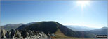
Haycock, Little Scoat Fell and Red Pike (Wasdale) from the summit of Yewbarrow

Pillar, Top of Stirrup Crag and Kirk Fell from the summit of Yewbarrow

Kirk Fell, Great Gable, Great End and Lingmell from the summit of Yewbarrow

Great End, Lingmell, Scafell Pike, Sca Fell and Slightside from the summit of Yewbarrow

Slightside, Harter Fell (Eskdale) and Burnmoor Tarn from the summit of Yewbarrow

Small tarn near the summit of Looking Stead (Pillar)

Looking Stead (Pillar) summit cairn

Haystacks from Looking Stead (Pillar) with a Herdwick Sheep for company

Piers Gill from the path to Middleboot Knots

Middleboot Knotts summit cairn

Round How (Scafell) summit cairn

Round How peeping through the mist from the bottom of Great End

Scafell Pike (left) and Broad Crag (right) from Ill Crag

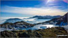
Great Gable peeping up through the clouds during a cloud inversion from Scafell Pike

Cul Mor with a light dusting of snow seen from a frozen Lochan Dearg a' Chuil Mhoir

Snow on Canisp with Loch Veyatie in the foreground from the summit of Cul Mor

Snow on Bod a' Mhadail with Loch Sionascaig in the distance from the summit of Cul Mor

Suilven (Caisteal Liath) from the summit of Cul Mor

Snow on Suilven (Caisteal Liath) from the summit of Cul Mor

Canisp with a light dusting on snow from the summit of Cul Mor

Route up to Grisedale Pike via Sleet How starting from Braithwaite

Looking back to the zig zags from Scar Crags at the route down from Sail (Derwent Fells)

The Lunch House above West Sleddale Reservoir


Great Saddle Crag summit cairn


Path down to Sleddale Hall and Wet Sleddale Reservoir


On top of Steel Knotts (Pikeawassa)

Summit of Meall na Suiramach, Isle of Skye

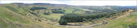
Grasmere from Loughrigg Terrace


Approaching the summit of Green Pikes (Caw)

View from the summit of Caw (Dunnerdale Fells)

Path up to the summit of Green Pikes (Caw)

Caw (Dunnerdale Fells) summit trig point

Seat How (Birker Fell) summit cairn

Wild flowers on the scramble up Seat How (Birker Fell)

Boathouse on the shore of Devoke Water

Devoke Water from Woodend Height (Yoadcastle)

Woodend Height (Yoadcastle) summit cairn


Cairn on White Pike (Birkby Fell)

The Knott (Stainton Fell) from White Pike (Birkby Fell)

Small waterfall on Linbeck Gill at the Southern end of Devoke Water

Water Crag (Birker Fell) summit cairn

Rough Crag (Birker Fell) summit cairn

A view of Wallace Monument heading up the Dumyat

Derwent Water and Keswick from Surprise View


Lamb Pasture from The Forest (Bannisdale)

View from The Forest (Bannisdale)

On The Forest (Bannisdale) summit

The Forest (Bannisdale) summit cairn

White Howe (Bannisdale) summit trig point piller

View from White Howe (Bannisdale)

White Howe (Bannisdale) from Long Crag (Bannisdale Fell)

Shipman Knotts in cloud above Longsleddale from Ancrow Brow (North East Top)

Ancrow Brow (Swinklebank Crag) summit cairn

Hidden Tarn near Ancrow Brow (Swinklebank Crag) summit

Fence posts near the summit of Capplebarrow

View down Longsleddale from Todd Fell

Looking back to Whiteside Pike from Todd Fell


The summit cairn on Seat Robert


Looking back to Fewling Stones from High Wether Howe summit cairn

Looking back to Seat Robert from High Wether Howe summit cairn

Looking across Swindale to Howes (Mosedale) from High Wether Howe

Looking across Swindale to Nabs Moor from High Wether Howe

Looking down to Nabs Moor from Howes


Forces Falls (Swindale) and Swindale Beck

Forces Falls (Swindale) and Swindale Beck

Cairns on the approach to the summit of Moel Hebog


The Moelwyns from the path approaching the summit of Moel Hebog

Moel Hebog summit plateau and trig point

The Nantlle Ridge from Moel Hebog summit plateau

Looking southwest from Moel Hebog


Descending into Bwlch Meillionen from Moel Hebog


Rock cleft in Bwlch Meillionen

The Snowdon (Yr Wyddfa) (left) and Yr Aran (right) from Bwlch Meillionen

Temporary bridge in Bwlch Meillionen

Snowdon (Yr Wyddfa) (left), Yr Aran and Carnedd Moel Siabod (right) from the summit of Moel Yr Ogof


Moel Yr Ogof summit cairn and plateau

Moel Eilio (left), Foel Gron, Moel Cynghorion and Snowdon (Yr Wyddfa) from Moel Yr Ogof

The cairn on the summit of Moel Yr Ogof


Cnicht (centre left), Moelwyn Mawr and Moelwyn Bach from Moel Yr Ogof


Approaching the summit of Moel Lefn

Moel Yr Ogof from the summit of Moel Lefn

Snowdon (Yr Wyddfa) (left), Yr Aran and Carnedd Moel Siabod (right) from the summit of Moel Lefn

Beddgelert Forest, Beddgelert and Llyn Dinas from Moel Lefn


Mynydd Tal-y-mignedd from Bwlch Cwm-trwsgl

The rocky descent into Bwlch Cwm-trwsgl

The Nantlle Ridge from Bwlch Cwm-trwsgl

Snowdon (Yr Wyddfa) (left), Yr Aran and Carnedd Moel Siabod (right) from Bwlch Cwm-trwsgl

Bluebells in June in Bwlch Cwm-trwsgl


Sheep crossing the path near Beddgelert
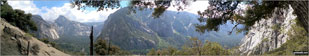
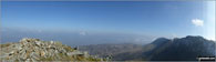
Yosemite National Park from the ascent of Yosemite Falls
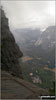
The precipitous view of the Yosemite Valley one gets near the summit of the Yosemite Falls

The Stagger Inn sign outside the Drovers Inn in Inverarnan

The River Falloch - looking north from Beinglas Campsite Bridge

The River Falloch - looking south from Beinglas Campsite Bridge

Garabal Hill and Inverarnan from Ben Glas Burn

Meall an Fhudair towering above Inverarnan (bottom left) from Ben Glas Burn

Creag nan Caorann (left) and Beinn Dubhcraig (centre right) from Ben Glas Burn

Ben Vorlich (The Arrochar Alps) from Ben Glas Burn


Beinn Chabhair from Ben Glas Burn


Ben Vorlich (The Arrochar Alps) from Ben Glas Burn


Meall nan Tarmachan from Lochan Beinn Chabhair

Approaching the summit of Beinn Chabhair


Ben Lomond from Beinn Chabhair


Meall an Fhudair (mid distance right) and Ben Bhuidhe on the horizon from Beinn Chabhair

Beinn a' Chleibh, Ben Lui (Beinn Laoigh), Ben Oss and Beinn Dubhchraig from Beinn Chabhair

Ben Mor and Stob Binnein (far right) from Beinn Chabhair

An Caisteal (Glen Falloch) (left) and Beinn a' Chroin from Beinn Chabhair

Stob a' Choin (left) and Meall Mor (Strath Gartney) (right) above Glen Larig from Beinn Chabhair

On the summit of Beinn Chabhair


Beinn Chabhair from Ben Glas Burn

Mountain Goats above Ben Glas Burn

Mountain Goat above Ben Glas Burn
Grey Mare's Tail (Ben Glas Burn) waterfall


River Fallan near Kirkton Farm near Crainlarich

Bridge over the River Fallan near Kirkton Farm near Crainlarich

Sheepfold above Kirkton Farm near Crainlarich

Footbridge over the railway above Kirkton Farm near Crainlarich

Beinn Dubhchraig, Ben Oss and Beinn Chuirn from moorland above Kirkton Farm near Crainlarich

Awkward stile over a deer fence on moorland above Kirkton Farm near Crainlarich

Unnamed Scottish burn on moorland above Kirkton Farm near Crainlarich

Unusual cloud formations above Beinn Challum

Beinn Challum (South Top) summit cairn with Ben More and Stob Binnein in the distance

Beinn Challum (South Top) from Beinn Challum


Ben More and Stob Binnein from Beinn Challum summit

Beinn Dubhchraig, Ben Oss and Beinn Chuirn from Beinn Challum


Ben Mor, Stob Binnein and Cruach Adrain from Beinn Challum

Beinn Challum from the slopes towards Gleann a' Chlachain

Beinn Dubhchraig, Ben Oss, Beinn Chuirn and Gleann a' Chlachain from the slopes of Beinn Challum


Beinn Chaorach from Gleann a' Chlachain

Railway Bridge over Allt Gleann a' Chlachain north of Auchtertyre

The remains of St Fillan's Priory, Kirkton Farm

River Fallan near Kirkton Farm near Crainlarich with Cruach Adrain

Allt Riobain waterfalls with Sgiath Chuil (left) and Sgiath Chrom on the horizon

Allt Riobain with Sgiath Chuil (left) and Sgiath Chrom beyond

Allt Riobain with Meall Glas (Glen Lochay) and Beinn Cheathaich on the horizon


Sgiath Chuil summit cairn with Stob Binnein and Ben More (centre right) in the distance

Meall Ghaordaidh from the summit of Sgiath Chuil

Beinn Sheasgarnaich from the summit of Sgiath Chuil

Beinn Challum from the summit of Sgiath Chuil


Glen Lochay from Meall a' Churain

Trig point and cairn on the summit of Beinn Cheathaich

Meall Glas (Glen Lochay) summit cairn

Ben More from Meall Glas (Glen Lochay)

Meall Glas (Glen Lochay) summit with Ben Challum in the background

Ben Challum from Meall Glas (Glen Lochay)

Meall Glas (Glen Lochay) from Meal Glas Beag

Sgiath Chuil looms over Glen Dochart near Auchessan

Meall Glas ((Glen Lochay)) and Beinn Cheathaich towering above Auchessan


The Queens Head in Askham Village

Gently climbing across Haber Hill

Ullswater from Heughscar Hill summit cairn

The lone gatepost that remains at Ketley Gate

Heughscar Hill from Ketley Gate

Tree and barn near Widewath Farm

On the back road through Helton village

Knipescar Common from Helton village

Stone stable near Helton village

Knipescar Common from near Askham church

1832 carved above the door to Askham church


The date 1674 carved into a door frame in Askham village

Stob Breac from Inverlochlarig

Stob a' Choin from Inverlochlarig

Stob Fear-tomhais (Ceann na Baintighearna) from Inverlochlarig

Beinn Tulaichean from Inverlochlarig Burn

Cruach Ardrain from Inverlochlarig Burn

Stob Invercarnaig from Inverlochlarig Burn


Ben More (left) and Stob Binnein (right) from the upper slopes of Beinn Tulaichean


Beinn Tulaichean summit cairn with Stob a' Choin in the background

Ben More (left) and Stob Binnein (right) from the summit of Beinn Tulaichean

The summit cairn on Beinn Tulaichean with Cruach Ardrain in the background


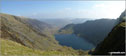
Looking south east down Loch Voil towards Inverlochlarig

Beinn a' Choin from the summit of Beinn Tulaichean

A distant Ben Lomond from the summit of Beinn Tulaichean

Cruach Ardrain (left) and Stob Garbh (Cruach Ardrain) (right) from the summit of Beinn Tulaichean


Beinn Tulaichean from the bealach above Coire Earb


Ben More (left) and Stob Binnein (right) from the summit of Cruach Ardrain

Stob Garbh (Cruach Ardrain) from the summit of Cruach Ardrain

Ben Lomond from the summit of Cruach Ardrain

Ben Ledi from the summit of Cruach Ardrain

Ben Vorlich (Coire Garbh) and Stuc a'Chroin from the summit of Cruach Ardrain


Ben Vane, Beinn Ime and Beinn Narnain from the summit of Cruach Ardrain

Crianlarich from the summit of Cruach Ardrain

Cruach Ardrain from the bealach south of Stob Garbh (Cruach Ardrain)

Stob Garbh (Cruach Ardrain) summit cairn

Beinn Tulaichean (left) and Cruach Ardrain from the summit of Stob Garbh (Cruach Ardrain)

Ben More and Stob Binnein from Stob Garbh (Cruach Ardrain)

Lochan at the highest point of Creagan Liatha

Contented Bull in Inverlochlarig Glen


Outhouse near Inverlochlarig Farm

Local man taking his dog and lamb for a walk near Inverlochlarig

Sunset over Stob a' Choin from Inverlochlarig

Golden hues on Stob a' Choin from Inverlochlarig

Stob Fear-tomhais (Ceann na Baintighearna) reflected in Loch Voil

Waymark showing the route through Auchessan

Some of the local cattle near Auchessan

Allt Riobain with Meall Glas (Glen Lochay) and Beinn Cheathaich in the distance


Tottlebank Height summit cairn


Summit Trig Point on Burney (Great Burney) with Coniston Water in the distance

A glimpse of Coniston Water from Tottlebank Height

Tottlebank Height Summit Cairn


On the summit of Y Garn (Moel Hebog) with the Snowdon (Yr Wyddfa) group in the background

Craig y Bera and Mynydd Mawr (Llyn Cwellyn) tower above Drws-y-coed from Y Garn (Moel Hebog)

Craig y Bera and Mynydd Mawr (Llyn Cwellyn) from Y Garn (Moel Hebog)

Approaching Mynydd Drws-y-coed on the Nantlle Ridge

Scrambling on Mynydd Drws-y-coed on the Nantlle Ridge

Climbing Mynydd Drws-y-coed on the Nantlle Ridge with Trum y Ddysgl beyond (right)

Mynydd Tal-y-mignedd from Trum y Ddysgl


The Jubilee Monument Obelisk on the summit of Mynydd Tal-y-mignedd

The Moelwyns - Cnicht (left) and Moelwyn Mawr (right) - from Mynydd Tal-y-mignedd

Bwlch Dros-bern and Craig Cwm Silyn from Mynydd Tal-y-mignedd

Craig Cwm Silyn from Mynydd Tal-y-mignedd

The summit of Craig Cwm Silyn with Moel Lefn, Moel yr Ogof & Moel Hebog in the background (far left)

Yr Eifl (The Rivals) on The Llyn peninsula from the summit of Mynydd Tal-y-mignedd

Mynydd Mawr (Llyn Celyn) and Craig y Bera from the summit of Craig Cwm Silyn


Mynydd Tal-y-mignedd and Mynydd Drws-y-coed from the summit of Craig Cwm Silyn

Moel Lefn (centre), Moel yr Ogof and Moel Hebog (right) from the summit of Craig Cwm Silyn

Moel Lefn (centre), Moel yr Ogof and Moel Hebog (right) from the summit of Craig Cwm Silyn

The summit of Craig Cwm Silyn with Moel Lefn in the background


Cairn on the summit of Craig Cwm Silyn


Looking west from Craig y Bera

The crags of Craig y Bera with Mynydd Mawr (Llyn Cwellyn) beyond

Mynydd Mawr (Llyn Cwellyn) from Craig y Bera


Mynydd Mawr (Llyn Cwellyn) summit plateau

Summit cairn on Mynydd Mawr (Llyn Cwellyn)


Moel Eilio, Foel Gron and Foel Goch (Snowdon) tower above Llyn Celwyn from Foel Rudd (Mynydd Mawr)

Approaching Beddgelert Forest from below Foel Rudd (Mynydd Mawr)

Mynydd Drws-y-coed (left) and Y Garn (Moel Hebog) from the Nantlle Road (B4418) near Rhyd Ddu

Mynydd Drws-y-coed (left) and Y Garn (Moel Hebog) from Rhyd Ddu

Ladyside Pike summit cairn with Hopegill Head (centre left) and Grasmoor (right) in the background

The steep descent from Hopegill Head to Ladyside Pike

Ladyside Pike from Hopegill Head

Ladyside Pike from Hopegill Head

Hobcarton End from Grisedale Pike


A lovely family I met on Grisedale Pike summit

Hobcarton Crag, Hopegill Head and Ladyside Pike from Hobcarton End

Muncaster Fell (Hooker Crag) summit trig point

The view from Muncaster Fell (Hooker Crag)

A cairn on Yew Bank (Blawith Fells) with Harter Fell (Eskdale) in the distance (right)

Yew Bank (Blawith Fells) summit cairn

The Coniston Fells from Yew Bank (Blawith Fells)


Looking down on Beacon Tarn from Wool Knott summit


Coniston Water from Beacon (Blawith Fells)

Beacon (Blawith Fells) summit cairn

Looking down into Borrowdale from near High House Bank


High House Bank from Robin Hood (Crookdale)

Robin Hood (Crookdale) summit cairn

Cairn on Robin Hood (Crookdale)

Small Cairn on Lord's Seat (Crookdale)

Grey Crag (Sleddale) summit cairn


Great Yarlside from Little Yarlside


Clapper bridge over Nant Cadair en-route to Mynydd Moel

Mynydd Moel from the clapper bridge over Nant Cadair

Mynydd Moel from the Mynydd Moel path above Nant Cadair

Craig Cwm Amarch from the Mynydd Moel path above Nant Cadair


Cloud inversion seen from near the summit of Mynydd Moel

Craig Cwm Amarch, Cadair Idris (right) and Llyn Cau from near the summit of Mynydd Moel

Approaching a false summit on Mynydd Moel

Approaching the true summit on Mynydd Moel


View from the summit of Mynydd Moel

Looking west to Cadair Idris (Penygadair) from the summit of Mynydd Moel

Ladder stile en route from Mynydd Moel to Cadair Idris (Penygadair)

Craig Cwm Amarch (left) and Cadair Idris (Penygadair) from the path from Mynydd Moel

Cadair Idris (Penygadair) from the path from Mynydd Moel


Cliffs seen from the path between Mynydd Moel and Cadair Idris (Penygadair)

Approaching Cadair Idris (Penygadair)

Approaching the summit of Cadair Idris (Penygadair)

Llyn Gafr from Cadair Idris (Penygadair)


Rocks en-route to Cadair Idris (Penygadair)

Looking back to Mynydd Moel from Cadair Idris (Penygadair)

The shelter on Cadair Idris (Penygadair)

Cadair Idris (Penygadair) summit

Cadair Idris (Penygadair) summit

Craig Cwm Amarch from Cadair Idris (Penygadair) summit

Cadair Idris (Penygadair) summit in the snow

Cadair Idris (Penygadair) summit trig point

Cyfrwy from Cadair Idris (Penygadair) summit trig point

Looking north east from Cadair Idris (Penygadair) summit trig point

Mynydd Moel from Cadair Idris (Penygadair) summit trig point

Craig Cwm Amarch and Mynydd Pencoed from Cadair Idris (Penygadair) summit trig point

Llyn y Gadair from Cadair Idris (Penygadair) summit trig point

Cyfrwy from Cadair Idris (Penygadair) summit trig point

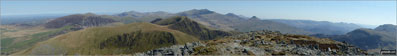
Looking back to Cadair Idris (Penygadair) from the Pony Path to Cyfrwy

Panorama showing Cyfrwy, Mynydd Moel and Cadair Idris (Penygadair)

Llyn Gafr and Llyn y Gadair from Cyfrwy

Llyn y Gadair and Mynydd Moel from Cyfrwy

Mynydd Moel and Cadair Idris (Penygadair) from Cyfrwy

Cadair Idris (Penygadair) from Cyfrwy

The Pony Path between Cadair Idris (Penygadair) and Cyfrwy


Cadair Idris (Penygadair) from Cyfrwy

Tyrrau Mawr (Craig-las) from Cyfrwy

Cadair Idris (Penygadair) from Cyfrwy

Path to Craig Cwm Amarch from Cadair Idris (Penygadair)
Llyn Cau from Craig Cau between Craig Cwm Amarch and Cadair Idris (Penygadair)

Path up to Craig Cwm Amarch from Craig Cau

Cadair Idris (Penygadair) from Craig Cau


Llyn Cau from near the top of Craig Cwm Amarch


Stile marker on Craig Cwm Amarch

Llyn Cau from the summit of Craig Cwm Amarch

Cadair Idris (Penygadair) from the summit of Craig Cwm Amarch

Cadair Idris (Penygadair) and Mynydd Moel (right) from the summit of Craig Cwm Amarch

Llyn Cau from Craig Cwm Amarch
Craig Cwm Amarch and Cadair Idris (Penygadair)

Craig Cwm Amarch and Cadair Idris (Penygadair)


On the Minffordd Path near Craig Lwyd

Craig Cwm Amarch (left) and Craig Cau above Llyn Cau from the Minffordd Path near Craig Lwyd

Mynydd Dol-ffanog from the Minffordd Path near Craig Lwyd


Marker post on the Minffordd Path


Woodland on the Minffordd Path

Stone steps on the Minffordd Path

More steps on the Minffordd Path

Stone bridge across Nant Cadair on the Minffordd Path

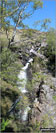
One of Nant Cadair's many waterfalls on the Minffordd Path

Gate at the start of the Minffordd Path

National Park tea rooms near the start of the Minffordd Path

Early morning snow on the summit of Scafell Pike

The sun breaking through over a snowy Ilkley Moor

West Buck Stones (Ilkley Moor) in the snow

Overgate Croft Farm (Ilkley Moor) Trig Point in the snow

Snowy forest on High Moor leading to Rombalds Moor (Ilkley Moor)

Snow on Cowper's Cross (Ilkley Moor)

Rombalds Moor (Ilkley Moor) Trig Point in the snow

Looking down over Newby Bridge from Finsthwaite

Finsthwaite Tower on Finsthwaite Heights

Finsthwaite Village from Finsthwaite Heights

Cloud over Top o' Selside from Carron Crag

The Howgill Fells from Carron Crag

View over Grizdale Forest from Carron Crag

My shadow on Carron Crag Trig point


Claife Viewing Station on the west shore of Lake Windermere near Far Sawry Ferry House

View over Windermere from the path up Claife Heights

Claife Heights (High Blind How) summit trig point

Moss Eccles Tarn on Claife Heights

The Langdale Pikes from Wise Een Tarn on Claife Heights

Brock Barrow (Top o' Selside) summit cairn with Coniston Water below

Low Light Haw (Top o' Selside) summit cairn

High Light Haw (Top o' Selside) summit cairn

Coniston Water from the second cairn on Brock Barrow (Top o' Selside)


The path through the heather on Top o' Selside

On the track down towards Holme Styles Reservoir near Holmfirth

Yateholme Reservoir in the snow above Holmfirth

Looking south over a snowy Stickle Tarn to Wetherlam and the Coniston Fells from Pavey Ark

The viewpoint marker on the summit of Lose Hill (Ward's Piece)

Back Tor (Hollins Cross) from Hollins Cross


Walking up through Cavedale from Castleton

The view from the summit of Higher Shelf Stones

War time Graffiti on Higher Shelf Stones

Higher Shelf Stones summit trig point

Plane Wreckage from the crashed flying fortress on Higher Shelf Stones.


The Wain Stones (or Kissing Stones) on Bleaklow Head (Bleaklow Hill)

Bleaklow Head (Bleaklow Hill) summit


On Clennell Street descending back to Alwinton after visiting Bloodybush Edge

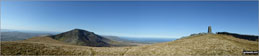
Bloodybush Edge summit trig point

The boggy approach to Bloodybush Edge summit trig point

Looking north to The Cheviot (left) and Hedgehope Hill from the summit of Cushat Law


Windy Gyle summit cairn and trig point

The Pennine Way from Windy Gyle summit trig point

Stile over the border fence between England and Scotland on the way to Windy Gyle


The view from Hedgehope Hill summit

Hedgehope Hill summit cairn and trig point

Long Crags on the descent from Hedgehope Hill

Scotsman's Cairn on Cairn Hill, SW of The Cheviot


View from the path near the summit of The Cheviot


The River Rawthey behind The Cross Keys near Sedburgh

The River Rawthey valley from Great Dummacks


The view from Fell Head (Howgills) summit cairn

Fell Head (Howgills) summit cairn


Descending towards Bowderdale Beck from Randygill Top


Baugh Fell and Knoutberry Haw from near West Baugh Fell Tarn

The Howgills from the descent from Knoutberry Haw

Cairns and curricks below Knoutberry Haugh

Knoutberry Haugh summit trig point

The tiny cairn on the summit of Baugh Fell (Tarn Rigg Hill)

Waterfall on the River Rawthey near Rawthey Bridge

Tributary to the River Rawthey near Rawthey Bridge

The River Rawthey near Rawthey Bridge

Waterfall at Rawthey Gill Quarry

A cairn near High Seat (Mallerstang)

High Seat (Mallerstang) summit cairn

Tall currick near Hugh Seat on Mallerstang Common


Archy Styrigg (Gregory Chapel) summit cairn

The Water Cut Sculpture on The Lady Anne's Way, Mallerstang


A snowy Whernside though Arten Gill Viaduct

To contribute to go4awalk.com or to contact us about anything at all - see Talk To Us.
For help see Help.
go4awalk.com and go4awalk.co.uk are registered trademarks of TMDH Limited.
Copyright © 2000-2026 TMDH Limited. All rights reserved.
Copyright Terms & Conditions Privacy Statement
A - Z Walks Home Log On/Accounts Photo Gallery Walk Ideas and Collections Fell Facts Hill Skills Walking Questions and Answers Your Stories News Competitions Product Reviews/Gear Tests Walking Gear Guides Peaks and Mountains Peak Bagging Find New Walking Friends Camping GPS Waypoints for Walking Contents Walk Search Talk To Us go4awalk.com Help Free Example Walks Newsletter


