
![]()
Gowbarrow Fell (Airy Crag)
481m (1579ft)
The Eastern Fells, The Lake District, Cumbria, England
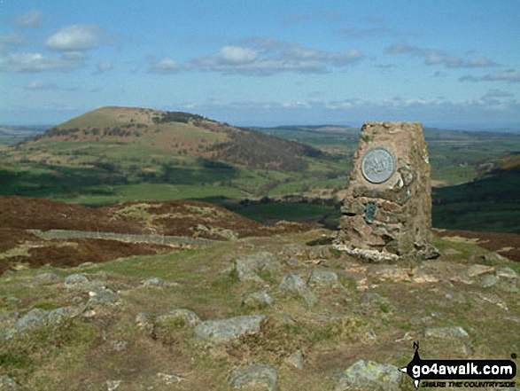
The summit of Gowbarrow Fell (Airy Crag) is marked by an Ordnance Survey Trig Point.
Not familiar with this top?
You can walk/hike to the top of Gowbarrow Fell (Airy Crag) by using either of these 2 easy‑to‑follow route maps:
Walk c352 Gowbarrow Fell (Airy Crag) from Aira Force
An impressive waterfall and a taste of the fells
   |
|---|
Vital Statistics:
| Length: | 4.5ml (7km) |
|---|---|
| Ascent: | 1,204ft (367m) |
| Time: | 3 hrs |
| Grade: |  (Moderate) (Moderate) |

Route Summary:
Aira Force National Trust Car Park (nr Glenridding) - Aira Force - Riddings Beck - Waterfalls - High Force - Gowbarrow Fell (Airy Crag) - Gowbarrow Park - Green Hill (Gowbarrow Fell) - Aira Force Car Park.
Walk c309 Great Mell Fell, Little Mell Fell and Gowbarrow Fell
Three remote Wainwrights in a single walk
|
|---|
Vital Statistics:
| Length: | 12.25ml (19.5km) |
|---|---|
| Ascent: | 3,254ft (992m) |
| Time: | 7½ hrs |
| Grade: |  (Hard) (Hard) |

Route Summary:
Brownrigg Farm - Great Mell Fell - Greenrow Great Barn - Lowthwaite - Little Mell Fell - The Hause - Underwood - Cove Park Campsite - Watermillock - Priest's Crag - Great Meldrum - Gowbarrow Fell (Airy Crag) - Norman Crag - Ulcat Row - Matterdale End - Brownrigg Farm
See Gowbarrow Fell (Airy Crag) and the surrounding tops on our free-to-access 'Google Style' Peak Bagging Maps:
The Eastern Fells of The Lake District National Park
Less data - quicker to download
The Whole of The Lake District National Park
More data - might take a little longer to download
See Gowbarrow Fell (Airy Crag) and the surrounding tops on our unique, downloadable, PDF Peak Bagging Maps:

NB: Whether you print off a copy or download it to your phone, these PDF Peak Baggers' Maps might prove incredibly useful when your are up there on the tops and you cannot get a phone signal.
*This version is marked with the walk routes you need to follow to Walk all 214 Wainwrights in just 59 walks.
You can find Gowbarrow Fell (Airy Crag) & all the walks that climb it on these unique free-to-access Interactive Walk Planning Maps:
1:25,000 scale OS Explorer Map (orange/yellow covers):
1:50,000 scale OS Landranger Map (pink/magenta covers):
 Fellow go4awalkers who have already walked, climbed, scaled, summited, hiked & bagged Gowbarrow Fell (Airy Crag)
Neil Walker walked up Gowbarrow Fell (Airy Crag) on August 14th, 2025 [from/via/route] Royal Hotel, Dockray [with] Emma [weather] Sunny/overcast
Geoff Hand climbed it on June 10th, 2025 [from/via/route] Walked from Aira Force carpark over Hind Crag to Yew Crag & the Memorial Seat. Climbed Gowbarrow to Airy Crag. We then walkedSouth west back to high force & Aira Force. [with] Two friends Richard Macilwaine and John Dooley [weather] Cloudy, with sunny spells. Warm - Picked up a chap on the way home, he was nearly blind & quite lost. We took him back to the Patterdale Hotel & then went for a pint in the Ullswater Hotel.
Christine Shepherd bagged it on April 24th, 2010 [from/via/route] Used walk c309 from Brownrigg Farm [with] On my own [weather] Fine & clear - Climbed again on 30.08.2018 from Aira Force NT Carpark, just up & down. Did another up & down on 11.7.2022, before going for Afternoon Tea in Windermere. Climbed Gowbarrow again on a rather grey day as part of the Ullswater Way.
Caroline Winter hiked Gowbarrow Fell (Airy Crag) on October 24th, 2024 [from/via/route] Aira upper road, Gowbarrow Fell, circuit about Ullswater, Aira falls [with] Becky [weather] Damp day with light breeze. - Great views over Ullswater, had a swim in water at falls on return
Martin Hartshorne summited on September 11th, 2024 [from/via/route] Aira force car park, yew crag, Gowbarrow fell, aira force [with] finley and Alex!!! [weather] Mostly sunshine windyon the top evening sunshine to finish
To add (or remove) your name and experiences on this page - Log On and edit your Personal Mountain Bagging Record
. . . [see more walk reports]
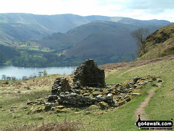
More Photographs & Pictures of views from, on, or of, Gowbarrow Fell (Airy Crag)

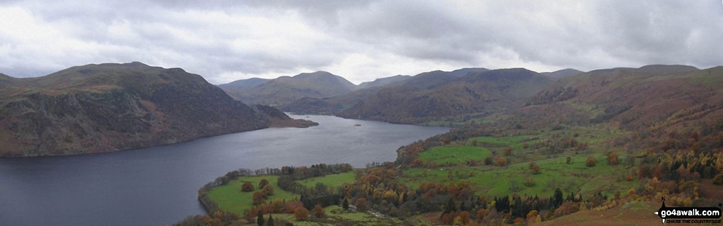


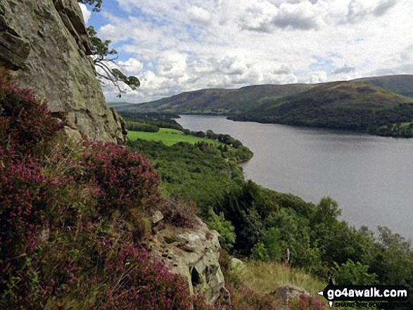
Climbing up the edge of Gowbarrow Fell (Airy Crag) high above the North Western shores of Ullswater.

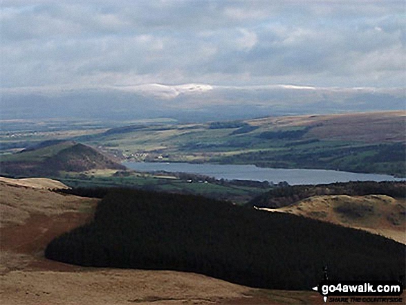
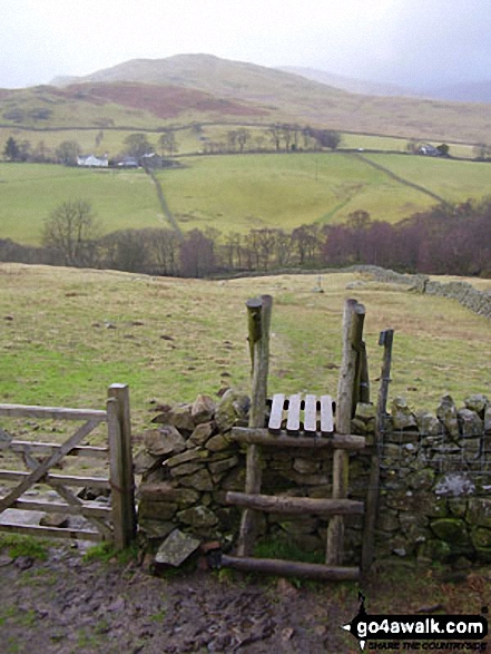
Watson's Dodd, Great Dodd and Clough Head and Dockray from Gowbarrow Fell (Airy Crag)
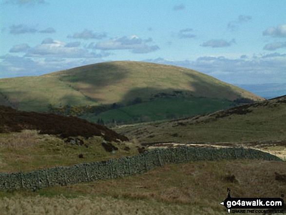
Watermillock Common with Hart Side beyond from below Gowbarrow Fell (Airy Crag)
. . . see all 17 walk photographs & pictures of views from, on, or of, Gowbarrow Fell (Airy Crag)
Send us your photographs and pictures on, of, or from Gowbarrow Fell (Airy Crag)
If you would like to add your walk photographs and pictures to this page, please send them as email attachments (configured for any computer) along with your name to:
and we shall do our best to publish them.
(Guide Resolution = 300dpi. At least = 660pixels (wide) x 440 pixels (high).)

You can also submit photos via our Facebook Page.
NB. Please indicate where each photo was taken and whether you wish us to credit your photos with a Username or your First Name/Last Name.


