
![]()
Cnicht
689m (2260ft)
The Moelwyns, Snowdonia, Gwynedd, Wales
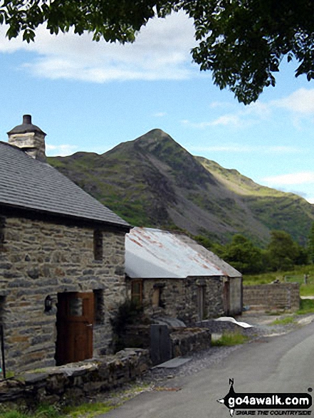
Cnicht is often referred to as the Welsh Matterhorn. When viewed from the village of Croesor and the south-west, Cnicht appears to be a perfect pyramid shaped mountain that resembles the Matterhorn on the border between Italy and Switzerland.
Tap/mouse over a coloured circle (1-3 easy walks, 4-6 moderate walks, 7-9 hard walks) and click to select.
The summit of Cnicht is marked by a rocky outcrop.
Not familiar with this top?
You can walk/hike to the top of Cnicht by using any of these 4 easy‑to‑follow route maps:
Walk gw163 Cnicht from Blaen Nanmor
A steep rocky scramble up the Welsh Matterhorn
   |
|---|
Vital Statistics:
| Length: | 6.75ml (11km) |
|---|---|
| Ascent: | 2,369ft (722m) |
| Time: | 5 hrs |
| Grade: |  (Hard) (Hard) |

Route Summary:
Blaen Nanmor - Gelli-lago Nantmor Mountain Centre - Bwlch y Battel - Croesor Bach - Cnicht - Cnicht (North Top) - Llyn Yr Adar - Y Cyrniau - Llyn Llagi - Clogwyn Gottal - Carned Melyn - Llwynyrhwch - Cefn Gerynt - Gerynt - Blaen Nanmor
Walk gw131 Cnicht from Croesor
Cnicht offers almost a 360 degree panorama.
|
|---|
Vital Statistics:
| Length: | 7.25ml (11.5km) |
|---|---|
| Ascent: | 2,273ft (693m) |
| Time: | 5 hrs |
| Grade: | (Moderate) |

Route Summary:
Croesor - Croesor Bach - Cnicht - The Welsh Matterhorn - Cnicht (North Top) - Llyn Yr Adar - Afon Cwm-y-foel - Llyn Cwm-corsiog - Clogwyn Birth - Rhosydd Quarry - Bwlch y Rhosydd - Croesor Quarry - Cwm Croesor - Croesor
Walk gw224 Cnicht, Hafod-yr-Hydd and Moelwyn Mawr from Croesor
Superb views of sea and valley.
|
|---|
Vital Statistics:
| Length: | 9ml (14.5km) |
|---|---|
| Ascent: | 3,355ft (1,023m) |
| Time: | 6.75hrs |
| Grade: |  (Hard) (Hard) |

Route Summary:
Croesor - Croesor Bach - Cnicht - Cnicht (North Top) - Llyn Yr Adar - Afon Cwm-y-foel - Llyn Cwm-corsiog - Clogwyn Birth - Rhosydd Quarry - Moel-yr-hydd - Moelwyn Mawr (North Ridge Top) - Moelwyn Mawr - Croesor
Walk gw173 Cnicht, Moel-yr-hydd, Moelwyn Mawr and Moelwyn Bach from Croesor
Superb views of sea and valley
|
|---|
Vital Statistics:
| Length: | 10ml (16km) |
|---|---|
| Ascent: | 3,923ft (1,196m) |
| Time: | 7½ hrs |
| Grade: | (Hard) |

Route Summary:
Croesor - Croesor Bach - Cnicht - Cnicht (North Top) - Llyn Yr Adar - Afon Cwm-y-foel - Llyn Cwm-corsiog - Clogwyn Birth - Rhosydd Quarry - Moel-yr-hydd - Moelwyn Mawr (North Ridge Top) - Moelwyn Mawr - Craigysgafn - Bwlch Stwlan - Moelwyn Bach - Croesor
See Cnicht and the surrounding tops on our free-to-access 'Google Style' Peak Bagging Maps:
The Moelwyns area of Snowdonia National Park
Less data - quicker to download
The Whole of Snowdonia National Park
More data - might take a little longer to download
See Cnicht and the surrounding tops on our unique, downloadable, PDF Peak Bagging Map:

NB: Whether you print off a copy or download it to your phone, this PDF Peak Baggers' Map might prove incredibly useful when your are up there on the tops and you cannot get a phone signal.
You can find Cnicht & all the walks that climb it on these unique free-to-access Interactive Walk Planning Maps:
1:25,000 scale OS Explorer Map (orange/yellow covers):
1:50,000 scale OS Landranger Map (pink/magenta covers):
 Fellow go4awalkers who have already walked, climbed, scaled, summited, hiked & bagged Cnicht
Bronwen Chinien walked up Cnicht on February 5th, 2023 [from/via/route] From Croesor [with] Bronwen, Viken and Gethin [weather] Summer, sunny - Gethin's first mountain (age 4) - he loved scrambling up the rocks to peak. Had to carry him across boggy bits further round. German trio helped us with route finding.
Melfyn Parry climbed it on April 11th, 2019 [from/via/route] Start & finish at Croesor car park at SH631446. Steep tarmac road to start of the walking path. Ascent to summit of Cnicht was via well defined path. Stunning views in all directions. Descent from summit toward Llyn Adar before turning right to pass by Llynnau Dwyffos. Path a little boggy along here up to brow of hill. Descent to Rhosydd quarry & then up the old incline to stop for lunch. Ascent to ridge line & then followed fence to summit of Moelwyn Mawr. Descent back to car park via grassy slope, not too steep & then tarmac lane. [with] DS [weather] Mainly sunny & warm, occasional cold breeze.
Mark Smith bagged it on March 13th, 2010 [weather] cold but sunny
Sion Britton hiked Cnicht on May 30th, 2021 [from/via/route] O Croesor. [with] Rhiannon [weather] Braf
Donovan Suddell summited on April 10th, 2021 [from/via/route] Croesor using gw173 [with] My wife [weather] Sunny & clear, odd sprinkle of snow - gw173 is a mighty fine walk, & Cnicht is a special mountain
To add (or remove) your name and experiences on this page - Log On and edit your Personal Mountain Bagging Record
. . . [see more walk reports]
More Photographs & Pictures of views from, on, or of, Cnicht
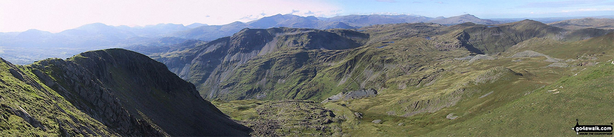
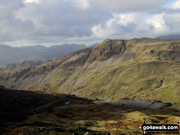
The north-west ridge of Molewyn Mawr (left) with Cnicht, Cnicht (North Top) and Ysgafell Wen (far right) across Cwm Croesor and Clogwyn Brith from the summit of Moelwyn Mawr
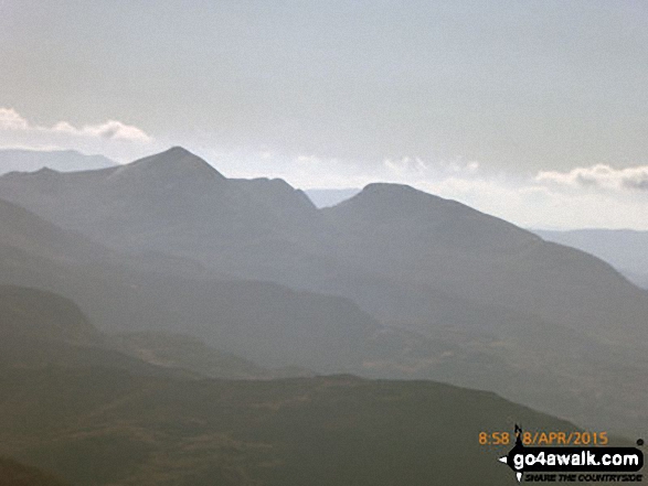
The Moelwyns - Cnicht (left) and Moelwyn Mawr (right) - from Mynydd Tal-y-mignedd
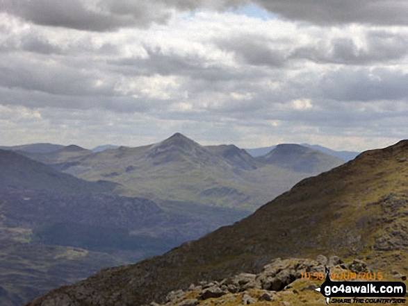


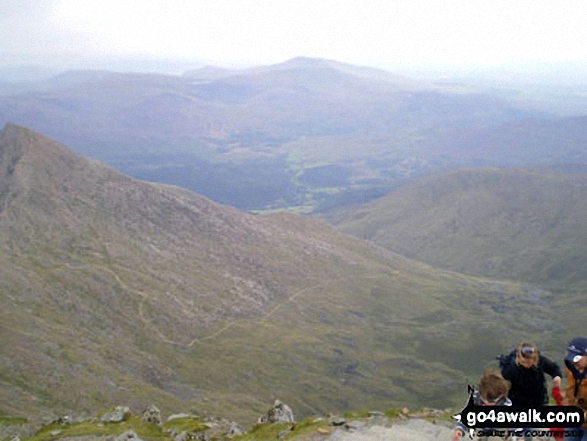
The Watkin Path, Nantgwynant and Cnicht on the horizon from the summit of Snowdon (Yr Wyddfa)
. . . see all 35 walk photographs & pictures of views from, on, or of, Cnicht
Send us your photographs and pictures on, of, or from Cnicht
If you would like to add your walk photographs and pictures to this page, please send them as email attachments (configured for any computer) along with your name to:
and we shall do our best to publish them.
(Guide Resolution = 300dpi. At least = 660pixels (wide) x 440 pixels (high).)

You can also submit photos via our Facebook Page.
NB. Please indicate where each photo was taken and whether you wish us to credit your photos with a Username or your First Name/Last Name.


