Snowdonia National Park - a fully detailed list of all the Mountains, Peaks, Tops and Hills (Page 1 of 5)
Snowdonia National Park in Clwyd, Conwy, Gwynedd and Powys is the area of Wales within the Snowdonia National Park boundary including the non-National Park 'island' around Blaenau Ffestiniog.
If you include just the Mountains (Hewitts) and the Nuttalls there are 121 tops to climb, bag & conquer and the highest point is Snowdon (Yr Wyddfa) at 1,085m (3,561ft).
To see these Mountains, Peaks, Tops and Hills displayed in different ways - see the options in the left-hand column and towards the bottom of this page.
LOG ON and RELOAD this page to show which Mountains, Peaks, Tops and Hills you have already climbed, bagged & conquered [. . . more details]
Page 1 of 5 Go to page:
1 2 3 4 5 |
See this list in: Alphabetical Order
| Height Order‡
To reverse the order select the link again.
Mountain, Peak, Top or Hill:
Bagged
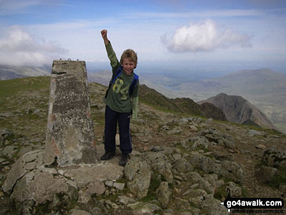
1. Snowdon (Yr Wyddfa)
1,085m (3,561ft)
Mountain (1st in Wales, 1st in England & Wales)
Nuttall (1st in Wales, 1st in England & Wales)
Marilyn (1st in Wales, 43rd in GB)
OS Trig Point
Snowdon (Yr Wyddfa) is the highest point in the county of Gwynedd, the highest point in Snowdonia National Park and the highest point in England and Wales.
To walk, climb & bag Snowdon (Yr Wyddfa) use any of these easy-to-follow walks:
See the location of Snowdon (Yr Wyddfa) and walks up it on a google MapSnowdon (Yr Wyddfa) is on interactive maps:
OS Explorer (Orange Covers): OL17
OS Landranger (Pink Covers): 115
Snowdon (Yr Wyddfa) is on downloadable PDF you can Print or Save to your Phone:
|
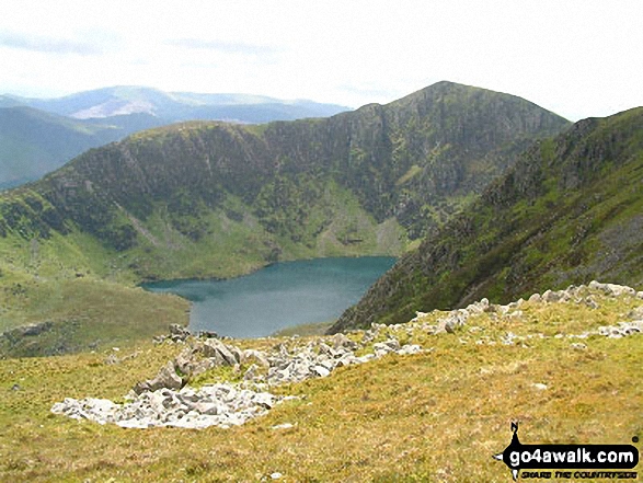
2. Garnedd Ugain (Crib y Ddysgl)
1,066m (3,499ft)
Mountain (2nd in Wales, 2nd in England & Wales)
Nuttall (2nd in Wales, 2nd in England & Wales)
OS Trig Point
To walk, climb & bag Garnedd Ugain (Crib y Ddysgl) use any of these easy-to-follow walks:
See the location of Garnedd Ugain (Crib y Ddysgl) and walks up it on a google MapGarnedd Ugain (Crib y Ddysgl) is on interactive maps:
OS Explorer (Orange Covers): OL17
OS Landranger (Pink Covers): 115
Garnedd Ugain (Crib y Ddysgl) is on downloadable PDF you can Print or Save to your Phone:
|
3. Carnedd Llewelyn
1,064m (3,492ft)
Mountain (3rd in Wales, 3rd in England & Wales)
Nuttall (3rd in Wales, 3rd in England & Wales)
Marilyn (2nd in Wales, 57th in GB)
Carnedd Llewelyn is the highest point in the county of Conwy.
To walk, climb & bag Carnedd Llewelyn use any of these easy-to-follow walks:
See the location of Carnedd Llewelyn and walks up it on a google MapCarnedd Llewelyn is on interactive maps:
OS Explorer (Orange Covers): OL17
OS Landranger (Pink Covers): 115
Carnedd Llewelyn is on downloadable PDF you can Print or Save to your Phone:
|
4. Carnedd Dafydd
1,040m (3,413ft)
Mountain (4th in Wales, 4th in England & Wales)
Nuttall (4th in Wales, 4th in England & Wales)
OS Trig Point
To walk, climb & bag Carnedd Dafydd use either of these easy-to-follow walks:
See the location of Carnedd Dafydd and walks up it on a google MapCarnedd Dafydd is on interactive maps:
OS Explorer (Orange Covers): OL17
OS Landranger (Pink Covers): 115
Carnedd Dafydd is on downloadable PDF you can Print or Save to your Phone:
|
5. Glyder Fawr
999m (3,279ft)
Mountain (5th in Wales, 5th in England & Wales)
Nuttall (5th in Wales, 5th in England & Wales)
Marilyn (3rd in Wales, 111th in GB)
We hope to have walks that climb & bag Glyder Fawr very soon
See the location of Glyder Fawr and walks up it on a google MapGlyder Fawr is on interactive maps:
OS Explorer (Orange Covers): OL17
OS Landranger (Pink Covers): 115
Glyder Fawr is on downloadable PDF you can Print or Save to your Phone:
|
6. Glyder Fach
990m (3,249ft)
Mountain (6th in Wales, 6th in England & Wales)
Nuttall (6th in Wales, 6th in England & Wales)
To walk, climb & bag Glyder Fach use any of these easy-to-follow walks:
See the location of Glyder Fach and walks up it on a google MapGlyder Fach is on interactive maps:
OS Explorer (Orange Covers): OL17
OS Landranger (Pink Covers): 115
Glyder Fach is on downloadable PDF you can Print or Save to your Phone:
|
7. Pen yr Ole Wen
978m (3,210ft)
Mountain (7th in Wales, 7th in England & Wales)
Nuttall (7th in Wales, 7th in England & Wales)
To walk, climb & bag Pen yr Ole Wen use any of these easy-to-follow walks:
See the location of Pen yr Ole Wen and walks up it on a google MapPen yr Ole Wen is on interactive maps:
OS Explorer (Orange Covers): OL17
OS Landranger (Pink Covers): 115
Pen yr Ole Wen is on downloadable PDF you can Print or Save to your Phone:
|
8. Foel Grach
976m (3,203ft)
Mountain (8th in Wales, 9th in England & Wales)
Nuttall (8th in Wales, 9th in England & Wales)
To walk, climb & bag Foel Grach use this easy-to-follow walk:
See the location of Foel Grach and walks up it on a google MapFoel Grach is on interactive maps:
OS Explorer (Orange Covers): OL17
OS Landranger (Pink Covers): 115
Foel Grach is on downloadable PDF you can Print or Save to your Phone:
|
9. Castell y Gwynt (Glyder Fach)
972m (3,190ft)
Nuttall (9th in Wales, 10th in England & Wales)
To walk, climb & bag Castell y Gwynt (Glyder Fach) use any of these easy-to-follow walks:
See the location of Castell y Gwynt (Glyder Fach) and walks up it on a google MapCastell y Gwynt (Glyder Fach) is on interactive maps:
OS Explorer (Orange Covers): OL17
OS Landranger (Pink Covers): 117
Castell y Gwynt (Glyder Fach) is on downloadable PDF you can Print or Save to your Phone:
|
10. Yr Elen
962m (3,157ft)
Mountain (9th in Wales, 11th in England & Wales)
Nuttall (10th in Wales, 12th in England & Wales)
To walk, climb & bag Yr Elen use either of these easy-to-follow walks:
See the location of Yr Elen and walks up it on a google MapYr Elen is on interactive maps:
OS Explorer (Orange Covers): OL17
OS Landranger (Pink Covers): 115
Yr Elen is on downloadable PDF you can Print or Save to your Phone:
|
11. Y Garn (Glyderau)
947m (3,108ft)
Mountain (10th in Wales, 13th in England & Wales)
Nuttall (11th in Wales, 15th in England & Wales)
Marilyn (4th in Wales, 167th in GB)
To walk, climb & bag Y Garn (Glyderau) use any of these easy-to-follow walks:
See the location of Y Garn (Glyderau) and walks up it on a google MapY Garn (Glyderau) is on interactive maps:
OS Explorer (Orange Covers): OL17
OS Landranger (Pink Covers): 115
Y Garn (Glyderau) is on downloadable PDF you can Print or Save to your Phone:
|
12. Foel-fras (Carneddau)
942m (3,091ft)
Mountain (11th in Wales, 14th in England & Wales)
Nuttall (12th in Wales, 16th in England & Wales)
OS Trig Point
We hope to have walks that climb & bag Foel-fras (Carneddau) very soon
See the location of Foel-fras (Carneddau) and walks up it on a google MapFoel-fras (Carneddau) is on interactive maps:
OS Explorer (Orange Covers): OL17
OS Landranger (Pink Covers): 115
Foel-fras (Carneddau) is on downloadable PDF you can Print or Save to your Phone:
|
13. Carnedd Gwenllian (Carnedd Uchaf)
926m (3,039ft)
Mountain (12th in Wales, 18th in England & Wales)
Nuttall (13th in Wales, 20th in England & Wales)
Carnedd Gwenllian was formerly known as Carnedd Uchaf (in 2009) and as Garnedd Uchaf prior to that.
We hope to have walks that climb & bag Carnedd Gwenllian (Carnedd Uchaf) very soon
See the location of Carnedd Gwenllian (Carnedd Uchaf) and walks up it on a google MapCarnedd Gwenllian (Carnedd Uchaf) is on interactive maps:
OS Explorer (Orange Covers): OL17
OS Landranger (Pink Covers): 115
Carnedd Gwenllian (Carnedd Uchaf) is on downloadable PDF you can Print or Save to your Phone:
|
14. Elidir Fawr
924m (3,033ft)
Mountain (13th in Wales, 19th in England & Wales)
Nuttall (14th in Wales, 22nd in England & Wales)
Marilyn (5th in Wales, 201st in GB)
To walk, climb & bag Elidir Fawr use either of these easy-to-follow walks:
See the location of Elidir Fawr and walks up it on a google MapElidir Fawr is on interactive maps:
OS Explorer (Orange Covers): OL17
OS Landranger (Pink Covers): 115
Elidir Fawr is on downloadable PDF you can Print or Save to your Phone:
|
15. Crib Goch
923m (3,029ft)
Mountain (14th in Wales, 20th in England & Wales)
Nuttall (15th in Wales, 23rd in England & Wales)
To walk, climb & bag Crib Goch use any of these easy-to-follow walks:
See the location of Crib Goch and walks up it on a google MapCrib Goch is on interactive maps:
OS Explorer (Orange Covers): OL17
OS Landranger (Pink Covers): 115
Crib Goch is on downloadable PDF you can Print or Save to your Phone:
|
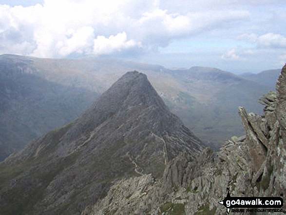
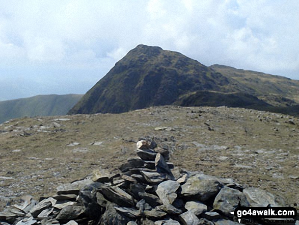
16. Tryfan
915m (3,003ft)
Mountain (15th in Wales, 21st in England & Wales)
Nuttall (16th in Wales, 24th in England & Wales)
Marilyn (6th in Wales, 212th in GB)
To walk, climb & bag Tryfan use either of these easy-to-follow walks:
See the location of Tryfan and walks up it on a google MapTryfan is on interactive maps:
OS Explorer (Orange Covers): OL17
OS Landranger (Pink Covers): 115
Tryfan is on downloadable PDF you can Print or Save to your Phone:
|
17. Aran Fawddwy
905m (2,970ft)
Mountain (16th in Wales, 23rd in England & Wales)
Nuttall (17th in Wales, 26th in England & Wales)
Marilyn (7th in Wales, 228th in GB)
OS Trig Point
To walk, climb & bag Aran Fawddwy use either of these easy-to-follow walks:
See the location of Aran Fawddwy and walks up it on a google MapAran Fawddwy is on interactive maps:
OS Explorer (Orange Covers): OL23
OS Landranger (Pink Covers): 124
Aran Fawddwy is on downloadable PDF you can Print or Save to your Phone:
|
18. Y Lliwedd
898m (2,947ft)
Mountain (17th in Wales, 26th in England & Wales)
Nuttall (18th in Wales, 29th in England & Wales)
Marilyn (8th in Wales, 240th in GB)
To walk, climb & bag Y Lliwedd use either of these easy-to-follow walks:
See the location of Y Lliwedd and walks up it on a google MapY Lliwedd is on interactive maps:
OS Explorer (Orange Covers): OL17
OS Landranger (Pink Covers): 115
Y Lliwedd is on downloadable PDF you can Print or Save to your Phone:
|
19. Y Lliwedd (East Top)
893m (2,931ft)
Nuttall (19th in Wales, 31st in England & Wales)
To walk, climb & bag Y Lliwedd (East Top) use either of these easy-to-follow walks:
See the location of Y Lliwedd (East Top) and walks up it on a google MapY Lliwedd (East Top) is on interactive maps:
OS Explorer (Orange Covers): OL17
OS Landranger (Pink Covers): 115
Y Lliwedd (East Top) is on downloadable PDF you can Print or Save to your Phone:
|
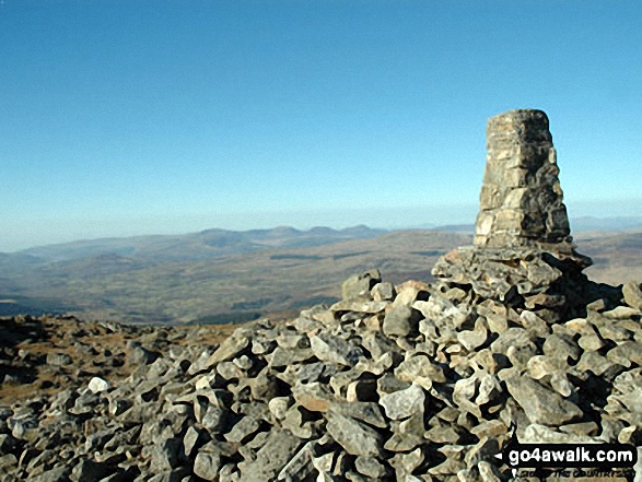
20. Cadair Idris (Penygadair)
892m (2,929ft)
Mountain (18th in Wales, 27th in England & Wales)
Nuttall (20th in Wales, 32nd in England & Wales)
Marilyn (9th in Wales, 247th in GB)
OS Trig Point
To walk, climb & bag Cadair Idris (Penygadair) use any of these easy-to-follow walks:
See the location of Cadair Idris (Penygadair) and walks up it on a google MapCadair Idris (Penygadair) is on interactive maps:
OS Explorer (Orange Covers): OL23
OS Landranger (Pink Covers): 124
Cadair Idris (Penygadair) is on downloadable PDF you can Print or Save to your Phone:
|
21. Aran Benllyn
885m (2,905ft)
Mountain (20th in Wales, 32nd in England & Wales)
Nuttall (22nd in Wales, 37th in England & Wales)
To walk, climb & bag Aran Benllyn use either of these easy-to-follow walks:
See the location of Aran Benllyn and walks up it on a google MapAran Benllyn is on interactive maps:
OS Explorer (Orange Covers): OL23
OS Landranger (Pink Covers): 124
Aran Benllyn is on downloadable PDF you can Print or Save to your Phone:
|
22. Carnedd Moel Siabod
872m (2,861ft)
Mountain (21st in Wales, 36th in England & Wales)
Nuttall (23rd in Wales, 41st in England & Wales)
Marilyn (11th in Wales, 281st in GB)
OS Trig Point
To walk, climb & bag Carnedd Moel Siabod use any of these easy-to-follow walks:
See the location of Carnedd Moel Siabod and walks up it on a google MapCarnedd Moel Siabod is on interactive maps:
OS Explorer (Orange Covers): OL17
OS Landranger (Pink Covers): 115
Carnedd Moel Siabod is on downloadable PDF you can Print or Save to your Phone:
|
23. Erw y Ddafad-ddu
872m (2,861ft)
Mountain (22nd in Wales, 37th in England & Wales)
Nuttall (24th in Wales, 42nd in England & Wales)
To walk, climb & bag Erw y Ddafad-ddu use either of these easy-to-follow walks:
See the location of Erw y Ddafad-ddu and walks up it on a google MapErw y Ddafad-ddu is on interactive maps:
OS Explorer (Orange Covers): OL23
OS Landranger (Pink Covers): 124
Erw y Ddafad-ddu is on downloadable PDF you can Print or Save to your Phone:
|
24. Mynydd Moel
863m (2,832ft)
Mountain (23rd in Wales, 40th in England & Wales)
Nuttall (26th in Wales, 47th in England & Wales)
To walk, climb & bag Mynydd Moel use any of these easy-to-follow walks:
See the location of Mynydd Moel and walks up it on a google MapMynydd Moel is on interactive maps:
OS Explorer (Orange Covers): OL23
OS Landranger (Pink Covers): 124
Mynydd Moel is on downloadable PDF you can Print or Save to your Phone:
|
25. Arenig Fawr (Moel Yr Eglwys)
854m (2,802ft)
Mountain (24th in Wales, 46th in England & Wales)
Nuttall (27th in Wales, 53rd in England & Wales)
Marilyn (12th in Wales, 311th in GB)
OS Trig Point
To walk, climb & bag Arenig Fawr (Moel Yr Eglwys) use any of these easy-to-follow walks:
See the location of Arenig Fawr (Moel Yr Eglwys) and walks up it on a google MapArenig Fawr (Moel Yr Eglwys) is on interactive maps:
OS Explorer (Orange Covers): OL18
OS Landranger (Pink Covers): 124 and
125
Arenig Fawr (Moel Yr Eglwys) is on downloadable PDF you can Print or Save to your Phone:
|
26. Llwytmor
849m (2,786ft)
Mountain (25th in Wales, 49th in England & Wales)
Nuttall (28th in Wales, 56th in England & Wales)
To walk, climb & bag Llwytmor use this easy-to-follow walk:
See the location of Llwytmor and walks up it on a google MapLlwytmor is on interactive maps:
OS Explorer (Orange Covers): OL17
OS Landranger (Pink Covers): 115
Llwytmor is on downloadable PDF you can Print or Save to your Phone:
|
27. Arenig Fawr (South Top)
836m (2,744ft)
Nuttall (29th in Wales, 64th in England & Wales)
To walk, climb & bag Arenig Fawr (South Top) use either of these easy-to-follow walks:
See the location of Arenig Fawr (South Top) and walks up it on a google MapArenig Fawr (South Top) is on interactive maps:
OS Explorer (Orange Covers): OL18
OS Landranger (Pink Covers): 124 and
125
Arenig Fawr (South Top) is on downloadable PDF you can Print or Save to your Phone:
|
28. Pen yr Helgi Du
833m (2,734ft)
Mountain (26th in Wales, 57th in England & Wales)
Nuttall (30th in Wales, 66th in England & Wales)
To walk, climb & bag Pen yr Helgi Du use any of these easy-to-follow walks:
See the location of Pen yr Helgi Du and walks up it on a google MapPen yr Helgi Du is on interactive maps:
OS Explorer (Orange Covers): OL17
OS Landranger (Pink Covers): 115
Pen yr Helgi Du is on downloadable PDF you can Print or Save to your Phone:
|
29. Foel-goch
831m (2,727ft)
Mountain (28th in Wales, 59th in England & Wales)
Nuttall (32nd in Wales, 68th in England & Wales)
To walk, climb & bag Foel-goch use either of these easy-to-follow walks:
See the location of Foel-goch and walks up it on a google MapFoel-goch is on interactive maps:
OS Explorer (Orange Covers): OL17
OS Landranger (Pink Covers): 115
Foel-goch is on downloadable PDF you can Print or Save to your Phone:
|
30. Carnedd y Filiast (Glyderau)
822m (2,698ft)
Mountain (30th in Wales, 64th in England & Wales)
Nuttall (36th in Wales, 75th in England & Wales)
To walk, climb & bag Carnedd y Filiast (Glyderau) use this easy-to-follow walk:
See the location of Carnedd y Filiast (Glyderau) and walks up it on a google MapCarnedd y Filiast (Glyderau) is on interactive maps:
OS Explorer (Orange Covers): OL17
OS Landranger (Pink Covers): 115
Carnedd y Filiast (Glyderau) is on downloadable PDF you can Print or Save to your Phone:
|
Page 1 of 5 Go to page:
1 2 3 4 5 |
View these 121 Mountains, Peaks, Tops and Hills:
# Whether you print copies or download them to your phone, these Peak Baggers' Maps will prove incredibly useful if you want to know what's what when you are up in the mountains and cannot get a phone signal.
Is there a Mountain, Peak, Top or Hill missing from the above google map or list?
Let us know an we will add it to our database.


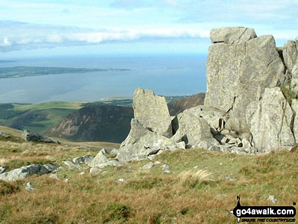
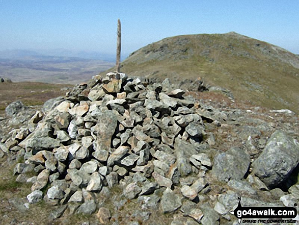


 Snowdon (Yr Wyddfa) in The Glyders (or Glyderau)Snowdonia


