82 walks in The Dark Peak Area of The Peak District
Eighty-two easy-to-follow, hand-crafted walks including routes from The Snake Pass, Bowden Bridge, Castleton, Crowden, Greenfield, Dove Stone Reservoir, Edale, Hadfield, Hathersage, Hayfield, Holmfirth, Hope, Ladybower Reservoir, Derwent, Howden, Melltham, Glossop & Woodhead that visit Kinder Scout (the highest point), Back Tor, Great Dove Stone Rocks, Mam Tor, Lose Hill, Winhill Pike, Barrow Stones, Bleaklow Stones, Bleaklow Hill, Black Hill (Soldiers Lump) & The Wain Stones amongst many other locations. More details about each walk can be found below the map.
The Dark Peak Area of The Peak District National Park is area within the National Park boundary north of the A6 from Hazel Grove to Chapel-en-le-Frith, the A623 to Sparrowpit, the minor road from Sparrowpit along Rushup Edge to Castleton and the A6187 from Castleton to Sheffield.
To see interactive maps and list of Mountains, Tops, Peaks and Hills to climb in the area, see Peak Bagging the Lake District.
Interactive Map of Walks in The Dark Peak Area of The Peak District
![]() How to Load this interactive map: Due to usage restrictions, you must be Registered and Logged-On to go4awalk.com to view and use the interactive Google Map below. You do not need to purchase any credits, but you must be Registered and Logged-On.
How to Load this interactive map: Due to usage restrictions, you must be Registered and Logged-On to go4awalk.com to view and use the interactive Google Map below. You do not need to purchase any credits, but you must be Registered and Logged-On.
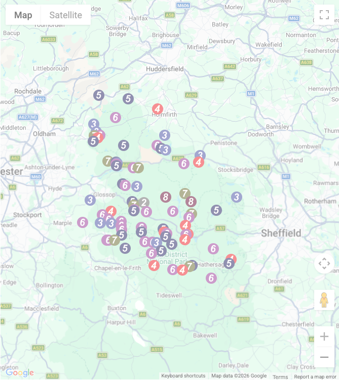
You can use these checkboxes to show only the grades of walk you are interested in:-
Eighty-two easy-to-follow, circular, walk route maps in The Dark Peak Area of The Peak District in Walk Grade Order
See this list of walks, routes & maps in:
Grade Order | Length Order | Time Order | Walk Number or Start Location Order
NB. To reverse (toggle) this order, click Grade Order again
Scroll down the list of walks below & click on each walk title (in blue) to locate it on the map above.
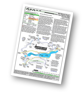
   |
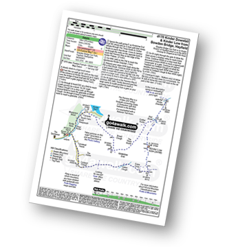
Vital Statistics:
| Length: | 7.5 miles (12 km) |
| Ascent: | 1,467 ft (447 m) |
| Time: | 4.25 hrs |
| Grade: |  |

Route Summary:
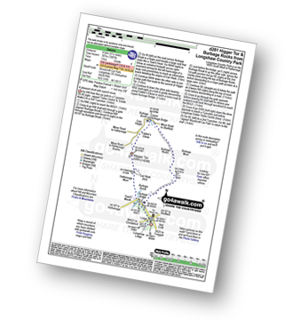
Grindleford Station - Padley Gorge - Lawrence Field - Toad's Mouth - Hathersage Moor - Carl Wark - Higger Tor - Fiddler's Elbow - Upper Burbage Bridge - Burbage Moor - Burbage Rocks - Longshaw Country Park - Sheffield Plantation - Nether Padley - Oaks Wood - Grindleford Station
|
Vital Statistics:
| Length: | 9.5 miles (15 km) |
| Ascent: | 1,696 ft (517 m) |
| Time: | 5.25 hrs |
| Grade: |  |
Route Summary:
Strines Station - Lower Cliffe Cottage - Higher Banks Cottage - Cobden Edge - Mellor Moor - Mellor - Mellor Church - Hilltop Farm - Shiloh Hall Farm - Ringstones Farm - Ayton Farm - Rowarth - Thornsett Fields Farm - New Mills - Whitle - Brook Bottom - The Goyt Way - The Midshires Way - Strines Station
|
Vital Statistics:
| Length: | 7.25 miles (11.5 km) |
| Ascent: | 1,515 ft (562 m) |
| Time: | 4.25 hrs |
| Grade: | |

Route Summary:
Crowden - The Pennine Way - Torside Reservoir - Rhodeswood Reservoir - Higher Deepclough - Devil's Elbow - Ogden Clough - Nell's Pike - Bramah Edge - Peaknaze Moor - The Pennine Way - Torside Reservoir - Crowden
|
Vital Statistics:
| Length: | 8.25 miles (13 km) |
| Ascent: | 1,812 ft (552 m) |
| Time: | 4.75 hrs |
| Grade: | |
Route Summary:
Edale - The Nab - Ringing Roger - Edale Moor (Kinder Scout) - Madwoman's Stones - Crookstone Knoll (Kinder Scout) - Crookstone Hill - Hope Cross - Jaggers Clough - Backside Wood - Nether Moor - Lady Booth Brook - Rowland Cote (Edale Youth Hostel) - Ollerbrook Booth - The Vale of Edale - Edale
|
Vital Statistics:
| Length: | 4.75 miles (7.5 km) |
| Ascent: | 899 ft (274 m) |
| Time: | 2.75 hrs |
| Grade: |  |
Route Summary:
Hayfield - Sett Valley Trail - Birch Vale - The River Sett - The Pennine Bridleway - Lantern Pike - Hey Wood - Little Hayfield - Sett Valley Trail - Hayfield
|
Vital Statistics:
| Length: | 16.5 miles (26.5 km) |
| Ascent: | 2,604 ft (794 m) |
| Time: | 8½ hrs |
| Grade: |  |

Route Summary:
Ladybower Reservoir - Fairholmes Car Park - Derwent Reservoir - Howden Reservoir - Fagney Clough - Ridgewalk Moor - Barrow Stones - Bleaklow Stones (Bleaklow Hill) - Alport Moor - West End Moor - Birchin Hat - Alport Castles - Rowlee Pasture - Lockerbrook Heights - Lockerbrook Farm - Fairholmes Car Park - Ladybower Reservoir
|
Vital Statistics:
| Length: | 3.5 miles (5.5 km) |
| Ascent: | 705 ft (215 m) |
| Time: | 2 hrs |
| Grade: |  |
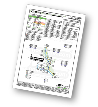
Route Summary:
Birchin Clough - (A57 Snake Pass) - Lady Clough - River Ashop - Saukin Ridge - Black Ashop Moor - Snake Plantations - Lady Clough Moor - Lady Clough - Lady Clough Bridge - Birchin Clough - (A57 Snake Pass).
|
Vital Statistics:
| Length: | 7.5 miles (12 km) |
| Ascent: | 1,766 ft (538 m) |
| Time: | 4½ hrs |
| Grade: | |
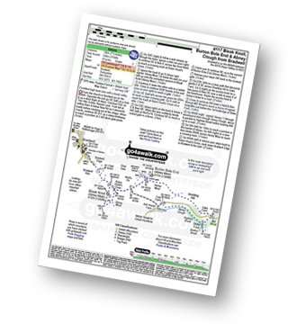
Route Summary:
Bradwell - Bradwell Hills - Bradwell Edge - Robin Hood's Cross - Bleak Knoll (Abney Moor) - Durham Edge (Abney Moor) - Abney Moor - Wolf's Pit - Burton Bole End (Abney Moor) - Smelting Hill - Oaks Farm - Mill Wood - Stoke Ford - Highlow Brook - Abney Clough - Abney - Abney Moor - Bradwell
|
Vital Statistics:
| Length: | 9.5 miles (15 km) |
| Ascent: | 1,588 ft (484 m) |
| Time: | 5 hrs |
| Grade: | |
Route Summary:
Hope - Townhead Bridge - Losehill End - Lose Hill (Ward's Piece) - Back Tor (Hollins Cross) - Barker Bank - Hollins Cross - Mam Tor Farm - Knowlgate Farm - Odin Sitch - Castleton - Hollowford Centre - Spring House Farm - Hope
|
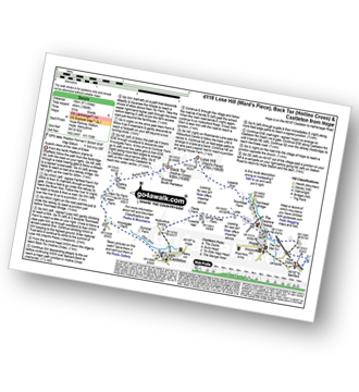
Vital Statistics:
| Length: | 5.75 miles (9 km) |
| Ascent: | 928 ft (283 m) |
| Time: | 3 hrs |
| Grade: |  |
Route Summary:
Peak Forest - Old Dam - Sweet Knoll Farm - Eldon Hole - Eldon Hill (Perryfoot) - Eldon Hill Quarries - The Limestone Way - Old Moor - Bradwell Moor - The Cop - West View - Old Dam - Peak Forest
|
Vital Statistics:
| Length: | 10 miles (16 km) |
| Ascent: | 1,568 ft (478 m) |
| Time: | 5.25 hrs |
| Grade: | |

Route Summary:
Ashopton Bridge - Ladybower Reservoir - Ashopton - Whinstone Lee Tor - Hurkling Stones - Wheel Stones - White Tor (Derwent Edge) - Salt Cellar (Boulder) - Derwent Edge - Dove Stone (Boulder) - Dovestones Tor - Cakes of Bread - Bradfield Gate Head - Back Tor (Derwent Edge) - Lost Lad - Bamford House - Little Howden Moor - Derwent Reservoir - Derwent Valley - Ladybower Reservoir - Ashopton Bridge..
|
Vital Statistics:
| Length: | 5.25 miles (8.5 km) |
| Ascent: | 630 ft (192 m) |
| Time: | 2½ hrs |
| Grade: | |
Route Summary:
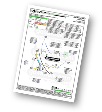
Snake Pass - (A57) - The Pennine Way - Bleaklow Head (Bleaklow Hill) - The The Wain Stones (or Kissing Stones) - Higher Shelf Stones - A57 Snake Pass.
|
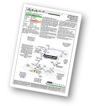
Vital Statistics:
| Length: | 6 miles (9.5 km) |
| Ascent: | 1,887 ft (575 m) |
| Time: | 4 hrs |
| Grade: | |

Route Summary:
Castleton - The Limestone Way - Peveril Castle - Cave Dale - Old Moor - Rowter Farm - Windy Knoll - Mam Tor - Hollins Cross - Backtor Nook - Castleton
|
Vital Statistics:
| Length: | 12.75 miles (19 km) |
| Ascent: | 2,258 ft (688 m) |
| Time: | 6.75 hrs |
| Grade: |  |
Route Summary:
Bradwell - Jennings Dale - Little Hucklow - Windmill - Great Hucklow - Bretton - Bretton Moor - Bretton Brook - Stoke Ford - Oaks Farm - Smelting Hill - Abney Moor - Burton Bole End (Abney Moor) - Wolf's Pit - Shatton Edge - Shatton Hope Valley - Townfield Barn - Elmore Hill Farm - Bothams Farm - Bradwell
|
Vital Statistics:
| Length: | 9.5 miles (15 km) |
| Ascent: | 2,097 ft (639 m) |
| Time: | 5½ hrs |
| Grade: | |
Route Summary:
Hathersage - Hathersage Pinfold - Toothill Farm - Hookcar Sitch - Overstones Farm - Cowper Stone - Stanage Edge (Stanage Edge) - Hook's Car - White Path Moss - Robin Hood's Cave - Stanage Plantation - Long Causeway - Stanage Edge - High Neb (Stanage Edge) - Crow Chin - Moscar Moor - Bamford Moor - Upper Hurst Brook - Bole Hill (Bamford) - Bolehill Wood - Upper Hurst Farm - Gatehouse Farm - Hurstclough Lane - Nether Hurst Farm - Coggers Lane - Hathersage
|
Vital Statistics:
| Length: | 9 miles (14.5 km) |
| Ascent: | 1,689 ft (515 m) |
| Time: | 5 hrs |
| Grade: | |

Route Summary:
Birchin Clough - A57 Snake Pass - Lady Clough - River Ashop - Rough Bank - Fair Brook - Kinder Scout - Edale Moor - Kinder Plateau - Kinder Downfall - The Pennine Way - The Edge (Kinder Scout) - Ashop Head - Mill Hill (Ashop Head) - Black Ashop Moor - Within Clough - Red Clough - Upper Gate Clough - Ashop Clough - Birchin Clough
|
Vital Statistics:
| Length: | 4.75 miles (7.5 km) |
| Ascent: | 1,195 ft (364 m) |
| Time: | 3 hrs |
| Grade: | |

Route Summary:
Ladybower Reservoir - Bridge End Car Park - Ridges Coppice - Hagg Side - Open Hagg - Longley Bank - Bridge-end Pasture - Crook Hill (Ladybower) - Crook Hill (Ladybower) (South Top) - Crookhill Farm - Ladybower Reservoir - Hurst Clough Car Park - Bridge End Car Park.
|
Vital Statistics:
| Length: | 8.75 miles (14 km) |
| Ascent: | 1,887 ft (575 m) |
| Time: | 5.25 hrs |
| Grade: | |

Route Summary:
Yorkshire Bridge - Parkin Clough - Winhill Plantation - Winhill Pike (Win Hill) - Twitchill Farm - Fullwood Stile Farm - Roman Road - Hope Cross - Ladybower Reservoir - Wiseman Hey Clough Plantation - Yorkshire Bridge
|
Vital Statistics:
| Length: | 10.25 miles (16.5 km) |
| Ascent: | 1,585 ft (483 m) |
| Time: | 5.25 hrs |
| Grade: | |
Route Summary:
Edale - Ollerbrook Booth - Rowland Cote (Edale Youth Hostel) - Lady Booth Brook - Nether Moor - Backside Wood - Jaggers Clough - Hope Cross - Fulwood Stile Farm. Hope - The River Noe - Normans Farm - Edale End - Carr House - Nether Booth - Ollerbrook Booth - The Vale of Edale - Edale
|
Vital Statistics:
| Length: | 8.75 miles (14 km) |
| Ascent: | 1,861 ft (567 m) |
| Time: | 5 hrs |
| Grade: | |

Route Summary:
Hayfield - Sett Valley Trail - Birch Vale - Morland Road - Ollersett - New Allotments - Chinley Churn - Cracken Edge - Chinley - Vorposten - Hayfield
|
Vital Statistics:
| Length: | 11.25 miles (18 km) |
| Ascent: | 1,759 ft (536 m) |
| Time: | 5.75 hrs |
| Grade: | |

Route Summary:
Bradwell - Bradwell Hills - Bradwell Edge - Robin Hood's Cross - Bleak Knoll (Abney Moor) - Durham Edge (Abney Moor) - Abney Moor - Abney Grange - Bretton Brook - Great Hucklow - Windmill - High Rake Mine - High Rake - Tideslow Rake - Tides Low - New Farm - Tideswell Moor - Bradwell Moor - Old Moor - Potter Barn - Smalldale Hall - Bradwell
|
Vital Statistics:
| Length: | 10.75 miles (17 km) |
| Ascent: | 2,242 ft (683 m) |
| Time: | 6.25 hrs |
| Grade: | |

Route Summary:
Bowden Bridge - Hayfield - Booth Sheepwash - Farlands - Broad Clough - Kinderlow End - Three Knolls - Cluther Rocks - Red Brook - The Pennine Way - Kinder Downfall - Kinder Low (Kinder Scout) - Brown Knoll (Edale) - South Head (Hayfield) - Mount Famine - Elle Bank - The Pennine Bridleway - Tunstead House - Hayfield
|
Vital Statistics:
| Length: | 11.5 miles (18.5 km) |
| Ascent: | 2,001 ft (610 m) |
| Time: | 6 hrs |
| Grade: | |
Route Summary:
Castleton - The Limestone Way - Cave Dale - Perry Dale - Sparrowpit - Rushup Farm - Rushup Hall - Rushup Edge - Lord's Seat (Rushup Edge) - Mam Tor - Hollins Cross - Backtor Nook - Castleton
|
Vital Statistics:
| Length: | 5.25 miles (8.5 km) |
| Ascent: | 823 ft (251 m) |
| Time: | 2.75 hrs |
| Grade: | |
Route Summary:
Crowden - The Pennine Way - Torside Reservoir - Rhodeswood Reservoir - The Longdendale Trail - The Pennine Way - Torside Reservoir - Crowden
|
Vital Statistics:
| Length: | 10.5 miles (17 km) |
| Ascent: | 1,986 ft (605 m) |
| Time: | 5.75 hrs |
| Grade: | |

Route Summary:
Edale - The Pennine Way - Upper Booth - Jacob's Ladder (Edale) - Brown Knoll (Edale) - Colborne (Colbourne) - Chapel Gate Track - Lord's Seat (Rushup Edge) - Mam Tor - Hollins Cross - Edale
|
Vital Statistics:
| Length: | 13.25 miles (21 km) |
| Ascent: | 2,081 ft (634 m) |
| Time: | 7 hrs |
| Grade: | |
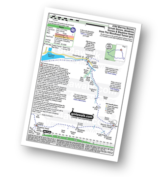
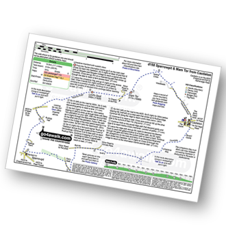
Route Summary:
Woodhead Tunnel - Far Black Clough - Swains Head - Swains Greave - Barrow Stones - Grinah Stones - Bleaklow Stones (Bleaklow Hill) - Bleaklow Head (Bleaklow Hill) - The Wain Stones (or Kissing Stones) - The Pennine Way - Joseph Patch - John Track Well - Torside Clough - Peaknaze Moor - Reaps Farm - The Longdendale Trail - Torside Reservoir - Woodhead Reservoir - Woodhead Tunnel
|
Vital Statistics:
| Length: | 7.75 miles (12.5 km) |
| Ascent: | 1,650 ft (503 m) |
| Time: | 4½ hrs |
| Grade: | |

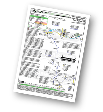
Route Summary:
Slackhall - Chestnut Centre - Bowden Head Fold - Wash - Breckhead Farm - Dawsnap Farm - Bennett Barn - Bullhill Farm - Andrews Farm - Pennine Bridleway - Mount Famine - South Head (Hayfield) - Roych Clough - Bolehill Clough - Tom Moor Plantation - Breck Edge - Slackhall
|
Vital Statistics:
| Length: | 9.75 miles (15.5 km) |
| Ascent: | 2,074 ft (632 m) |
| Time: | 6 hrs |
| Grade: | |
Route Summary:
Stoney Middleton - The Cliff - Eyam - Sir William Hill - Eyam Moor - Bole Hill (Highlow) - Bretton Brook - Stoke Ford - Mill Wood - Brook Wood - Highlow Brook - Hazleford - Hazleford Hall - Leadmill - Leadmill Bridge - River Derwent - The Derwent Valley Heritage Way - Coppice Wood - Burbage Brook - Grindleford - Horse Hay Coppice - Derwent Farm - Froggatt Bridge - Knouchley Farm - Stoney Middleton
|
Vital Statistics:
| Length: | 8.75 miles (14 km) |
| Ascent: | 1,851 ft (564 m) |
| Time: | 5 hrs |
| Grade: | |
Route Summary:
Bowden Bridge - Hayfield - Booth Sheepwash - Farlands - Broad Clough - Kinderlow End - Three Knolls - Cluther Rocks - Red Brook - The Pennine Way - Kinder Downfall - Kinder Low (Kinder Scout) - Edale Cross - Oaken Clough - Coldwell Clough - Bowden Bridge - Hayfield
|
Vital Statistics:
| Length: | 10.5 miles (17 km) |
| Ascent: | 2,055 ft (626 m) |
| Time: | 6 hrs |
| Grade: | |
Route Summary:
Hayfield - Sett Valley Trail - Birch Vale - The River Sett - The Pennine Bridleway - Lantern Pike - Rowarth - Cown Edge Rocks - Chunal Road (Glossop) - Hollingwood Clough - Middle Moor (Hayfield) - The Snake Path - Hayfield
|
Vital Statistics:
| Length: | 9 miles (14.5 km) |
| Ascent: | 1,850 ft (564 m) |
| Time: | 5.25 hrs |
| Grade: | |

Route Summary:
Old Glossop - Shittern Clough - Lightside - Yellow Slacks - Dog Rock - Dowstone Clough - Yellowslacks Brook - The Wain Stones (or Kissing Stones) - Bleaklow Head (Bleaklow Hill) - Higher Shelf Stones - Crooked Clough - The Pennine Way - Old Woman - Doctor's Gate Path - Shelf Brook - Moss Lea Farm - Old Glossop
|
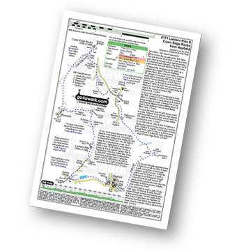
Vital Statistics:
| Length: | 6.25 miles (10 km) |
| Ascent: | 1,610 ft (491 m) |
| Time: | 4 hrs |
| Grade: | |
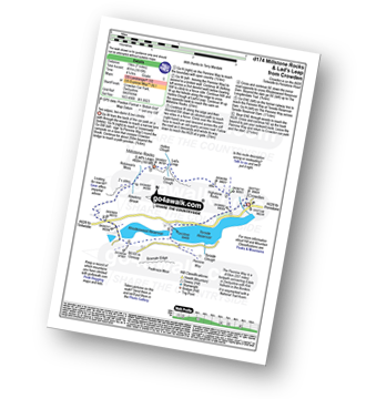
Route Summary:
Crowden - The Pennine Way - Highstone Rocks - Lad's Leap - Millstone Rocks (Lad's Leap) - Rhodeswood Reservoir - The Longdendale Trail - The Pennine Way - Torside Reservoir - Crowden
|
Vital Statistics:
| Length: | 9.75 miles (15.5 km) |
| Ascent: | 1,841 ft (561 m) |
| Time: | 5½ hrs |
| Grade: | |

Route Summary:
Birchin Clough - (A57 Snake Pass) - Lady Clough - River Ashop - Rough Bank - Fair Brook - Fairbrook Naze (Kinder Scout) - The Kinder Plateau - Edale Moor - The Edge (Kinder Scout) - The Pennine Way - Ashop Head - Mill Hill - Black Ashop Moor - Within Clough - Red Clough - Upper Gate Clough - Ashop Clough - Birchin Clough - (A57 Snake Pass).
|
Vital Statistics:
| Length: | 3.75 miles (6 km) |
| Ascent: | 820 ft (250 m) |
| Time: | 2.25 hrs |
| Grade: | |
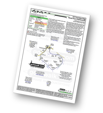
Route Summary:
Charlesworth - The Banks - The Cown Edge Way - Coombes Edge - Coombes Rocks - Coombes Tor - Far Coombes - Oak Wood Farm - Bot Wood - Holehouse - Charlesworth
|
Vital Statistics:
| Length: | 8.75 miles (14 km) |
| Ascent: | 2,192 ft (688 m) |
| Time: | 5½ hrs |
| Grade: | |

Route Summary:
Bowden Bridge - Hayfield - Booth Sheepwash - White Brow - Kinder Reservoir - Nab Brow - William Clough - Ashop Head - Mill Hill (Ashop Head) - The Pennine Way - Kinder Scout - The Edge (Kinder Scout) - Kinder Downfall - Red Brook - Cluther Rocks - Kinder Low (Kinder Scout) - Edale Cross - Kinderlow End - Oaken Clough - Tunstead House Farm - Bowden Bridge - Hayfield
|
Vital Statistics:
| Length: | 8.5 miles (13.5 km) |
| Ascent: | 2,289 ft (698 m) |
| Time: | 5½ hrs |
| Grade: | |
Route Summary:
Crowden - The Pennine Way - Highstone Rocks - Lad's Leap - Millstone Rocks (Lad's Leap) - Rhodeswood Reservoir - Higher Deepclough - Devil's Elbow - Ogden Clough - Nell's Pike - Bramah Edge - Peaknaze Moor - The Pennine Way - Torside Reservoir - Crowden
|
Vital Statistics:
| Length: | 8.25 miles (13 km) |
| Ascent: | 2,060 ft (628 m) |
| Time: | 5 hrs |
| Grade: | |

Route Summary:
Birchin Clough - A57 Snake Pass - Lady Clough - River Ashop - Rough Bank - Fair Brook - Gate Side Clough - Wood Moor - Dunge Clough - The Wicken - Blackden Brook - Blackden Moor - Kinder Scout - Edale Moor - Kinder Plateau - Seal Edge - Seal Stones (Kinder Scout) - Fair Brook - Birchin Wood - Birchin Clough
|
Vital Statistics:
| Length: | 9 miles (14.5 km) |
| Ascent: | 1,746 ft (532 m) |
| Time: | 5 hrs |
| Grade: | |
Route Summary:
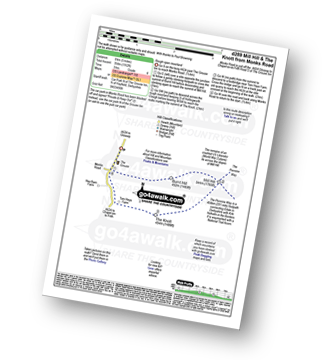
Crowden - Crowden Brook - The Pennine Way - Highstone Rocks - Span Gutter - Rakes Rocks - Oakenclough Brook - Laddow Moss - Black Chew Head (Laddow Rocks) - Near Broadslate - Sliddens - Dun Hill - Black Hill (Soldier's Lump) - Tooleyshaw Moss - Tooleyshaw Moor - White Low - Westend Moss - Hey Moss - Hey Edge - Crowden
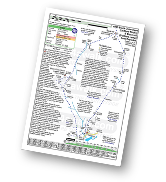
|
Vital Statistics:
| Length: | 4.75 miles (7.5 km) |
| Ascent: | 843 ft (257 m) |
| Time: | 2.75 hrs |
| Grade: | |

Route Summary:
Hayfield - Sett Valley Trail Car Park - Valley Road - Bowden Bridge Car Park - Kinder Road - Kinder Reservoir - White Brow - Middle Moor (Hayfield) - Snake Path - Sett Valley Trail Car Park - Hayfield
|
Vital Statistics:
| Length: | 10 miles (16 km) |
| Ascent: | 2,368 ft (722 m) |
| Time: | 6 hrs |
| Grade: | |

Route Summary:
Ladybower Reservoir - Fairholmes Car Park - Lockerbrook Farm - Lockerbrook Heights - Rowlee Pasture - Alport Castles - River Alport - Alport Dale - Alport Farm - Hayridge Farm - Upper Ashop - Blackley Clough - Hagg Farm - Hagg Side - Fairholmes Car Park - Ladybower Reservoir
|
Vital Statistics:
| Length: | 12.5 miles (20 km) |
| Ascent: | 2,143 ft (653 m) |
| Time: | 6.75 hrs |
| Grade: | |
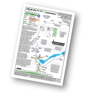
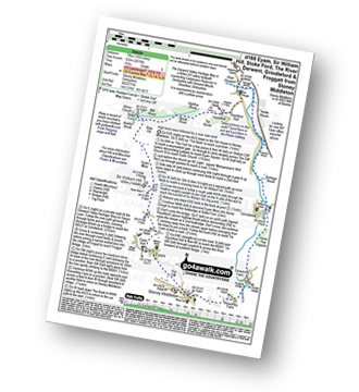
Route Summary:
Hadfield - The Longdenden Trail - Tintwistle - Arnfield Gamekeepers Cottage - Arnfield Brook - Arnfield Farm - Tintwistle Low Moor - Ogden Brook - Arnfield Moor - Arnfield Flats - Ormes Moor - Wilderness - Windgate Edge - Blindstones Moor - Featherbed Moss (Chew Reservoir) - Laddow Moss - Black Chew Head (Laddow Rocks) - The Pennine Way - Oakenclough Brook - Rakes Rocks - Highstone Rocks - Torside Reservoir - Rhodeswood Reservoir - The Longdendale Trail - Hadfield
|
Vital Statistics:
| Length: | 13.5 miles (21.5 km) |
| Ascent: | 2,914 ft (888 m) |
| Time: | 7.75 hrs |
| Grade: | |
Route Summary:
Hayfield - Sett Valley Trail - Birch Vale - Morland Road - Ollersett - New Allotments - Chinley Head - Mount Famine - South Head (Hayfield) - Brown Knoll (Edale) - Edale Cross - Oaken Clough - Coldwell Clough - Tunstead House - Bowden Bridge - Hayfield
|
Vital Statistics:
| Length: | 7 miles (11 km) |
| Ascent: | 1,044 ft (318 m) |
| Time: | 3½ hrs |
| Grade: | |
Route Summary:
Edale - Ollerbrook Booth - Rowland Cote (Edale Youth Hostel) - Lady Brook Booth - Nether Moor - Backside Wood - Jaggers Clough - Edale End - Carr House - Nether Booth - Ollerbrook Booth - The Vale of Edale - Edale
|
Vital Statistics:
| Length: | 6.5 miles (10.5 km) |
| Ascent: | 1,241 ft (378 m) |
| Time: | 3.75 hrs |
| Grade: | |

Route Summary:
Bradwell - Bradwell Hills - Bradwell Edge - Robin Hood's Cross - Bleak Knoll (Abney Moor) - Durham Edge (Abney Moor) - Abney Moor - Abney Grange - Bretton Brook - Great Hucklow - Windmill - Little Hucklow - Coplow Dale - Intake Dale - Bradwell Dale - Bradwell
|
Vital Statistics:
| Length: | 8.25 miles (13 km) |
| Ascent: | 1,532 ft (467 m) |
| Time: | 4½ hrs |
| Grade: | |
Route Summary:
Edale - Small Clough - Hardenclough Farm - Greenlands - Hollins Cross - Back Tor (Hollins Cross) - Lose Hill (Ward's Piece) - Hope - The River Noe - Normans Farm - Edale End - Carr House - Nether Booth - Ollerbrook Booth - The Vale of Edale - Edale
|
Vital Statistics:
| Length: | 3 miles (5 km) |
| Ascent: | 951 ft (290 m) |
| Time: | 2 hrs |
| Grade: | |

Route Summary:
Edale - Small Clough - Hardenclough Farm - Greenlands - Mam Tor - Hollins Cross - Hollins - The Vale of Edale - Edale
|
Vital Statistics:
| Length: | 7.25 miles (11.5 km) |
| Ascent: | 1,526 ft (465 m) |
| Time: | 4.25 hrs |
| Grade: | |

Route Summary:
Old Glossop - Shittern Clough - Lightside - Yellow Slacks - Dowstone Clough - Dog Rock - Higher Shelf Stones - James's Thorn - Doctors Gate Path - Shelf Brook - Moss Lea Farm - Old Glossop
|
Vital Statistics:
| Length: | 10.25 miles (16.5 km) |
| Ascent: | 1,870 ft (570 m) |
| Time: | 5.75 hrs |
| Grade: | |

Route Summary:
Edale - The Pennine Way - Upper Booth - Jacob's Ladder (Edale) - Kinder Low (Kinder Scout) - Red Brook - Kinder Downfall - Kinder Scout - Edale Moor - Kinder Plateau - Crowden Head (Kinder Scout) - Grindslow Knoll (Kinder Scout) - Grindsbrook Clough - Grinds Brook - The Vale of Edale - Edale
|
Vital Statistics:
| Length: | 9.25 miles (15 km) |
| Ascent: | 1,919 ft (585 m) |
| Time: | 5.25 hrs |
| Grade: | |
Route Summary:
Edale - Upper Booth - Highfield Farm - Tagsnaze Farm - The Orchard Farm - Dalehead Bunkhouse - Whitemoor Clough - Chapel Gate (Track) - Rushupp Edge - Lord's Seat (Rushup Edge) - Mam Tor - Hollins Cross - Backtor Nook - Backtor Farm - Backtor Bridge - Woodhouse Farm - The Vale of Edale - Cotefield Farm - Ollerbrook Booth - Edale
|
Vital Statistics:
| Length: | 7.5 miles (12 km) |
| Ascent: | 1,808 ft (551 m) |
| Time: | 4½ hrs |
| Grade: | |

Route Summary:
Bowden Bridge - Hayfield - Turnstead House - Coldwell Clough - Oaken Clough - Edale Cross - Brown Knoll (Edale) - South Head (Hayfield) - Mount Famine - Elle Bank - The Pennine Bridleway - Tunstead House - Bowden Bridge - Hayfield
|
Vital Statistics:
| Length: | 13.75 miles (22 km) |
| Ascent: | 2,061 ft (628 m) |
| Time: | 7 hrs |
| Grade: | |

Route Summary:
Ladybower Reservoir - Fairholmes Car Park - Ashopton - Whinstone Lee Tor - Hurkling Stones - Wheel Stones - White Tor (Derwent Edge) - Salt Cellar (Boulder) - Derwent Edge - Dove Stone (Boulder) - Dovestones Tor - Cakes of Bread - Bradfield Gate Head - Back Tor (Derwent Edge) - Lost Lad - Sheepfold Clough - Abbey Brook - Howden Dean - Abbey Tip Plantation - Derwent Reservoir - Fairholmes Car Park - Ladybower Reservoir
|
Vital Statistics:
| Length: | 10.5 miles (17 km) |
| Ascent: | 2,468 ft (752 m) |
| Time: | 6.25 hrs |
| Grade: | |
Route Summary:
Hayfield - Sett Valley Trail - Birch Vale - Morland Road - Ollersett - New Allotments - Cracken Edge - Chinley Churn - Chinley Head - Dry Clough Farm - Chinley - Naze House - Greystead - Alder Ling - Wicken House - Andrews Farm - South Head (Hayfield) - Mount Famine - Elle Bank - Pennine Bridleway - Tunstead House - Bowden Bridge - Hayfield
|
Vital Statistics:
| Length: | 12.25 miles (19.5 km) |
| Ascent: | 2,189 ft (667 m) |
| Time: | 6.75 hrs |
| Grade: | |

Route Summary:
Birchin Clough - (A57 Snake Pass) - Lady Clough - River Ashop - Rough Bank - Fair Brook - Seal Edge - Seal Stones (Kinder Scout) - Fairbrook Naze (Kinder Scout) - The Kinder Plateau - Edale Moor - The Edge (Kinder Scout) - The Pennine Way - Ashop Head - Mill Hill (Ashop Head) - Featherbed Top (Featherbed Moss) - A57 Snake Pass - Old Woman - Doctors Gate - Lady Clough - Birchin Clough - (A57 Snake Pass).
|
Vital Statistics:
| Length: | 10.5 miles (17 km) |
| Ascent: | 1,975 ft (602 m) |
| Time: | 5.75 hrs |
| Grade: | |

Route Summary:
Woodhead Tunnel - Middle Black Clough - Bleaklow Stones (Bleaklow Hill) - Bleaklow Head (Bleaklow Hill) - The Wain Stones (or Kissing Stones) - The Pennine Way - Clough Edge - The Longdendale Trail - Crowden - Woodhead Reservoir - Woodhead Tunnel
|
Vital Statistics:
| Length: | 6.75 miles (10.5 km) |
| Ascent: | 1,289 ft (393 m) |
| Time: | 3.75 hrs |
| Grade: | |

Route Summary:
Heatherdene Car Park - Ladybower Reservoir - Yorkshire Bridge - Parkin Clough - Winhill Plantation - Winhill Pike (Win Hill) - Hope Bank - Wooler Knoll - Woodlands Valley - Ladybower Reservoir - Wiseman Hey Clough Plantation - Yorkshire Bridge - Heatherdene Car Park
|
Vital Statistics:
| Length: | 12.75 miles (20.5 km) |
| Ascent: | 2,094 ft (638 m) |
| Time: | 6.75 hrs |
| Grade: | |

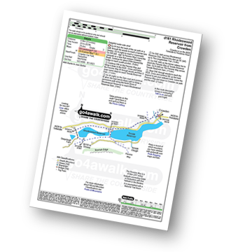
Route Summary:
Ladybower Reservoir - Fairholmes Car Park - Derwent Reservoir - Abbey Bank - Abbey Brook - Hey Bank (Nether Hey) - Howden Moors - Nether Hey (Howden Edge) - Row Top - Featherbed Moss (Howden Edge) - High Stones (Howden Moor) - Willfrey Edge - High Peak - Margery Stones - Margery Hill - Outer Edge - Crow Stones - Crow Stones Edge - Airspeed Consul TF-RPM Plane Wreckage - Broadhead Clough - Cranberry Bed - Swine Side - Cranberry Clough - Cold Side Oaks - Slippery Stones - Packhorse Bridge (River Derwent) - Howden Reservoir - Cold Side (Howden Reservoir) - Derwent Reservoir - Fairholmes Car Park - Ladybower Reservoir
|
Vital Statistics:
| Length: | 5.5 miles (8.5 km) |
| Ascent: | 1,007 ft (307 m) |
| Time: | 3 hrs |
| Grade: | |
Route Summary:
Longshaw Country Park - Woodcroft Car Park - Burbage Brook - Burbage Bridge - Toad's Mouth - Hathersage Moor - Carl Wark - Higger Tor - Upper Burbage Bridge - Burbage Moor - Burbage Rocks - Longshaw Country Park
|
Vital Statistics:
| Length: | 5.75 miles (9 km) |
| Ascent: | 971 ft (296 m) |
| Time: | 3 hrs |
| Grade: | |
Route Summary:
Hope - Hope Bank - Wooler Knoll - Winhill Plantation - Winhill Pike (Win Hill) - Thornhill - Aston - Hope
|
Vital Statistics:
| Length: | 5 miles (8 km) |
| Ascent: | 1,162 ft (354 m) |
| Time: | 3 hrs |
| Grade: | |
Route Summary:
Chunal Road (Glossop) - A624 - The Grouse Inn - Burnt Hill - Mill Hill - The Knott (Hayfield) - Hollingworth Clough - Tom Heys Farm - The Grouse Inn - A624 - Chunal Road (Glossop)
|
Vital Statistics:
| Length: | 8.25 miles (13 km) |
| Ascent: | 1,860 ft (567 m) |
| Time: | 4.75 hrs |
| Grade: | |

Route Summary:
Edale - The Pennine Way - Upper Booth - Jacob's Ladder (Edale) - Edale Head - Kinder Scout - Edale Moor - Kinder Plateau - Kinder Low (Kinder Scout) - Noe Stool (Edale Head) - Pym Chair (Edale Head) - Crowden Tower (Kinder Scout) - Crowden Brook - Grindslow Knoll (Kinder Scout) - Grindsbrook Clough - Grinds Brook - The Vale of Edale - Edale
|
Vital Statistics:
| Length: | 19.75 miles (31.5 km) |
| Ascent: | 2,757 ft (840 m) |
| Time: | 9.75 hrs |
| Grade: | |

Route Summary:
Ladybower Reservoir - Fairholmes Car Park - Ashopton - Whinstone Lee Tor - Hurkling Stones - Wheel Stones - White Tor (Derwent Edge) - Salt Cellar (Boulder) - Derwent Edge - Dove Stone (Boulder) - Dovestones Tor - Cakes of Bread - Bradfield Gate Head - Back Tor (Derwent Edge) - Abbey Brook - High Peak - Howden Moors - Featherbed Moss (Howden Edge) - High Stones (Howden Moor) - Margery Hill - Outer Edge - Crow Stones - Crow Stones Edge - Airspeed Consul TF-RPM Plane Wreckage - Broadhead Clough - Cranberry Bed - Bull Clough - Cranberry Clough - Slippery Stones - Packhorse Bridge (River Derwent) - Howden Reservoir - Cold Side (Howden Reservoir) - Derwent Reservoir - Fairholmes Car Park - Ladybower Reservoir
|
Vital Statistics:
| Length: | 8.75 miles (14 km) |
| Ascent: | 1,328 ft (405 m) |
| Time: | 4½ hrs |
| Grade: | |

Route Summary:
Birchin Clough - Snake Path - Ashop Clough - Upper Gate Clough - Red Clough - Within Clough - Ashop Head - The Pennine Way - Mill Hill (Ashop Head) - Featherbed Top (Featherbed Moss) - A57 Snake Pass - Old Woman - Doctors Gate - Lady Clough - Birchin Clough
|
Vital Statistics:
| Length: | 9.5 miles (15 km) |
| Ascent: | 2,074 ft (632 m) |
| Time: | 5½ hrs |
| Grade: | |

Route Summary:
Hayfield - Sett Valley Trail - Birch Vale - The River Sett - The Pennine Bridleway - Lantern Pike - Matley Moor - Burnt Hill - Mill Hill (Ashop Head) - The Pennine Way - William Clough - Kinder Reservoir - Snake Path - Middle Moor - Hayfield
|
Vital Statistics:
| Length: | 4.5 miles (7 km) |
| Ascent: | 729 ft (222 m) |
| Time: | 2½ hrs |
| Grade: | |
Route Summary:
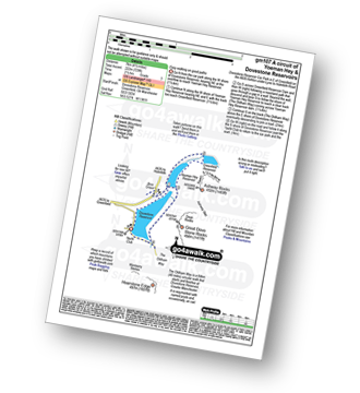
Dove Stone Reservoir - Greenfield - The Oldham Way - Yeoman Hey Reservoir - Dove Stone Reservoir
|
Vital Statistics:
| Length: | 6.25 miles (10 km) |
| Ascent: | 1,441 ft (439 m) |
| Time: | 3.75 hrs |
| Grade: | |

Route Summary:
Dove Stone Reservoir - Greenfield - The Oldham Way - Yeoman Hey Reservoir - Ashway Rocks - Ashway Gap - Dean Rocks - Great Dove Stone Rocks - Dove Stone Moss - Chew Reservoir - Chew Brook - Dove Stone Reservoir
|
Vital Statistics:
| Length: | 8.5 miles (13.5 km) |
| Ascent: | 1,848 ft (563 m) |
| Time: | 5 hrs |
| Grade: | |

Route Summary:
Dove Stone Reservoir - Greenfield - The Oldham Way - Yeoman Hey Reservoir - Greenfield Reservoir - Birchin Clough - Raven Stones Brow - Ashway Rocks - Ashway Gap - Dean Rocks - Great Dove Stone Rocks - Dove Stone Moss - Chew Reservoir - Chew Brook - Dove Stone Reservoir
|
Vital Statistics:
| Length: | 7 miles (11 km) |
| Ascent: | 1,615 ft (492 m) |
| Time: | 4.25 hrs |
| Grade: | |

Route Summary:
Dove Stone Reservoir - Greenfield - The Oldham Way - Chew Brook - Chew Reservoir - Stable Stones Brow (Hoarstone Edge) - Alphin Pike - Dove Stone Reservoir
|
Vital Statistics:
| Length: | 5 miles (8 km) |
| Ascent: | 607 ft (246 m) |
| Time: | 2½ hrs |
| Grade: | |
Route Summary:
Binn Green Car Park - Greenfield - The Oldham Way - Pots and Pans War Memorial - Dick Hill - Shaw Rocks - Slades Rocks - Saddleworth Moor - Saddleworth (Broadstone Hill) - Binn Green Car Park - Greenfield.
|
Vital Statistics:
| Length: | 11.5 miles (18.5 km) |
| Ascent: | 2,501 ft (762 m) |
| Time: | 6.75 hrs |
| Grade: | |

Route Summary:
Dove Stone Reservoir - Greenfield - The Oldham Way - Yeoman Hey Reservoir - Greenfield Reservoir - Birchin Clough - Raven Stones Brow - Ashway Rocks - Dean Rocks - Great Dove Stone Rocks - Chew Reservoir - Stable Stones Brow (Hoarstone Edge) - Alphin Pike - Dove Stone Reservoir
|
Vital Statistics:
| Length: | 5 miles (8 km) |
| Ascent: | 827 ft (252 m) |
| Time: | 2½ hrs |
| Grade: | |
Route Summary:
Low Bradfield - Mill Farm - Peck Hall - Sheffield Country Walk - Cliffe House Farm - Primrose Cottage Farm - Onesmoor (Kirk Edge) - High Bradfield - Sheffield Country Walk - Low Bradfield
|
Vital Statistics:
| Length: | 7.5 miles (12 km) |
| Ascent: | 1,118 ft (360 m) |
| Time: | 4 hrs |
| Grade: | |

Route Summary:
Langsett Barn - Langsett - Langsett Reservoir - Langsett Reservoir Dam - Upper Midhope - Thickwoods - Thickwoods Brook - Fenny Common Ings - Fenny Common - Pike Lowe Stones - Pike Lowe - Candlerush Edge - Sugden Top - Lost Lad (Langsett) - Mickleden Edge (Langsett) - Haslingshaw Hingcliff Common - Delf Edge - Langsett Reservoir - The Porter or Little Don River - Crookland Wood - Langsett Reservoir - Langsett Barn
|
Vital Statistics:
| Length: | 8.25 miles (13 km) |
| Ascent: | 1,362 ft (415 m) |
| Time: | 4.25 hrs |
| Grade: | |
Route Summary:
Strines Reservoir - Broggin Farm - Sheffield Country Walk - Lee Bank - Sugworth Delf - Sugworth Edge - Sugworth Hall - Moscar Cross Farm - Lodge Moor (Ughill Moors) - Stake Hill Road (track) - Wet Shaw Lane - Oaks Piece - Wragg House Plantation - Dale Dike Reservoir - Dale Dike - Upper Thornseat - Hallfield House - Stubbun Farm - Broggin Farm - Strines Reservoir
|
Vital Statistics:
| Length: | 5.5 miles (8.5 km) |
| Ascent: | 728 ft (222 m) |
| Time: | 2.75 hrs |
| Grade: | |
Route Summary:
Winscar Reservoir - Dunford Bridge - Harden Reservoir - Harden Clough - Cook's Study Hill - Snailsden Reservoir - Snailsden - Upper Snailsden Moss - Harden Clugh - Harden Reservoir - Winscar Reservoir - Dunford Bridge.
|
Vital Statistics:
| Length: | 3.75 miles (6.5 km) |
| Ascent: | 673 ft (205 m) |
| Time: | 2.25 hrs |
| Grade: | |
Route Summary:
Langsett Barn - Langsett - Langsett Reservoir Dam - Upper Midhope - Thickwoods - Thickwoods Brook - North America Farm - Delf Edge - Langsett Reservoir - The Porter or Little Don River - Crookland Wood - Langsett Reservoir - Langsett Barn
|
Vital Statistics:
| Length: | 5.25 miles (8.5 km) |
| Ascent: | 817 ft (249 m) |
| Time: | 2.75 hrs |
| Grade: | |

Route Summary:
Winscar Reservoir - Dunford Bridge - The Barnsley Boundary Walk - Little Moor - The Trans Pennine Trail - The Longdendale Trail - Windle Edge - Upper Windleden Reservoir - Fiddlers Green - South Nab - Lady Cross - Salter's Brook Moss - Gallows Moss - Carr Top - Woodhead Railway Tunnel Air Shaft - Upper Grip Hill - Lower Grip Hill - Winscar Reservoir - Dunford Bridge.
|
Vital Statistics:
| Length: | 11.5 miles (18.5 km) |
| Ascent: | 1,674 ft (510 m) |
| Time: | 6 hrs |
| Grade: | |
Route Summary:
The Flouch Car Park - Crookland Wood - Swinden Lane - Fox Clough - Langsett Moors - Barmings - Hordron Road - Long Moor Clough - Hordron Clough - The Porter or Little Don River - Laund Clough - Harden Moor - Howden Edge - Hoar Stones - Horse Stone (Horse Stone Naze) - Stainery Clough Head - Howden Moors - Crow Stones - Crow Stones Edge - Outer Edge - Cut Gate End - Cut Gate Path - Mickleden Edge - Delf Edge - Langsett Reservoir - The Porter or Little Don River - The Flouch.
|
Vital Statistics:
| Length: | 12 miles (19 km) |
| Ascent: | 1,365 ft (416 m) |
| Time: | 5.75 hrs |
| Grade: | |
Route Summary:
Winscar Reservoir - Dunford Bridge - The Barnsley Boundary Walk - Little Moor - The Trans Pennine Trail - The Longdendale Trail - Windle Edge - Bagshaw Ridge - Gallows Moss - Salter's Brook Moss - Long Side - Hawthorn Clough - Woodhead Railway Tunnel Air Shaft - Upper Head Dike - Dead Edge End - Upper Dead Edge - Grains Moss - Withins Edge - Britland Edge Hill - Bleakmires Moss - Twizle Head Moss - Lad Clough Knoll - Ramsden Clough - Snailsden - Upper Snailsden Moss - Harden Clugh - Harden Reservoir - Winscar Reservoir - Dunford Bridge.
|
Vital Statistics:
| Length: | 7.25 miles (11.5 km) |
| Ascent: | 896 ft (273 m) |
| Time: | 3.75 hrs |
| Grade: | |
Route Summary:
Winscar Reservoir - Dunford Bridge - The Barnsley Boundary Walk - Little Moor - The Trans Pennine Trail - The Longdendale Trail - Windle Edge - Bagshaw Ridge - Gallows Moss - Salter's Brook Moss - Long Side (Woodhead) - Hawthorn Clough - Woodhead Railway Tunnel Air Shaft - Upper Head Dike - Dead Edge End - Upper Dead Edge - Grains Moss - Little Grains Clough - Winscar Reservoir - Dunford Bridge.
|
Vital Statistics:
| Length: | 8.75 miles (14 km) |
| Ascent: | 1,316 ft (401 m) |
| Time: | 4½ hrs |
| Grade: | |
Route Summary:
Meltham - Royd Edge - Meltham Moor - Cock Crowing Stone - West Nab - Hey Sike Clough - Horseley Head Moss - Wessenden - Binn Moor - Deer Hill Reservoir - Meltham
|
Vital Statistics:
| Length: | 6 miles (9.5 km) |
| Ascent: | 1,152 ft (351 m) |
| Time: | 3.25 hrs |
| Grade: | |
Route Summary:
Holmfirth - Nora Batty's House and Sid's Cafe (Last of The Summer Wine) - Malkin Farm - River Holme - Hinchliffe Mill - Hogley Green - Hogley Farm - Upperthong - Netherthong - Holmfirth
|
Vital Statistics:
| Length: | 8.5 miles (13.5 km) |
| Ascent: | 1,319 ft (405 m) |
| Time: | 4½ hrs |
| Grade: | |
Route Summary:
Marsden - Tunnel End - Hey Green - Close Gate Bridge - Stack End - Willkay Clough - Green Laitch - Wilmer Green Clough - Broad Wham - Haigh Gutter - The Pennine Way - Oldgate Moss - Haigh Gutter Moss - Blea Green - Northern Rotcher - Dinner Stone - Standedge (Close Moor) - Millstone Edge - Standedge - Brun Moor - Brun Clough Reservoir - Redbrook Rreservoir - The Standedge Trail - Carr Clough - Marsden
|
Vital Statistics:
| Length: | 9.75 miles (15.5 km) |
| Ascent: | 1,902 ft (580 m) |
| Time: | 5½ hrs |
| Grade: | |

Route Summary:
Wessenden Head - The Pennine Way - Wessenden Reservoir - Wessenden Lodge - Blakely Clough - Black Moss Reservoir - Black Hill (Soldier's Lump) - Wessenden Head
See this list of walks, routes & maps in:
Grade Order | Length Order | Time Order | Walk Number or Start Location Order
NB. To reverse (toggle) this order, click Grade Order again


