14 easy-to-follow circular walk route maps of all grades in The Cadair Idris area area of Snowdonia
The Cadair Idris area area of Snowdonia National Park is the area enclosed by:
- Afon Mawddach from Fairbourne to Dolgellau to the North West
- The A470 from Dolgellau to Mallwyd to the East
- The edge of the Snowdonia National Park from Mallwyd to Afon Dyfi to the South
- The Irish Sea from Afon Dyfi to Afon Mawddach to the West
Tap/mouse over a coloured circle (1-3 easy walks, 4-6 moderate walks, 7-9 hard walks) and click to select.
You can use these checkboxes to show only the grades of walk you are interested in:-
Scroll down the list of walks below & click on each walk title (in blue) to locate it on the map above.
See this list of walks, routes & maps in:
Grade Order | Length Order | Time Order | Walk Number or Start Location Order
NB. To reverse (toggle) this order, click Grade Order again
   |
Vital Statistics:
| Length: | 10.5 miles (17 km) |
| Ascent: | 4,060 ft (1,237 m) |
| Time: | 8 hrs |
| Grade: |  |
Route Summary:
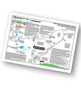
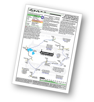
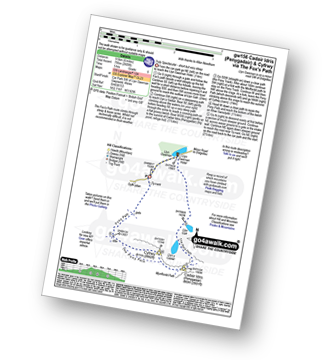
Minffordd Hotel - Afon Faw - Ystrad-gwyn - Nant Cadair - The Minffordd Path - Llyn Cau - Craig Lwyd - Craig Cwm Amarch - Craig Cau - Cadair Idris (Penygadair) - Cyfrwy - Cadair Idris (Penygadair) - Mynydd Moel - Gau Graig - Mynydd Gwerngraig - A487 - Nant Yr Allt-ioen - Cwm Rhwyddfor - Bwlch Llyn Bach - Minffordd.
|
Vital Statistics:
| Length: | 9.5 miles (15 km) |
| Ascent: | 2,777 ft (846 m) |
| Time: | 6½ hrs |
| Grade: |  |
Route Summary:
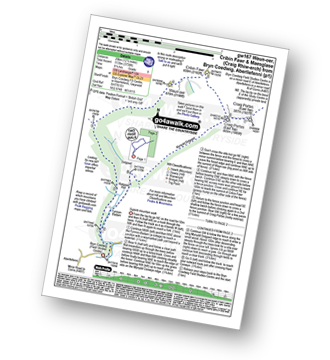
Aberllefenni - Bryn Coedwig Field Studies Centre - Cwm Ratgoed - Fynnon-Badarn - Ffridd Newydd - Mynydd Ceiswyn - Waun-oer - Cribin Fawr - Craig Portas - Craig Portas (East Top) - Craig Portas - Mynydd Dolgoed - Dolgoed - Ratgoed Hall - Bryn Coedwig - Aberllefenni
|
Vital Statistics:
| Length: | 10.5 miles (17 km) |
| Ascent: | 3,627 ft (1,105 m) |
| Time: | 7½ hrs |
| Grade: |  |
Route Summary:
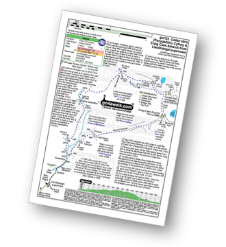
Llanfihangel-y-pennant - Afon Cadair - Tynyfach - Gwastadfryn - Hafotty Gwastaffryn - Rhiw Gwerdydd - The Pony Path - Cyfrwy - Cadair Idris (Penygadair) - Craig Cau - Craig Cwm Amarch - Mynydd Pencoed - Pencoed - Llanfihangel-y-pennant
|
Vital Statistics:
| Length: | 7.75 miles (12.5 km) |
| Ascent: | 2,281 ft (695 m) |
| Time: | 5.25 hrs |
| Grade: | |
Route Summary:
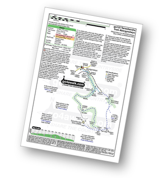
Abergynolwyn - Nant Gwernol - Nant Gwernol Station - Drum House - Nant Moelfre - Moelfre - Tarrenhendre - Pant Gwyn (Tarrenhendre) - Bryn-Eglwys Quarry - Abergynolwyn
|
Vital Statistics:
| Length: | 4.5 miles (7 km) |
| Ascent: | 1,454 ft (443 m) |
| Time: | 4 hrs |
| Grade: |  |

Route Summary:
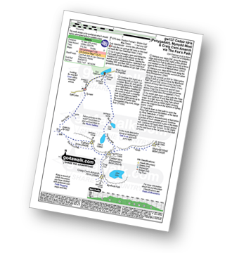
Llyn Gwernan - The Pony Path - Llyn y Cadair - The Fox's Path (lower Section) - Llyn Gafr - Llyn Gwernan
|
Vital Statistics:
| Length: | 8.5 miles (13.5 km) |
| Ascent: | 2,406 ft (733 m) |
| Time: | 5½ hrs |
| Grade: | |
Route Summary:
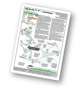
Llynnau Cregennen - Hafotty-fach - Craig-y-llyn - Tyrrau Mawr (Craig-las) - Tyrau Mawr (Craig-las) - Carnedd Lwyd - Rhiw Gwerdydd - Pony Path - Dyffr-ydan - Cefn-yr-Owen Isaf - Ty'n-llidiart - Llynnau Cregennen
|
Vital Statistics:
| Length: | 9.75 miles (15.5 km) |
| Ascent: | 4,247 ft (1,294 m) |
| Time: | 7.75 hrs |
| Grade: | |
Route Summary:
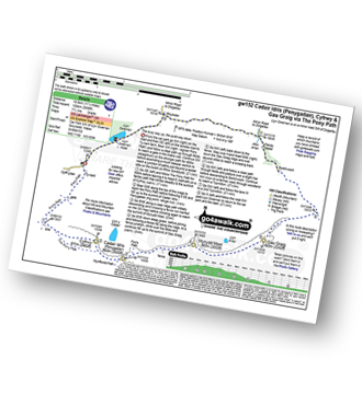
Llyn Gwernan - Llyn Gafr - The Fox's Path - Cadair Idris (Penygadair) - Mynydd Moel - Craig Cwm Amarch - Craig Cau - The Pony Path - Cyfrwy - Rhiw Gwerdydd - Llyn Gwernan
|
Vital Statistics:
| Length: | 6 miles (9.5 km) |
| Ascent: | 3,218 ft (981 m) |
| Time: | 5½ hrs |
| Grade: | |

Route Summary:
Minffordd Hotel - Afon Faw - Ystrad-gwyn - Nant Cadair - The Minffordd Path - Llyn Cau - Craig Lwyd - Craig Cwm Amarch - Craig Cau - Cadair Idris (Penygadair) - Mynydd Moel - Mynydd Moel Path - Minffordd.
|
Vital Statistics:
| Length: | 10.5 miles (17 km) |
| Ascent: | 3,328 ft (1,014 m) |
| Time: | 7.25 hrs |
| Grade: | |
Route Summary:
Abergynolwyn - Nant Gwernol - Nant Gwernol Station - Drum House - Nant Moelfre - Moelfre - Tarrenhendre - Pant Gwyn (Tarrenhendre) - Mynydd Rhyd-galed - Foel y Geifr - Tarren y Gesail - Bryn-Eglwys Quarry - Abergynolwyn
|
Vital Statistics:
| Length: | 11.25 miles (18.5 km) |
| Ascent: | 3,558 ft (1,084 m) |
| Time: | 7.75 hrs |
| Grade: | |
Route Summary:
Llyn Gwernan - The Pony Path - Rhiw Gwerdydd - Cyfrwy - Cadair Idris (Penygadair) - Mynydd Moel - Gau Graig - Bwlch-coch - Pandy Gader - Afon Arran - Rhydwen - Llyn Gwernan
|
Vital Statistics:
| Length: | 6 miles (9.5 km) |
| Ascent: | 2,609 ft (975 m) |
| Time: | 5 hrs |
| Grade: | |
Route Summary:
Llyn Gwernan - Llyn Gafr - Llyn y Cadair - The Fox's Path - Cadair Idris (Penygadair) - The Pony Path - Cyfrwy - Rhiw Gwerdydd - Llyn Gwernan
|
Vital Statistics:
| Length: | 12.5 miles (20 km) |
| Ascent: | 3,738 ft (1,139 m) |
| Time: | 8.25 hrs |
| Grade: | |
Route Summary:
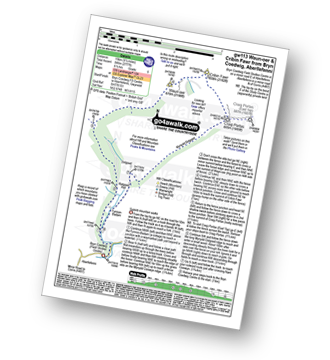
Aberllefenni - Bryn Coedwig Field Studies Centre - Cwm Ratgoed - Fynnon-Badarn - Ffridd Newydd - Mynydd Ceiswyn - Waun-oer - Cribin Fawr - Craig Portas - Craig Portas (East Top) - Maesglase (Craig Rhiw-erch) - Maesglase (Maen Du) - Craig Portas (East Top) - Craig Portas - Mynydd Dolgoed - Dolgoed - Ratgoed Hall - Bryn Coedwig - Aberllefenni
|
Vital Statistics:
| Length: | 10 miles (16 km) |
| Ascent: | 2,737 ft (834 m) |
| Time: | 6½ hrs |
| Grade: | |

Route Summary:
Llanfihangel-y-pennant - Tynyfach - Gwastadfryn - Hafotty Gwastaffryn - Rhiw Gwerdydd - Carnedd Lwyd - Tyrrau Mawr (Craig-las) - Tyrau Mawr (Craig-las) - Craig-y-llyn - Twll y Ogof - Bodilan Fach - Afon Cadair - Llanfihangel-y-pennant
|
Vital Statistics:
| Length: | 5 miles (8 km) |
| Ascent: | 1,375 ft (419 m) |
| Time: | 3.25 hrs |
| Grade: |  |

Route Summary:
Arthog - Afon Arthog - Arthog Waterfalls - Pant Phylip - Llys-Bradwen - Llynnau Cregennan - Cregennen Lakes - Pared y Cefn hir - Pant y Cae - Tan y Coed - Arthog
See this list of walks, routes & maps in:
Grade Order | Length Order | Time Order | Walk Number or Start Location Order
NB. To reverse (toggle) this order, click Grade Order again


