The 30 nearest, easy-to-follow, circular walks, routes & maps to UK Postcode CW11
The thirty nearest, easy-to-follow, circular walks, routes & maps to UK Postcode CW11 in Walk Grade Order
   |
Vital Statistics:
| Length: | 8.25 miles (13 km) |
| Ascent: | 804ft (245m) |
| Time: | 3.75hrs |
| Grade: |  |
Route Summary:
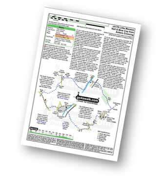
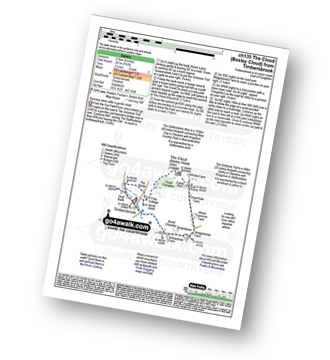
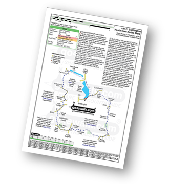
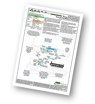
Ackers Crossing - The Macclesfield Canal - The Cheshire Ring Canal Walk - Little Moreton Hall - Boarded Barn Farm - Rode Mill - Claphatches - Scholar Green - Mount Pleasant - Mow Cop (Old Man of Mow) - The Gritstone Trail - The Staffordshire Way - The South Cheshire Way - Quarry Wood - Hanging Wood - Roe Park - Ackers Crossing
|
Vital Statistics:
| Length: | 5.5 miles (9 km) |
| Ascent: | 689ft (215m) |
| Time: | 2.75hrs |
| Grade: |  |
Route Summary:
Ackers Crossing - The Macclesfield Canal - The Cheshire Ring Canal Walk - Scholar Green - Mount Pleasant - Mow Cop (Old Man of Mow) - The Gritstone Trail - The Staffordshire Way - The South Cheshire Way - Quarry Wood - Hanging Wood - Roe Park - Ackers Crossing
|
Vital Statistics:
| Length: | 5.5 miles (9 km) |
| Ascent: | 115ft (35m) |
| Time: | 2.25hrs |
| Grade: |  |
Route Summary:
Ackers Crossing - The Macclesfield Canal - The Cheshire Ring Canal Walk - Little Moreton Hall - Boarded Barn Farm - Rode Mill - Claphatches - Scholar Green - The Macclesfield Canal - Ackers Crossing
|
Vital Statistics:
| Length: | 8.25 miles (13 km) |
| Ascent: | 295ft (90m) |
| Time: | 3½ hrs |
| Grade: | |
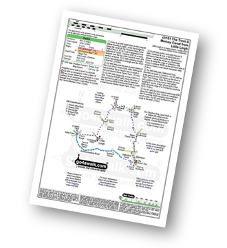
Route Summary:
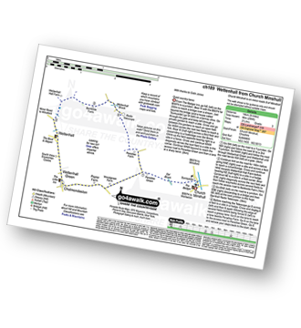
Church Minshull - Sunnyside - Eel Brook - Paradise Green - Paradise Wood - Wettenhall Green - Wettenhall - Stockerlane - Bankside Farm - Brookside Wood - Wettenhall Brook - Darnall Radio Telescope - Paradise Farm - Paradise Green - Eel Brook - Sunnyside - Church Minshull
|
Vital Statistics:
| Length: | 4 miles (6.5 km) |
| Ascent: | 791ft (241m) |
| Time: | 2.25hrs |
| Grade: | |
Route Summary:
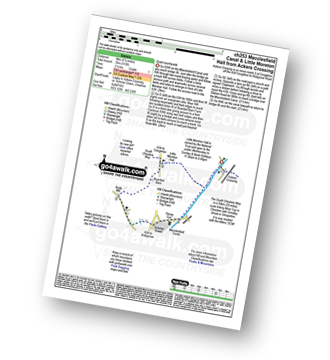
Timbersbrook - The Gritstone Trail - Pool Bank - The Staffordshire Way - Folly Cottage - Cloud Plantation - The Cloud (Bosley Cloud) - Avona - Cloud Side Farm - Bridgestones Farm - Bridestones Burial Chamber - Timbersbrook
|
Vital Statistics:
| Length: | 9 miles (14.5 km) |
| Ascent: | 1,208ft (368m) |
| Time: | 4½ hrs |
| Grade: |  |
Route Summary:
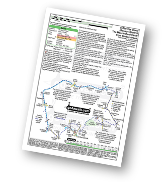
Timbersbrook - The Gritstone Trail - Pool Bank - The Staffordshire Way - Folly Cottage - Cloud Plantation - The Cloud (Bosley Cloud) - Avona - The Dane Valley Way - River Dane - The Macclesfield Canal - The Cheshire Ring Canal Walk - Buglawton - Brook House Farm - Pool Bank - Timbersbrook
|
Vital Statistics:
| Length: | 9.5 miles (15 km) |
| Ascent: | 358ft (109m) |
| Time: | 3.75hrs |
| Grade: | |
Route Summary:
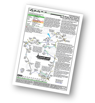
Over Peover - Peover Hall - Great Wood - Peover Eye - Woodend Farm - Blackden Heath - Redlion Brook - Goostrey - The Bongs - Swanwick Hall Farm - Booth Bed Lane - Boots Green - Meadowbank Farm - Long Lane - Peover Hall - Peover Hall Church - Peover Village Hall - Over Peover
|
Vital Statistics:
| Length: | 7.5 miles (12 km) |
| Ascent: | 1,359ft (414m) |
| Time: | 4.25hrs |
| Grade: | |
Route Summary:
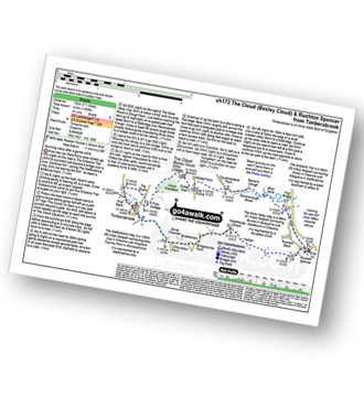
Timbersbrook - The Gritstone Trail - Pool Bank - The Staffordshire Way - Folly Cottage - Cloud Plantation - The Cloud (Bosley Cloud) - Avona - The Dane Valley Way - Raven's Clough - Ravensclough Brook - Rushton Spencer - Oulton - Woodhouse Green - Bridgestones Farm - Bridestones Burial Chamber - Timbersbrook
|
Vital Statistics:
| Length: | 7.5 miles (12 km) |
| Ascent: | 197ft (60m) |
| Time: | 3 hrs |
| Grade: |  |
Route Summary:
Redes Mere - Redes Mere Nature Reserve - Fanshawe - Hills Green Farm - Hazelwall Farm - Henshaw Hall Farm - Heskey Wood - Snape Brook - Moss Wood - Crabtree Moss Farm - Marton Gate Farm - Northwood Farm - Sandbank Farm - Mere Moss Wood - Siddington Heath - Holly Cottage - Blake House Farm - Capesthorne Hall - Redes Mere
|
Vital Statistics:
| Length: | 7.25 miles (11.5 km) |
| Ascent: | 404ft (123m) |
| Time: | 3 hrs |
| Grade: | |
Route Summary:
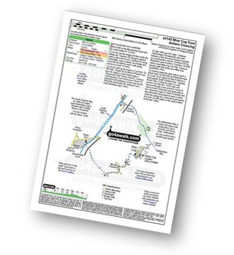
North Rode - Gawsworth - Oakgrove - The Macclesfield Canal - The Cheshire Ring Canal Walk - Bosley Locks - Big Dogbottom Wood - Station Wood - North Rode Manor Fish Pond - North Rode
|
Vital Statistics:
| Length: | 6 miles (9.5 km) |
| Ascent: | 164ft (50m) |
| Time: | 2½ hrs |
| Grade: | |
|
Vital Statistics:
| Length: | 3.75 miles (6 km) |
| Ascent: | 118ft (36m) |
| Time: | 1½ hrs |
| Grade: | |
|
Vital Statistics:
| Length: | 9.25 miles (15 km) |
| Ascent: | 545ft (166m) |
| Time: | 4 hrs |
| Grade: | |
Route Summary:
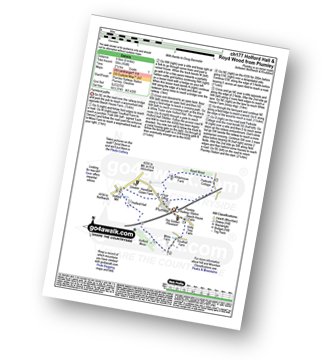
Gawsworth - Oakgrove - The Macclesfield Canal - The Cheshire Ring Canal Walk - Bosley Locks - River Dane Aquaduct - Railway Viaduct - Crossley Farm - Colleymill Bridge - North Rode - Manor Farm - Beancroft Wood - Rodegreen Farm - Gawsworth
|
Vital Statistics:
| Length: | 5.25 miles (8.5 km) |
| Ascent: | 417ft (127m) |
| Time: | 2½ hrs |
| Grade: | |
Route Summary:
Whitegate - New Pool - Petty Pool - Pettypool Wood - Newchurch Common - Whitegate Way (Dismantled Railway) - Whitegate Station - Martonsands - Foxwist Green - Whitegate
|
Vital Statistics:
| Length: | 4.5 miles (7 km) |
| Ascent: | 341ft (104m) |
| Time: | 2 hrs |
| Grade: | |
Route Summary:
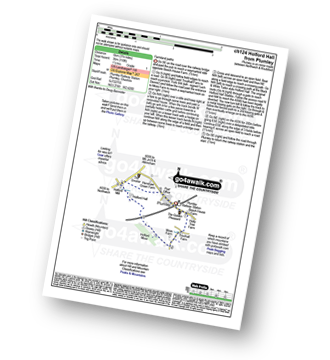
Bosley Locks - The Macclesfield Canal - The Cheshire Ring Canal Walk - River Dane Aquaduct - Railway Viaduct - Crossley Farm - Colleymill Bridge - North Rode - North Rode Manor Fish Pond - Station Wood - Big Dogbottom Wood - Bosley Locks
|
Vital Statistics:
| Length: | 5.5 miles (8.5 km) |
| Ascent: | 896ft (273m) |
| Time: | 3 hrs |
| Grade: | |
Route Summary:
Rushton Spencer - Oulton - Woodhouse Green - Wood Common Farm - Avona - The Staffordshire Way - The Gritstone Trail - The Cloud (Bosley Cloud) - Bosley Cloud - Avona - The Dane Valley Way - Raven's Clough - Ravensclough Brook - Rushton Spencer
|
Vital Statistics:
| Length: | 10 miles (16 km) |
| Ascent: | 1,404ft (428m) |
| Time: | 5 hrs |
| Grade: | |
Route Summary:
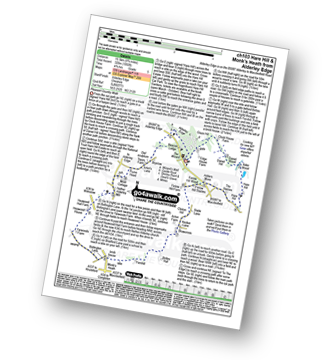
Rudyard Reservoir - The Staffordshire Way - Ryecroft Gate - Rushton Spencer - Heaton Lodge Farm - Weathercock Farm - Gun End House - Gun (Staffordshire) - Fould Farm - Fould Villa - Poolend - Willgate Farm - Rudyard - Black Wood - Rudyard Reservoir
|
Vital Statistics:
| Length: | 4.5 miles (7 km) |
| Ascent: | 295ft (90m) |
| Time: | 2 hrs |
| Grade: | |
Route Summary:
Rudyard Reservoir - The Staffordshire Way - Rudyard - Rea Cliffe Wood - Cliffe Park Hall - Rudyard Reservoir
|
Vital Statistics:
| Length: | 4.5 miles (7 km) |
| Ascent: | 66ft (20m) |
| Time: | 1½ hrs |
| Grade: | |
Route Summary:
Oakgrove - The Macclesfield Canal - The Cheshire Ring Canal Walk - Gawsworth - Oakgrove
|
Vital Statistics:
| Length: | 5 miles (8 km) |
| Ascent: | 226ft (69m) |
| Time: | 2.25hrs |
| Grade: | |
Route Summary:
Pickmere - Wathall Farm - Moss End - Hilltop Farm - The North Cheshire Way - Great Budworth - Pick Mere - Pickmere
|
Vital Statistics:
| Length: | 3.75 miles (6 km) |
| Ascent: | 253ft (77m) |
| Time: | 2 hrs |
| Grade: | |
Route Summary:
Marbury Park Country Park - Forge Brook - Big Wood - Trent and Mersey Canal - The Cheshire Ring Walk - Anderton - Anderton Boat Lift - Kennel Wood - The Northe Cheshire Way - Marbury Park Country Park
|
Vital Statistics:
| Length: | 8.75 miles (14 km) |
| Ascent: | 1,050ft (320m) |
| Time: | 4.25hrs |
| Grade: | |
Route Summary:
Alderley Edge - Clock House Farm - Daniel Hill - Daniel Wood - Alder Wood - Hare Hill - Finlow Hill Wood - Clinton Hill - Birtles Hill - Fernhill - Monk's Heath - Yarwoods Farm - Heawood House - Nether Alderley Mill - Nether Alderley - Alderley Edge
|
Vital Statistics:
| Length: | 4.5 miles (7 km) |
| Ascent: | 266ft (81m) |
| Time: | 2 hrs |
| Grade: | |
Route Summary:
Gurnett - The Macclesfield Canal - The Cheshire Ring Canal Walk - Oakgrove - Sutton Reservoir - Sutton Grange - Gurnett
|
Vital Statistics:
| Length: | 3.5 miles (5.5 km) |
| Ascent: | 286ft (87m) |
| Time: | 1.75hrs |
| Grade: | |
Route Summary:
Tiverton - The Shropshire Union Canal - Wharton's Lock - The Sandstone Trail - Beeston Castle - Beeston - Beeston Hall Farm - Tiverton
|
Vital Statistics:
| Length: | 11.25 miles (18 km) |
| Ascent: | 883ft (269m) |
| Time: | 5 hrs |
| Grade: | |
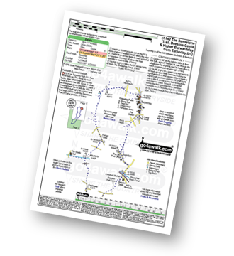
Route Summary:
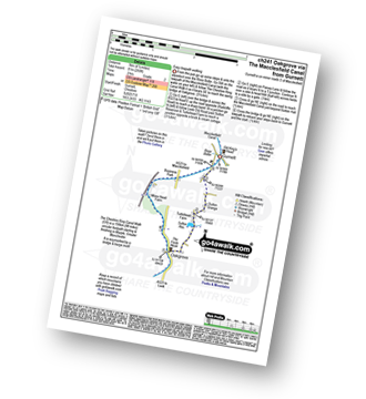
Tarpoley - The Sandstone Trail - Ferney Lees - Wharton's Bridge - The Shorpshire Union Canal - Wharton's Lock - Beeston Castle - Beeston - Peckforton Woods - Higher Burwardsley - Waste Hill - Peckforton Hills - Peckforton Castle Lodge - Willis's Wood - Beeston - A49 - Tiverton - Tarpoley
|
Vital Statistics:
| Length: | 6 miles (9.5 km) |
| Ascent: | 295ft (90m) |
| Time: | 2½ hrs |
| Grade: | |
Route Summary:
Tarpoley - The Sandstone Trail - Ferney Lees - Wharton's Bridge - The Shorpshire Union Canal - Wharton's Lock - A49 - Tiverton - Tarpoley
|
Vital Statistics:
| Length: | 5 miles (8 km) |
| Ascent: | 338ft (103m) |
| Time: | 2.25hrs |
| Grade: | |
Route Summary:
Little Leigh - Friar's Rough - Trent and Mersey Canal - Bardleymeadow Wood - Daleford House - Saltersford Tunnel - Barnton - Stone Heyes Farm - Desley Heath Farm - Claterwick Farm - Little Leigh
|
Vital Statistics:
| Length: | 8.5 miles (13.5 km) |
| Ascent: | 1,690ft (515m) |
| Time: | 4.75hrs |
| Grade: | |
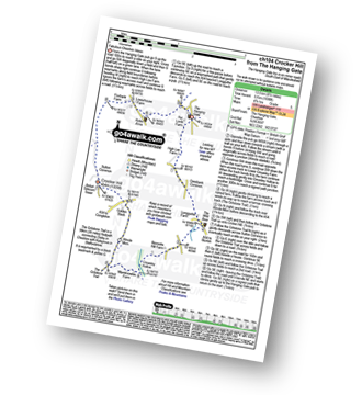
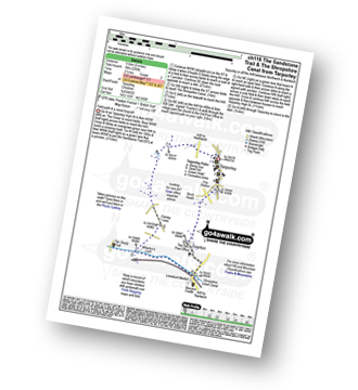
Route Summary:
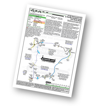
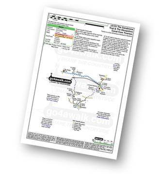
The Hanging Gate - Pot Lords - High Lee Farm - Withenshaw - Cessbank Common - Longgutter - Lower Greasley Farm - Greasley Hollow - Mareknowles Farm - The Gritstone Trail - Wincle Minn - Golden Slack - Croker Hill - Sutton Common - Foxbank Farm - Higher Sutton - Lowerhouse Farm - The Hanging Gate
|
Vital Statistics:
| Length: | 5.75 miles (9 km) |
| Ascent: | 354ft (108m) |
| Time: | 2½ hrs |
| Grade: | |
Route Summary:
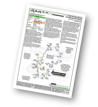
Mottram St Andrew - River Bollin - Willot Nurseries - Top O' Th' Hill Farm - Mottram Hall Golf Course - Mottram Hall - Woodside Farm - Legh Hall - Hunters Pool - Goose Green Farm - Mottram St Andrew
|
Vital Statistics:
| Length: | 4 miles (6.5 km) |
| Ascent: | 272ft (83m) |
| Time: | 1.75hrs |
| Grade: | |
Route Summary:
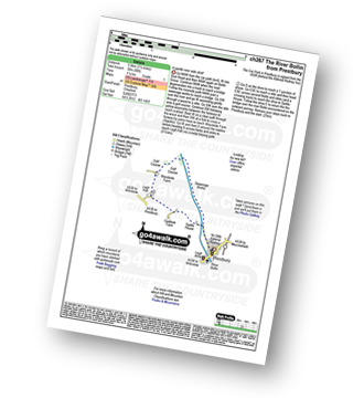
Prestbury - The River Bollin - The North Cheshire Way - Woodside Farm - Legh Hall - Woodend Farm - Spittle House - Prestbury


