UK Postcode W1 - The 30 nearest easy-to-follow, circular walk route maps to you
The thirty nearest easy-to-follow, circular walk route maps to you in UK Postcode W1 in Walk Grade Order
The UK cities, towns and villages in Greater London, England that have W1 in their UK Postcode include:
• Bond Street • Goodge Street • Great Portland Street • Marble Arch • Marylebone • Mayfair • Oxford Circus • Oxford Street • Park Lane • Piccadilly Circus • Regent Street • Soho • Tottenham Court Road • Warren Street •
Not familiar with the area around W1?
See these 30 nearest walks to UK Postcode W1 on a google map
   |
Vital Statistics:
| Length: | 7.25 miles (11.5 km) |
| Ascent: | 381 ft (116 m) |
| Time: | 3 hrs |
| Grade: |  |

Route Summary:
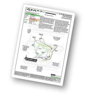
Richmond Park - Pembroke Lodge - Hamcross Plantation - Ham Bottom - Park Gate - Kingston Gate - Robin Hood Gate - Beverley Brook - Roehampton Gate - Adam's Pond - Sheen Gate - The Bog - Richmond Gate - Richmond Park (Richmond Park) - Pembroke Lodge - Richmond Park
|
Vital Statistics:
| Length: | 3.75 miles (6 km) |
| Ascent: | 387 ft (118 m) |
| Time: | 1.75 hrs |
| Grade: |  |
Route Summary:
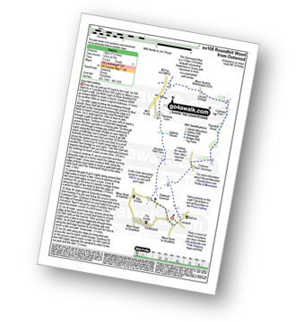
Chipstead - Chipstead Bottom - Fames Rough - Perrotts Farm - Ruffett Wood - Chipstead
|
Vital Statistics:
| Length: | 5.5 miles (9 km) |
| Ascent: | 466 ft (142 m) |
| Time: | 2½ hrs |
| Grade: | |

Route Summary:
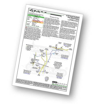
Tattenham Corner - Epsom Downs Racecourse - Langley Cale - The Warren - Nohome Farm - Downs View Wood - Walton On The Hill - The Nere - Withybed Corner - Walton Downs - Tattenham Corner - Epsom Downs Racecourse.
|
Vital Statistics:
| Length: | 6.5 miles (10.5 km) |
| Ascent: | 542 ft (165 m) |
| Time: | 3 hrs |
| Grade: | |

Route Summary:
Farthing Downs - Fairdean Downs - Chaldon Church - Chaldon - The North Downs Way - Ockley Hill - Hilltop House - Willey Park Farm - Caterham - Farthing Downs
|
Vital Statistics:
| Length: | 6.5 miles (9.5 km) |
| Ascent: | 689 ft (210 m) |
| Time: | 2.75 hrs |
| Grade: | |

Route Summary:
Oxted - The Greensand Way - Limpsfield - The North Downs Way - Tandridge Hill - Townland Pool - Oxted Mill - The Greensand Way - Oxted
|
Vital Statistics:
| Length: | 4 miles (6.5 km) |
| Ascent: | 420 ft (128 m) |
| Time: | 2 hrs |
| Grade: | |
Route Summary:
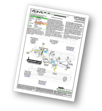
Godstone - Glebe Water - Church Town - Leigh Place - Oakpark Wood - Tandridge - The Greensand Way - Enterdent - Tilburstowhill Common - Godstone
|
Vital Statistics:
| Length: | 4.75 miles (7.5 km) |
| Ascent: | 466 ft (142 m) |
| Time: | 2.25 hrs |
| Grade: | |
Route Summary:
Bletchingley - The Greensand Way - Steners Hill - South Nutfield - Crabtree House - Henhaw Farm - Castlehill Farm - Bletchingley
|
Vital Statistics:
| Length: | 7.25 miles (11.5 km) |
| Ascent: | 752 ft (229 m) |
| Time: | 3½ hrs |
| Grade: |  |
Route Summary:
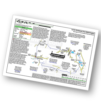
Bletchingley - The Greensand Way - Coldharbour Farm - Hobgarden Wood - Leigh Place - Glebe Water - Bay Pond - Godstone - Brewer Street - Bletchingley
|
Vital Statistics:
| Length: | 7 miles (11 km) |
| Ascent: | 1,115 ft (340 m) |
| Time: | 3½ hrs |
| Grade: | |
Route Summary:
Car Park S of Mickleham - River Mole - Norbury Park House - Fetcham Downs - Westhumble - The North Downs Way - Box Hill - Car Park S of Mickleham
|
Vital Statistics:
| Length: | 9.5 miles (15 km) |
| Ascent: | 1,306 ft (398 m) |
| Time: | 4.75 hrs |
| Grade: |  |
Route Summary:
Otford - The North Downs Way - Otford Mount - Hillydeal Wood - Rowdow Hill - Rowdow Wood - Shorehill Farm - Otford Manor - Fab's Wood - Cotman's Ash - Summeryards Wood - Knockmill Wood - Highfield Piggery - Little East Hill Farm - Broom Wood - Romney Street - Courtfield Wood - Eastdown - Great Wood - Paine's Farm - Greenhill Wood - Otford
|
Vital Statistics:
| Length: | 7.25 miles (11.5 km) |
| Ascent: | 840 ft (256 m) |
| Time: | 3½ hrs |
| Grade: | |
Route Summary:
Romney Street - Courtfield Wood - Eastdown - Great Wood - Paine's Farm - Rowdon Hill - The North Downs Way - Rowdow Wood - Shorehill Farm - Otford Manor - Fab's Wood - Cotman's Ash - Summeryards Wood - Knockmill Wood - Highfield Piggery - Little East Hill Farm - Broom Wood - Romney Street
|
Vital Statistics:
| Length: | 7 miles (11 km) |
| Ascent: | 962 ft (293 m) |
| Time: | 3½ hrs |
| Grade: | |
Route Summary:
Brockham - The Greensand Way - St Michael's Church - Betchworth - The North Downs Way - Brockham Warren - Box Hill - Betchworth Park Golf Club - Park Farm - Pondtail Farm - Brockham
|
Vital Statistics:
| Length: | 2.75 miles (4.5 km) |
| Ascent: | 151 ft (46 m) |
| Time: | 1.25 hrs |
| Grade: |  |
Route Summary:
Brockham - The Greensand Way - The River Mole - St Michael's Church - Betchworth - Denby's Wood - Oldpark Wood - Brockham
|
Vital Statistics:
| Length: | 4.25 miles (6.5 km) |
| Ascent: | 131 ft (40 m) |
| Time: | 1.75 hrs |
| Grade: | |
Route Summary:
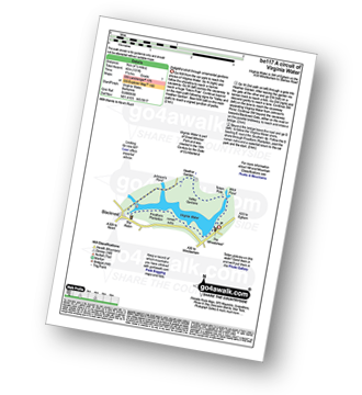
Virginia Water - Wick Pond - Totem Pole - Oxshed Clump - Valley Gardens - Heather Gardens - Johnson's Pond - Blacknest - Frostform Plantation - Leptis Magna Roman Ruins - Cascade Bridge - Virginia Water
|
Vital Statistics:
| Length: | 7 miles (11 km) |
| Ascent: | 650 ft (198 m) |
| Time: | 3.25 hrs |
| Grade: | |
Route Summary:
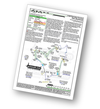
Thorndon Country Park North - Thorndon Park - Thorndon Hall - Ingrave - Herongate - Thorndon Country Park South - Old Hall Pond - Pigeon Mount - Jury Hill - Childerditch Pond - Scrub Hill - Countryside Centre - Thorndon Country Park North
Not familiar with the area around W1?
See these 30 nearest walks to UK Postcode W1 on a google map
|
Vital Statistics:
| Length: | 8.5 miles (13.5 km) |
| Ascent: | 866 ft (264 m) |
| Time: | 4 hrs |
| Grade: | |
Route Summary:
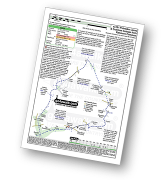
Ranmore Common - The North Downs Way - The Spains - The Roundabouts - Burnetts Leaf - Hogden Cottage - Pigden Cottage - Polesden Lacey - Bookham Wood - Crabtree Cottage - Chapel Farm - Westhumble Chapel - Ashcombe Wood - St Barnabus Church - Ranmore Common
|
Vital Statistics:
| Length: | 7.25 miles (11.5 km) |
| Ascent: | 873 ft (266 m) |
| Time: | 3½ hrs |
| Grade: | |
Route Summary:
Ranmore Common - Yewtree Farm - Polesden Lacey - Pigden Cottage - Hogden Cottage - Friars Farm - Dunley Wood - The North Downs Way - White Downs - Burnetts Leaf - The Roadabouts - The Spains - Ranmore Common
|
Vital Statistics:
| Length: | 5.25 miles (8.5 km) |
| Ascent: | 715 ft (218 m) |
| Time: | 2.75 hrs |
| Grade: | |
Route Summary:
Ranmore Common - Tanner's Hatch (Youth Hostel) - Bagden Farm - Crabtree Cottage - Chapel Farm - Westhumble Church - The North Downs Way - Ashcombe Wood - Denbies - St Barnabus Church - Ranmore Common
|
Vital Statistics:
| Length: | 4.75 miles (7.5 km) |
| Ascent: | 630 ft (192 m) |
| Time: | 2½ hrs |
| Grade: | |
Route Summary:
Ranmore Common - Yewtree Farm - Polesden Lacey - Connicut Wood - Freehold Wood - Tanner's Hatch (Yough Hostel) - Ranmore Common
|
Vital Statistics:
| Length: | 6.25 miles (10 km) |
| Ascent: | 286 ft (87 m) |
| Time: | 2½ hrs |
| Grade: | |
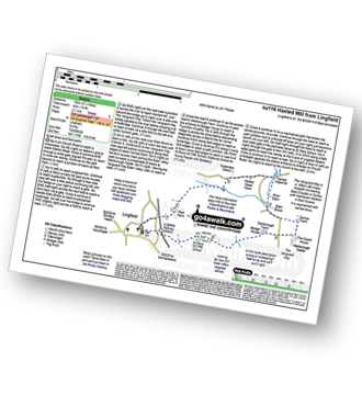
Route Summary:
Leigh - Clayhill Farm - Gad Brook - Denby's Wood - St Michael's Church - Betchworth - Wonham Manor - Ricebridge Farm - Skeets Farm - Leigh
|
Vital Statistics:
| Length: | 4.5 miles (7 km) |
| Ascent: | 151 ft (46 m) |
| Time: | 1.75 hrs |
| Grade: | |
|
Vital Statistics:
| Length: | 7.5 miles (12 km) |
| Ascent: | 417 ft (127 m) |
| Time: | 3.25 hrs |
| Grade: | |
Route Summary:
Outwood - Windmill - Outwood Common - Shepheard's Hurst - Burstow Farm - Henshaw Farm - Laundry Cottage - Cuckseys Farm - Poundhill Wood - Outwood Swan Sanctuary - Outwood
|
Vital Statistics:
| Length: | 4.75 miles (7.5 km) |
| Ascent: | 647 ft (197 m) |
| Time: | 2½ hrs |
| Grade: | |

Route Summary:
Westcott - Coomb Farm - The North Downs Way - The Rondabouts - The Spains - Ranmore Common - The Greensand Way - Westcott
|
Vital Statistics:
| Length: | 6.25 miles (10 km) |
| Ascent: | 752 ft (229 m) |
| Time: | 3 hrs |
| Grade: | |

Route Summary:
Westcott - Mill Pond - The Greensand Way - Sylvanus Wood - Stable Copse - Bushy Wood - Friday Street - Tilling Bourne - Horsley Copse - Wotton - Vale Farm - Westcott
|
Vital Statistics:
| Length: | 6.75 miles (11 km) |
| Ascent: | 243 ft (74 m) |
| Time: | 2½ hrs |
| Grade: | |
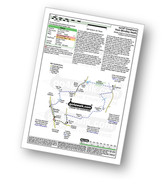
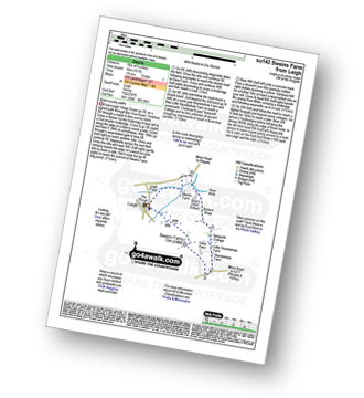
Route Summary:
Blindley Heath - Ardenrun Farm - Crowhurst Place - Crowhurst - Ashen Plantations - Gays Cottages - Comforts Place Farm - Oak Tree Farm - Blindley Heath
|
Vital Statistics:
| Length: | 6.25 miles (10 km) |
| Ascent: | 141 ft (43 m) |
| Time: | 2½ hrs |
| Grade: | |
Route Summary:
Lingfield - Park Farm - Puttenden Manor - Haxted Watermill - River Eden - Eden Brook - Cernes Farm - Starborough Castle - St Piers School - Lingfield Railway Station - Lingfield
|
Vital Statistics:
| Length: | 5.5 miles (9 km) |
| Ascent: | 768 ft (234 m) |
| Time: | 3 hrs |
| Grade: | |
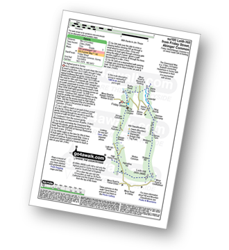
Route Summary:
Friday Street - Abinger Common - Abinger Bottom - The Greensand Way - Leith Hill - Shakes Hill - Whitberry Hill - Stable Copse - Bushy Wood - Friday Street
|
Vital Statistics:
| Length: | 5.5 miles (9 km) |
| Ascent: | 945 ft (288 m) |
| Time: | 3 hrs |
| Grade: | |

Route Summary:
Silent Pool Car Park - Sherbourne Pond - Silent Pool - The Boxwood - Clandon Downs - Newlands Corner - Albury Downs - Merrow Downs - White Lane Farm - Keepers Cottage - St Martha's Hill - Pilgram's Way - Newbarn Farm - Water Lane Cottages - Timber Croft - Albury St - Silent Pool Car Park
|
Vital Statistics:
| Length: | 4.5 miles (7 km) |
| Ascent: | 236 ft (72 m) |
| Time: | 2 hrs |
| Grade: | |
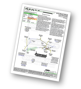
Route Summary:
Charlwood - The Sussex Border Path - Barfield Farm - Greenings Farm - Glover's Wood Nature Reserve - Charlwood
|
Vital Statistics:
| Length: | 8.25 miles (13 km) |
| Ascent: | 1,634 ft (498 m) |
| Time: | 4½ hrs |
| Grade: | |
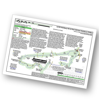
Route Summary:
Holmbury St Mary - The Greensand Way - Holmbury Hill - Duke of Kent School - Pitch Hill - Winterfold Hill - Winterfold Wood - Hurt Wood - Holmbury St Mary
Not familiar with the area around W1?
See these 30 nearest walks to UK Postcode W1 on a google map


