UK Postcode SY22 - The 30 nearest easy-to-follow, circular walk route maps to you
The thirty nearest easy-to-follow, circular walk route maps to you in UK Postcode SY22 in Walk Grade Order
The UK cities, towns and villages in Powys, Wales that have SY22 in their UK Postcode include:
• Arddlin • Bwlch-y-cibau • Crosslanes • Deuddwr • Domgay • Four Crosses • Geuffordd • Godor • Llandrinio • Llandysilio • Llanfechain • Llanfihangel-yng-Ngwynfa • Llanfyllin • Llansantffraid-ym-Mechain • Llanymynech • Maesbrook • Meifod • Melverley • Melverley Green • Pontrobert • Sarnau • Trefnanney • Tycrwyn • Waen-fach •
Not familiar with the area around SY22?
See these 30 nearest walks to UK Postcode SY22 on a google map
   |
Vital Statistics:
| Length: | 9.5 miles (15 km) |
| Ascent: | 2,632ft (802m) |
| Time: | 6 hrs |
| Grade: |  |

Route Summary:
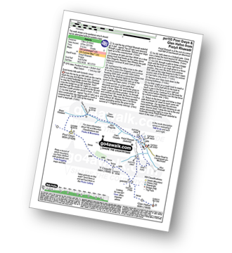
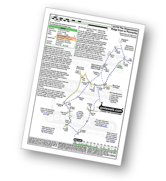
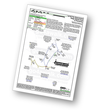
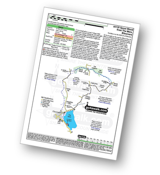
Tyn-y-ffridd - Cwm Maen Gwynedd - Mynydd Tarw - Foel Wen (South Top) - Foel Wen - Tomle - Bwlch Maen Gwynedd - Craig Berwyn - Cadair Berwyn - Cadair Berwyn (North Top) - Moel Sych - Moel Yr Ewig - Godor (North Top) - Godor - Tyn-y-ffridd
|
Vital Statistics:
| Length: | 6 miles (9.5 km) |
| Ascent: | 2,530ft (771m) |
| Time: | 4.75hrs |
| Grade: |  |

Route Summary:
Pistyll Rhaeadr Waterfall - Tan-y-pistyll - Nant y Llyn - LLyn Lluncaws - Cadair Berwyn - Cadair Berwyn (North Top) - Moel Sych - Trum Felen - Afon Disgynfa - Pistyll Rhaeadr - Tan-y-pistyll.
|
Vital Statistics:
| Length: | 12.75 miles (20.5 km) |
| Ascent: | 3,180ft (969m) |
| Time: | 7.75hrs |
| Grade: |  |

Route Summary:
Pistyll Rhaeadr Waterfall - Tan-y-pistyll - Nant y Llyn - LLyn Lluncaws - Cadair Berwyn - Cadair Berwyn (North Top) - Moel Sych - Ceulan Myheryn - Post Gwyn - Y Clogydd - Glan Hafon (Y Garn) - Afon Yr Ast - Pistyll Rhaeadr - Tan-y-pistyll.
|
Vital Statistics:
| Length: | 8.25 miles (13 km) |
| Ascent: | 2,215ft (675m) |
| Time: | 5.25hrs |
| Grade: | |
Route Summary:
Pistyll Rhaeadr Waterfall - Tan-y-pistyll - Nant y Llyn - Afon Disgynfa - Cwm Rhiwiau - Cwm Yr Eithin - Blaen Gaswen - Post Gwyn - Y Clogydd - Glan Hafon (Y Garn) - Afon Yr Ast - Pistyll Rhaeadr - Tan-y-pistyll.
|
Vital Statistics:
| Length: | 7.75 miles (12.5 km) |
| Ascent: | 1,083ft (330m) |
| Time: | 4 hrs |
| Grade: |  |
Route Summary:
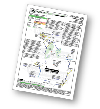
Pontesbury - Oaks Wood - The Marches Way - Oaks - Wrentnall - Pulverbatch - Habberley - Pontesbury
|
Vital Statistics:
| Length: | 7.75 miles (12.5 km) |
| Ascent: | 1,661ft (506m) |
| Time: | 4½ hrs |
| Grade: | |

Route Summary:
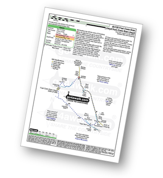
Cwm Pennant - Ffridd Ddu - Bryniau Gleision - Cwm Sian Llwyd - Foel Cwm-Sian Llwyd - Trwyn Swch - Nant Llwyn-gwerh - Nant Ceunant-bach - Milltir Gerrig - Nant Cwm Pydew - Blaen-y-cwm - Cwm Pennant
|
Vital Statistics:
| Length: | 4.75 miles (7.5 km) |
| Ascent: | 916ft (279m) |
| Time: | 2.75hrs |
| Grade: |  |
Route Summary:
Cwm Sian Llwyd - Foel Cwm-Sian Llwyd - Trwyn Swch - Nant Llwyn-gwerh - Nant Ceunant-bach - Milltir Gerrig - Pont Cwm Pydew - Nant Cwm Pydew - Cwm Sian Llwyd
|
Vital Statistics:
| Length: | 9 miles (14.5 km) |
| Ascent: | 420ft (128m) |
| Time: | 3.75hrs |
| Grade: | |
Route Summary:
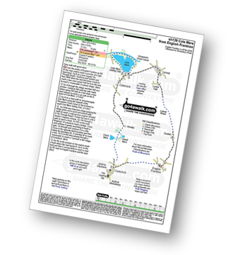
Cockshutt - English Frankton - Quaikin - Lyneal Wood - Lyneal Hall - River Roden - Lyneal - Cole Mere - Colemere - Whattal Farm - Whattal Moss - Seat Mere - Crose Mere - Lloyd's Wood - Crosemere House - Cockshutt,.
|
Vital Statistics:
| Length: | 5.25 miles (8.5 km) |
| Ascent: | 876ft (267m) |
| Time: | 3 hrs |
| Grade: | |

Route Summary:
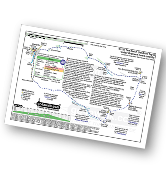
Stiperstones Car Park - The Shropshire Way - Nipstone Rock - The Rock - Ridge - Cold Hill Farm - Stiperstones Car Park
|
Vital Statistics:
| Length: | 7.75 miles (12.5 km) |
| Ascent: | 1,355ft (413m) |
| Time: | 4.25hrs |
| Grade: | |
Route Summary:
Stiperstones Car Park - Gatten Plantation - The Shropshire Way - Shepherd's Rock - Devil's Chair - Stiperstones (Manstone Rock) - Nipstone Rock - The Rock - Ridge - Cold Hill Farm - Stiperstones Car Park
|
Vital Statistics:
| Length: | 3.25 miles (5 km) |
| Ascent: | 479ft (146m) |
| Time: | 1.75hrs |
| Grade: |  |
Route Summary:
Stiperstones Car Park - Gatten Plantation - The Shropshire Way - Shepherd's Rock - Devil's Chair - Stiperstones (Manstone Rock) - Stiperstones Car Park
|
Vital Statistics:
| Length: | 16.25 miles (26 km) |
| Ascent: | 3,213ft (979m) |
| Time: | 9 hrs |
| Grade: |  |

Route Summary:
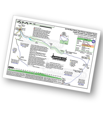
Llandrillo - Pont Rhyd-yr-hydd - Bwlch Llandrillo Wayfarer Memorial - Pen Bwlch Llandrillo Top - Bronwen (North Top) - Cadair Bronwen - Bwlch Maen Gwynedd - Craig Berwyn - Cadair Berwyn - Cadair Berwyn (North Top) - Moel Sych - Ceulan Myheryn - Milltir Gerrig - Blaen-y-cwm - Llandrillo
|
Vital Statistics:
| Length: | 10.25 miles (16.5 km) |
| Ascent: | 2,627ft (801m) |
| Time: | 6½ hrs |
| Grade: | |
Route Summary:
Llandrillo - Pont Rhyd-yr-hydd - Bwlch Llandrillo Wayfarer Memorial - Pen Bwlch Llandrillo Top - Cadair Bronwen (North Top) - Cadair Bronwen - Bwlch Maen Gwynedd - Ffordd Gan Elin - Llandrillo
|
Vital Statistics:
| Length: | 7.5 miles (12 km) |
| Ascent: | 420ft (128m) |
| Time: | 3.25hrs |
| Grade: | |

Route Summary:
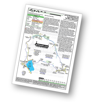
The Mere - Ellesmere - Crimps Farm - Ellesmere Point - Welshampton - Hawthorn House - The Stocks - Brook House - Stocks Farm - Coptiviney - Old Coptiviney - Crimps Cottage - The Mere - Ellesmere.
|
Vital Statistics:
| Length: | 8.75 miles (14 km) |
| Ascent: | 578ft (176m) |
| Time: | 3.75hrs |
| Grade: | |
Route Summary:
The Mere - Ellesmere - Crimps�Farm - Ellesmere Point - Welshampton - Hawthorn House - The Stocks - Brook House - Mill Wood - Old Coppice - Spout Wood - Sandy Hall - Haughton Farm - The Mere - Ellesmere.
Not familiar with the area around SY22?
See these 30 nearest walks to UK Postcode SY22 on a google map
|
Vital Statistics:
| Length: | 6.5 miles (10.5 km) |
| Ascent: | 241ft (104m) |
| Time: | 2.75hrs |
| Grade: | |
Route Summary:
The Mere - Ellesmere - Crimps Cottage - Old Coptiviney - Coptiviney - Brook House - Mill Wood - Old Coppice - Spout Wood - Sandy Hall - Haughton Farm - The Mere - Ellesmere.
|
Vital Statistics:
| Length: | 5.5 miles (9 km) |
| Ascent: | 295ft (90m) |
| Time: | 2½ hrs |
| Grade: | |
Route Summary:
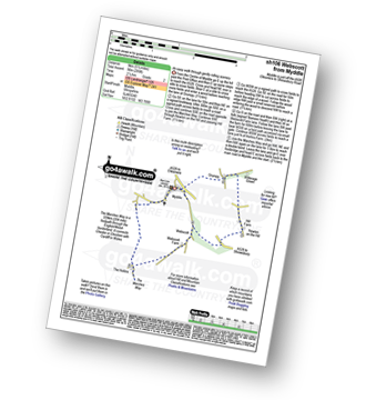
Myddle - Myddle Hill - Grumpy - Hill Farm - Newton on the Hill - Webscott - The Hollins - Myddle
|
Vital Statistics:
| Length: | 15.5 miles (25 km) |
| Ascent: | 3,157ft (962m) |
| Time: | 8.75hrs |
| Grade: | |
Route Summary:
Cynwyd - Afon Trystion - Cynwyd Forest - Pen Creigiau'r Barcut - Bwlch Cynwyd - Moel Fferna - Cerrig Coediog - Pan y Ladron - Pen Bwlch Llandrillo Top - Bwlch Llandrillo Wayfarer Memorial - Blaen Llynor - Cadair Bronwen (North Top) - Cadair Bronwen - Bwlch Llandrillo Wayfarer Memorial - Nant Gwyn - Nat y Cwm - Rhos-y-maerdy - Cynwyd
|
Vital Statistics:
| Length: | 12.25 miles (19.5 km) |
| Ascent: | 2,356ft (718m) |
| Time: | 6.75hrs |
| Grade: | |

Route Summary:
Cynwyd - Afon Trystion - Cynwyd Forest - Pen Creigiau'r Barcut - Bwlch Cynwyd - Moel Fferna - Cerrig Coediog - Pan y Ladron - Pen Bwlch Llandrillo Top - Bwlch Llandrillo Wayfarer Memorial - Nant Gwyn - Nat y Cwm - Rhos-y-maerdy - Cynwyd
|
Vital Statistics:
| Length: | 4.75 miles (7.5 km) |
| Ascent: | 1,628ft (496m) |
| Time: | 3½ hrs |
| Grade: | |

Route Summary:
Hirnant Pass - Foel Goch (Berwyns) - Trum y Gwrgedd - Trum y Gwragedd - Foel y Geifr (Berwyns) - Pen y Cerrig - Hirnant Pass
|
Vital Statistics:
| Length: | 10.5 miles (17 km) |
| Ascent: | 2,081ft (634m) |
| Time: | 6 hrs |
| Grade: | |

Route Summary:
Hirnant Pass - Pen y Cerrig - Pen y Boncyn Trefeilw - Stac Rhos - Cefn Gwyntog - Foel Cedig - Cyrniau Nod - Y Groes Fagl - Pennllyn Forest - Ystrad-y-groes - Hirnant Pass
|
Vital Statistics:
| Length: | 12.75 miles (20.5 km) |
| Ascent: | 2,763ft (842m) |
| Time: | 7½ hrs |
| Grade: | |

Route Summary:
Hirnant Pass - Foel Goch (Berwyns) - Trum y Gwrgedd - Trum y Gwragedd - Foel y Geifr (Berwyns) - Pen y Cerrig Duon - Pen y Boncyn Trefeilw - Stac Rhos - Cefn Gwyntog - Foel Cedig - Cyrniau Nod - Y Groes Fagl - Pennllyn Forest - Ystrad-y-groes - Hirnant Pass
|
Vital Statistics:
| Length: | 5 miles (8 km) |
| Ascent: | 197ft (60m) |
| Time: | 2 hrs |
| Grade: |  |
Route Summary:
Welshampton - Rowe Farm - Shropshire Union Canal (Llangollen Branch) - Cole Mere - Welshampton
|
Vital Statistics:
| Length: | 9.25 miles (14.5 km) |
| Ascent: | 321ft (98m) |
| Time: | 3.75hrs |
| Grade: | |

Route Summary:
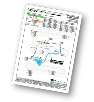
Loppington - Bentley Farm - Roden Farm - Brandwood Farm - Marton Coppice - Petton - Petton Hall - Petton Park - The Wood Farm - Woodgate Farm - Loppington
|
Vital Statistics:
| Length: | 5 miles (8 km) |
| Ascent: | 843ft (257m) |
| Time: | 2½ hrs |
| Grade: | |

Route Summary:
Llandderfel - Llyn Bodweni - Afron Dyfrdwy (River Dee) - Bryn-Banon - Coed Bryn Banon - Ty'n-y-bwlch - Llyn Maes-y-clawydd - Coed Hen-blas - Llandderfel
|
Vital Statistics:
| Length: | 11 miles (17.5 km) |
| Ascent: | 2,839ft (865m) |
| Time: | 6.75hrs |
| Grade: | |

Route Summary:
Bwlch y Groes - Gwaun Yr Hen-Luest - Clipiau-Duon - Llechwedd Du (Arans) - Afon Twrch - Foel Rhudd - Esgeiriau Gwynion - Bwlch Sirddyn - Foel Hafod-fynydd - Creiglyn Dyfi - Llaethnant - Ceunant y Briddell - Pen y Craig - Natn Llewlyn-goch - Blaen-pennant - Afon Rhiwlech - Foel y Groes - Moel y Cerrig Duon - Bwlch y Groes
|
Vital Statistics:
| Length: | 6 miles (9.5 km) |
| Ascent: | 351ft (107m) |
| Time: | 2½ hrs |
| Grade: | |
Route Summary:
Grinshill - The Marches Way - Yorton Villa Farm - Yorton House Farm - Yorton Heath - Sansaw Heath - Sheepcotes - Sansaw Business Park - The Shropshire Way - Grinshill
|
Vital Statistics:
| Length: | 4.75 miles (7.5 km) |
| Ascent: | 295ft (90m) |
| Time: | 2 hrs |
| Grade: | |

Route Summary:
Uffington - Haughmond Hill (Forest Commisison) - The Hollies - Haughmond Abbey - Abbey Wood - Haughmond Farm - New Coppice - Haughmond Hill (Forest Commisison) - Uffington
|
Vital Statistics:
| Length: | 9 miles (14.5 km) |
| Ascent: | 797ft (243m) |
| Time: | 4.25hrs |
| Grade: | |

Route Summary:
Corbet Wood - Grinshill - Clive - Grumpy - Myddle - The Marches Way - Webscott - Newton on the Hill - Yorton - Clive - Grinshill - The Shropshire Way - Corbet Wood - Grinshill
|
Vital Statistics:
| Length: | 5.25 miles (8.5 km) |
| Ascent: | 459ft (140m) |
| Time: | 2½ hrs |
| Grade: | |

Not familiar with the area around SY22?
See these 30 nearest walks to UK Postcode SY22 on a google map


