UK Postcode RG7 - The 30 nearest easy-to-follow, circular walk route maps to you
The thirty nearest easy-to-follow, circular walk route maps to you in UK Postcode RG7 in Walk Grade Order
The UK cities, towns and villages in Berkshire, England that have RG7 in their UK Postcode include:
• Aldermaston • Aldermaston Soke • Aldermaston Wharf • Beech Hill • Beenham • Bradfield • Brimpton • Bucklebury • Burghfield Common • Burghfield Hill • Chapel Row • Englefield • Farley Hill • Grazeley • Midgham • Mortimer • Mortimer West End • North Street • Padworth • Sheffield Bottom • Silchester • Southend • Spencers Wood • Stanford Dingley • Stratfield Mortimer • Stratfield Saye • Sulhamstead • Swallowfield • Theale • Three Mile Cross • Ufton Nervet • Upper Bucklebury • Wasing • West End Green • Wokefield Park • Woolhampton •
Not familiar with the area around RG7?
See these 30 nearest walks to UK Postcode RG7 on a google map
   |
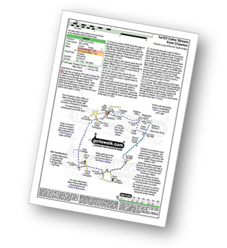
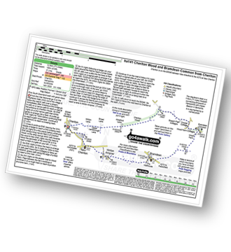
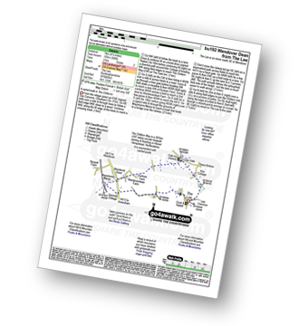
Vital Statistics:
| Length: | 5 miles (8 km) |
| Ascent: | 190ft (58m) |
| Time: | 2 hrs |
| Grade: |  |

Route Summary:
Winchfield Hurst - Barley Mow Bridge - The Basingstoke Canal - Stacey's Bridge - The Three Castles Path - Baseley's Bridge - Sprat's Hatch Bridge - Sprat's Hatch Farm - Tundry Pond - Parsonage Copse - Double Bridge Farm - Whitlow Alders - Crookham Village - Brook Hill - Brook Meadow Farm - Dogmersfield - Norman's Green - Pilcot Farm - Winchfield Hurst
|
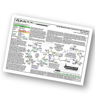
Vital Statistics:
| Length: | 7.5 miles (12 km) |
| Ascent: | 673ft (205m) |
| Time: | 3.75hrs |
| Grade: |  |

Route Summary:
Chawton - Alton - Jane Austen's House Museum - The St Swithun's Way - Park Cottage - Upper Woodside Farm - New Copse - Dell Piece - Weathermore Copse - Medstead and Four Marks - Watercress Railway Line - Chawton Park Wood - Alton - Chawton
|
Vital Statistics:
| Length: | 5.5 miles (8.5 km) |
| Ascent: | 263ft (80m) |
| Time: | 2.25hrs |
| Grade: |  |
Route Summary:
Chawton - Alton - Jane Austen's House Museum - The St Swithun's Way - Lower Farringdon - Upper Farringdon - Caker Stream - Round Groves Copse - Peck Copse - Shepherd's Court - Eastfield Farm - Chawton
|
Vital Statistics:
| Length: | 4.25 miles (6.5 km) |
| Ascent: | 131ft (40m) |
| Time: | 1.75hrs |
| Grade: | |
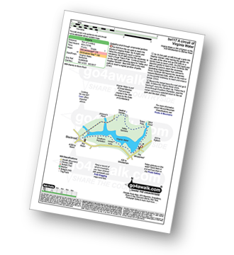
Route Summary:
Virginia Water - Wick Pond - Totem Pole - Oxshed Clump - Valley Gardens - Heather Gardens - Johnson's Pond - Blacknest - Frostform Plantation - Leptis Magna Roman Ruins - Cascade Bridge - Virginia Water
|
Vital Statistics:
| Length: | 7 miles (11 km) |
| Ascent: | 515ft (157m) |
| Time: | 3 hrs |
| Grade: | |

Route Summary:
Selborne - Dorton - Oakhanger Stream - Oakhanger - Binswood Farm - Shortheath - The Hangers Way - Pheasant Wood - Wick Hill Hanger - High Candovers - Wick Wood - Coombe Wood - Long Lyth - Selborne
|
Vital Statistics:
| Length: | 5.5 miles (9 km) |
| Ascent: | 738ft (225m) |
| Time: | 2.75hrs |
| Grade: | |
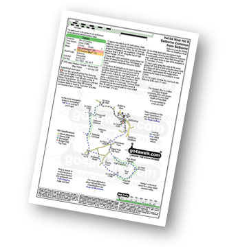
Route Summary:
Selborne - The Hangers Way - High Common - High Wood Hanger - Noar Hill - Noar Hill Hanger - Bridleway Wood - Selborne Common - Coneycroft Hill - Selborne
|
Vital Statistics:
| Length: | 5 miles (8 km) |
| Ascent: | 410ft (125m) |
| Time: | 2.25hrs |
| Grade: | |

Route Summary:
Great Bedwyn - Kennet and Avon Canal - Castle Copse - Bedwyn Brail - Wilton - Wilton Windmill - Crofton Crossing - Kennet and Avon Canal - Great Bedwyn
|
Vital Statistics:
| Length: | 6.5 miles (10.5 km) |
| Ascent: | 420ft (128m) |
| Time: | 2.70hrs |
| Grade: | |
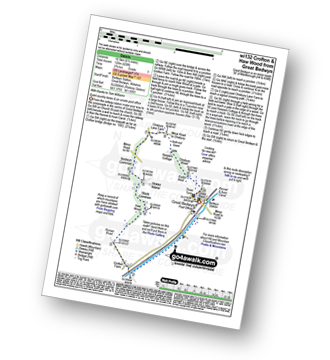
Route Summary:
Great Bedwyn - Kennet and Avon Canal - Crofton Crossing - Crofton Farm - Haw Wood - Stock Common - Bedwyn Common - Chisbury Wood - Great Bedwyn
|
Vital Statistics:
| Length: | 8.25 miles (13 km) |
| Ascent: | 660ft (201m) |
| Time: | 3.75hrs |
| Grade: |  |

Route Summary:
Great Bedwyn - Kennet and Avon Canal - Castle Copse - Bedwyn Brail - Wilton - Wilton Windmill - Kennet and Avon Canal - Crofton Crossing - Crofton Farm - Haw Wood - Stock Common - Bedwyn Common - Chisbury Wood - Great Bedwyn
|
Vital Statistics:
| Length: | 5 miles (8 km) |
| Ascent: | 387ft (118m) |
| Time: | 2.25hrs |
| Grade: | |

Route Summary:
Cheriton - The Wayfarer's Walk - Hinton Lane - Upper Lamborough Lane - Broad Lane - Cheriton Wood - Alresford Lane - New Cottages - Bramdean House - Bramdean - Hinton Ampner - New Cheriton - Cheriton
|
Vital Statistics:
| Length: | 7.75 miles (12.5 km) |
| Ascent: | 610ft (186m) |
| Time: | 3½ hrs |
| Grade: | |
Route Summary:
Cheriton - The Wayfarer's Walk - Hinton Lane - Upper Lamborough Lane - Broad Lane - Cheriton Wood - Alresford Lane - Copwer Cottage - Bramdean Common - Wood Farm - Bramdean - Hinton Ampner - New Cheriton - Cheriton
|
Vital Statistics:
| Length: | 5.25 miles (8.5 km) |
| Ascent: | 994ft (303m) |
| Time: | 3 hrs |
| Grade: | |
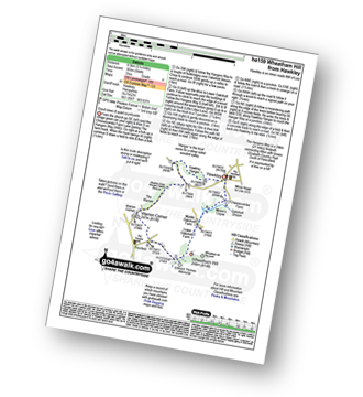
Route Summary:
Hawkley - The Hangers Way - Lower Oakshott Farm - Wheatham Hill - Edward Thomas Memorial - Froxfield - Warren Corner - Wealdon Edge Hangers Nature Reserve - Hawkley Hanger - Hawkley
|
Vital Statistics:
| Length: | 6 miles (9.5 km) |
| Ascent: | 528ft (161m) |
| Time: | 2.75hrs |
| Grade: | |
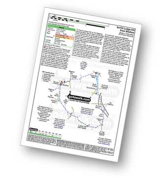
Route Summary:
Bledlow - The Midshires Way - The Warren - The Ridgeway - Thickthorn Wood - Lodge Hill - Longwood Farm - The Old Rectory - Saunderton - Horsenden - Bledlow
|
Vital Statistics:
| Length: | 5 miles (8 km) |
| Ascent: | 374ft (114m) |
| Time: | 2.25hrs |
| Grade: | |

Route Summary:
Bramdean - Alresford Lane - Cheriton Wood - Copwer Cottage - Bramdean Common - Wood Farm - Bramdean
|
Vital Statistics:
| Length: | 8.5 miles (13.5 km) |
| Ascent: | 873ft (266m) |
| Time: | 4 hrs |
| Grade: | |

Route Summary:
Aldbourne - The Giant's Grave - Upper Upham - The Ridgeway - Sugar Hill - Four Barrows - Aldbourne
Not familiar with the area around RG7?
See these 30 nearest walks to UK Postcode RG7 on a google map
|
Vital Statistics:
| Length: | 10 miles (16 km) |
| Ascent: | 985ft (300m) |
| Time: | 4.75hrs |
| Grade: |  |

Route Summary:
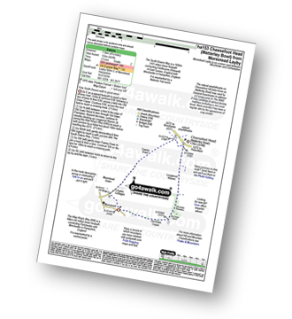
Cheesefoot Head Car Park - Cheesefoot Head (Matterley Bowl) - Fawley Down - Hydes Cottages - Morestead - Old Down Copse - Bushy Copse - Longwood House - Longwood Dead Farm - Lane End - The South Downs Way - Holden Farm - Gander Down - Temple Valley - Cheesefoot Head Car Park
|
Vital Statistics:
| Length: | 5.5 miles (9 km) |
| Ascent: | 722ft (220m) |
| Time: | 2.75hrs |
| Grade: | |
Route Summary:
Great Hampden - The Chiltern Way - Hampden House - Little Hampden - The South Bucks Way - Cobbleshill Farm - Hampden Bottom - Pepperboxes Wood - Honor End Farm - Great Hampden
|
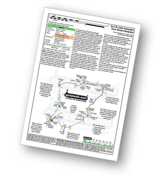
Vital Statistics:
| Length: | 9.75 miles (15.5 km) |
| Ascent: | 1,126ft (343m) |
| Time: | 4.75hrs |
| Grade: | |

Route Summary:
Winchester - Tun Bridge - The Itchen Way - Itchen Navigation - St Catherine's Hill - Pilgrims' Trail - Twyford Down - Morestead Down - Hydes Cottages - Fawley Down - The Allan King's Way - Cheesefoot Head Car Park - Cheesefoot Head (Matterley Bowl) - The South Downs Way - The Pilgrim's Way - Telegraph Hill - Little Golders - Chilcomb - Highcliffe - The Soke - City Mill - Wharf Bridge - Tun Bridge - Winchester
|
Vital Statistics:
| Length: | 7.5 miles (12 km) |
| Ascent: | 1,175ft (358m) |
| Time: | 4 hrs |
| Grade: | |
Route Summary:
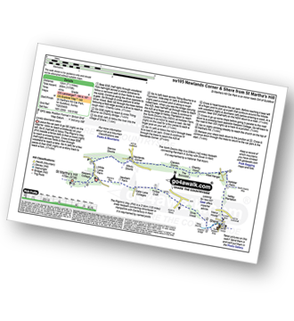
St Martha's Hill Car Park - Pilgram's Way - Newbarn Farm - Water Lane Cottages - Timber Croft - Silver Wood - Shere - Netley Plantation Hollister Farm - The North Downs Way - West Hanger - Chantry Wood - The Boxwood - Clandon Downs - Newlands Corner - Albury Downs - Merrow Downs - White Lane Farm - Keepers Cottage - St Martha's Hill - St Martha's Hill Car Park
|
Vital Statistics:
| Length: | 4.75 miles (7.5 km) |
| Ascent: | 443ft (135m) |
| Time: | 2.25hrs |
| Grade: | |
Route Summary:
Morestead - Old Copse Down - Old Down Wood - Old Down Plantation - Longwood Warren - The Allan King's Way - Cheesefoot Head (Matterley Bowl) - Fawley Down - Morestead Down - Morestead
|
Vital Statistics:
| Length: | 5 miles (8 km) |
| Ascent: | 230ft (70m) |
| Time: | 2 hrs |
| Grade: | |
Route Summary:
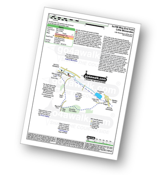
Little Missenden - The South Bucks Way - Lower Park - Shardeloes Lake - Amersham Cricket Ground - Lower Park House - Wheatley Wood - Mop End - Mop End Farm - Taby's Lane - Breaches Wood - Little Missenden
|
Vital Statistics:
| Length: | 3.75 miles (6 km) |
| Ascent: | 538ft (164m) |
| Time: | 2 hrs |
| Grade: | |
Route Summary:
Little Hampden Common - Little Hampden - The South Bucks Way - Cobblershill Farm - The Chiltern Way - Cockshoots Wood - Mayortorne Manor - Russell Farm - Dunsmore - Scrub Wood - Hampdenleaf Wood - The Icknield Way - Little Hampden Common
|
Vital Statistics:
| Length: | 4.5 miles (7 km) |
| Ascent: | 693ft (211m) |
| Time: | 2½ hrs |
| Grade: | |

Route Summary:
Great Kimble - The North Bucks Way - Askett - Monks Risborough - Whiteleaf - The Icknield Way - The Ridgeway - Whiteleaf Cross - Cadsden - Grangelands And Pulpit Hill Nature Reserve - Chequer's Knap - The North Bucks Way - Great Kimble
|
Vital Statistics:
| Length: | 5.5 miles (9 km) |
| Ascent: | 945ft (288m) |
| Time: | 3 hrs |
| Grade: | |

Route Summary:
Silent Pool Car Park - Sherbourne Pond - Silent Pool - The Boxwood - Clandon Downs - Newlands Corner - Albury Downs - Merrow Downs - White Lane Farm - Keepers Cottage - St Martha's Hill - Pilgram's Way - Newbarn Farm - Water Lane Cottages - Timber Croft - Albury St - Silent Pool Car Park
|
Vital Statistics:
| Length: | 5.5 miles (9 km) |
| Ascent: | 853ft (260m) |
| Time: | 3 hrs |
| Grade: | |

Route Summary:
Butler's Cross - Monument Hill (Coombe Hill) - The Ridgeway - Linton's Wood - Goodmerhill Wood - Chisley Wood - The Icknield Way - Chequers - Pond Wood - Pulpit Wood - The North Bucks Way - The Midshires Way - Chequers Knap - Whorley Wood - Ellesborough Warren - Boxtree Wood - Beacon Hill (Ellesborough) - Ellesborough - The Aylesbury Ring - Springs Farm - Butler's Cross
|
Vital Statistics:
| Length: | 4.5 miles (7 km) |
| Ascent: | 345ft (105m) |
| Time: | 2 hrs |
| Grade: | |
Route Summary:
The Lee - Kiln Cottage - Lee Gate - The Chiltern Way - Durham Farm - Wendoverdean Farm - Wendover Dean - Mayortorne Manor - Spinney Cottage - The Lee
|
Vital Statistics:
| Length: | 8.25 miles (13 km) |
| Ascent: | 919ft (280m) |
| Time: | 4 hrs |
| Grade: | |
Route Summary:
The Lee - Kiln Cottage - Lee Gate - The Chiltern Way - Durham Farm - Wendoverdean Farm - Wendover Dean - Mayortorne Manor - Russell Farm - Dunsmore - Scrub Wood - Hampdenleaf Wood - The Icknield Way - Little Hampden Common - Little Hampden - The South Bucks Way - Cobblershill Farm - The Chiltern Way - Cockshoots Wood - Mayortorne Manor - Spinney Cottage - The Lee
|
Vital Statistics:
| Length: | 9 miles (14.5 km) |
| Ascent: | 328ft (100m) |
| Time: | 3½ hrs |
| Grade: | |
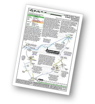
Route Summary:
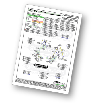
Dinton - Upton - The Aylsebury Ring - Dinton Castle - Starveall Farm - Eythrope Park - The Midshires Way - The North Bucks Way - The Swans Way - Bridge Lodge - The River Thame - The Bernwood Jubilee Way - The Thame Valley Way - Nether Winchendon - Lower Winchendon - Cuddington - Haddenham - Dad Brook - Townsend - Haddenham - Westington - Dinton
|
Vital Statistics:
| Length: | 6.5 miles (10.5 km) |
| Ascent: | 230ft (70m) |
| Time: | 2½ hrs |
| Grade: | |
Route Summary:
Stone - Hartwell Church - Upper Hartwell - Whaddon Hill Farm - The North Bucks Way - River Thame - Thame Valley Walk - The Midshires Way - Weir Lodge - Bridge Lodge - Eythrope Park - Beachendon Cottages - Eythrope House - Aylesbury Ring - Stone
|
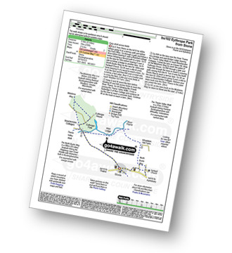
Vital Statistics:
| Length: | 6 miles (9.5 km) |
| Ascent: | 496ft (151m) |
| Time: | 2.75hrs |
| Grade: | |

Route Summary:
Coleshill - Brimstone Farm - Badbury Hill Fort - Badbury Hill - Great Coxwell - Ashen Copse Farm - Flamborough Wood - Coleshill Park - Coleshill
Not familiar with the area around RG7?
See these 30 nearest walks to UK Postcode RG7 on a google map


