UK Postcode LL43 - The 30 nearest easy-to-follow, circular walk route maps to you
The thirty nearest easy-to-follow, circular walk route maps to you in UK Postcode LL43 in Walk Grade Order
The UK cities, towns and villages in Gwynedd, Wales that have LL43 in their UK Postcode include:
• Tal-y-bont •
Not familiar with the area around LL43?
See these 30 nearest walks to UK Postcode LL43 on a google map
   |
Vital Statistics:
| Length: | 12 miles (19 km) |
| Ascent: | 4,723ft (1,439m) |
| Time: | 9.25hrs |
| Grade: |  |
Route Summary:
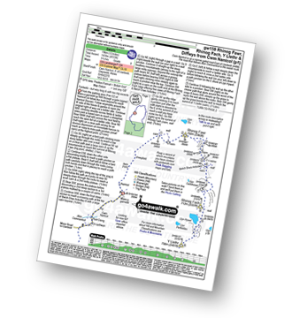
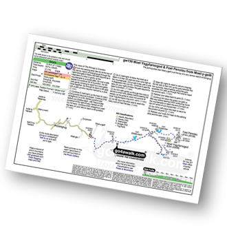
Maes-y-garnedd - Nantcol - Rhinog Fawr - Bwlch Drws-Ardudwy - Rhinog Fach - Llyn Hywel - Y Llethr - Crib-y-rhiw - Diffwys - Diffwys (West Top) - Llyn Bodlyn - Cil-cychwyn - Pont Cerrig - Afon Cwmnantcol - Cwm Nantcol - Maes-y-garnedd
|
Vital Statistics:
| Length: | 5 miles (8 km) |
| Ascent: | 1,375ft (419m) |
| Time: | 3.25hrs |
| Grade: |  |

Route Summary:
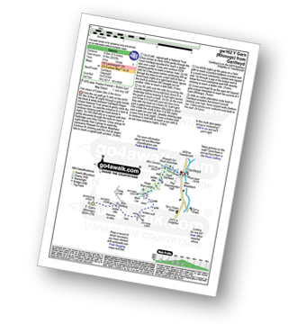
Arthog - Afon Arthog - Arthog Waterfalls - Pant Phylip - Llys-Bradwen - Llynnau Cregennan - Cregennen Lakes - Pared y Cefn hir - Pant y Cae - Tan y Coed - Arthog
|
Vital Statistics:
| Length: | 8.5 miles (13.5 km) |
| Ascent: | 2,406ft (733m) |
| Time: | 5½ hrs |
| Grade: |  |
Route Summary:
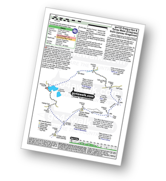
Llynnau Cregennen - Hafotty-fach - Craig-y-llyn - Tyrrau Mawr (Craig-las) - Tyrau Mawr (Craig-las) - Carnedd Lwyd - Rhiw Gwerdydd - Pony Path - Dyffr-ydan - Cefn-yr-Owen Isaf - Ty'n-llidiart - Llynnau Cregennen
|
Vital Statistics:
| Length: | 6 miles (9.5 km) |
| Ascent: | 2,609ft (975m) |
| Time: | 5 hrs |
| Grade: | |
Route Summary:
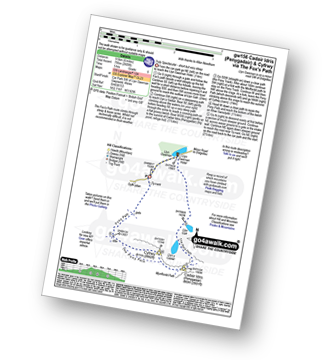
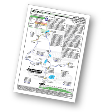
Llyn Gwernan - Llyn Gafr - Llyn y Cadair - The Fox's Path - Cadair Idris (Penygadair) - The Pony Path - Cyfrwy - Rhiw Gwerdydd - Llyn Gwernan
|
Vital Statistics:
| Length: | 4.5 miles (7 km) |
| Ascent: | 1,454ft (443m) |
| Time: | 4 hrs |
| Grade: |  |

Route Summary:
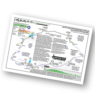
Llyn Gwernan - The Pony Path - Llyn y Cadair - The Fox's Path (lower Section) - Llyn Gafr - Llyn Gwernan
|
Vital Statistics:
| Length: | 11.25 miles (18.5 km) |
| Ascent: | 3,558ft (1,084m) |
| Time: | 7.75hrs |
| Grade: |  |
Route Summary:
Llyn Gwernan - The Pony Path - Rhiw Gwerdydd - Cyfrwy - Cadair Idris (Penygadair) - Mynydd Moel - Gau Graig - Bwlch-coch - Pandy Gader - Afon Arran - Rhydwen - Llyn Gwernan
|
Vital Statistics:
| Length: | 9.75 miles (15.5 km) |
| Ascent: | 4,247ft (1,294m) |
| Time: | 7.75hrs |
| Grade: | |
Route Summary:
Llyn Gwernan - Llyn Gafr - The Fox's Path - Cadair Idris (Penygadair) - Mynydd Moel - Craig Cwm Amarch - Craig Cau - The Pony Path - Cyfrwy - Rhiw Gwerdydd - Llyn Gwernan
|
Vital Statistics:
| Length: | 6.5 miles (10.5 km) |
| Ascent: | 1,664ft (507m) |
| Time: | 4.25hrs |
| Grade: |  |
Route Summary:
Moel-y-geifr - Llyn Eiddew-bach - Llyn Du - Moel Ysgyfarnogod - Foel Penolau - Llyn Dywarchen - Llyn Eiddew-bach - Moel-y-geifr
|
Vital Statistics:
| Length: | 5.5 miles (8.5 km) |
| Ascent: | 2,032ft (619m) |
| Time: | 4 hrs |
| Grade: | |
Route Summary:
Ganllwyd - Cwm Camlan - Afon Camlan - Rhaeadr Du - Black Waterfalls - Coed Ganllwyd - Ffridd Bryn-melyn - Nant Las - Bryn Bedwog - Y Garn (Rhinogs) - Bryn Bedwog - Nant Las - Ffridd Bryn-melyn - Coed Ganllwyd - Black Waterfalls - Rhaeadr Du - Afon Camlan - Cwm Camlan - Ganllwyd
|
Vital Statistics:
| Length: | 10.5 miles (17 km) |
| Ascent: | 3,627ft (1,105m) |
| Time: | 7½ hrs |
| Grade: | |
Route Summary:
Llanfihangel-y-pennant - Afon Cadair - Tynyfach - Gwastadfryn - Hafotty Gwastaffryn - Rhiw Gwerdydd - The Pony Path - Cyfrwy - Cadair Idris (Penygadair) - Craig Cau - Craig Cwm Amarch - Mynydd Pencoed - Pencoed - Llanfihangel-y-pennant
|
Vital Statistics:
| Length: | 10 miles (16 km) |
| Ascent: | 2,737ft (834m) |
| Time: | 6½ hrs |
| Grade: | |

Route Summary:
Llanfihangel-y-pennant - Tynyfach - Gwastadfryn - Hafotty Gwastaffryn - Rhiw Gwerdydd - Carnedd Lwyd - Tyrrau Mawr (Craig-las) - Tyrau Mawr (Craig-las) - Craig-y-llyn - Twll y Ogof - Bodilan Fach - Afon Cadair - Llanfihangel-y-pennant
|
Vital Statistics:
| Length: | 3.5 miles (5.5 km) |
| Ascent: | 289ft (88m) |
| Time: | 1.75hrs |
| Grade: |  |

Route Summary:
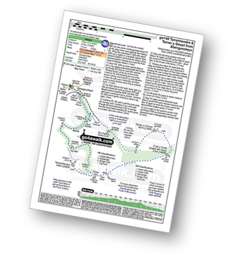
Coed y Groes - Gwern Offeiriaid - The Precipice Walk - Ffridd Dol-Fawr - Foel Faner (fort) - Llyn Cynwych - Gwern Offeiriaid - Coed y Groes
|
Vital Statistics:
| Length: | 7.75 miles (12.5 km) |
| Ascent: | 2,281ft (695m) |
| Time: | 5.25hrs |
| Grade: | |
Route Summary:
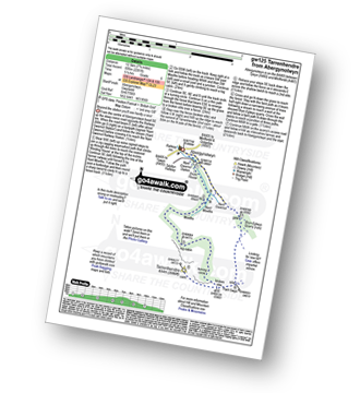
Abergynolwyn - Nant Gwernol - Nant Gwernol Station - Drum House - Nant Moelfre - Moelfre - Tarrenhendre - Pant Gwyn (Tarrenhendre) - Bryn-Eglwys Quarry - Abergynolwyn
|
Vital Statistics:
| Length: | 10.5 miles (17 km) |
| Ascent: | 3,328ft (1,014m) |
| Time: | 7.25hrs |
| Grade: | |
Route Summary:
Abergynolwyn - Nant Gwernol - Nant Gwernol Station - Drum House - Nant Moelfre - Moelfre - Tarrenhendre - Pant Gwyn (Tarrenhendre) - Mynydd Rhyd-galed - Foel y Geifr - Tarren y Gesail - Bryn-Eglwys Quarry - Abergynolwyn
|
Vital Statistics:
| Length: | 10.5 miles (17 km) |
| Ascent: | 4,060ft (1,237m) |
| Time: | 8 hrs |
| Grade: | |
Route Summary:
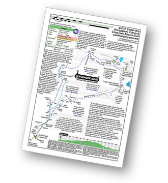
Minffordd Hotel - Afon Faw - Ystrad-gwyn - Nant Cadair - The Minffordd Path - Llyn Cau - Craig Lwyd - Craig Cwm Amarch - Craig Cau - Cadair Idris (Penygadair) - Cyfrwy - Cadair Idris (Penygadair) - Mynydd Moel - Gau Graig - Mynydd Gwerngraig - A487 - Nant Yr Allt-ioen - Cwm Rhwyddfor - Bwlch Llyn Bach - Minffordd.
Not familiar with the area around LL43?
See these 30 nearest walks to UK Postcode LL43 on a google map
|
Vital Statistics:
| Length: | 6 miles (9.5 km) |
| Ascent: | 3,218ft (981m) |
| Time: | 5½ hrs |
| Grade: | |

Route Summary:
Minffordd Hotel - Afon Faw - Ystrad-gwyn - Nant Cadair - The Minffordd Path - Llyn Cau - Craig Lwyd - Craig Cwm Amarch - Craig Cau - Cadair Idris (Penygadair) - Mynydd Moel - Mynydd Moel Path - Minffordd.
|
Vital Statistics:
| Length: | 6.25 miles (10 km) |
| Ascent: | 456ft (139m) |
| Time: | 2.75hrs |
| Grade: | |
Route Summary:
Criccieth - Criccieth Castle - The Llyn Coastal Path - Cardigan Bay - Afon Dwyfor - Llanystumdwy - Afon Dwyfach - Criccieth
|
Vital Statistics:
| Length: | 4.75 miles (7.5 km) |
| Ascent: | 417ft (127m) |
| Time: | 2.25hrs |
| Grade: |  |
Route Summary:
Criccieth - Pont Rhyd-y-benllig - Cefn-y-maen - Bron Eifion - Broneifion Farm - The Llyn Coastal Path - Cardigan Bay - Criccieth Castle - Criccieth
|
Vital Statistics:
| Length: | 6 miles (9.5 km) |
| Ascent: | 335ft (102m) |
| Time: | 2½ hrs |
| Grade: | |

Route Summary:
Llanystumdwy - Afon Dwyfach - Cefn-y-maen - Bron Eifion Farm - The Llyn Coastal Path - Cardigan Bay - Afon Dwyfor - Llanystumdwy
|
Vital Statistics:
| Length: | 8.5 miles (13.5 km) |
| Ascent: | 2,493ft (760m) |
| Time: | 5½ hrs |
| Grade: | |
Route Summary:
Cwm Yr Allt-lwyd - Afon Mawddach - Dduallt (Arenigs) - Bryn Melyn - Ty-newydd-y-mynydd - Rhobell Fawr - Cwm Yr Allt-lwyd
|
Vital Statistics:
| Length: | 12.5 miles (20 km) |
| Ascent: | 3,738ft (1,139m) |
| Time: | 8.25hrs |
| Grade: | |
Route Summary:
Aberllefenni - Bryn Coedwig Field Studies Centre - Cwm Ratgoed - Fynnon-Badarn - Ffridd Newydd - Mynydd Ceiswyn - Waun-oer - Cribin Fawr - Craig Portas - Craig Portas (East Top) - Maesglase (Craig Rhiw-erch) - Maesglase (Maen Du) - Craig Portas (East Top) - Craig Portas - Mynydd Dolgoed - Dolgoed - Ratgoed Hall - Bryn Coedwig - Aberllefenni
|
Vital Statistics:
| Length: | 9.5 miles (15 km) |
| Ascent: | 2,777ft (846m) |
| Time: | 6½ hrs |
| Grade: | |
Route Summary:
Aberllefenni - Bryn Coedwig Field Studies Centre - Cwm Ratgoed - Fynnon-Badarn - Ffridd Newydd - Mynydd Ceiswyn - Waun-oer - Cribin Fawr - Craig Portas - Craig Portas (East Top) - Craig Portas - Mynydd Dolgoed - Dolgoed - Ratgoed Hall - Bryn Coedwig - Aberllefenni
|
Vital Statistics:
| Length: | 7.25 miles (11.5 km) |
| Ascent: | 315ft (96m) |
| Time: | 3 hrs |
| Grade: | |
|
Vital Statistics:
| Length: | 4 miles (6.5 km) |
| Ascent: | 177ft (54m) |
| Time: | 1.75hrs |
| Grade: | |

|
Vital Statistics:
| Length: | 5.5 miles (8.5 km) |
| Ascent: | 1,453ft (443m) |
| Time: | 3½ hrs |
| Grade: | |
Route Summary:
Croesor - Rhosydd Quarry - Bwlch y Rhosydd - Clogwyn Brith - Croesor Quarry - Cwm Croesor - Croesor
|
Vital Statistics:
| Length: | 7.25 miles (11.5 km) |
| Ascent: | 2,273ft (693m) |
| Time: | 5 hrs |
| Grade: | |

Route Summary:
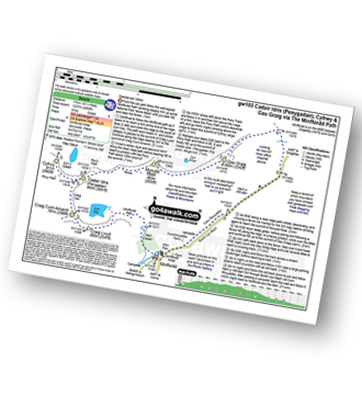
Croesor - Croesor Bach - Cnicht - The Welsh Matterhorn - Cnicht (North Top) - Llyn Yr Adar - Afon Cwm-y-foel - Llyn Cwm-corsiog - Clogwyn Birth - Rhosydd Quarry - Bwlch y Rhosydd - Croesor Quarry - Cwm Croesor - Croesor
|
Vital Statistics:
| Length: | 10 miles (16 km) |
| Ascent: | 3,923ft (1,196m) |
| Time: | 7½ hrs |
| Grade: | |

Route Summary:
Croesor - Croesor Bach - Cnicht - Cnicht (North Top) - Llyn Yr Adar - Afon Cwm-y-foel - Llyn Cwm-corsiog - Clogwyn Birth - Rhosydd Quarry - Moel-yr-hydd - Moelwyn Mawr (North Ridge Top) - Moelwyn Mawr - Craigysgafn - Bwlch Stwlan - Moelwyn Bach - Croesor
|
Vital Statistics:
| Length: | 9 miles (14.5 km) |
| Ascent: | 3,355ft (1,023m) |
| Time: | 6.75hrs |
| Grade: | |

Route Summary:
Croesor - Croesor Bach - Cnicht - Cnicht (North Top) - Llyn Yr Adar - Afon Cwm-y-foel - Llyn Cwm-corsiog - Clogwyn Birth - Rhosydd Quarry - Moel-yr-hydd - Moelwyn Mawr (North Ridge Top) - Moelwyn Mawr - Croesor
|
Vital Statistics:
| Length: | 8.25 miles (13 km) |
| Ascent: | 3,037ft (926m) |
| Time: | 6 hrs |
| Grade: | |

Route Summary:
Croesor - Rhosydd Quarry - Bwlch y Rhosydd - Clogwyn Brith - Moel-yr-hydd - Moelwyn Mawr (North Ridge Top) - Moelwyn Mawr - Craigysgafn - Bwlch Stwlan - Moelwyn Bach - Croesor
|
Vital Statistics:
| Length: | 6 miles (9.5 km) |
| Ascent: | 1,414ft (431m) |
| Time: | 3.75hrs |
| Grade: | |

Route Summary:
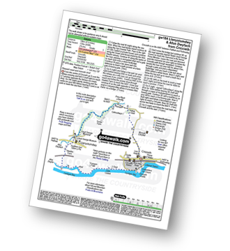
Nantmoor - Cwm Bychan - Grib Ddu - Afon Goch - Llyn Dinas - Sygun Copper Mine - Afon Colwyn - Beddgelert - Afon Abergaslyn - Ynys Dol-lleian - Afon Glaslyn - Nantmoor
Not familiar with the area around LL43?
See these 30 nearest walks to UK Postcode LL43 on a google map


