UK Postcode EX33 - The 30 nearest easy-to-follow, circular walk route maps to you
The thirty nearest easy-to-follow, circular walk route maps to you in UK Postcode EX33 in Walk Grade Order
The UK cities, towns and villages in Devon, England that have EX33 in their UK Postcode include:
• Braunton • Croyde • Georgeham • Halsinger • Knowle • North Buckland • Pickwell • Saunton • Wrafton •
Not familiar with the area around EX33?
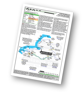
See these 30 nearest walks to UK Postcode EX33 on a google map
   |
Vital Statistics:
| Length: | 5.5 miles (8.5 km) |
| Ascent: | 1,493 ft (455 m) |
| Time: | 3½ hrs |
| Grade: |  |

Route Summary:
Lynton - The Danes Or Valley Of Rocks - Six Acre Wood - The South West Coast Path - Lee Bay - Lee Abbey - Castle Rock - Rugged Jack - Wringcliff Bay - Ruddy Ball - Lynmouth - Lynton
|
Vital Statistics:
| Length: | 5 miles (8 km) |
| Ascent: | 1,708 ft (521 m) |
| Time: | 3.75 hrs |
| Grade: | |

Route Summary:
Lynmouth - The East Lyn River - Wester Wood - Horner's Neck Wood - Watersmeet - Watersmeet House - Trilly - Countisbury - Butter Hill - The Sought West Coast Path - Lower Blackhead - Sillery Sands - Black Rocks - Point Perilous - Lynmouth
|
Vital Statistics:
| Length: | 8.75 miles (14 km) |
| Ascent: | 1,634 ft (498 m) |
| Time: | 4.75 hrs |
| Grade: |  |

Route Summary:
Withypool - The Two Moors Way - Withypool Hill - Westwater Farm - Parsonage Down - River Barle - Tarr Steps - Knaplock Wood - Withypool
|
Vital Statistics:
| Length: | 6.75 miles (11 km) |
| Ascent: | 1,254 ft (382 m) |
| Time: | 3.75 hrs |
| Grade: | |
Route Summary:
Webbers Post - Dicky's Path - Hollow Combe - Dunkery Beacon - Little Rowbarrow - Great Rowbarrow - Lang Combe Head - Cloutsham Gate - Cloutsham Farm - East Water Valley - Webbers Post
|
Vital Statistics:
| Length: | 6 miles (9.5 km) |
| Ascent: | 1,408 ft (429 m) |
| Time: | 3½ hrs |
| Grade: | |

Route Summary:
Bossington - Allerford - Selworthy - Selworthy Beacon - The South West Coast Path - Hurlstone Combe - Hurlstone Point - Porlock Bay - Bossington
|
Vital Statistics:
| Length: | 9.5 miles (15 km) |
| Ascent: | 2,038 ft (621 m) |
| Time: | 5½ hrs |
| Grade: |  |

Route Summary:
Luccombe - Luccombe Plantation - Webbers Post - Dicky's Path - Hollow Combe - Dunkery Beacon - Little Rowbarrow - Great Rowbarrow - Lang Combe Head - Cloutsham Gate - Stoke Pero Church - Prickslade - Cloutsham Farm - East Water Valley - Webbers Post - Horner Plantataion - Luccombe
|
Vital Statistics:
| Length: | 6 miles (9.5 km) |
| Ascent: | 1,188 ft (362 m) |
| Time: | 3½ hrs |
| Grade: | |
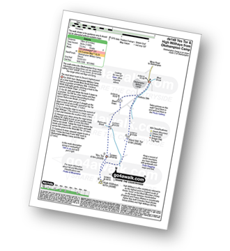
Route Summary:
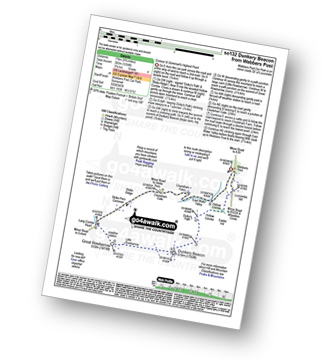
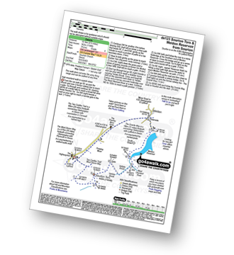
Okehampton Camp - Anthony Stile - Black Down - Red-a-ven Brook - Okehampton Army Firing Range - Yes Tor - High Willhays - West Mill Tor - Okehampton Camp
|
Vital Statistics:
| Length: | 10.25 miles (16.5 km) |
| Ascent: | 1,664 ft (507 m) |
| Time: | 5½ hrs |
| Grade: | |

Route Summary:
Belstone - The Tarka Trail - Nine Stones Stone Circle - Belstone Tor - Irishman's Wall - Higher Tor - Okehampton Army Firing Range - Oke Tor - The River Taw - Steeperton Tor - Steeperton Brook - Wild Tor - Hound Tor - White Moor Stone Circle - Little Hound Tor - South Tawton Common - Cosdon Hill (Cawsand Hill) - Skaigh Warren - The River Taw - Belstone
|
Vital Statistics:
| Length: | 5.75 miles (9 km) |
| Ascent: | 824 ft (251 m) |
| Time: | 3 hrs |
| Grade: |  |

Route Summary:
Belstone - Nine Stones Stone Circle - Okehampton Army Firing Range - Belstone Tor - Higher Tor - Oke Tor - River Taw - Birchy Lake - The Tarka Trail - Belstone
|
Vital Statistics:
| Length: | 7.5 miles (12 km) |
| Ascent: | 1,141 ft (348 m) |
| Time: | 3½ hrs |
| Grade: | |

Route Summary:
Belstone - The Tarka Trail - Nine Stones Stone Circle - Belstone Tor - Higher Tor - Okehampton Army Firing Range - Oke Tor - Steeperton Tor - Steeperton Gorge - River Taw - Belstone
|
Vital Statistics:
| Length: | 7 miles (11 km) |
| Ascent: | 1,185 ft (361 m) |
| Time: | 3.75 hrs |
| Grade: | |

Route Summary:
Belstone - The Tarka Trail - Belstone Cleave - Skaigh - Tor Down The East Okement River - Watchett Hill Cottage - Well Park - Belstone
|
Vital Statistics:
| Length: | 2.75 miles (4.5 km) |
| Ascent: | 696 ft (212 m) |
| Time: | 2 hrs |
| Grade: |  |

|
Vital Statistics:
| Length: | 6.25 miles (10 km) |
| Ascent: | 1,621 ft (494 m) |
| Time: | 4 hrs |
| Grade: | |
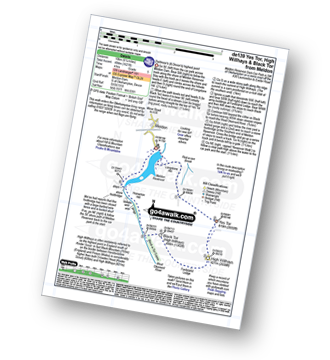
Route Summary:
Meldon Reservoir - Longstone Hill - Okehampton Army Firing Range - Yes Tor - High Willhays - Black Tor - West Okement River - Vellake Weir - Meldon Reservoir
|
Vital Statistics:
| Length: | 9.5 miles (15 km) |
| Ascent: | 1,687 ft (514 m) |
| Time: | 5 hrs |
| Grade: | |

Route Summary:
Meldon Reservoir - Longstone Hill - Yes Tor - High Willhays - Dinger Tor - Brim Beck - Kneeset Nose - Sandy Ford - West Okement River - Black-a-Tor Copse - Vellake Weir - Meldon Reservoir
|
Vital Statistics:
| Length: | 5.75 miles (9 km) |
| Ascent: | 1,083 ft (330 m) |
| Time: | 3.25 hrs |
| Grade: | |
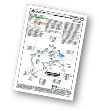
Route Summary:
Bury - River Haddeo - Hartford Bottom - Hartford Lodge - Pulham River - Upton Dam - Wimbleball Lake - Haddon Hill - Hadborough (Haddon Hill) - Hadborough Plantation - Haddon Farm - Bury
Not familiar with the area around EX33?
See these 30 nearest walks to UK Postcode EX33 on a google map
|
Vital Statistics:
| Length: | 6.5 miles (10.5 km) |
| Ascent: | 1,188 ft (362 m) |
| Time: | 3.75 hrs |
| Grade: | |
Route Summary:
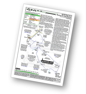
Sourton - Sourton Church - Two Castles Trail - The West Devon Way - Sourton Tors - Vellake Brook - West Okement River - Vellake Weir - Meldon Reservoir - Downside - The Granite Way - Prewley Moor - Sourton Church.
|
Vital Statistics:
| Length: | 8.25 miles (13 km) |
| Ascent: | 1,375 ft (419 m) |
| Time: | 4½ hrs |
| Grade: | |
Route Summary:
Sourton - Sourton Church - River Lyd - Gren Tor - Hunt Tor - Woodcock Hill - Rattle Brook - Kitty Tor (Amicombe Hill) - Amicombe Hill - Sten-a-tor - Corn Ridge - Sourton Tors - Two Castles Trail - The West Devon Way - Prewley Moor - The Granite Way - Sourton Church.
|
Vital Statistics:
| Length: | 9.5 miles (15.5 km) |
| Ascent: | 1,638 ft (499 m) |
| Time: | 5.25 hrs |
| Grade: | |

Route Summary:
Sourton - Sourton Church - River Lyd - Gren Tor - Hunt Tor - Woodcock Hill - Great Links Tor - Higher Dunna Goat - Lower Dunna Goat - Rattle Brook - Green Tor - Kitty Tor (Amicombe Hill) - Amicombe Hill - Steng-a-tor - Corn Ridge - Branscombe Loaf - Sourton Tors - Two Castles Trail - The West Devon Way - Prewley Moor - The Granite Way - Sourton Church.
|
Vital Statistics:
| Length: | 8 miles (12.5 km) |
| Ascent: | 1,182 ft (360 m) |
| Time: | 4 hrs |
| Grade: | |
Route Summary:
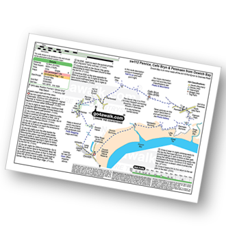
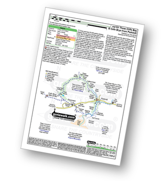
Oxwich Bay - Oxwich - Oxwich Marsh - Penrice - Mill Wood - Penrice Castle - Perriswood - The Gower Way - Cefn Bryn - Penmaen - Three Cliffs Bay - Penmaen Burrows - Nicholaston Burrows - Oxwich Bay - Oxwich Burrows - Oxwich.
|
Vital Statistics:
| Length: | 6.75 miles (11 km) |
| Ascent: | 1,208 ft (368 m) |
| Time: | 3.75 hrs |
| Grade: | |

Route Summary:
Shobrooke - Shobrook Lake - Coombe Barton - Stockleigh Wood - Parsonage Copse - Stockleigh Pomeroy - Stong's Brake - Raddon Hills - Raddon Court - West Raddon - Exeter Hill Cross - Shobrooke
|
Vital Statistics:
| Length: | 3.5 miles (5.5 km) |
| Ascent: | 460 ft (140 m) |
| Time: | 1.75 hrs |
| Grade: | |
Route Summary:
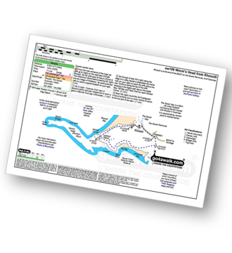
Rhossili - The Gower Way - Middleton - Mewslade Bay - Fall Bay - The Gower Coast National Nature Reserve - Tears Point - Worms Head - Kitchen Corner - Rhossili Bay - Rhossili
|
Vital Statistics:
| Length: | 5.25 miles (8.5 km) |
| Ascent: | 912 ft (278 m) |
| Time: | 3 hrs |
| Grade: | |

Route Summary:
Dogmarsh Bridge - The River Teign - The Teign Gorge - Sharp Tor - Fingle Bridge - Drewston Wood - Drewston Common - Hunting Gate - Piddletown Common - Castle Drogo - Hunter's Tor - Coombe - The River Teign - Dogmarsh Bridge
|
Vital Statistics:
| Length: | 5.5 miles (8.5 km) |
| Ascent: | 945 ft (288 m) |
| Time: | 3 hrs |
| Grade: | |
Route Summary:
Parkmill - Pennard Castle - The Gower - Three Cliffs Bay - Penmaen - The Gower Way - Cefn Bryn - Park Woods - Green Cwm - Cathole Rock - Parkmill
|
Vital Statistics:
| Length: | 9 miles (14.5 km) |
| Ascent: | 1,398 ft (426 m) |
| Time: | 4.75 hrs |
| Grade: | |

Route Summary:
Lanehead Car Park - Higher Willsworthy - Crouster Farm - Merrivale Army Firing Range - Lynch Tor - Oakhampton Army Firing Range - Fur Tor - Amicombe Brook - Watern Oke - River Tavy - Tavy Cleave - Wilsworthy Army Firing Range - Mine Leat - Nattor Farm - Lanehead Car Park.
|
Vital Statistics:
| Length: | 4.5 miles (7 km) |
| Ascent: | 870 ft (265 m) |
| Time: | 2½ hrs |
| Grade: | |

Route Summary:
Lanehead - Ger Tor - Willsworthy Army Firing Range - Hare Tor - Rattle Brook - River Tavy - Watern Oke - Tavy Cleave - Mine Leat - Nattor Farm - Lanehead
|
Vital Statistics:
| Length: | 5 miles (8 km) |
| Ascent: | 673 ft (205 m) |
| Time: | 2½ hrs |
| Grade: | |
Route Summary:
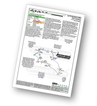
Laneast - Treroose - Trespearne - Gimblett's Mill - River Inny - Trethinna - Trerithick - Trenarrett - Lower Tregunnon - Higher Tregunnon Farm - River Inny - Laneast
|
Vital Statistics:
| Length: | 6.25 miles (10 km) |
| Ascent: | 1,729 ft (527 m) |
| Time: | 4 hrs |
| Grade: | |

Route Summary:
Boscastle - River Valency - Minster Wood - Upper Boscastle - Trehane Farm - Trevalga - The South West Coast Path - Grower Rock - Grower Gut - Western Blackapit - Willapark - Boscastle Harbour - Boscastle
|
Vital Statistics:
| Length: | 3.25 miles (5 km) |
| Ascent: | 765 ft (233 m) |
| Time: | 2 hrs |
| Grade: | |
Route Summary:
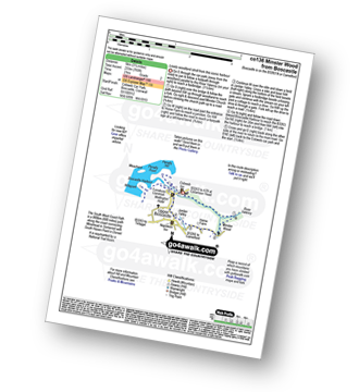
Boscastle - River Valency - Minster Wood - Jordan Valley - Upper Boscastle - Boscastle Harbour - Boscastle
|
Vital Statistics:
| Length: | 11.25 miles (18 km) |
| Ascent: | 3,197 ft (974 m) |
| Time: | 7½ hrs |
| Grade: |  |
Route Summary:
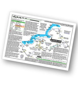
Boscastle - The South West Coast Path - River Valency - Boscastle Harbour - Penally Point - Penally Hill - Pentargon Bay - Pentargon Falls - Beeny Cliff - Seals Hole - Fire Beacon Point - Beeny - Trebyla Farm - Penvention Farm - St Julietta's Church - River Valency - Minster Wood - Upper Boscastle - Trehane Farm - Trevalga - The South West Coast Path - Grower Rock - Grower Gut - Western Blackapit - Willapark - Boscastle Harbour - Boscastle
|
Vital Statistics:
| Length: | 7 miles (11 km) |
| Ascent: | 1,789 ft (545 m) |
| Time: | 4½ hrs |
| Grade: | |
Route Summary:
Boscastle - The South West Coast Path - River Valency - Boscastle Harbour - Penally Point - Penally Hill - Pentargon Bay - Pentargon Falls - Beeny Cliff - Seals Hole - Fire Beacon Point - Beeny - Trebyla Farm - Penvention Farm - St Julietta's Church - River Valency - Boscastle
Not familiar with the area around EX33?
See these 30 nearest walks to UK Postcode EX33 on a google map


