UK Postcode SL3 - The 30 nearest easy-to-follow, circular walk route maps to you
The thirty nearest easy-to-follow, circular walk route maps to you in UK Postcode SL3 in Walk Grade Order
The UK cities, towns and villages in Berkshire, England that have SL3 in their UK Postcode include:
• Coln-brook • Datchet • Fulmer • George Green • Horton • Langley • Poyle •
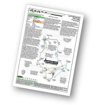
Tap/mouse over a coloured circle (1-3 easy walks, 4-6 moderate walks, 7-9 hard walks) and click to select.
Scroll down the list of walks below & click on each walk title (in blue) to locate it on the map above.
   |
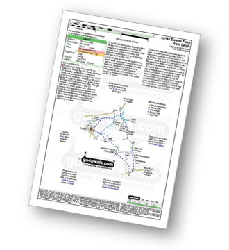
Vital Statistics:
| Length: | 4.25 miles (6.5 km) |
| Ascent: | 131 ft (40 m) |
| Time: | 1.75 hrs |
| Grade: |  |
Route Summary:
Virginia Water - Wick Pond - Totem Pole - Oxshed Clump - Valley Gardens - Heather Gardens - Johnson's Pond - Blacknest - Frostform Plantation - Leptis Magna Roman Ruins - Cascade Bridge - Virginia Water
|
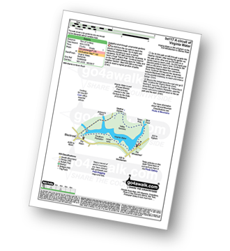
Vital Statistics:
| Length: | 7.25 miles (11.5 km) |
| Ascent: | 381 ft (116 m) |
| Time: | 3 hrs |
| Grade: |  |

Route Summary:
Richmond Park - Pembroke Lodge - Hamcross Plantation - Ham Bottom - Park Gate - Kingston Gate - Robin Hood Gate - Beverley Brook - Roehampton Gate - Adam's Pond - Sheen Gate - The Bog - Richmond Gate - Richmond Park (Richmond Park) - Pembroke Lodge - Richmond Park
|
Vital Statistics:
| Length: | 5 miles (8 km) |
| Ascent: | 230 ft (70 m) |
| Time: | 2 hrs |
| Grade: |  |
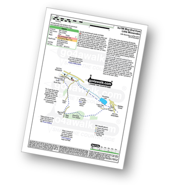
Route Summary:
Little Missenden - The South Bucks Way - Lower Park - Shardeloes Lake - Amersham Cricket Ground - Lower Park House - Wheatley Wood - Mop End - Mop End Farm - Taby's Lane - Breaches Wood - Little Missenden
|
Vital Statistics:
| Length: | 4.5 miles (7 km) |
| Ascent: | 345 ft (105 m) |
| Time: | 2 hrs |
| Grade: | |
Route Summary:
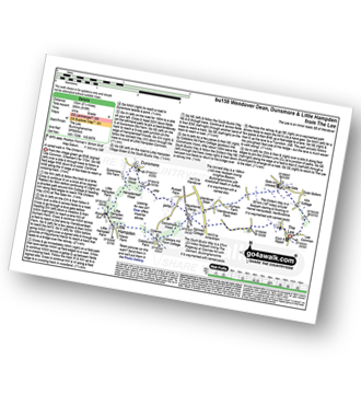
The Lee - Kiln Cottage - Lee Gate - The Chiltern Way - Durham Farm - Wendoverdean Farm - Wendover Dean - Mayortorne Manor - Spinney Cottage - The Lee
|
Vital Statistics:
| Length: | 8.25 miles (13 km) |
| Ascent: | 919 ft (280 m) |
| Time: | 4 hrs |
| Grade: |  |
Route Summary:
The Lee - Kiln Cottage - Lee Gate - The Chiltern Way - Durham Farm - Wendoverdean Farm - Wendover Dean - Mayortorne Manor - Russell Farm - Dunsmore - Scrub Wood - Hampdenleaf Wood - The Icknield Way - Little Hampden Common - Little Hampden - The South Bucks Way - Cobblershill Farm - The Chiltern Way - Cockshoots Wood - Mayortorne Manor - Spinney Cottage - The Lee
|
Vital Statistics:
| Length: | 5.5 miles (9 km) |
| Ascent: | 722 ft (220 m) |
| Time: | 2.75 hrs |
| Grade: | |
Route Summary:
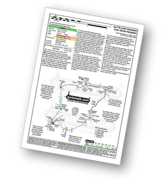
Great Hampden - The Chiltern Way - Hampden House - Little Hampden - The South Bucks Way - Cobbleshill Farm - Hampden Bottom - Pepperboxes Wood - Honor End Farm - Great Hampden
|
Vital Statistics:
| Length: | 5.5 miles (9 km) |
| Ascent: | 466 ft (142 m) |
| Time: | 2½ hrs |
| Grade: | |

Route Summary:
Tattenham Corner - Epsom Downs Racecourse - Langley Cale - The Warren - Nohome Farm - Downs View Wood - Walton On The Hill - The Nere - Withybed Corner - Walton Downs - Tattenham Corner - Epsom Downs Racecourse.
|
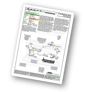
Vital Statistics:
| Length: | 7.5 miles (12 km) |
| Ascent: | 1,175 ft (358 m) |
| Time: | 4 hrs |
| Grade: | |
Route Summary:
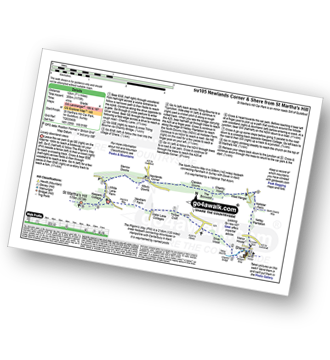
St Martha's Hill Car Park - Pilgram's Way - Newbarn Farm - Water Lane Cottages - Timber Croft - Silver Wood - Shere - Netley Plantation Hollister Farm - The North Downs Way - West Hanger - Chantry Wood - The Boxwood - Clandon Downs - Newlands Corner - Albury Downs - Merrow Downs - White Lane Farm - Keepers Cottage - St Martha's Hill - St Martha's Hill Car Park
|
Vital Statistics:
| Length: | 5.5 miles (9 km) |
| Ascent: | 945 ft (288 m) |
| Time: | 3 hrs |
| Grade: | |

Route Summary:
Silent Pool Car Park - Sherbourne Pond - Silent Pool - The Boxwood - Clandon Downs - Newlands Corner - Albury Downs - Merrow Downs - White Lane Farm - Keepers Cottage - St Martha's Hill - Pilgram's Way - Newbarn Farm - Water Lane Cottages - Timber Croft - Albury St - Silent Pool Car Park
|
Vital Statistics:
| Length: | 3.75 miles (6 km) |
| Ascent: | 538 ft (164 m) |
| Time: | 2 hrs |
| Grade: | |
Route Summary:
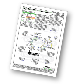
Little Hampden Common - Little Hampden - The South Bucks Way - Cobblershill Farm - The Chiltern Way - Cockshoots Wood - Mayortorne Manor - Russell Farm - Dunsmore - Scrub Wood - Hampdenleaf Wood - The Icknield Way - Little Hampden Common
|
Vital Statistics:
| Length: | 7 miles (11 km) |
| Ascent: | 1,115 ft (340 m) |
| Time: | 3½ hrs |
| Grade: | |
Route Summary:
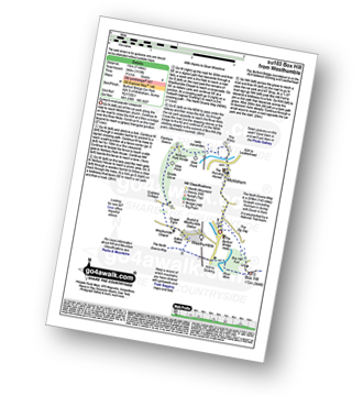
Car Park S of Mickleham - River Mole - Norbury Park House - Fetcham Downs - Westhumble - The North Downs Way - Box Hill - Car Park S of Mickleham
|
Vital Statistics:
| Length: | 4.75 miles (7.5 km) |
| Ascent: | 630 ft (192 m) |
| Time: | 2½ hrs |
| Grade: | |
Route Summary:
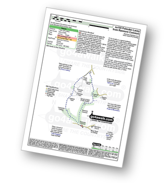
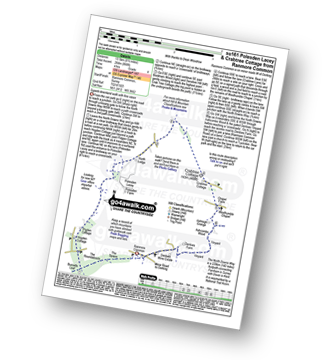
Ranmore Common - Yewtree Farm - Polesden Lacey - Connicut Wood - Freehold Wood - Tanner's Hatch (Yough Hostel) - Ranmore Common
|
Vital Statistics:
| Length: | 5.25 miles (8.5 km) |
| Ascent: | 715 ft (218 m) |
| Time: | 2.75 hrs |
| Grade: | |
Route Summary:
Ranmore Common - Tanner's Hatch (Youth Hostel) - Bagden Farm - Crabtree Cottage - Chapel Farm - Westhumble Church - The North Downs Way - Ashcombe Wood - Denbies - St Barnabus Church - Ranmore Common
|
Vital Statistics:
| Length: | 7.25 miles (11.5 km) |
| Ascent: | 873 ft (266 m) |
| Time: | 3½ hrs |
| Grade: | |
Route Summary:
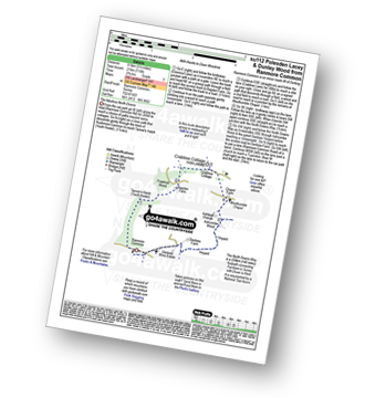
Ranmore Common - Yewtree Farm - Polesden Lacey - Pigden Cottage - Hogden Cottage - Friars Farm - Dunley Wood - The North Downs Way - White Downs - Burnetts Leaf - The Roadabouts - The Spains - Ranmore Common
|
Vital Statistics:
| Length: | 8.5 miles (13.5 km) |
| Ascent: | 866 ft (264 m) |
| Time: | 4 hrs |
| Grade: | |
Route Summary:
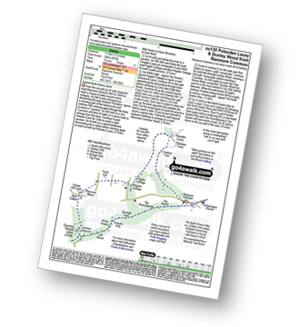
Ranmore Common - The North Downs Way - The Spains - The Roundabouts - Burnetts Leaf - Hogden Cottage - Pigden Cottage - Polesden Lacey - Bookham Wood - Crabtree Cottage - Chapel Farm - Westhumble Chapel - Ashcombe Wood - St Barnabus Church - Ranmore Common
|
Vital Statistics:
| Length: | 6.25 miles (10 km) |
| Ascent: | 752 ft (229 m) |
| Time: | 3 hrs |
| Grade: | |

Route Summary:
Westcott - Mill Pond - The Greensand Way - Sylvanus Wood - Stable Copse - Bushy Wood - Friday Street - Tilling Bourne - Horsley Copse - Wotton - Vale Farm - Westcott
|
Vital Statistics:
| Length: | 4.75 miles (7.5 km) |
| Ascent: | 647 ft (197 m) |
| Time: | 2½ hrs |
| Grade: | |

Route Summary:
Westcott - Coomb Farm - The North Downs Way - The Rondabouts - The Spains - Ranmore Common - The Greensand Way - Westcott
|
Vital Statistics:
| Length: | 3.75 miles (6 km) |
| Ascent: | 387 ft (118 m) |
| Time: | 1.75 hrs |
| Grade: | |
Route Summary:
Chipstead - Chipstead Bottom - Fames Rough - Perrotts Farm - Ruffett Wood - Chipstead
|
Vital Statistics:
| Length: | 5 miles (8 km) |
| Ascent: | 190 ft (58 m) |
| Time: | 2 hrs |
| Grade: | |

Route Summary:
Winchfield Hurst - Barley Mow Bridge - The Basingstoke Canal - Stacey's Bridge - The Three Castles Path - Baseley's Bridge - Sprat's Hatch Bridge - Sprat's Hatch Farm - Tundry Pond - Parsonage Copse - Double Bridge Farm - Whitlow Alders - Crookham Village - Brook Hill - Brook Meadow Farm - Dogmersfield - Norman's Green - Pilcot Farm - Winchfield Hurst
|
Vital Statistics:
| Length: | 4.5 miles (7 km) |
| Ascent: | 693 ft (211 m) |
| Time: | 2½ hrs |
| Grade: | |

Route Summary:
Great Kimble - The North Bucks Way - Askett - Monks Risborough - Whiteleaf - The Icknield Way - The Ridgeway - Whiteleaf Cross - Cadsden - Grangelands And Pulpit Hill Nature Reserve - Chequer's Knap - The North Bucks Way - Great Kimble
|
Vital Statistics:
| Length: | 5.5 miles (9 km) |
| Ascent: | 853 ft (260 m) |
| Time: | 3 hrs |
| Grade: | |

Route Summary:
Butler's Cross - Monument Hill (Coombe Hill) - The Ridgeway - Linton's Wood - Goodmerhill Wood - Chisley Wood - The Icknield Way - Chequers - Pond Wood - Pulpit Wood - The North Bucks Way - The Midshires Way - Chequers Knap - Whorley Wood - Ellesborough Warren - Boxtree Wood - Beacon Hill (Ellesborough) - Ellesborough - The Aylesbury Ring - Springs Farm - Butler's Cross
|
Vital Statistics:
| Length: | 6 miles (9.5 km) |
| Ascent: | 528 ft (161 m) |
| Time: | 2.75 hrs |
| Grade: | |
Route Summary:
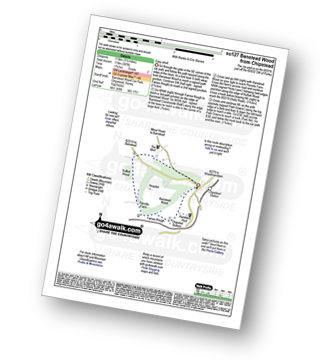
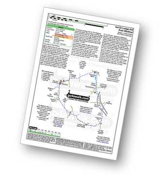
Bledlow - The Midshires Way - The Warren - The Ridgeway - Thickthorn Wood - Lodge Hill - Longwood Farm - The Old Rectory - Saunderton - Horsenden - Bledlow
|
Vital Statistics:
| Length: | 2.75 miles (4.5 km) |
| Ascent: | 151 ft (46 m) |
| Time: | 1.25 hrs |
| Grade: | |
Route Summary:
Brockham - The Greensand Way - The River Mole - St Michael's Church - Betchworth - Denby's Wood - Oldpark Wood - Brockham
|
Vital Statistics:
| Length: | 7 miles (11 km) |
| Ascent: | 962 ft (293 m) |
| Time: | 3½ hrs |
| Grade: | |
Route Summary:
Brockham - The Greensand Way - St Michael's Church - Betchworth - The North Downs Way - Brockham Warren - Box Hill - Betchworth Park Golf Club - Park Farm - Pondtail Farm - Brockham
|
Vital Statistics:
| Length: | 5.5 miles (9 km) |
| Ascent: | 768 ft (234 m) |
| Time: | 3 hrs |
| Grade: | |
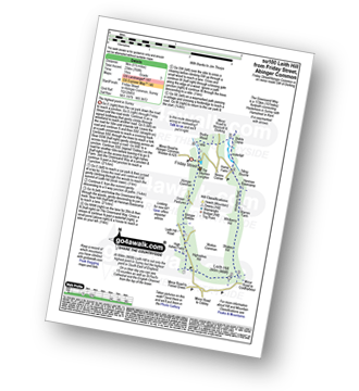
Route Summary:
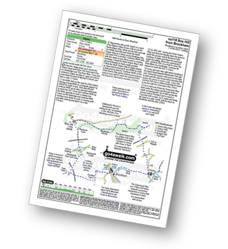
Friday Street - Abinger Common - Abinger Bottom - The Greensand Way - Leith Hill - Shakes Hill - Whitberry Hill - Stable Copse - Bushy Wood - Friday Street
|
Vital Statistics:
| Length: | 8.25 miles (13 km) |
| Ascent: | 1,634 ft (498 m) |
| Time: | 4½ hrs |
| Grade: |  |
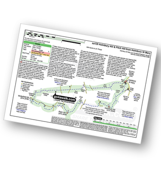
Route Summary:
Holmbury St Mary - The Greensand Way - Holmbury Hill - Duke of Kent School - Pitch Hill - Winterfold Hill - Winterfold Wood - Hurt Wood - Holmbury St Mary
|
Vital Statistics:
| Length: | 10.25 miles (16.5 km) |
| Ascent: | 1,933 ft (589 m) |
| Time: | 5.75 hrs |
| Grade: |  |
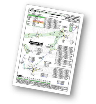
Route Summary:
Holmbury St Mary - The Greensand Way - Holmbury Hill - Radnor Place Farm - Ewhurst - Rapsley Farm - Pitch Hill - Winterfold Hill - Winterfold Wood - Hurt Wood - Holmbury St Mary
|
Vital Statistics:
| Length: | 6.5 miles (10.5 km) |
| Ascent: | 542 ft (165 m) |
| Time: | 3 hrs |
| Grade: | |

Route Summary:
Farthing Downs - Fairdean Downs - Chaldon Church - Chaldon - The North Downs Way - Ockley Hill - Hilltop House - Willey Park Farm - Caterham - Farthing Downs
|
Vital Statistics:
| Length: | 6.25 miles (10 km) |
| Ascent: | 286 ft (87 m) |
| Time: | 2½ hrs |
| Grade: | |
Route Summary:
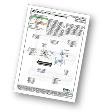
Leigh - Clayhill Farm - Gad Brook - Denby's Wood - St Michael's Church - Betchworth - Wonham Manor - Ricebridge Farm - Skeets Farm - Leigh
|
Vital Statistics:
| Length: | 4.5 miles (7 km) |
| Ascent: | 151 ft (46 m) |
| Time: | 1.75 hrs |
| Grade: | |