UK Postcode NE71 - The 30 nearest easy-to-follow, circular walk route maps to you
The thirty nearest easy-to-follow, circular walk route maps to you in UK Postcode NE71 in Walk Grade Order
The UK cities, towns and villages in Northumberland, England that have NE71 in their UK Postcode include:
• Akeld • Coupland • Doddington • Earle • Ewart Newtown • Fenton • Flodden • Haugh Head • Hethpool • Humbleton • Kimmerston • Kirknewton • Langleeford • Lanton • Middleton Hall • Milfield • Nesbit • Westnewton • Wooler •
Tap/mouse over a coloured circle (1-3 easy walks, 4-6 moderate walks, 7-9 hard walks) and click to select.
Scroll down the list of walks below & click on each walk title (in blue) to locate it on the map above.
   |
Vital Statistics:
| Length: | 3.25 miles (5 km) |
| Ascent: | 525 ft (160 m) |
| Time: | 1.75 hrs |
| Grade: |  |
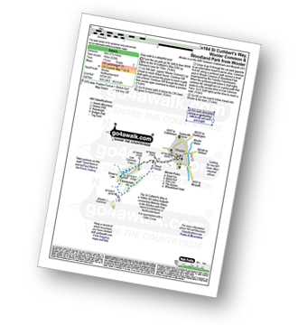
Route Summary:
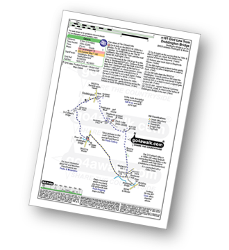
Wooler - The St Cuthbert's Way - Waud House - Kenterdale Hill - Wooler Common and Woodland Park - Wooler
|
Vital Statistics:
| Length: | 4.75 miles (7.5 km) |
| Ascent: | 985 ft (300 m) |
| Time: | 2.75 hrs |
| Grade: |  |
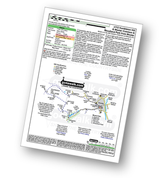
Route Summary:
Wooler - Gallowlaw Gallowlaw Hill - Humbleton - Humbleton Hill - Brown's Law - Wooler Common And Woodland Park - Wooler
|
Vital Statistics:
| Length: | 5.75 miles (9 km) |
| Ascent: | 1,214 ft (370 m) |
| Time: | 3½ hrs |
| Grade: |  |
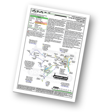
Route Summary:
Wooler - Gallowlaw Gallowlaw Hill - Humbleton - Humbleton Hill - Brown's Law - Wooler Common and Woodland Park - The St Cuthbert's Way - Kenterdale Hill - Waud House - Wooler
|
Vital Statistics:
| Length: | 6.5 miles (10.5 km) |
| Ascent: | 240 ft (73 m) |
| Time: | 2.75 hrs |
| Grade: | |
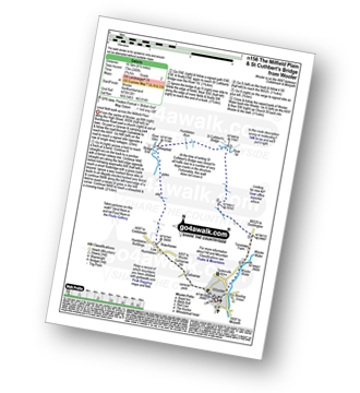
Route Summary:
Wooler - Gallowlaw Gallowlaw Hill - Low Humbleton - Bowchester - The River Glen - Bridge End - Humbleton Burn Milfield Plain - St Cuthbert's Bridge - Turvelaws Farm - Wooler
|
Vital Statistics:
| Length: | 7.5 miles (12 km) |
| Ascent: | 1,257 ft (383 m) |
| Time: | 4½ hrs |
| Grade: |  |

Route Summary:
Wooler - The St Cuthbert's Way - Waud House - Kenterdale Hill - Wooler Common - Switcher Wood - Earlhillhead Farm - Carey Burn - Careyburn Bridge - Harthope Burn - Colgate Water (High Level Route) - Happy Valley - Middleton Old Town - North Middleton - Colgate Mill - Colgate Water - Earle Mill - Wooler Water - Wooler
|
Vital Statistics:
| Length: | 10.75 miles (17 km) |
| Ascent: | 1,746 ft (532 m) |
| Time: | 5.75 hrs |
| Grade: |  |

Route Summary:
Wooler - The St Cuthbert's Way - Waud House - Kenterdale Hill - Wooler Common - Carey Burn - Broadstruthers Burn - Commonburn House - Wackerage Cairn - Tom Tallon's Crag - The St Cuthbert's Way - Gleadscleugh - Akeld Burn - Humbleton - Gallowlaw - Wooler
|
Vital Statistics:
| Length: | 8.5 miles (13.5 km) |
| Ascent: | 1,093 ft (333 m) |
| Time: | 4.25 hrs |
| Grade: | |

Route Summary:
Wooler - The St Cuthbert's Way - Weetwood Bank - Weetwood Moor - River Till - Weetwood Bridge - Weetwood Hall - Weetwood Hill - Broomy Knowe - Shepherds House - Dod Law - Doddington Moor - Doddington - Milfield Plain - Doddington Bridge - Turvelaws Farm - Wooler
|
Vital Statistics:
| Length: | 10.25 miles (16.5 km) |
| Ascent: | 1,182 ft (360 m) |
| Time: | 5 hrs |
| Grade: | |

Route Summary:
Wooler - The St Cuthbert's Way - Weetwood Bank - Weetwood Moor - River Till - Weetwood Bridge - Weetwood Hall - Weetwood Hill - Broomy Knowe - Shepherds House - Dod Law (Doddington Moor) - Doddington Moor - Doddington - River Till - St Cuthbert's Bridge - Milfield Plain - River Glen - Bridge End - Bowchester - Low Humbleton - Gallowlaw Hill - Gallowlaw - Wooler
|
Vital Statistics:
| Length: | 6.5 miles (10.5 km) |
| Ascent: | 1,043 ft (318 m) |
| Time: | 3½ hrs |
| Grade: | |

Route Summary:
Wooler - The St Cuthbert's Way - Waud House - Kenterdale Hill - Wooler Common - Switcher Wood - Earlhillhead Farm - Carey Burn - Careyburn Bridge - Harthope Burn - Colgate Water (Low Level Route) - Skirl Naked - Grimping Haugh - Broom Crook Plantation - Happy Valley - Careyburn Bridge - Colgate Mill - Earle Mill - Wooler Water - Wooler
|
Vital Statistics:
| Length: | 5.5 miles (8.5 km) |
| Ascent: | 620 ft (189 m) |
| Time: | 2.75 hrs |
| Grade: | |
Route Summary:
Doddington Bridge - Quarry Hill - Weetwood Hill - Broomy Knowe - Shepherds House - Dod Law - Doddington Moor - Doddington - Milfield Plain - River Till - Doddington Bridge
|
Vital Statistics:
| Length: | 3.75 miles (6 km) |
| Ascent: | 700 ft (213 m) |
| Time: | 2.25 hrs |
| Grade: | |
Route Summary:
Careyburn Bridge - Carey Burn - Switcher Wood - Earlhillhead Farm - Wooler Common - Carey Burn - Careyburn Bridge
|
Vital Statistics:
| Length: | 4.5 miles (7 km) |
| Ascent: | 781 ft (238 m) |
| Time: | 2½ hrs |
| Grade: | |

Route Summary:
Careyburn Bridge - Carey Burn - Harthope Burn - Middleton Old Town - North Middleton - Colgate Mill - Colgate Water (Low Level Route) - Happy Valley - Broom Crook Plantation - Grimping Haugh - Skirl Naked - Careyburn Bridge
|
Vital Statistics:
| Length: | 8.5 miles (13.5 km) |
| Ascent: | 2,114 ft (644 m) |
| Time: | 5½ hrs |
| Grade: | |

Route Summary:
Harthope Burn Valley - Hawsen Burn Parking Area - New Burn - Scald Hill - The Cheviot - Cairn Hill (Scotsmans Cairn) - Harthope Burn - Hrthope Linn - Langleeford Hope - Cat Loup - Ray Burn - Langleeford Farm - Hawsen Burn Parking Area.
|
Vital Statistics:
| Length: | 9.5 miles (15.5 km) |
| Ascent: | 2,800 ft (853 m) |
| Time: | 6½ hrs |
| Grade: |  |

Route Summary:
Harthope Burn Valley - Hawsen Burn Parking Area - New Burn - Scald Hill - The Cheviot - Cairn Hill (Scotsmans Cairn) - Harthope Burn - Comb Fell - Hedgehope Hill - Long Crags - Housey Crags - Hawsen Burn Parking Area.
|
Vital Statistics:
| Length: | 10.5 miles (17 km) |
| Ascent: | 2,614 ft (797 m) |
| Time: | 6½ hrs |
| Grade: | |

Route Summary:
Harthope Burn Valley - Cold Law - Broadhope Hill - Scald Hill - The Cheviot - The Pennine Way - Harthope Burn - Langleeford Hope - Langleeford - Harthope Burn Valley
|
Vital Statistics:
| Length: | 7 miles (11 km) |
| Ascent: | 2,022 ft (616 m) |
| Time: | 4½ hrs |
| Grade: | |

Route Summary:
Harthope Burn Valley - Hawsen Burn Parking Area - New Burn - Scald Hill - The Cheviot - Scald Hill - New Burn - Hawsen Burn Parking Area.
|
Vital Statistics:
| Length: | 8.25 miles (13 km) |
| Ascent: | 1,483 ft (452 m) |
| Time: | 4½ hrs |
| Grade: | |
Route Summary:
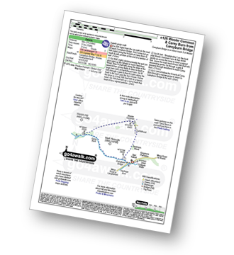
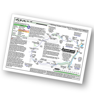
Hethpool - The St Cuthbert's Way - White Hill (Hethpool) - East Laddie's Knowe - Laddie's Knowe or Betsy's Cairn - Black Bog (Haddon Hill) - Haddon Hill - Ring Chesters - Sheepfold - Eccles Cairn - England / Scotland Border - The Pennine Way - Tuppie's Grave - The Tongue - Maddie's Well - Madam Law - Wideopen Head - Trowup Burn - Trowupburn - College Valley - College Burn - Hethpool
|
Vital Statistics:
| Length: | 5 miles (8 km) |
| Ascent: | 1,021 ft (311 m) |
| Time: | 3 hrs |
| Grade: | |

Route Summary:
Hethpool - The St Cuthbert's Way - White Hill (Hethpool) - East Laddie's Knowe - Laddie's Knowe or Betsy's Cairn - Black Bog (Haddon Hill) - Haddon Hill - Ring Chesters - Elsdonburn Farm - Elsdon Burn - The St Cuthbert's Way - Hethpool
|
Vital Statistics:
| Length: | 7.25 miles (11.5 km) |
| Ascent: | 1,165 ft (355 m) |
| Time: | 3.75 hrs |
| Grade: | |
Route Summary:
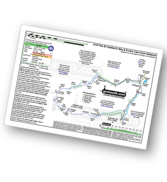
Hethpool - The St Cuthbert's Way - Elsdon Burn - Elsdonburn Farm - Shank's Sike - Scaldhill Shank - Tom's Knowe - Tuppie's Sike - Eccles Cairn - England / Scotland Border - The Pennine Way - Tuppie's Grave - The Tongue - Maddie's Well - Madam Law - Wideopen Head - Trowup Burn - Trowupburn - College Valley - College Burn - Hethpool
|
Vital Statistics:
| Length: | 13.75 miles (22 km) |
| Ascent: | 2,665 ft (812 m) |
| Time: | 7.75 hrs |
| Grade: | |

Route Summary:
Hethpool - The St Cuthbert's Way - Elsdon Burn - Elsdonburn Farm - Shank's Sike - Scaldhill Shank - Tom's Knowe - Tuppie's Sike - Eccles Cairn - England / Scotland Border - The Pennine Way - White Law - Steel Rig - Black Hag (Hethpool) - The Schil - Birnie Brae - Red Cribs - Mounthooly - Fleehope - Whitehall - College Valley - Hethpool
|
Vital Statistics:
| Length: | 16.5 miles (26.5 km) |
| Ascent: | 3,144 ft (958 m) |
| Time: | 9.25 hrs |
| Grade: |  |

Route Summary:
Hethpool - College Valley - Whitehall - Fleehope - Mounthooly - Birnie Brae - The Pennine Way - Red Cribs - Auchope Cairn - Cairn Hill - The Cheviot - Scald Hill - Goldcleugh - Lambden Burn - Dunsdale - Coldburn - Southernknowe - Whitehall - Hethpool
|
Vital Statistics:
| Length: | 7.5 miles (12 km) |
| Ascent: | 1,316 ft (401 m) |
| Time: | 4 hrs |
| Grade: | |

Route Summary:
Hethpool - The St Cuthbert's Way - White Hill (Hethpool) - East Laddie's Knowe - Laddie's Knowe or Betsy's Cairn - Black Bog (Haddon Hill) - Haddon Hill - Ring Chesters - Sheepfold - Eccles Cairn - England / Scotland Border - Elsdonnurn Farm - Elsdon Burn - The St Cuthbert's Way - Hethpool
|
Vital Statistics:
| Length: | 6.25 miles (10 km) |
| Ascent: | 1,037 ft (316 m) |
| Time: | 3½ hrs |
| Grade: | |

Route Summary:
Hepburn Wood - Hepburn Crags - Ros Castle (Ross Castle) - Hepburn Moor - Botany Cottage - Quarryhouse Moor - Blawearie - Hepburn Crags - Hepburn Wood
|
Vital Statistics:
| Length: | 3.75 miles (6 km) |
| Ascent: | 499 ft (152 m) |
| Time: | 2 hrs |
| Grade: | |

Route Summary:
Old Bewick - Hanging Crag - Blawearie - Tick Law - Harehop Kennels - Hill End - Old Bewick
|
Vital Statistics:
| Length: | 8.5 miles (13.5 km) |
| Ascent: | 988 ft (301 m) |
| Time: | 4.25 hrs |
| Grade: | |

Route Summary:
Eglingham - Tarry - Eglingham Moor - Curleheugh - Hare Crag - Ceteran Hill - Ceteran Meadows Moss - Blawearie - Bewick Moor - Tick Law - Harehope Hill - Harehope Farm - Ticket Hill - Eglingham
|
Vital Statistics:
| Length: | 10.5 miles (16.5 km) |
| Ascent: | 2,244 ft (684 m) |
| Time: | 6 hrs |
| Grade: | |

Route Summary:
Alnham - Salter's Road - Northfieldhead - White Gate - High Knowes - Ewartly Shank - Shank Burn - Little Dod - Shill Moor - Breamish Valley - Meggrim's Knowe - Alnhammoor Farm - Rowhope Burn - Leafield Edge - Deb Cleugh - Northfieldhead - Alnham
|
Vital Statistics:
| Length: | 5 miles (8 km) |
| Ascent: | 180 ft (55 m) |
| Time: | 2 hrs |
| Grade: |  |
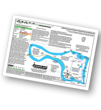
Route Summary:
Holy Island (Lindisfarne) Car Park - The Priory - The St Cuthbert's Way - Lindisfarne Castle - Emannuel Head - Holy Island (Lindisfarne) Car Park
|
Vital Statistics:
| Length: | 7.5 miles (12 km) |
| Ascent: | 1,753 ft (534 m) |
| Time: | 4½ hrs |
| Grade: | |

Route Summary:
Rowhope Burn Bridge - River Coquet - Hindside Knowe - The Street - Swineside Law - Black Braes - Windy Rigg Top - Windy Gyle - Trows Burn - Rowhope Burn - Rowhope Burn Bridge
|
Vital Statistics:
| Length: | 8.75 miles (14 km) |
| Ascent: | 1,260 ft (384 m) |
| Time: | 4½ hrs |
| Grade: | |

Route Summary:
Morebattle - The St Cuthbert's Way - Kale Water - Grubbit Law - Cushat End - Hownam Law - South Cote - Howgate - Heavyside - Gateshaw - Morebattle
|
Vital Statistics:
| Length: | 11.25 miles (18 km) |
| Ascent: | 2,311 ft (704 m) |
| Time: | 6½ hrs |
| Grade: | |

Route Summary:
Wedder Leap - River Coquest - Rowhope Burn - Hindside Knowe - The Street - Swineside Law - Black Braes - Windy Rigg Top - Windy Gyle - Hazely Law - Usway Burn - Middle Hill - Fairhaugh - Barrow Burn - Barrowburn.


