45 easy to follow walk route maps of all grades in The North Pennines
The North Pennines covers parts of Cumbria, County Durham and Northumberland and is the area enclosed by:
- The A689 from Carlisle to Brampton and then the A69 from Brampton to Newcastle-upon-Tyne to the North
- The North Sea from Newcastle-upon-Tyne to Middleborough to the East
- The River Tees from Middlesborough to Barnard Castle, the northern edge of the Yorkshire Dales National Park to the M6 near Shap to the South
- The M6 from Shap to Carlisle to the West
Tap/mouse over a coloured circle (1-3 easy walks, 4-6 moderate walks, 7-9 hard walks) and click to select.
You can use these checkboxes to show only the grades of walk you are interested in:-
Forty-five easy-to-follow walk route maps of all grades in The North Pennines in Walk Grade Order
Scroll down the list of walks below & click on each walk title (in blue) to locate it on the map above.
See this list of walks, routes & maps in:
Grade Order |
Length Order |
Time Order |
Walk Number or Start Location Order
NB. To reverse (toggle) this order, click Grade Order again
   |
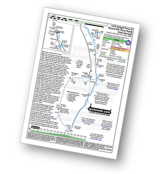
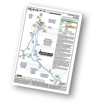
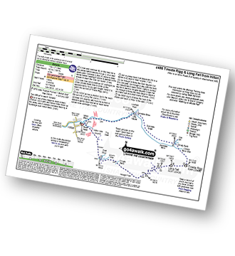
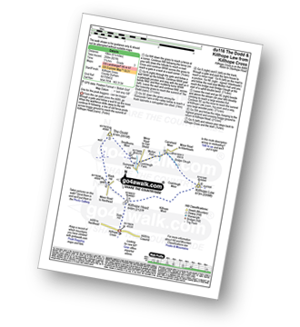
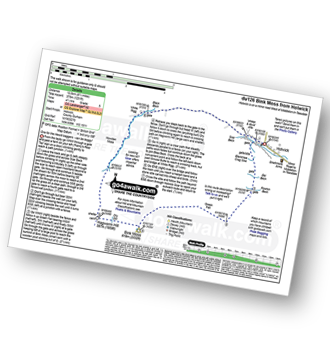
Vital Statistics:
| Length: | 20 miles (32 km) |
| Ascent: | 2,905ft (885m) |
| Time: | 10 hrs |
| Grade: |  |
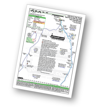
Route Summary:
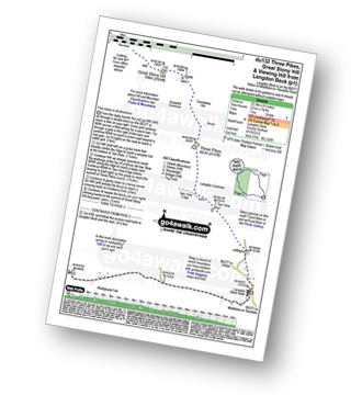
Garrigill - The Pennine Way - The South Tyne Trail - Low Crossgill - Ash Gill - Ashgill Force - Hole House Farm - Tynehead Farm - Tyne Head - River Tees - Dunfell Hush - Great Dun Fell - Little Dun Fell - Cross Fell - Skirwith Fell - Yad Stone - Greg's Hut (bothy) - Backstone Edge (Lambgreen Hills) - Long Man Hill - Meg Moffat's Hill - Black Band - Garrigill
|
Vital Statistics:
| Length: | 10.25 miles (16.5 km) |
| Ascent: | 2,002ft (610m) |
| Time: | 5.75hrs |
| Grade: |  |
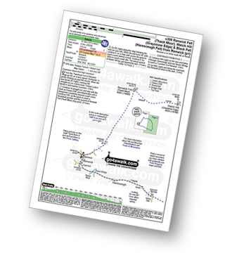
Route Summary:
Renwick - Townend - Renwick Fell (Thack Moor) - Watch Hill (Graystone Edge) - Black Fell (Haresceugh Fell) - Little Daffenside - Hartside Height - Hartside Top Cafe (A686) - Ricker Gill - Seavy Sike - Haresceugh - Raven Bridge - Townfoot - Renwick
|
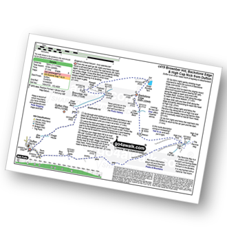
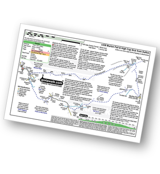
Vital Statistics:
| Length: | 10.75 miles (17 km) |
| Ascent: | 2,437ft (743m) |
| Time: | 6 hrs |
| Grade: | |
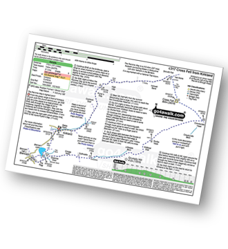
Route Summary:
Kirkland - Kirkland Beck - Cocklick Scar - Plylier's Gap - High Cap - Ironwell Band - The Pennine Way - Cross Fell - Crowdundle Head - Tees Head - Sturba Nook - Wildboar Scar - Grumply Hill - Littledale Beck - Cringle Moor - Blencarn - Blencarn Lake - Blencarn Beck - Kirk Hill - Kirkland
|
Vital Statistics:
| Length: | 6.28 miles (10 km) |
| Ascent: | 666ft (203m) |
| Time: | 3 hrs |
| Grade: |  |
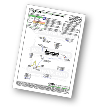
Route Summary:
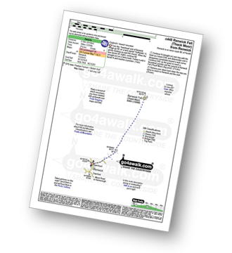
Hartside Top Cafe - Hartside Height - Little Daffenside - Black Fell (Haresceugh Fell) - Little Daffenside - Hartside Height - Benty Hill - Hartside Height - Hartside Top Cafe
|
Vital Statistics:
| Length: | 5.75 miles (9 km) |
| Ascent: | 1,480ft (451m) |
| Time: | 3.75hrs |
| Grade: | |
Route Summary:
Clesketts - Tortie Farm - Howgill Cottages - Tindale Fells - Howgill Beck - Cold Fell Pike (Geltsdale) - Tindale Fell - Tindale Tarn - Thron Farm - Clesketts
|
Vital Statistics:
| Length: | 11.25 miles (18 km) |
| Ascent: | 2,629ft (801m) |
| Time: | 6.75hrs |
| Grade: |  |
Route Summary:
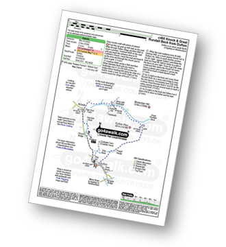
Dufton - The Pennine Way - Coatsyke Farm (Coatsike Farm) - Halsteads - Great Rundale Beck - Cosca Hill - Swindale Beck - Knock Old Man - Knock Fell - Green Castle - Knock Ore Gill - Knock Pike - Swindale Beck - Knock Village - Knock Church - Dufton
|
Vital Statistics:
| Length: | 9.75 miles (15.5 km) |
| Ascent: | 2,038ft (621m) |
| Time: | 5.75hrs |
| Grade: | |
Route Summary:
Thrang Beck - The Lady Anne's Way - Water Cut Sculpture - Hell Gill Bridge - Little Fell (Lunds Fell) (Mallerstang) - Hugh Seat - Black Fell Moss - Archy Styrigg (Gregory Chapel) - High Seat (Mallerstang) - Mallerstang Edge - Outhgill - River Eden - Thrang Beck
|
Vital Statistics:
| Length: | 15.75 miles (25 km) |
| Ascent: | 2,918ft (889m) |
| Time: | 8.75hrs |
| Grade: | |
Route Summary:
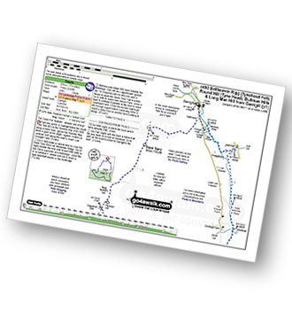
Hilton Town Head - Hilton Beck - Warcop Training Area - Swindale Brow - Swindale Beck - Swindale Edge - Marn Gill - Christy Bank - Siss Gill - Burton Fell - Little Fell (Burton Fell) - Hilton Fell - Arnside Rake - King's Pot - Mickle Fell - Fisher Sike - Maize Beck - Swarth Beck - Master Sike - Murton Fell - Murton Fell (SE Top) - Scordale - Lowfield Hush - Hilton Town Head
|
Vital Statistics:
| Length: | 10.25 miles (16.5 km) |
| Ascent: | 1,408ft (429m) |
| Time: | 5.25hrs |
| Grade: |  |
Route Summary:
Garrigill - The Pennine Way - The South Tyne Trail - Low Crossgill - Ash Gill - Ashgill Force - Waterfall - Hole House Farm - Tynehead Farm - Tyne Head - Round Hill (Tyne Head) - Noonstones Hill - Dorthgill Farm - Hill House Farm - Lee Houses - Garrigill
|
Vital Statistics:
| Length: | 11.25 miles (18 km) |
| Ascent: | 2,206ft (672m) |
| Time: | 6.25hrs |
| Grade: | |
Route Summary:
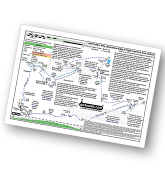
Dufton - Eller Beck - Pusgill House - Great Rundale Beck - Bluethwaite Hill - Threlkeld Side - Brownber Hill - Tossgill Edge - Great Rundale Tarn - Backstone Edge (Dufton Fell) - Narrowgate Beacon - Little Rundale Beck - High Cup Nick - High Cup - The Pennine Way - Narrow Gate Path - Peeping Hill - Bow Hall - Town Head - Dufton
|
Vital Statistics:
| Length: | 11 miles (17.5 km) |
| Ascent: | 2,288ft (697m) |
| Time: | 6.25hrs |
| Grade: | |
Route Summary:
Melmerby - Meikle Awfell - Cuns Fell - Maiden Way (Roman Road) - Meg's Cairn - Melmerby Fell - Knapside Hill - Little Knapside Hill - Fiend's Fell - Twotop Bridge - Hazel Rigg Farm - Gamblesby - Gill Beck - Melmerby
|
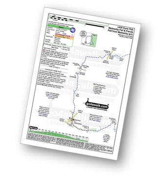
Vital Statistics:
| Length: | 11.75 miles (19 km) |
| Ascent: | 1,943ft (592m) |
| Time: | 6.25hrs |
| Grade: | |
Route Summary:
Clesketts - Tortie Farm - Howgill Cottages - Tindale Fells - Howgill Beck - Tindale Fell - Cold Fell Pike (Geltsdale) - Great Blacklaw Hill - Old Water - Old Water Bridge - Gairs Farm - Howgill Cottages - Clesketts
|
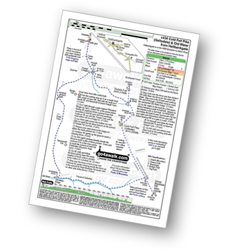
Vital Statistics:
| Length: | 8.75 miles (14 km) |
| Ascent: | 798ft (243m) |
| Time: | 4 hrs |
| Grade: | |
Route Summary:
Garrigill - The Pennine Way - The South Tyne Trail - The River South Tyne - Low Sillyhall Farm - Bleagate Farm - Low Cowgap Farm - Low Nest Farm - Brewery Bridge - Alston - Crosslands - Leadgate - Blackburn Bridge - Garrigill
|
Vital Statistics:
| Length: | 10.75 miles (17 km) |
| Ascent: | 1,976ft (602m) |
| Time: | 6 hrs |
| Grade: | |
Route Summary:
Dufton - The Pennine Way - Town End - Kemplar Bridge - Greenhow Farm - Keisley House - Harbour Flatt Farm - Trundale Gill - Middle Tongue - Murton Fell - Murton Herds - High Cup - High Cup Gill - High Cup Nick - The Pennine Way - Narrow Gate Path - Peeping Hill - Bow Hall - Town Head - Dufton
|
Vital Statistics:
| Length: | 4 miles (6.5 km) |
| Ascent: | 643ft (196m) |
| Time: | 2.25hrs |
| Grade: |  |
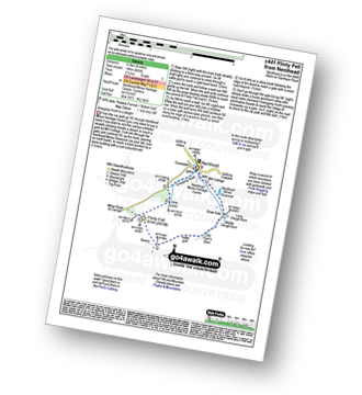
Route Summary:
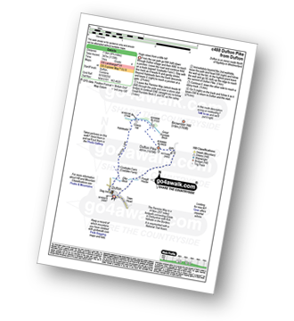
Nenthead - Nenthead Mines Heritage Centre - Shaw Side - Old Carr's Burn - Flinty Fell - Dowgang Hush - Nenthead
|
Vital Statistics:
| Length: | 11 miles (17.5 km) |
| Ascent: | 1,766ft (538m) |
| Time: | 5.75hrs |
| Grade: | |
Route Summary:
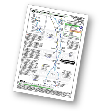
Garrigill - The Pennine Way - The South Tyne Trail - Low Crossgill - Ash Gill - Ashgill Force - Waterfall - Hole House Farm - Tynehead Farm - Allan's Clough - Bellbeaver Rigg (Tynehead Fell) - Tyne Head - Round Hill (Tyne Head) - Noonstones Hill - Dorthgill Farm - Hill House Farm - Lee Houses - Garrigill
|
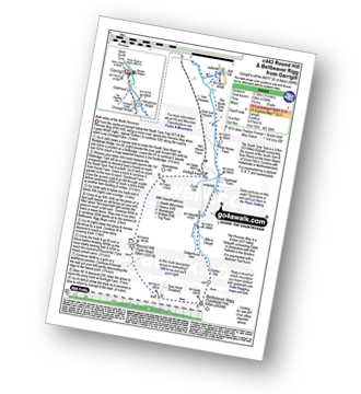
Vital Statistics:
| Length: | 12.75 miles (20.5 km) |
| Ascent: | 2,819ft (859m) |
| Time: | 7½ hrs |
| Grade: | |
Route Summary:
Dufton - The Pennine Way - Eller Beck - Coastsyke Farm (Coatsike Farm) - Hurning Lane - Halsteads - Cosca Hill - Great Rundale Beck - Dufton Pike - Bluethwaite Hill - Threlkeld Side - Brownber Hill - Tossgill Edge - Great Rundale Tarn - Backstone Edge (Dufton Fell) - Narrowgate Beacon - Little Rundale Beck - High Cup Nick - High Cup - The Pennine Way - Narrow Gate Path - Peeping Hill - Bow Hall - Town Head - Dufton
|
Vital Statistics:
| Length: | 5 miles (8 km) |
| Ascent: | 571ft (174m) |
| Time: | 2½ hrs |
| Grade: | |
Route Summary:
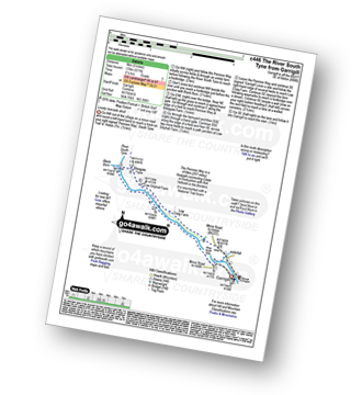
Garrigill - The Pennine Way - The River South Tyne - Black Burn - Bleagate Farm - Low Sillyhall Farm - Low Craig Farm - Garrigill
|
Vital Statistics:
| Length: | 4 miles (6.5 km) |
| Ascent: | 1,293ft (394m) |
| Time: | 2.75hrs |
| Grade: | |
|
Vital Statistics:
| Length: | 15.75 miles (25 km) |
| Ascent: | 2,343ft (714m) |
| Time: | 8 hrs |
| Grade: | |
Route Summary:
Garrigill - The Pennine Way - The South Tyne Trail - Low Crossgill - Ash Gill - Ashgill Force - Waterfall - Hole House Farm - Tynehead Farm - Allan's Clough - Bellbeaver Rigg (Tynehead Fell) - Tyne Head - Round Hill (Tyne Head) - Crossgill Head - Crossgill Pants - Rake End - Lambgreen Hills - Bullman Hills - Bullman Hills (North Top) - Bullman Sike - Cash Burn - Long Man Hill - Craglands Sike - Pikeman Hill - Meg Moffat's Hill - Black Band - Garrigill
|
Vital Statistics:
| Length: | 5 miles (8 km) |
| Ascent: | 703ft (214m) |
| Time: | 2½ hrs |
| Grade: | |
Route Summary:
Dufton - The Pennine Way - Eller Beck - Church Bridge - Knock Church - Swindale Beck - Knock - Cosca Hill - Great Rundale Beck - Pisgill House - Dufton
|
Vital Statistics:
| Length: | 10 miles (16 km) |
| Ascent: | 1,359ft (414m) |
| Time: | 4 hrs |
| Grade: | |
Route Summary:
Garrigill - The Pennine Way - The South Tyne Trail - Low Crossgill - Ash Gill - Ashgill Force - Waterfall - Hole House Farm - Tynehead Farm - Allan's Clough - Bellbeaver Rigg (Tynehead Fell) - Tyne Head - Garrigill
|
Vital Statistics:
| Length: | 4.75 miles (7.5 km) |
| Ascent: | 479ft (146m) |
| Time: | 2.25hrs |
| Grade: |  |
Route Summary:
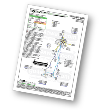
Alston - Leadgate - Blackburn Bridge - Bleagate Farm - The Pennine Way - Low Nest Farm - Alston
|
Vital Statistics:
| Length: | 4.75 miles (7.5 km) |
| Ascent: | 1,139ft (347m) |
| Time: | 3 hrs |
| Grade: | |
Route Summary:
Dufton - The Pennine Way - Eller Beck - Coastsyke Farm (Coatsike Farm) - Hurning Lane - Halsteads - Cosca Hill - Great Rundale Beck - Dufton Pike - Pusgill House - Dufton
|
Vital Statistics:
| Length: | 7 miles (11 km) |
| Ascent: | 1,381ft (421m) |
| Time: | 4 hrs |
| Grade: | |
Route Summary:
Hilton Town Head - Hilton Beck - Warcop Training Area - Swindale Brow - Swindale Beck - Swindale Edge - Marn Gill - Christy Bank - Siss Gill - Tinside Rigg - Long Fell - Howgill Fold - Cringle Beck - Lycum Sike - East Moor - Hilton Sike - Hilton Town Head
|
Vital Statistics:
| Length: | 10.5 miles (17 km) |
| Ascent: | 853ft (260m) |
| Time: | 4½ hrs |
| Grade: | |
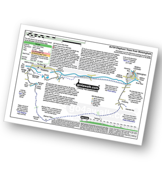
Route Summary:
Wolsingham - River Wear - Weardale - The Weardale Way - Ashes House - Towdy Potts - Spence Hill - Harthope - Sunnyside Edge - Elephant Trees - Pikestone Fell - Allotment House - Folly Plantation - Harehope Farm - White Kirkley Farm - Bolihope Burn - Lower Bishopley Farm - Miln House Farm - Bridge End - Frosterley - Weardale - Wolsingham
|
Vital Statistics:
| Length: | 11 miles (17 km) |
| Ascent: | 1,246ft (380m) |
| Time: | 5.25hrs |
| Grade: | |
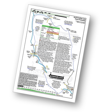
Route Summary:
Frosterley - Wireless Mast - Fatherley Currick - Collier Law - Weatherhill Engine - Heathery Burn - Stanhope Burn - Stanhope - River Wear - Stepping Stones - Weardale - The Weardale Way - Dryburnside Farm - Frosterley
|
Vital Statistics:
| Length: | 14 miles (22.5 km) |
| Ascent: | 1,904ft (580m) |
| Time: | 7 hrs |
| Grade: | |
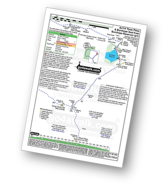
Route Summary:
Burnhope Reservoir - Ireshope Moor - Coldberry End - Three Pikes - Coldberry End - Great Stony Hill - Scaud Hill - Redgleam (Harwood Common) - Burnhope Seat - Dead Stones - White Edge (Burnhope Reservoir) - Lamb's Head - Highwatch Currick - The Malakoff - Bents Head - Stripe End - Burnhope Reservoir
|
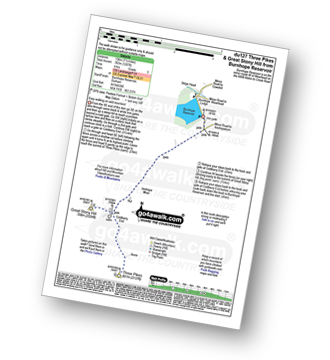
Vital Statistics:
| Length: | 6.25 miles (10 km) |
| Ascent: | 821ft (250m) |
| Time: | 3.25hrs |
| Grade: | |
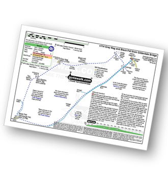
Route Summary:
Killhope Cross - Killhope Head - Black Hill - The Dodd - Smallburns Moor - Sunnyside Farm - Coalcleugh Farm - Mufton Hall - Carrshield Moor - Bridge Cleugh - Killhope Law - Killhope Head - Killhope Cross
|
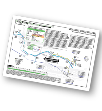
Vital Statistics:
| Length: | 14.5 miles (23 km) |
| Ascent: | 1,805ft (550m) |
| Time: | 7.25hrs |
| Grade: | |
Route Summary:
Stanhope - River Wear - Weardale - The Weardale Way - River Wear - Eastgate - Rookhope Burn - Rookhope - C2C Cycle Route - Longlaw End - Bolt's Law (Hunstanworth) - Weatherhill Engine - East Whitely Beck - Stanhope Burn - Stanhope
|
Vital Statistics:
| Length: | 17.5 miles (28 km) |
| Ascent: | 1,591ft (485m) |
| Time: | 7.75hrs |
| Grade: | |
Route Summary:
Barningham - Birk Hills Farm - Brown Hill - Cathaw Stoop - Carter Allotment - Badger Way - Badger Way Stoop - How Tallon - How Tallon Gate - How Tallon Ridge - High Moor - Arndale Springs - Frankinshaw How - Holgate Moor - Arndale hole - Kexwith Beck - Kexwith Farm - Moresdale Gill - Moresdale - Moresdale Road - Fair Seat Hill - Moresdale Ridge - Stony Man (St Andrew's Cross) - Booze Moor - Low Moor - Windeg Vein - Little Windeg - Dry Gill Bottom - Shaw Farm - Stang Side - Stang House - Freestone Ridge - Stang Top - Hope Moor - The Stang - Woodcote Gill - Black Hill Gate - Haythwaite Farm - Moorcock Farm - Bragg House - Barningham
|
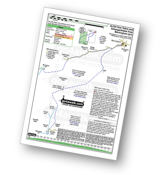
Vital Statistics:
| Length: | 8.25 miles (13 km) |
| Ascent: | 1,172ft (357m) |
| Time: | 4.25hrs |
| Grade: | |
Route Summary:
Middleton-in-Teesdale - River Tees - River Lune - Eller Brook - Grassholme Reservoir - Lunedale - The Pennine Way - Crossthwaite Common - Harter Fell (Crossthwaite Common) - River Tees - Middleton-in-Teesdale
|
Vital Statistics:
| Length: | 8.5 miles (13.5 km) |
| Ascent: | 1,231ft (375m) |
| Time: | 4½ hrs |
| Grade: | |
Route Summary:
Holwick - Holwick Scars - Rowton Beck - Green Fell - Bink Moss - Dry Gill - Hagworm Hill - Howden Moss - Black Beck - White Rigg - Holwick
|
Vital Statistics:
| Length: | 7.5 miles (12 km) |
| Ascent: | 1,287ft (392m) |
| Time: | 4 hrs |
| Grade: | |
Route Summary:
Burnhope Reservoir - Ireshope Moor - Coldberry End - Three Pikes - Coldberry End - Great Stony Hill - Coldberry End - Ireshope Moor - Burnhope Reservoir
|
Vital Statistics:
| Length: | 9 miles (14.5 km) |
| Ascent: | 1,651ft (503m) |
| Time: | 5 hrs |
| Grade: | |
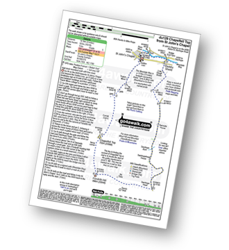
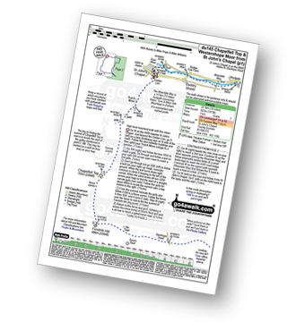
Route Summary:
St John's Chapel - Thatch Mires - Chapelfell Top - Fendrith Hill - Swinhope Moor - Dora's Seat - Swinhope Head - Swinside House - Daddry Shield - River Wear - Weardale - The Weardale Way - St John's Chapel
|
Vital Statistics:
| Length: | 12.5 miles (20 km) |
| Ascent: | 1,279ft (390m) |
| Time: | 5.75hrs |
| Grade: | |
Route Summary:
Bowlees - Wynch Bridge - River Tees - Holwick - Low Currick Rigg - Blea Beck - Whiteholm Bank - Dry Beck - Skyer Beck - Birk Rigg - Thistle Green - White Well Green - River Tees - Fox Earths - Raven Scar - Cronkley Scar - Green Hill - Cronkley Pasture - High House - The Pennine Way - Cronkley Farm - Bracken Rigg - Bleabeck Force - High Force - Saur Hill Bridge - Low Force - Wynch Bridge - Bowlees
|
Vital Statistics:
| Length: | 14 miles (22.5 km) |
| Ascent: | 1,743ft (531m) |
| Time: | 7 hrs |
| Grade: | |
Route Summary:
Langdon Beck - Tarn Hole - Tarn Hole Edge - Three Pikes - Grasshill Common - Causeway Hill - Coldberry Edge - Great Stony Hill - Scaud Hill - Redgleam (Harwood Common) - Swallow Hole - Holdenhurth Band - Herdship Fell - Viewing Hill - Backside Fell Bothy - West Common - Touting Hill - Cow Green Reservoir - Widdybank Fell - Langdon Beck
|
Vital Statistics:
| Length: | 9 miles (14.5 km) |
| Ascent: | 1,730ft (527m) |
| Time: | 5 hrs |
| Grade: | |
Route Summary:
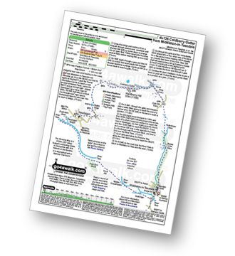
Middleton-in-Teesdale - Hudeshope Beck - Skears Lime Kilns - Club Gill Farm - Coldberry Mine - Coldberry Gutter - Hardberry Hill - Stable Edge - Newbiggin - Newbiggin Bridge - The Pennine Way - Park End Wood - Knott Hill - Middle Crossthwaite - The River Tees - Middleton-in-Teesdale
|
Vital Statistics:
| Length: | 7.75 miles (12.5 km) |
| Ascent: | 988ft (301m) |
| Time: | 4 hrs |
| Grade: | |
Route Summary:
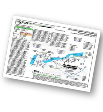
Balderhead Reservoir - High Birk Hat Farm - The Pennine Way - Hannah's Meadow - Birk Hat Farm - Blackton Reservoir - Baldsersdale - Willoughby Hall - Scoon Bank - West Brisco - Coproal Hill - East Brisco - How Beck - Lathe Haw - Lathehaw Rigg - Goldsborough Rigg - Goldsborough - East Friar House - Mawmon Sike - Balckton Grange - Balderhead Reservoir
|
Vital Statistics:
| Length: | 15.75 miles (23.5 km) |
| Ascent: | 1,835ft (559m) |
| Time: | 7.25hrs |
| Grade: | |
Route Summary:
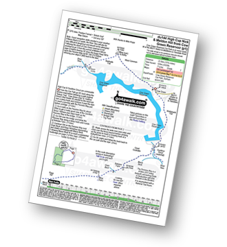
Cow Green Reservoir - Widdybank Fell - Cauldron Snout - The Pennine Way - Birkdale Farm - Grain Beck - Rasp Hill - Maize Beck - High Cup - High Cup Nick - Stake Beck - Meldon Hill (Dufton Fell) - Force Burn - River Tees - Backside Fell Bothy - Cow Green Reservoir
|
Vital Statistics:
| Length: | 14 miles (22.5 km) |
| Ascent: | 1,979ft (603m) |
| Time: | 7 hrs |
| Grade: | |
Route Summary:
St John's Chapel - Thatch Mires - Chapelfell Top - Fendrith Hill - Swinhope Moor - Dora's Seat - Swinhope Head - Westernhope Moor - Black Hill (Westernhope Moor) - Littlewood Farm - Brotherlee - Shield - River Wear - Weardale - The Weardale Way - Westgate - Daddry - St John's Chapel
|
Vital Statistics:
| Length: | 11.5 miles (18.5 km) |
| Ascent: | 1,631ft (497m) |
| Time: | 5.75hrs |
| Grade: | |
Route Summary:
Burnhope Reservoir - Ireshope Moor - Coldberry End - Great Stony Hill - Scaud Hill - Redgleam (Harwood Common) - Burnhope Seat - Dead Stones - White Edge (Burnhope Reservoir) - Lamb's Head - Highwatch Currick - The Malakoff - Bents Head - Stripe End - Burnhope Reservoir
|
Vital Statistics:
| Length: | 8.5 miles (13.5 km) |
| Ascent: | 1,093ft (333m) |
| Time: | 4.25hrs |
| Grade: | |
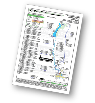
Route Summary:
Wolsingham - Waskerley Beck - Holywood House - Bael Hill House - Thistlewood Farm - Wolsingham North Moor - Tunstall Reservoir - Bishop Oak - Wolsingham
|
Vital Statistics:
| Length: | 10 miles (16 km) |
| Ascent: | 1,628ft (496m) |
| Time: | 5.25hrs |
| Grade: | |
Route Summary:
Gilderdale Bridge - The Pennine Way - Black Hill (Whitley Common) - Grey Nag - Tom Smith's Stone Top - Tom Smith's Stone - Croglin Water - Haresceugh Fell - Black Fell (Haresceugh Fell) - Woldgill Moss - Gilderdale Burn - Gilderdale Bridge
|
Vital Statistics:
| Length: | 6.25 miles (10 km) |
| Ascent: | 1,325ft (404m) |
| Time: | 3½ hrs |
| Grade: | |
Route Summary:
Gilderdale Bridge - Gilderdale Burn - The Pennine Way - Whitley Castle - Black Hill (Whitley Common) - Grey Nag - Black Hill (Whitley Common) - Whitley Castle - The Pennine Way - Gilderdale Burn - Gilderdale Bridge
See this list of walks, routes & maps in:
Grade Order |
Length Order |
Time Order |
Walk Number or Start Location Order
NB. To reverse (toggle) this order, click Grade Order again
To contribute to go4awalk.com or to contact us about anything at all - see Talk To Us. For help see Help.
go4awalk.com and go4awalk.co.uk are registered trademarks of TMDH Limited.
Copyright © 2000-2024 TMDH Limited. All rights reserved.
Copyright | Terms & Conditions | Privacy Statement
A - Z
Walks
Home
Log On/Accounts
Photo Gallery
Walk Ideas and Collections
Fell Facts
Places to Stay
Hill Skills
Walking Questions and Answers
Your Stories
News
Competitions
Product Reviews/Gear Tests
Walking Gear Guides
Peaks and Mountains
Peak Bagging
Find New Walking Friends
Camping
GPS Waypoints for Walking
Walk Search
Talk to us
go4awalk.com Help
Free example walks
Newsletter


