Six easy to follow walk route maps from the tiny settlement of Crowden in the Dark Peak (northern) area Peak District, Derbyshire, England
   |
Vital Statistics:
| Length: | 5.25 miles (8.5 km) |
| Ascent: | 823ft (251m) |
| Time: | 2.75hrs |
| Grade: |  |
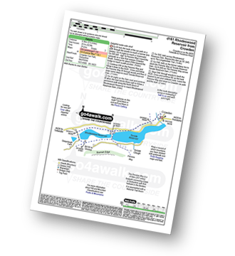
Route Summary:
Crowden - The Pennine Way - Torside Reservoir - Rhodeswood Reservoir - The Longdendale Trail - The Pennine Way - Torside Reservoir - Crowden
|
Vital Statistics:
| Length: | 7.25 miles (11.5 km) |
| Ascent: | 1,515ft (562m) |
| Time: | 4.25hrs |
| Grade: |  |
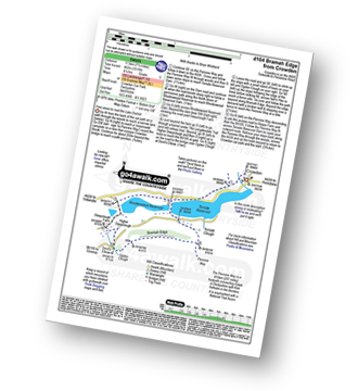
Route Summary:
Crowden - The Pennine Way - Torside Reservoir - Rhodeswood Reservoir - Higher Deepclough - Devil's Elbow - Ogden Clough - Nell's Pike - Bramah Edge - Peaknaze Moor - The Pennine Way - Torside Reservoir - Crowden
|
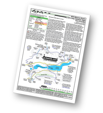
Vital Statistics:
| Length: | 6.25 miles (10 km) |
| Ascent: | 1,610ft (491m) |
| Time: | 4 hrs |
| Grade: | |
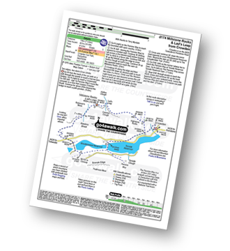
Route Summary:
Crowden - The Pennine Way - Highstone Rocks - Lad's Leap - Millstone Rocks (Lad's Leap) - Rhodeswood Reservoir - The Longdendale Trail - The Pennine Way - Torside Reservoir - Crowden
|
Vital Statistics:
| Length: | 9 miles (14.5 km) |
| Ascent: | 1,746ft (532m) |
| Time: | 5 hrs |
| Grade: | |
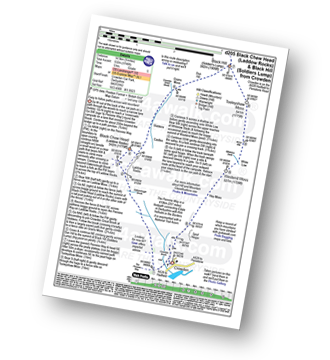
Route Summary:
Crowden - Crowden Brook - The Pennine Way - Highstone Rocks - Span Gutter - Rakes Rocks - Oakenclough Brook - Laddow Moss - Black Chew Head (Laddow Rocks) - Near Broadslate - Sliddens - Dun Hill - Black Hill (Soldier's Lump) - Tooleyshaw Moss - Tooleyshaw Moor - White Low - Westend Moss - Hey Moss - Hey Edge - Crowden
|
Vital Statistics:
| Length: | 8.5 miles (13.5 km) |
| Ascent: | 2,289ft (698m) |
| Time: | 5½ hrs |
| Grade: |  |
Route Summary:
Crowden - The Pennine Way - Highstone Rocks - Lad's Leap - Millstone Rocks (Lad's Leap) - Rhodeswood Reservoir - Higher Deepclough - Devil's Elbow - Ogden Clough - Nell's Pike - Bramah Edge - Peaknaze Moor - The Pennine Way - Torside Reservoir - Crowden
|
Vital Statistics:
| Length: | 10.5 miles (17 km) |
| Ascent: | 1,975ft (602m) |
| Time: | 5.75hrs |
| Grade: | |
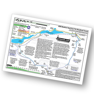
Route Summary:
Woodhead Tunnel - Middle Black Clough - Bleaklow Stones (Bleaklow Hill) - Bleaklow Head (Bleaklow Hill) - The Wain Stones (or Kissing Stones) - The Pennine Way - Clough Edge - The Longdendale Trail - Crowden - Woodhead Reservoir - Woodhead Tunnel
To contribute to go4awalk.com or to contact us about anything at all - see Talk To Us. For help see Help.
go4awalk.com and go4awalk.co.uk are registered trademarks of TMDH Limited.
Copyright © 2000-2024 TMDH Limited. All rights reserved.
Copyright | Terms & Conditions | Privacy Statement
A - Z
Walks
Home
Log On/Accounts
Photo Gallery
Walk Ideas and Collections
Fell Facts
Places to Stay
Hill Skills
Walking Questions and Answers
Your Stories
News
Competitions
Product Reviews/Gear Tests
Walking Gear Guides
Peaks and Mountains
Peak Bagging
Find New Walking Friends
Camping
GPS Waypoints for Walking
Walk Search
Talk to us
go4awalk.com Help
Free example walks
Newsletter


