9 easy to follow walk route maps of all grades on OS Explorer Map 332 Alnwick & Amble Craster & Whittingham
Nine easy-to-follow hand-crafted printable walk route maps that are wholly on or partly on OS Explorer Map 332 Alnwick & Amble Craster & Whittingham to suit all levels of fitness and ability.
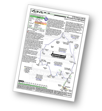
Tap/mouse over a coloured circle (1-3 easy walks, 4-6 moderate walks, 7-9 hard walks) and click to select.
You can use these checkboxes to show only the grades of walk you are interested in:-
Nine easy-to-follow walk route maps of all grades on OS Explorer Map 332 Alnwick & Amble Craster & Whittingham in Walk Grade Order
Scroll down the list of walks below & click on each walk title (in blue) to locate it on the map above.
See this list of walks, routes & maps in:
Grade Order |
Length Order |
Time Order |
Walk Number or Start Location Order
NB. To reverse (toggle) this order, click Grade Order again
   |
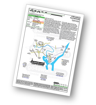
Vital Statistics:
| Length: | 5 miles (8 km) |
| Ascent: | 1,030ft (314m) |
| Time: | 3 hrs |
| Grade: |  |
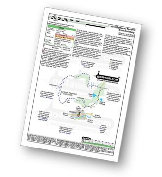
Route Summary:
Rothbury - Blaeberry Hill - Telecommncations Mast - Ship Crag - Brae Head - Target Plantation - Glitteringstone - Rothbury Terrace - Primrose Cottage - Debdon Burn - Debdon Plantation - Tumbleton House - Debden Lake - Tumbleton Lake - Addycombe Farm - Hillside Road - Rothbury
|
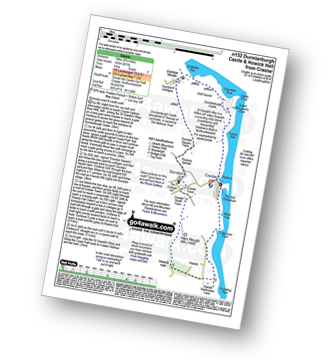
Vital Statistics:
| Length: | 5.25 miles (8.5 km) |
| Ascent: | 430ft (131m) |
| Time: | 2½ hrs |
| Grade: |  |
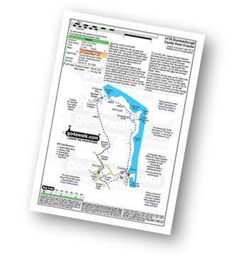
Route Summary:
Craster - Cushat Stiel - Queen Margaret's Cove - Dunstanburgh Castle - The St Oswald's Way - Embleton Bay - Dunstan Steads - Dunstan Square Farm - Proctors Spread - Dunstan - Craster Tower - Craster
|
Vital Statistics:
| Length: | 3.75 miles (6 km) |
| Ascent: | 499ft (152m) |
| Time: | 2 hrs |
| Grade: | |
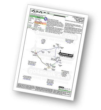
Route Summary:
Old Bewick - Hanging Crag - Blawearie - Tick Law - Harehop Kennels - Hill End - Old Bewick
|
Vital Statistics:
| Length: | 7.75 miles (12.5 km) |
| Ascent: | 1,250ft (381m) |
| Time: | 4 hrs |
| Grade: |  |
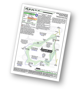
Route Summary:
Thrunton Wood - Callaly Crag - Hard Nab - Long Crag - Coe Crags - Coe Burn - Thrunton Wood
|
Vital Statistics:
| Length: | 4.5 miles (7 km) |
| Ascent: | 387ft (118m) |
| Time: | 2 hrs |
| Grade: | |
Route Summary:
Alnmouth - Beach - The St Oswald's Way - River Aln - Lesbury - Foxton Hall - Marden Rocks - Alnmouth Golf Club - Alnmouth
|
Vital Statistics:
| Length: | 8.75 miles (14 km) |
| Ascent: | 601ft (183m) |
| Time: | 4 hrs |
| Grade: | |
Route Summary:
Craster - Dunstanburgh Castle - Dunstan Steads Farm - Dunstan - Craster Tower - Hips Heugh - Howick Hall - Northumberland Coast - Rambling Kern - Cullernose Point - Black Hole - Craster
|
Vital Statistics:
| Length: | 6.25 miles (10 km) |
| Ascent: | 1,037ft (316m) |
| Time: | 3½ hrs |
| Grade: | |
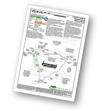
Route Summary:
Hepburn Wood - Hepburn Crags - Ros Castle (Ross Castle) - Hepburn Moor - Botany Cottage - Quarryhouse Moor - Blawearie - Hepburn Crags - Hepburn Wood
|
Vital Statistics:
| Length: | 4.5 miles (7 km) |
| Ascent: | 37ft (113m) |
| Time: | 2 hrs |
| Grade: | |
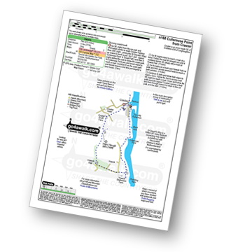
Route Summary:
Craster - Black Hole - Cullernose Point - Rambling Kern - Howick Hall - Hips Heugh - Craster Tower - Craster
|
Vital Statistics:
| Length: | 8.5 miles (13.5 km) |
| Ascent: | 988ft (301m) |
| Time: | 4.25hrs |
| Grade: | |
Route Summary:
Eglingham - Tarry - Eglingham Moor - Curleheugh - Hare Crag - Ceteran Hill - Ceteran Meadows Moss - Blawearie - Bewick Moor - Tick Law - Harehope Hill - Harehope Farm - Ticket Hill - Eglingham
See this list of walks, routes & maps in:
Grade Order |
Length Order |
Time Order |
Walk Number or Start Location Order
NB. To reverse (toggle) this order, click Grade Order again

To contribute to go4awalk.com or to contact us about anything at all - see Talk To Us. For help see Help.
go4awalk.com and go4awalk.co.uk are registered trademarks of TMDH Limited.
Copyright © 2000-2024 TMDH Limited. All rights reserved.
Copyright | Terms & Conditions | Privacy Statement
A - Z
Walks
Home
Log On/Accounts
Photo Gallery
Walk Ideas and Collections
Fell Facts
Places to Stay
Hill Skills
Walking Questions and Answers
Your Stories
News
Competitions
Product Reviews/Gear Tests
Walking Gear Guides
Peaks and Mountains
Peak Bagging
Find New Walking Friends
Camping
GPS Waypoints for Walking
Walk Search
Talk to us
go4awalk.com Help
Free example walks
Newsletter


