
![]()
Winhill Pike (Win Hill)
462m (1516ft)
The Dark Peak Area, The Peak District, Derbyshire, England
The summit of Winhill Pike (Win Hill) is marked by an Ordnance Survey Trig Point.

Not familiar with this top?
You can walk/hike to the top of Winhill Pike (Win Hill) by using any of these 3 easy‑to‑follow route maps:
Walk d288 Winhill Pike from Hope
Superb views with a relatively gently ascent
   |
|---|
Vital Statistics:
| Length: | 5.75ml (9km) |
|---|---|
| Ascent: | 971ft (296m) |
| Time: | 3 hrs |
| Grade: |  (Moderate) (Moderate) |
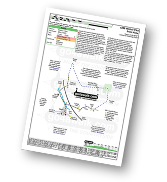
Route Summary:
Hope - Hope Bank - Wooler Knoll - Winhill Plantation - Winhill Pike (Win Hill) - Thornhill - Aston - Hope
Walk d271 Winhill Pike (Win Hill) from Heatherdene Car Park, Ladybower Reservoir
A steady but gentle ascent to superb views
|
|---|
Vital Statistics:
| Length: | 6.75ml (10.5km) |
|---|---|
| Ascent: | 1,289ft (393m) |
| Time: | 3.75hrs |
| Grade: | (Moderate) |

Route Summary:
Heatherdene Car Park - Ladybower Reservoir - Yorkshire Bridge - Parkin Clough - Winhill Plantation - Winhill Pike (Win Hill) - Hope Bank - Wooler Knoll - Woodlands Valley - Ladybower Reservoir - Wiseman Hey Clough Plantation - Yorkshire Bridge - Heatherdene Car Park
Walk d144 Winhill Pike (Win Hill) and Hope Cross from Yorkshire Bridge
A steep ascent to superb views
|
|---|
Vital Statistics:
| Length: | 8.75ml (14km) |
|---|---|
| Ascent: | 1,887ft (575m) |
| Time: | 5.25hrs |
| Grade: |  (Moderate) (Moderate) |

Route Summary:
Yorkshire Bridge - Parkin Clough - Winhill Plantation - Winhill Pike (Win Hill) - Twitchill Farm - Fullwood Stile Farm - Roman Road - Hope Cross - Ladybower Reservoir - Wiseman Hey Clough Plantation - Yorkshire Bridge
See Winhill Pike (Win Hill) and the surrounding tops on our free-to-access 'Google Style' Peak Bagging Maps:
The Dark Peak Area of The Peak District National Park
Less data - quicker to download
See Winhill Pike (Win Hill) and the surrounding tops on our unique, downloadable, PDF Peak Bagging Map:

NB: Whether you print off a copy or download it to your phone, this PDF Peak Baggers' Map might prove incredibly useful when your are up there on the tops and you cannot get a phone signal.
You can find Winhill Pike (Win Hill) & all the walks that climb it on these unique free-to-access Interactive Walk Planning Maps:
1:25,000 scale OS Explorer Map (orange/yellow covers):
1:50,000 scale OS Landranger Map (pink/magenta covers):
 Fellow go4awalkers who have already walked, climbed, scaled, summited, hiked & bagged Winhill Pike (Win Hill)
Dan Collins walked up Winhill Pike (Win Hill) on January 17th, 2026 [from/via/route] With Howard, Lucy & Seb from Losehill Hotel [with] Howard, Lucy and Seb
Hazel Gilbert climbed it on May 13th, 2024 [from/via/route] Hope [with] Lawrence [weather] Sunny
Ruth Mcfarlane bagged it during September, 2023 [from/via/route] Hope to Edale [with] myself
Patrick Molloy hiked Winhill Pike (Win Hill) on June 24th, 2021 [from/via/route] Out & back via Parkin Clough [with] Solo [weather] Cloudy, Humid
Anna White summited on March 7th, 2020 [from/via/route] Heatherdene Carpark ..From Ladybower Reservoirs (Derwent River side of Winhill) [with] Partner [weather] Cold & Windy - Amazing although very difficult ascent from the Derwent River side. Honestly didn't think I was going to make it !! Thighs were burning like crazy & I had to keep stopping to catch my breath..... The weather changed in a heartbeat nearing the summit, like intense bitter wind & cold .....but I DID IT in the end :)
Stephen Eddy conquered it on April 19th, 2019 [from/via/route] Hope, via edale [with] Jo Allen, Jack Eddy [weather] Sunny
Michael Lee scaled it during 1983 [from/via/route] Yorkshire Bridge & back down.. [with] Jill and loads of other people [weather] Dry, cold! - Steep but nice.. Done this many times in all sorts of weathers..
Tina Brindley walked up Winhill Pike (Win Hill) during October, 2016 [weather] mist windy
Lucy Perchard climbed it on May 27th, 2017 [from/via/route] Yorkshire Bridge & Hope Cross [with] Tony and Anneli [weather] Sunny - Second walk of our first "impromptu" camping trip to the Peak District
Oliver Hunter bagged it on September 21st, 2008 [from/via/route] Walked from Yorkshire Bridge, over Winhill Pike & along Ladybower Reservoir. [with] Me, Kat, Adam (9 months), Leon & Nicola. [weather] Warm with slight haze - Great view from the top!
David Brown hiked Winhill Pike (Win Hill) on May 4th, 2016 [from/via/route] Walk Route Map d271 Winhill Pike (Win Hill) from Yorkshire Bridge [weather] Sunny, wind on tops. A beautiful day in May - Took exactly the time it said to allow, including breaks & photographs!
Wayne Linley summited on October 28th, 2015 [from/via/route] Edale-ringing Roger-crookstone knoll -win hill pike [with] Craig Morris simon fleming [weather] Rain-overcast mist no wind - Quality mountain day
Lee Senior conquered it on March 28th, 2015 [from/via/route] From Castleton then onto Ladybower [with] Andy B [weather] Rain & VERY windy on summit
Kevin Russell scaled it on July 2nd, 2014 [with] Self [weather] HOT!
Pauline Styles walked up Winhill Pike (Win Hill) on April 15th, 2014 [from/via/route] Castleton [with] Jane Clayton [weather] Brilliant day, sunny & not too windy!
Emma Morris climbed it during February, 2012 [from/via/route] Yorkshire Bridge [weather] misty to start but then beautiful clear sunshine with amazing weather conversion in the valleys
Kerry Wykes bagged it on February 10th, 2014 [from/via/route] Yorkshire Bridge [with] Kate, Kerry, Sarah [weather] Sunny turning very cold - Fabulous day :-)
Nicola Parkinson hiked Winhill Pike (Win Hill) on February 8th, 2014 [from/via/route] d144 from Yorkshire Bridge [with] Stu [weather] Very windy
Kevin Bloor summited on December 22nd, 2013 [from/via/route] Yorkshire bridge [with] MaxineLatto [weather] Overcast & windy - Total distance walked was about 10 miles, did a figure of 8 & took Win hill in twice, very windy at top but Maxine managed to hug the trig point this time
John Gehrke conquered it on September 15th, 2013 [from/via/route] walk d144 [with] solo [weather] wet & wildly windy; first autumn storm of the year
Joanne Mcgawley scaled it on April 8th, 2012 [with] Rich [weather] Windy & Damp - 9.4 miles
Marie Hall walked up Winhill Pike (Win Hill) on May 2nd, 2011 [from/via/route] The bridge [with] Stuart [weather] cool & windy - have climbed this peak from three different points - good views & some nice woodland walking.
Ken Davies has climbed it [from/via/route] Yorkshire bridge [with] Bev [weather] Fine, snow on ground - Steep start, then pleasant easy stroll
Leona Skelton bagged it during June, 2011 [from/via/route] Ashopton [with] Alone [weather] Hot
Andrew Joss hiked Winhill Pike (Win Hill) on August 12th, 2012 [from/via/route] Castleton car park [with] Barbara, Pippa, Mick and Benson [weather] Started sunny then go rainy - Fantastic view
Giles Henderson summited on April 8th, 2012 [from/via/route] Ladybower car park [with] Lisa [weather] Drizzly
Patrick Rogozinski, Jim Sallis, Martin Greenwood, Geoffrey Robertshaw, Louis Smith, Stephen Millington, Mark Davidson, Louise Sandwith, Rob Barklamb and David Buttress have all walked, climbed & bagged Winhill Pike (Win Hill).
To add (or remove) your name and experiences on this page - Log On and edit your Personal Mountain Bagging Record
. . . [see less walk reports]
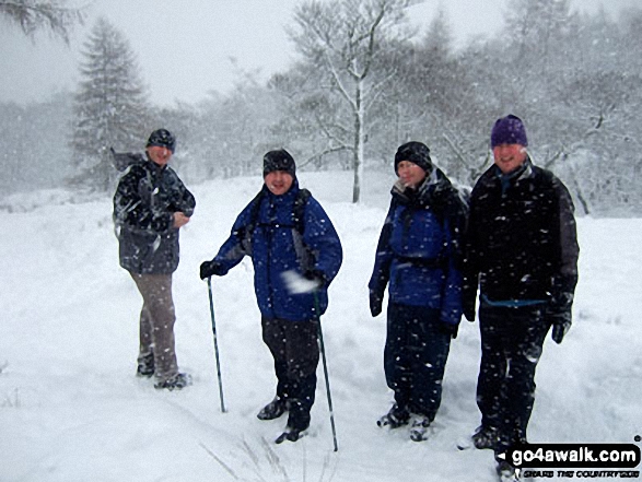
More Photographs & Pictures of views from, on, or of, Winhill Pike (Win Hill)
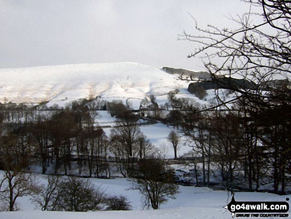
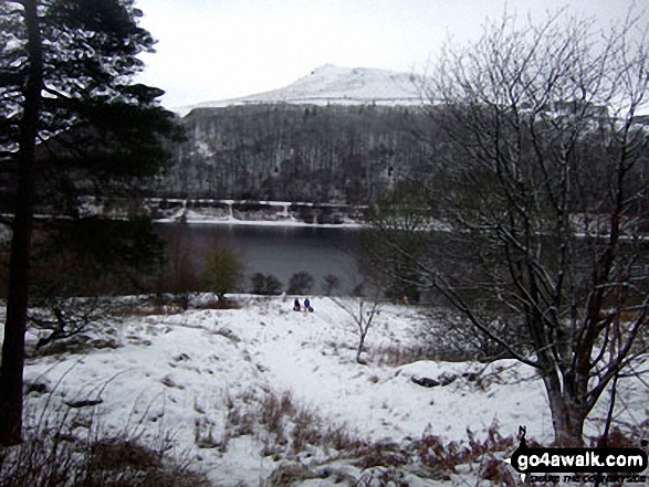
Winhill Pike (Win Hill) from The River Noe Valley north of Hope in heavy snow

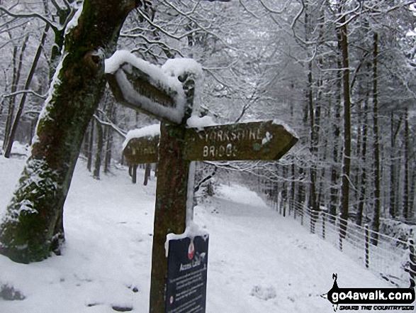
Crook Hill beyond Ladybower Reservoir from Wiseman Hey Clough Woods, Winhill Pike (Win Hill) in heavy snow
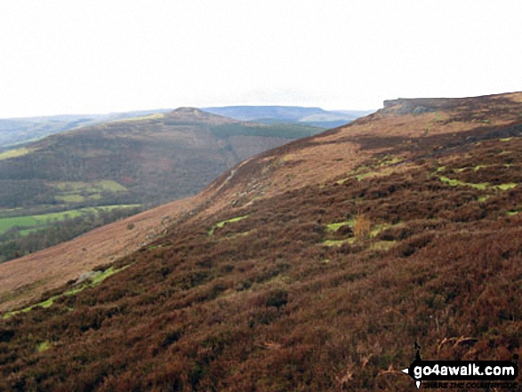
Winhill Pike (Win Hill) and Bamford Edge from the lower slopes of Bamford Moor
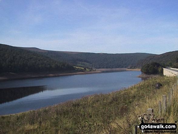

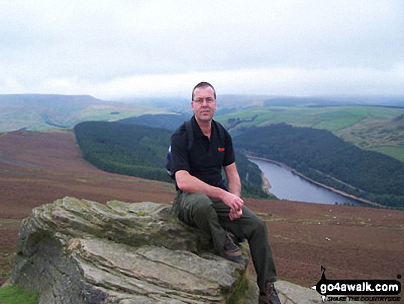
Lose Hill (Ward's Piece) and Ladybower Reservoir from Winhill Pike (Win Hill)

Winhill Pike (Win Hill), Ladybower Reservoir and Crook Hill from Dovestones Tor, Derwent Edge
. . . see all 37 walk photographs & pictures of views from, on, or of, Winhill Pike (Win Hill)
Send us your photographs and pictures on, of, or from Winhill Pike (Win Hill)
If you would like to add your walk photographs and pictures to this page, please send them as email attachments (configured for any computer) along with your name to:
and we shall do our best to publish them.
(Guide Resolution = 300dpi. At least = 660pixels (wide) x 440 pixels (high).)

You can also submit photos via our Facebook Page.
NB. Please indicate where each photo was taken and whether you wish us to credit your photos with a Username or your First Name/Last Name.


