
![]()
Windy Gyle
619m (2031ft)
The Scottish Borders, Northumberland National Park, Northumberland, England /Scotland
Since Windy Gyle lies on the border between England & Scotland it has the distinction of being classified as an English Mountain (Hewitt), an English Nuttall and a Scottish Donald.
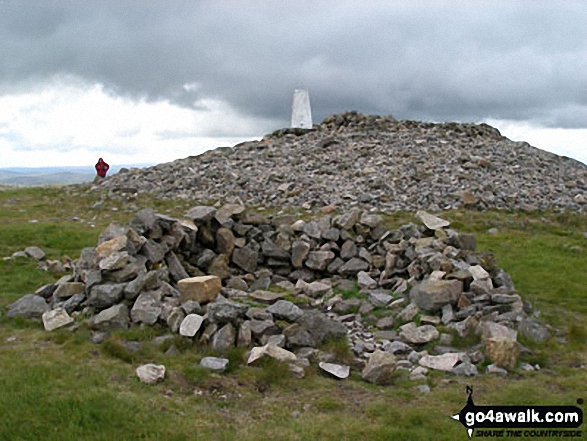
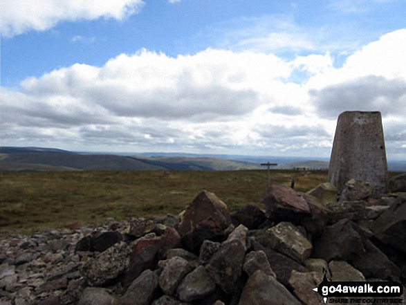
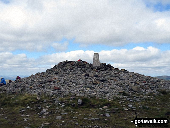
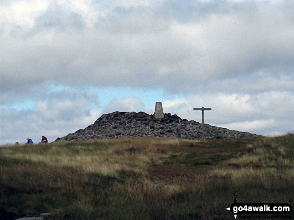
The summit of Windy Gyle is marked by an Ordnance Survey Trig Point & a huge cairn (on the Scottish side of the border).
You can find Windy Gyle & all the walks that climb it on these unique free-to-access Interactive Walk Planning Maps: (click/TAP to select)
1:25,000 scale OS Explorer Map (the ones with orange/yellow covers):
1:50,000 scale OS Landranger Map (the ones with pink/magenta covers):
See Windy Gyle and the surrounding tops on our free-to-access 'Google Style' Peak Bagging Maps:
A go4awalk.com downloadable PDF Peak Bagging Map featuring Windy Gyle should be available soon.
   |
|---|
Vital Statistics:
| Length: | 7.5ml (12km) |
|---|---|
| Ascent: | 1,753ft (534m) |
| Time: | 4½ hrs |
| Grade: |  (Moderate) (Moderate) |
Route Summary:
Rowhope Burn Bridge - River Coquet - Hindside Knowe - The Street - Swineside Law - Black Braes - Windy Rigg Top - Windy Gyle - Trows Burn - Rowhope Burn - Rowhope Burn Bridge
|
|---|
Vital Statistics:
| Length: | 9.5ml (15km) |
|---|---|
| Ascent: | 2,009ft (612m) |
| Time: | 5½ hrs |
| Grade: |  (Moderate) (Moderate) |
Route Summary:
Wedder Leap - River Coquet - Rowhope Burn - Trows Burn - Windy Gyle - The Pennine Way - Hazely Law - Hepden Burn - Clennel St - Middle Hill - Fairhaugh - Barrow Burn - Barrowburn.
|
|---|
Vital Statistics:
| Length: | 11.25ml (18km) |
|---|---|
| Ascent: | 2,311ft (704m) |
| Time: | 6½ hrs |
| Grade: | (Moderate) |
Route Summary:
Wedder Leap - River Coquest - Rowhope Burn - Hindside Knowe - The Street - Swineside Law - Black Braes - Windy Rigg Top - Windy Gyle - Hazely Law - Usway Burn - Middle Hill - Fairhaugh - Barrow Burn - Barrowburn.
 Fellow go4awalkers who have already walked, climbed, summited & bagged Windy Gyle
Mark Smith walked up Windy Gyle on August 26th, 2010 [from/via/route] pennine way [weather] hot & sunny
Caroline Winter climbed Windy Gyle on July 27th, 2021 [from/via/route] Wedder Leap CP, Middle Hill, Little Ward Law, Windy Gyle, Pennine Way, forest to Salters Road, Bloody Bush Edge, Cushats Law, Bloody Bush Edge, Bills Sike, Uswayford, Peat Sike, Middle Hill, CP [with] Becky & Andy [weather] Muggy, heat build up, cloudy, rain 1 minute after return to car. - Forecast thunder, but on morning rechecked & now, not coming in till evening. 9.5 hr walking. Forest before Windy Gyle no through route, as trees fallen. Flies persistent & a nuisance.
Mark Dixon bagged Windy Gyle during November, 1990 [with] Caroline Dodds - On skis
Kevin Foster hiked Windy Gyle on November 4th, 2018 [from/via/route] Walk n109 Windy Gyle from Rowhope Burn Bridge [with] Henry. [weather] Cloudy - An easy & enjoyable walk on good paths throughout. Windy Gyle is a fine top with extensive views in all directions. One other thing 'SHUT THE GATE'! This made me laugh because it was on every single gate I came across in large letters.
Andy Jakob summited Windy Gyle during August, 1985 [from/via/route] pennine way [with] Edith
David Wand conquered Windy Gyle on May 29th, 2001 [with] Gayle [weather] Rained in the night but dry for the walk & a light breeze
Chris Faulkner scaled Windy Gyle on July 14th, 2016 [from/via/route] Pennine Way [with] Michelle chandler [weather] Dry
Robert Shaw walked up Windy Gyle on May 10th, 2013 [from/via/route] Bagged on the Pennine Way between the 10th & 24th May 2013. [weather] Various !! - 15 days of mainly fun.
Jeanette Coward climbed Windy Gyle on September 30th, 2016 [from/via/route] Rowhope Burn [weather] Lovey autumnal day
Ian Barker bagged Windy Gyle on August 15th, 2014 [with] Peter Godfrey - Pennine Way
To add (or remove) your name and experiences on this page - Log On and edit your Personal Mountain Bagging Record
. . . [see more walk reports]
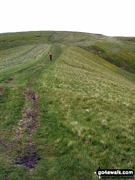
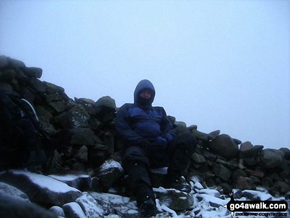
More Photographs & Pictures of views from, on or of Windy Gyle
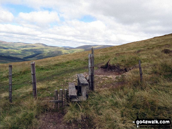
Stile over the border fence between England and Scotland on the way to Windy Gyle
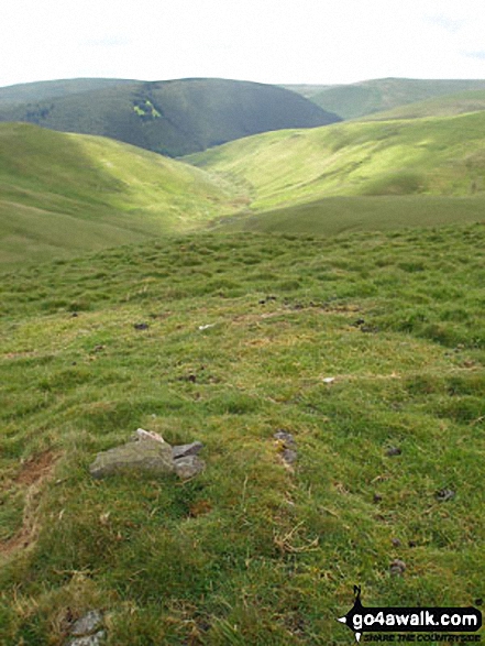
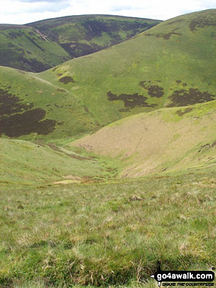
Swineside Law (left) and Black Braes (right) with Mozie Law (back left) and Windy Gyle (back right) from Hindside Knowe
. . . see just 20 walk photographs & pictures of views from, on or of Windy Gyle
Send us your photographs and pictures on, of, or from Windy Gyle
If you would like to add your walk photographs and pictures featuring views from, on or of Windy Gyle to this page, please send them as email attachments (configured for any computer) along with your name to:
and we shall do our best to publish them.
(Guide Resolution = 300dpi. At least = 660pixels (wide) x 440 pixels (high).)

You can also submit photos via our Facebook Page.
NB. Please indicate where each photo was taken.


