
![]()
Renwick Fell (Thack Moor)
609m (2000ft)
The North Pennines, Cumbria, England
Renwick Fell (Thack Moor) was reclassified from a 'Dewey' to a Mountain (Hewitt) and 'Nuttall' in April 2013. Formerly thought to be fractionally under the 609.6m (2000ft) required for mountain status, the Ordnance Survey has confirmed the height to be 609.62m (2000ft and 3/4 inch).
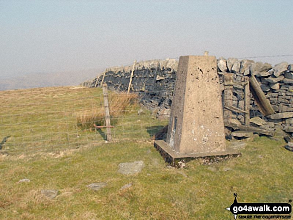
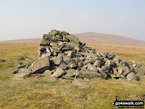
The summit of Renwick Fell (Thack Moor) is marked by an Ordnance Survey Trig Point.
You can find Renwick Fell (Thack Moor) & all the walks that climb it on these unique free-to-access Interactive Walk Planning Maps: (click/TAP to select)
1:25,000 scale OS Explorer Map (the ones with orange/yellow covers):
1:50,000 scale OS Landranger Map (the ones with pink/magenta covers):
Renwick Fell (Thack Moor) on our free-to-access 'Google Style' Peak Bagging Map:
See Renwick Fell (Thack Moor) and the surrounding tops on our downloadable PDF Peak Bagging Map:
   |
|---|
Vital Statistics:
| Length: | 4mls (6.5km) |
|---|---|
| Ascent: | 1,293ft (394m) |
| Time: | 2.75hrs |
| Grade: |  (Moderate) (Moderate) |
|
|---|
Vital Statistics:
| Length: | 10.25ml (16.5km) |
|---|---|
| Ascent: | 2,002ft (610m) |
| Time: | 5.75hrs |
| Grade: |  (Moderate) (Moderate) |
Route Summary:
Renwick - Townend - Renwick Fell (Thack Moor) - Watch Hill (Graystone Edge) - Black Fell (Haresceugh Fell) - Little Daffenside - Hartside Height - Hartside Top Cafe (A686) - Ricker Gill - Seavy Sike - Haresceugh - Raven Bridge - Townfoot - Renwick
 Fellow go4awalkers who have already walked, climbed, summited & bagged Renwick Fell (Thack Moor)
Caroline Winter walked up Renwick Fell (Thack Moor) on September 2nd, 2022 [from/via/route] Parked by church in Renwick, road to track, wide grassy track to wall at top, over north side, Renwick Fell [with] Becky [weather] Warm & dry afternoon - On Way up Spotted track to right along Green Rigg, which we planned to return on. Mistaken in thinking we could head along fence line east of Watch Hill. Track disappeared & long, unpassable grasses, so needed to wade through to track we came up on. Good views to North Lakes fells
Sam Jones climbed Renwick Fell (Thack Moor) on March 25th, 2022 [from/via/route] From Renwick whilst geocaching [with] Solo [weather] mix of sun & cloud - Awesome views good visibility
Mark Davidson bagged Renwick Fell (Thack Moor) on March 23rd, 2007 [from/via/route] Walk c337 Black Fell (Haresceugh Fell) & Benty Hill from Hartside Top Cafe [with] Alone [weather] Bright & sunny - lovely summer's day - Loved it (loved it!)
Kevin Foster hiked Renwick Fell (Thack Moor) on May 15th, 2018 [from/via/route] Renwick [with] Henry [weather] Sunny - I met a local man as I approached the top of the fell who said I was the first person he had seen on his many visits up here. However, he did go on to say that there hadn't been a path before & now there was one. A direct & fairly easy ascent from Renwick (park near the church near Outhwaite lane for the start of the walk).
Christine Shepherd summited Renwick Fell (Thack Moor) on January 22nd, 2017 [from/via/route] Walked straight up & back on the path from Renwick. [with] On my own [weather] Cold but calm, snowy on the top - The sun was just setting & the fell was bathed in red light as I approached it. I was heralded back to my car by Renwick church bells. A great little fell to climb after doing Cold Fell in the morning.
Darren Mortimer conquered Renwick Fell (Thack Moor) on February 27th, 2016 [from/via/route] Renwick [with] Dermot Palmer
Ray O'hara scaled Renwick Fell (Thack Moor) on June 25th, 2013 [from/via/route] C448 [weather] Sunny - Nice easy ascent & descent, no real bogs. A very pleasant walk with great views across to the Lake District
Patrick Rogozinski and Matthew Thomas have both walked, climbed & bagged Renwick Fell (Thack Moor).
To add (or remove) your name and experiences on this page - Log On and edit your Personal Mountain Bagging Record
More Photographs & Pictures of views from, on or of Renwick Fell (Thack Moor)
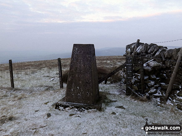
Renwick Fell (Thack Moor) summit Trig Point under a light dusting of snow
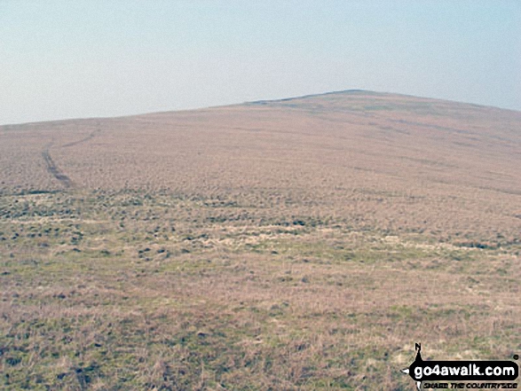
Currick near the summit of Watch Hill (Graystone Edge) with Renwick Fell (Thack Moor) in the background
Send us your photographs and pictures on, of, or from Renwick Fell (Thack Moor)
If you would like to add your walk photographs and pictures featuring views from, on or of Renwick Fell (Thack Moor) to this page, please send them as email attachments (configured for any computer) along with your name to:
and we shall do our best to publish them.
(Guide Resolution = 300dpi. At least = 660pixels (wide) x 440 pixels (high).)

You can also submit photos via our Facebook Page.
NB. Please indicate where each photo was taken.


