
![]()
Baystones (Wansfell)
488m (1601ft)
The Far Eastern Fells, The Lake District, Cumbria, England
Baystones (Wansfell) was promoted to Marilyn status in 2001 but demoted again in 2010.
You can find Baystones (Wansfell) & all the walks that climb it on these unique free-to-access Interactive Walk Planning Maps: (click/TAP to select)
1:25,000 scale OS Explorer Map (the ones with orange/yellow covers):
1:50,000 scale OS Landranger Map (the ones with pink/magenta covers):
See Baystones (Wansfell) and the surrounding tops on our free-to-access 'Google Style' Peak Bagging Maps:
See Baystones (Wansfell) and the surrounding tops on our downloadable PDF Peak Bagging Maps:
*Walk & bag all 36 Wainwrights in The Far Eastern Fells area of The Lake District in just 8 easy-to-follow circular walks.
*This version is marked with the walk routes you need to follow to Walk all 214 Wainwrights in just 59 walks. Click here for more information.
NB: Whether you print off a copy on to paper or download it to your phone, these PDF Peak Baggers Maps will prove incredibly useful when your are up there on the tops and you cannot get a phone signal!
   |
|---|
Vital Statistics:
| Length: | 5mls (8km) |
|---|---|
| Ascent: | 1,769ft (539m) |
| Time: | 3.75hrs |
| Grade: |  (Moderate) (Moderate) |
Route Summary:
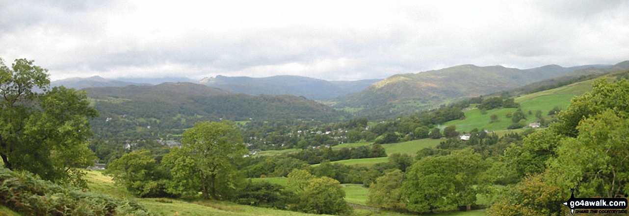
Ambleside - Stockghyll Force - Wansfell Pike - Baystones (Wansfell) - Wansfell Pike - Stockghyll Force - Ambleside
|
|---|
Vital Statistics:
| Length: | 6ml (9.5km) |
|---|---|
| Ascent: | 2,192ft (668m) |
| Time: | 5 hrs |
| Grade: |  (Moderate) (Moderate) |
Route Summary:
Ambleside - Stockghyll Force - Wansfell Pike - Baystones (Wansfell) - The Hundreds - Nanny Lane - Troutbeck - Robin Lane - High Skelghyll Farm - Skelghyll Wood - Jenkin Crag - Ambleside
 Fellow go4awalkers who have already walked, climbed, summited & bagged Baystones (Wansfell)
James Hughes walked up Baystones (Wansfell) on February 12th, 2024 [from/via/route] From Ambleside back via Troutbeck. Boggy in places. [weather] Mostly dry with sunny spells. Windy at top. - Walked Loughrigg Fell after & then topped off with pint & stew at The Temperance Inn. Meal deal from Tesco.
Christine Shepherd climbed Baystones (Wansfell) on September 20th, 2008 [from/via/route] Walked from Ambleside using walk c412 [with] Friends Karen and Stella [weather] Fine but boggy underfoot. - Climbed again with the Mountain bagging group on 12.1.20. This was an add on after bagging Sour Howes & Sallows Climbed again 27.04.2022 from Troutbeck.Solo
David Higginbottom bagged Baystones (Wansfell) on October 9th, 2023 [from/via/route] From Troutbeck church up & down 8k [with] Carolyn [weather] Good
Claire Rigg hiked Baystones (Wansfell) on January 30th, 2022 [with] Heidi [weather] Sunny
Dan Collins summited Baystones (Wansfell) on July 20th, 2023 [from/via/route] As part of c177 Wansfell walk [with] Family (just the lads) [weather] Lovely & sunny
Steve Lucas conquered Baystones (Wansfell) on June 1st, 2022 [with] On my own
hannah1507 scaled Baystones (Wansfell) on April 13th, 2023 [from/via/route] Walked from YHA Windermere [with] Lilly
Richard Fulcher walked up Baystones (Wansfell) on March 7th, 2023 [from/via/route] Parked near the church in Troutbeck & followed the path at the back of the church up to the village near Margaret's Well. We then took Nanny Lane up the hillside to Baystones (Wansfell) before traversing across the ridge to Wansfell Pike. We then followed the path down to join with Nanny Lane & back to the village. Had a pint of Wainwright's & Jen had 1/2 a pint of lager (£10 !!). This was a leisurely tramp with several stops for coffee & food. [with] Jen [weather] Cold, slight breeze gusting at times but very bright & sunny. - Next time I'd try the route through Skelgyll woods via the Aquaduct observatory.
Tim Winn climbed Baystones (Wansfell) on November 6th, 2022 [from/via/route] Thirlmere [with] Steve, John, Mike and Dave [weather] Cloudy
Ian Ashton bagged Baystones (Wansfell) on June 4th, 2022 [from/via/route] From trout beck inuding wansfell & wansfell pike. [with] Jack Liam Wife Joe H Joe C
To add (or remove) your name and experiences on this page - Log On and edit your Personal Mountain Bagging Record
. . . [see more walk reports]
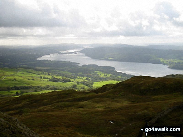
More Photographs & Pictures of views from, on or of Baystones (Wansfell)
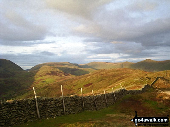
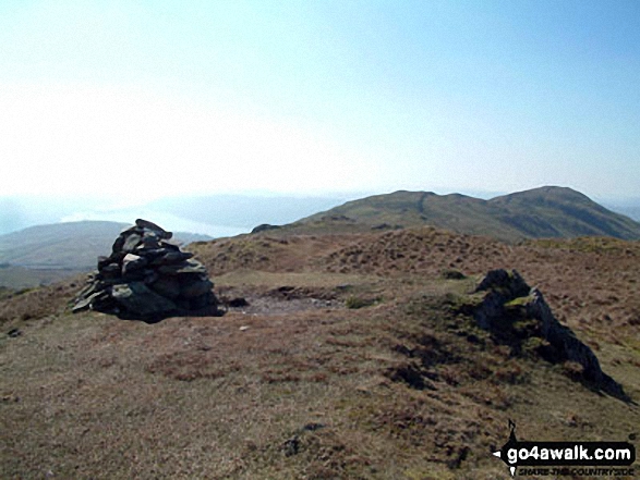
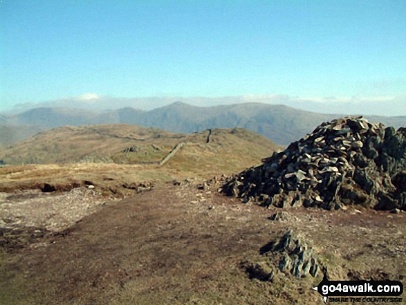
Red Screes (left), Thornthwaite Crag, Froswick, Ill Bell and Yoke from Baystones (Wansfell)
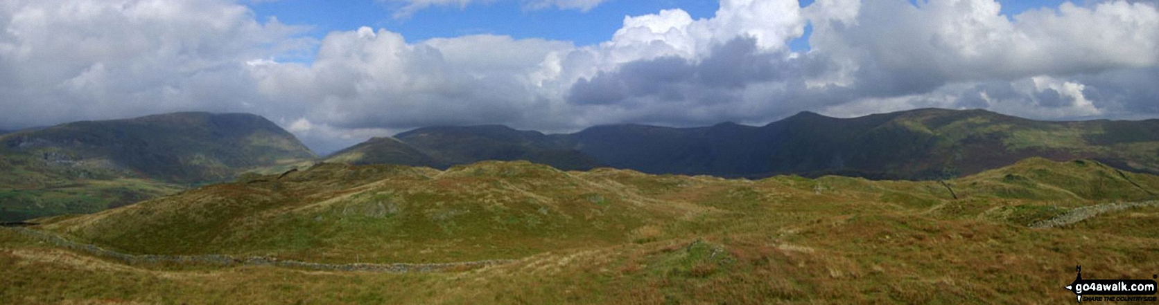
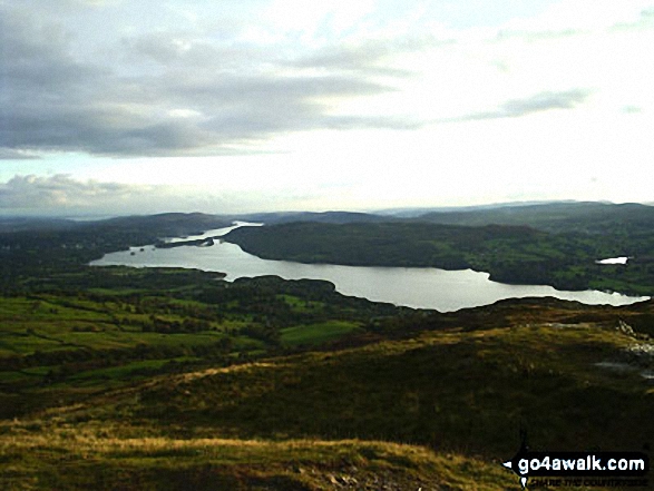
*Baystones (Wansfell) in the foreground with Red Screes (left), Stony Cove Pike (Caudale Moor), Thornthwaite Crag and the Froswick, Ill Bell, Yoke ridge silhouetted on the skyline from Wansfell Pike
Send us your photographs and pictures on, of, or from Baystones (Wansfell)
If you would like to add your walk photographs and pictures featuring views from, on or of Baystones (Wansfell) to this page, please send them as email attachments (configured for any computer) along with your name to:
and we shall do our best to publish them.
(Guide Resolution = 300dpi. At least = 660pixels (wide) x 440 pixels (high).)

You can also submit photos via our Facebook Page.
NB. Please indicate where each photo was taken.


