
![]()
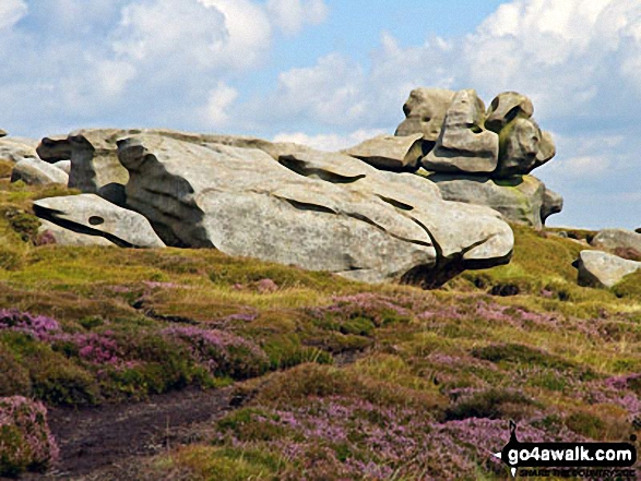
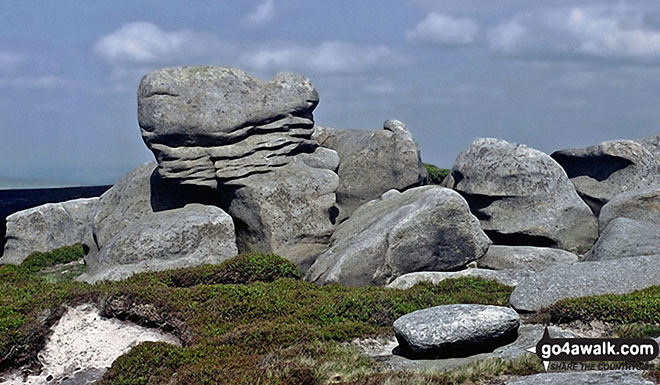
Barrow Stones
591m (1940ft)
The Dark Peak Area, The Peak District, Derbyshire, England
Not familiar with this top?
You can walk/hike to the top of Barrow Stones by using either of these 2 easy‑to‑follow route maps:
Walk d164 Barrow Stones, Grinah Stones, Bleaklow Stones and Bleaklow Head (Bleaklow Hill) from Woodhead
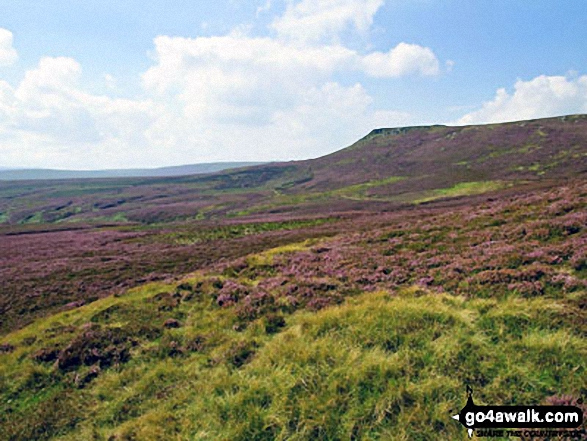
High remote moorland - glorious
   |
|---|
Vital Statistics:
| Length: | 13.25mls (21km) |
|---|---|
| Ascent: | 2,081ft (634m) |
| Time: | 7 hrs |
| Grade: |  (Hard) (Hard) |
Route Summary:
Woodhead Tunnel - Far Black Clough - Swains Head - Swains Greave - Barrow Stones - Grinah Stones - Bleaklow Stones (Bleaklow Hill) - Bleaklow Head (Bleaklow Hill) - The Wain Stones (or Kissing Stones) - The Pennine Way - Joseph Patch - John Track Well - Torside Clough - Peaknaze Moor - Reaps Farm - The Longdendale Trail - Torside Reservoir - Woodhead Reservoir - Woodhead Tunnel
Walk d114 Alport Castles and Bleaklow Stones from Fairholmes Car Park, Ladybower Reservoir
Rough & wild with one steep ascent
|
|---|
Vital Statistics:
| Length: | 16.5ml (26.5km) |
|---|---|
| Ascent: | 2,604ft (794m) |
| Time: | 8½ hrs |
| Grade: |  (Hard) (Hard) |

Route Summary:
Ladybower Reservoir - Fairholmes Car Park - Derwent Reservoir - Howden Reservoir - Fagney Clough - Ridgewalk Moor - Barrow Stones - Bleaklow Stones (Bleaklow Hill) - Alport Moor - West End Moor - Birchin Hat - Alport Castles - Rowlee Pasture - Lockerbrook Heights - Lockerbrook Farm - Fairholmes Car Park - Ladybower Reservoir
See Barrow Stones and the surrounding tops on our free-to-access 'Google Style' Peak Bagging Maps:
The Dark Peak Area of The Peak District National Park
Less data - quicker to download
See Barrow Stones and the surrounding tops on our unique, downloadable, PDF Peak Bagging Map:

NB: Whether you print off a copy or download it to your phone, this PDF Peak Baggers' Map might prove incredibly useful when your are up there on the tops and you cannot get a phone signal.
You can find Barrow Stones & all the walks that climb it on these unique free-to-access Interactive Walk Planning Maps:
1:25,000 scale OS Explorer Map (orange/yellow covers):
1:50,000 scale OS Landranger Map (pink/magenta covers):
 Fellow go4awalkers who have already walked, climbed, scaled, summited, hiked & bagged Barrow Stones
Nicola Parkinson walked up Barrow Stones on February 22nd, 2014 [from/via/route] d164 from Woodhead Tunnels [with] Stu [weather] Cold
Robert Logan climbed it on June 4th, 2011 [from/via/route] Fairholmes, Howden Reservoir, Ridgewalk Moor, Round Hill, Barrow Stones, Grinah Stones, Bleaklow Stones, Bleaklow, The Rdge, Alport Castles, Rowlee Pasture [with] Judith Logan [weather] Overcast, Warm
Mark Davidson has walked, climbed & bagged Barrow Stones.
To add (or remove) your name and experiences on this page - Log On and edit your Personal Mountain Bagging Record
More Photographs & Pictures of views from, on, or of, Barrow Stones

Send us your photographs and pictures on, of, or from Barrow Stones
If you would like to add your walk photographs and pictures to this page, please send them as email attachments (configured for any computer) along with your name to:
and we shall do our best to publish them.
(Guide Resolution = 300dpi. At least = 660pixels (wide) x 440 pixels (high).)

You can also submit photos via our Facebook Page.
NB. Please indicate where each photo was taken and whether you wish us to credit your photos with a Username or your First Name/Last Name.


