
![]()
Calders
675m (2216ft)
The Howgill Fells, The Yorkshire Dales, Cumbria, England
You can find Calders & all the walks that climb it on these unique free-to-access Interactive Walk Planning Maps: (click/TAP to select)
1:25,000 scale OS Explorer Map (the ones with orange/yellow covers):
1:50,000 scale OS Landranger Map (the ones with pink/magenta covers):
See Calders and the surrounding tops on our free-to-access 'Google Style' Peak Bagging Maps:
See Calders and the surrounding tops on our downloadable PDF Peak Bagging Map:
   |
|---|
Vital Statistics:
| Length: | 6ml (9.5km) |
|---|---|
| Ascent: | 1,946ft (593m) |
| Time: | 4½ hrs |
| Grade: |  (Moderate) (Moderate) |
Route Summary:
The Cross Keys - River Rawthey - Cautley Holme Beck - Cautley Spout - Cautley Crag - Great Dummacks - Little Dummacks - Calders - Bram Rigg Top - The Calf - Bowderdale Beck - Bowderdale Head - Cautley Holme Beck - The Cross Keys
|
|---|
Vital Statistics:
| Length: | 6.5ml (10.5km) |
|---|---|
| Ascent: | 2,612ft (796m) |
| Time: | 5 hrs |
| Grade: |  (Moderate) (Moderate) |
Route Summary:
The Cross Keys - River Rawthey - Cautley Holme Beck - Cautley Spout - Cautley Crag - Great Dummacks - Little Dummacks - Calders - Bram Rigg Top - The Calf - Bowderdale Beck - Bowderdale Head - Yarlside - Ben End - The Cross Keys
|
|---|
Vital Statistics:
| Length: | 8ml (12.5km) |
|---|---|
| Ascent: | 3,485ft (1,062m) |
| Time: | 6½ hrs |
| Grade: |  (Hard) (Hard) |
Route Summary:
The Cross Keys - River Rawthey - Ben End - Yarlside - Kensgriff - Randygill Top - Bowderdale Beck - The Calf - Bram Rigg Top - Calders - Great Dummacks - Cautley Crag - Croonthard Brow - Cautley Holme Beck - River Rawthey - The Cross Keys
|
|---|
Vital Statistics:
| Length: | 9.5ml (15km) |
|---|---|
| Ascent: | 3,114ft (949m) |
| Time: | 6½ hrs |
| Grade: | (Hard) |
Route Summary:
Sedbergh - Settlebeck Gill - Winder Hill - Arant Haw - Calders - Bram Rigg Top - The Calf - White Fell Head - Long Rigg Beck - Ivy Crag - Eller Mire - Crosdale Beck - Nursery Wood - Lockbank Farm - Sedbergh
|
|---|
Vital Statistics:
| Length: | 11ml (17.5km) |
|---|---|
| Ascent: | 4,430ft (1,350m) |
| Time: | 8½ hrs |
| Grade: |  (Hard) (Hard) |
Route Summary:
Carlingill Bridge - The Howgills - Carlingill Beck - Carlin Gill - Screes of Black Force - Carlingill Spout - Blakethwaite Bottom - Docker Knott - Great Blea Gill - Simon's Seat (Howgills) - Langdale Beck (Howgills) - Hazelgill Knott - Bowderdale Beck - Bowderdale Head - Cautley Spout - Cautley Crag - Great Dummacks - Little Dummacks - Calders - Bram Rigg Top - The Calf - White Fell Head - Bush Howe - Windscarth Wyke - Breaks Head - Fell Head (Howgills) - Fell Head Scar - Linghaw - Knowles - Back Balk - Gibbet Hill - Carlingill Bridge - The Howgill Fells.
|
|---|
Vital Statistics:
| Length: | 11.5ml (18.5km) |
|---|---|
| Ascent: | 4,411ft (1,344m) |
| Time: | 8.75hrs |
| Grade: | (Hard) |
Route Summary:
The Cross Keys - River Rawthey - Ben End - Yarlside - Kensgriff - Randygill Top - Bowderdale Beck - The Calf - Bush Howe - Fell Head (Howgills) - The Calf - Bram Rigg Top - Calders - Cautley Crag - Croonthard Brow - Cautley Holme Beck - River Rawthey - The Cross Keys
 Fellow go4awalkers who have already walked, climbed, summited & bagged Calders
Karen Pecsvaradi walked up Calders on May 12th, 2022 [from/via/route] Sedbergh [with] C307 [weather] Cloudy & windy but dry - Took 5 hours
Caroline Winter climbed Calders on May 31st, 2021 [from/via/route] Cross keys pub, Ben End, Yarlside, Kensgriff, Randygill Top, Bowderdale Beck, The Calf, White Fell Head, Calders, Great Dummacks, Pickering Gill [with] Becky [weather] Excellent views. Warm & sunny. Windy on tops. - Long day with lots of ups & downs
Mark Davidson bagged Calders on June 8th, 2006 [from/via/route] Walk c347 The Howgill Fells 2000ft'ers [with] MK [weather] Sunny & dry - gorgeous!
Margaret Richards hiked Calders on October 25th, 2018 [from/via/route] c307 The Calf from Sedbergh [with] Don [weather] Very misty
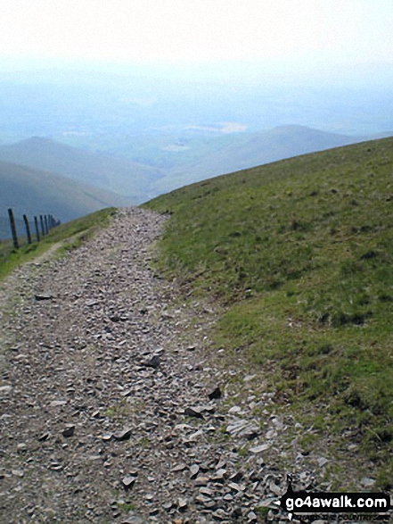
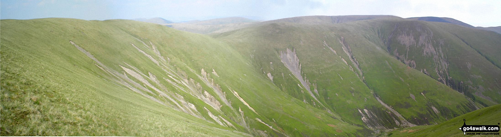
Kevin Foster summited Calders on September 19th, 2017 [from/via/route] The Cross Keys, Cautley [with] Diana and Henry [weather] Cloudy (Sunny in the breaks), no rain. - As we approached along the valley towards the waterfalls of Cautley Spout I thought to myself "I can't remember it being this steep". However, there is now a well engineered path which climbs up the right hand side of the waterfalls which, although steep, is a relatively easy climb. The stunning views of the waterfalls on your left more than compensate for the steep climbing. Soon we were crossing the stream above the falls to follow the path hugging the cliffs of Cautley Crag, with very impressive drops below & to the East. The best view of the day for me was from the top of Great Dummacks (end of Cautley Crag) looking back along the crags towards Bowderdale Head. From here it was a fairly level trudge over slightly boggy ground to the summit of Calders. Unfortunately, everywhere else was bathed in glorious sunlight whilst we were under a black cloud which made it feel pretty cold at times.However, spirits were well & truly lifted by the views South, Pen-Y-Ghent was particularly prominent, & West towards Morecambe Bay & the Irish Sea.
Tony Rogerson conquered Calders on May 7th, 2016 [from/via/route] Sedbergh Calders Bram Rigg Top The Calf Sedbergh [with] Caz Floss [weather] Warm Sunny intervals Breezy on tops
David Congreave scaled Calders on February 28th, 2015 [from/via/route] Cautley Spout
Darren Wilson walked up Calders on March 1st, 2015 [from/via/route] Cross Keys Calf Brim Rigg Calders [with] Anthony Ray Sean
Mark Purcell climbed Calders on February 12th, 2015 [with] MP
Christine Shepherd bagged Calders on April 20th, 2013 [from/via/route] Walked from The Cross Keys using walk c336 [with] On my own [weather] Sunny - Climbed this again 24.7.14 using walk c347.
To add (or remove) your name and experiences on this page - Log On and edit your Personal Mountain Bagging Record
. . . [see more walk reports]
More Photographs & Pictures of views from, on or of Calders
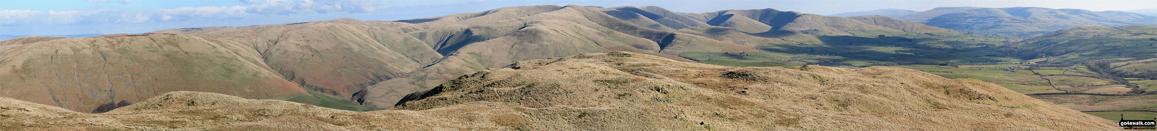
Blease Fell and The Howgill Fells 2000ft'ers - Randygill Top, The Calf, Calders and Fell Head (Howgills) - from Grayrigg Pike (Grayrigg Forest) summit
Send us your photographs and pictures on, of, or from Calders
If you would like to add your walk photographs and pictures featuring views from, on or of Calders to this page, please send them as email attachments (configured for any computer) along with your name to:
and we shall do our best to publish them.
(Guide Resolution = 300dpi. At least = 660pixels (wide) x 440 pixels (high).)

You can also submit photos via our Facebook Page.
NB. Please indicate where each photo was taken.


