
![]()
Atkinson Pike
845m (2773ft)
The Northern Fells, The Lake District, Cumbria, England
You can find Atkinson Pike & all the walks that climb it on these unique free-to-access Interactive Walk Planning Maps: (click/TAP to select)
1:25,000 scale OS Explorer Map (the ones with orange/yellow covers):
1:50,000 scale OS Landranger Map (the ones with pink/magenta covers):
See Atkinson Pike and the surrounding tops on our free-to-access 'Google Style' Peak Bagging Maps:
See Atkinson Pike and the surrounding tops on our downloadable PDF Peak Bagging Maps:
*Walk & bag all 24 Wainwrights in The Northern Fells area of The Lake District in just 7 easy-to-follow circular walks.
*This version is marked with the walk routes you need to follow to Walk all 214 Wainwrights in just 59 walks. Click here for more information.
NB: Whether you print off a copy on to paper or download it to your phone, these PDF Peak Baggers Maps will prove incredibly useful when your are up there on the tops and you cannot get a phone signal!
   |
|---|
Vital Statistics:
| Length: | 5.25ml (8.5km) |
|---|---|
| Ascent: | 2,255ft (687m) |
| Time: | 4½ hrs |
| Grade: |  (Moderate) (Moderate) |
Route Summary:
Scales - Mousthwaite Comb - Scales Fell - Brunt Knott - Scales Beck - Scales Tarn - Sharp Edge - Atkinson Pike - Blencathra or Saddleback (Hallsfell Top) - Scales Fell - Mousthwaite Comb - Scales
|
|---|
Vital Statistics:
| Length: | 6.25ml (10km) |
|---|---|
| Ascent: | 2,565ft (782m) |
| Time: | 4.75hrs |
| Grade: |  (Moderate) (Moderate) |
Route Summary:
Scales - Mousthwaite Comb - Scales Fell - Brunt Knott - Scales Beck - Scales Tarn - Sharp Edge - Atkinson Pike - Blencathra or Saddleback (Hallsfell Top) - Gategill Fell Top - Knowe Crag (Blease Fell) - Scales
|
|---|
Vital Statistics:
| Length: | 9.5ml (15km) |
|---|---|
| Ascent: | 3,070ft (936m) |
| Time: | 6½ hrs |
| Grade: |  (Hard) (Hard) |
Route Summary:
Mungrisdale - Souther Fell - River Glendermackin - Brunt Knott - Scales Beck - Scales Tarn - Sharp Edge - Atkinson Pike - Blencathra or Saddleback (Hallsfell Top) - Foule Crag - Bannerdale Crags - Bowscale Fell - Tarn Crags Top - Raven Crags - Mungrisdale
|
|---|
Vital Statistics:
| Length: | 11ml (17.5km) |
|---|---|
| Ascent: | 3,264ft (995m) |
| Time: | 7.25hrs |
| Grade: | (Hard) |
Route Summary:
Mungrisdale - Souther Fell - River Glendermackin - Brunt Knott - Scales Beck - Scales Tarn - Sharp Edge - Atkinson Pike - Blencathra or Saddleback (Hallsfell Top) - Mungrisdale Common - Bannerdale Crags - Bowscale Fell - Tarn Crags Top - Raven Crags - Mungrisdale
 Fellow go4awalkers who have already walked, climbed, summited & bagged Atkinson Pike
Paul Macey walked up Atkinson Pike on July 20th, 2023 [from/via/route] Using Walk 245 [weather] Mostly sunny some cloud towards end but not much 19 degrees at finish
Christine Shepherd climbed Atkinson Pike on April 23rd, 2006 [from/via/route] Walked from Scales Climbed again 10.08.2021 using walk c245 Repeated walk c245 on 3.4.2023 [with] Rebecca [weather] Cool but sunny
Rob Bennion bagged Atkinson Pike on January 2nd, 2023 [from/via/route] Cold, Clear, with Snow [with] Luke Bennion [weather] Cold, Clear, with Snow
Julie Besbrode hiked Atkinson Pike on August 4th, 2021 [with] Damian, Sam, Robin, Oli & Cameron (Oli's friend) [weather] Warm & sunny
Kevin Foster summited Atkinson Pike on April 13th, 2021 [from/via/route] Hallsfell Top [with] By myself [weather] Sunny to start but clouding over later. Clear visibility on tops. Cold when you stopped moving. - Another easy saunter from Hallsfell Top (this time in a sort of north easterly direction). A memorial cross marked out with white stones is a point of interest en route just after the tarn-let. It's worth making the detour right to the top of Sharp Edge for the dramatic aerial views even if not making a descent that way. I chickened out of the descent this way (I have done Sharp Edge in ascent many years ago I hasten to add) & headed off for the col dividing Blackhazel Beck from the Glenderamackin River. At the col I took the right sided path down the valley (as I had used the left sided path on the approach to Bannerdale Crags last November). As I reached the outflow from Scales Tarn I was sorely tempted to climb back up the stony path & have another go at Sharp Edge but time pressures prevailed so I carried on the track to Mousthwaite Comb vowing I'd return someday. This walk completed my Northern Fells section of the Nuttalls list.Only the Western & Southern Fells to go. However these two sections are the largest by some margin with 29 & 45 separate tops respectively!
Bill Salisbury conquered Atkinson Pike on August 27th, 2019 [from/via/route] Scales [with] Sue
Mark Davidson scaled Atkinson Pike on September 22nd, 2006 [with] Alone [weather] Lovely & sunny & dry
Stephen Eddy walked up Atkinson Pike on June 12th, 2015 [from/via/route] Scales via sharp edge [with] Mike Woodhouse, Tony Harris, Neil Whitehead [weather] Sunny
Lynn Symonds climbed Atkinson Pike on June 15th, 2014 [from/via/route] Mungrisdale [with] Nicole [weather] Some cloud but dry
Darren Mortimer bagged Atkinson Pike on November 10th, 2013 [from/via/route] Scales [with] Dermot Palmer
To add (or remove) your name and experiences on this page - Log On and edit your Personal Mountain Bagging Record
. . . [see more walk reports]
More Photographs & Pictures of views from, on or of Atkinson Pike
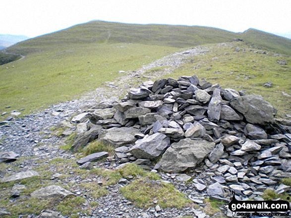
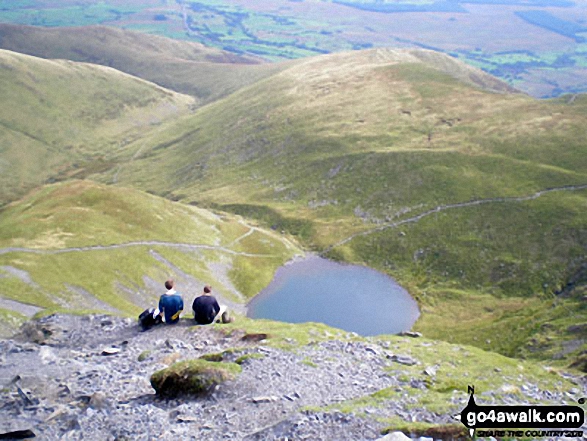
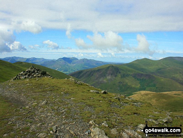
Scales Tarn from Atkinson Pike at the top of Sharp Edge, Blencathra (or Saddleback)
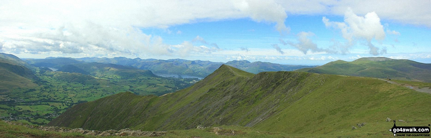
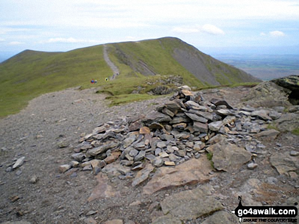
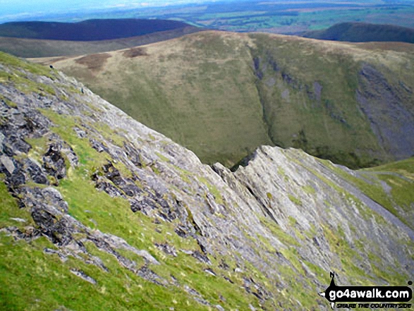
Hallsfell Top Ridge rising to Hallsfell Top (the summit of Blencathra or Saddleback) from Atkinson Pike at the top of Sharp Edge
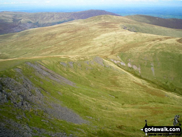
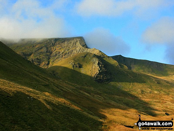
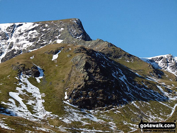
Blencathra (or Saddleback) (centre left distance) behind Atkinson Pike (centre right) with Sharp Edge prominent (mid left) from an unfamiliar viewpoint on Bowscale Fell
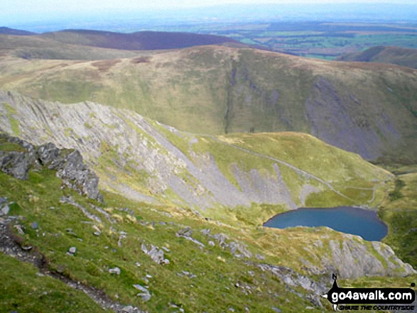
Sharp Edge and Scales Tarn from Atkinson Pike, Blencathra (or Saddleback)
Send us your photographs and pictures on, of, or from Atkinson Pike
If you would like to add your walk photographs and pictures featuring views from, on or of Atkinson Pike to this page, please send them as email attachments (configured for any computer) along with your name to:
and we shall do our best to publish them.
(Guide Resolution = 300dpi. At least = 660pixels (wide) x 440 pixels (high).)

You can also submit photos via our Facebook Page.
NB. Please indicate where each photo was taken.


