
![]()
Sir William Hill
429m (1407ft)
The White Peak Area, The Peak District, Derbyshire, England
Tap/mouse over a coloured circle (1-3 easy walks, 4-6 moderate walks, 7-9 hard walks) and click to select.
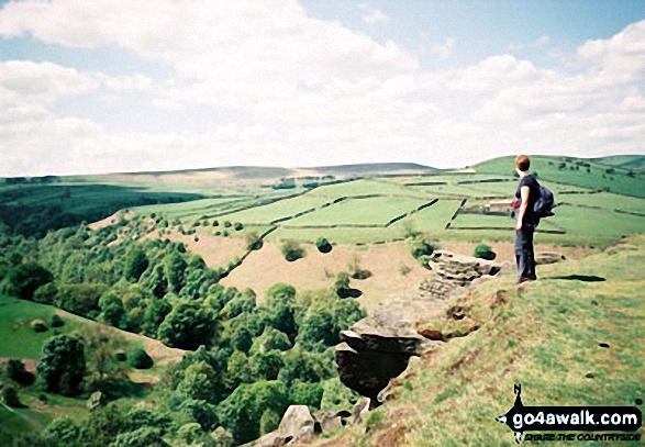
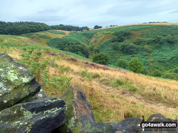
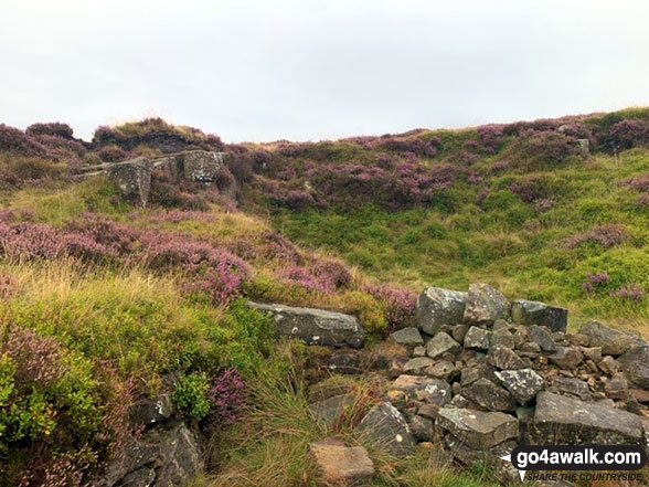
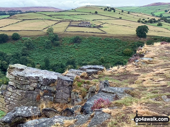
The summit of Sir William Hill is marked by an Ordnance Survey Trig Point.
You can find Sir William Hill & all the walks that climb it on these unique free-to-access Interactive Walk Planning Maps: (click/TAP to select)
1:25,000 scale OS Explorer Map (the ones with orange/yellow covers):
1:50,000 scale OS Landranger Map (the ones with pink/magenta covers):
See Sir William Hill and the surrounding tops on our free-to-access 'Google Style' Peak Bagging Maps:
See Sir William Hill and the surrounding tops on our downloadable PDF Peak Bagging Map:
   |
|---|
Vital Statistics:
| Length: | 6.25ml (10km) |
|---|---|
| Ascent: | 1,246ft (380m) |
| Time: | 3½ hrs |
| Grade: |  (Moderate) (Moderate) |
Route Summary:
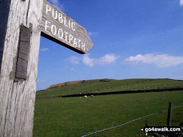
Eyam - Sir William Hill - Eyam Moor - Bole Hill (Highlow) - Stoke Ford - Abney Clough - Abney - Cockey Farm - Bretton Clough - Bretton - Eyam
|
|---|
Vital Statistics:
| Length: | 7ml (11km) |
|---|---|
| Ascent: | 1,342ft (409m) |
| Time: | 3.75hrs |
| Grade: | (Moderate) |
Route Summary:
Bretton - Bretton Clough - Cockey Farm - Abney - Abney Clough - Stoke Ford - Mill Wood - Highlow Brook - Tor Farm - Hazelford - Leam - Eyam Moor - Sir William Hill - Bretton
|
|---|
Vital Statistics:
| Length: | 9.75ml (15.5km) |
|---|---|
| Ascent: | 2,074ft (632m) |
| Time: | 6 hrs |
| Grade: |  (Moderate) (Moderate) |
Route Summary:
Stoney Middleton - The Cliff - Eyam - Sir William Hill - Eyam Moor - Bole Hill (Highlow) - Bretton Brook - Stoke Ford - Mill Wood - Brook Wood - Highlow Brook - Hazleford - Hazleford Hall - Leadmill - Leadmill Bridge - River Derwent - The Derwent Valley Heritage Way - Coppice Wood - Burbage Brook - Grindleford - Horse Hay Coppice - Derwent Farm - Froggatt Bridge - Knouchley Farm - Stoney Middleton
|
|---|
Vital Statistics:
| Length: | 9.75ml (15.5km) |
|---|---|
| Ascent: | 1,697ft (517m) |
| Time: | 5.25hrs |
| Grade: | (Moderate) |
Route Summary:
Eyam - Foolow - Eyam Edge - Bretton - Bretton Clough - Abney Clough - Stoke Ford - Mill Wood - Brook Wood - Hazelford - Leam - Eyam Moor - Sir William Hill - Eyam
 Fellow go4awalkers who have already walked, climbed, summited & bagged Sir William Hill
Adrian Garside walked up Sir William Hill on August 9th, 2021 [from/via/route] I parked to the west & just walked up to the stile & then the trig. The views are 360 degrees & awesome. This is like a tourist peak. I will visiit again, not least becuase there is a pub in Bretton that looks awesome for a summers beer [with] on my own [weather] to the South - sunny, approaching from the North West, storms. The Dark peaks looked dark! - bagged the trigpoint too.
Dave Gay climbed Sir William Hill on February 6th, 2011 [from/via/route] Circular walk from Hathersage Station via Eyam & Offerton Moors
Wayne Linley bagged Sir William Hill on May 6th, 2018 [from/via/route] Abney clough - tor wood-stanage- sir William hill -abney clough [with] Gunny Larry Hallet [weather] Hot & clear - Hot clear day, crossed eyam moor by taking a bearing ( the heather was like walking through snow) great day out.
Lucy Perchard hiked Sir William Hill on August 27th, 2017 [from/via/route] From Eyam & over Abney Moor [with] Tony [weather] Long sunny spells - lots of paragliders to watch over Abney Moor where the heather was fabulous
Nicola Parkinson summited Sir William Hill on April 13th, 2014 [from/via/route] Eyam [with] Stu [weather] Sunshine & cloud
David Brown conquered Sir William Hill on August 30th, 2016 [from/via/route] Eyam - via the church. Return route. [with] Ketaki Patil (housemate) [weather] Hot n sunny! In the evening. - Just missed the purple heather. There would be lots of it to see from up here, must come earlier next year!!
Elizabeth Graham scaled Sir William Hill on August 25th, 2014 [from/via/route] Bretton / Abney Clough D107 [with] Steve, Connor and Bryony [weather] Beautiful sunny day, around 18-20 deg - Wonderful walk with 4 of us.
Andrew Joss walked up Sir William Hill on April 26th, 2014 [from/via/route] Eyam [with] Barbara [weather] Cloud & sun
Geoffrey Robertshaw and Mark Davidson have both walked, climbed & bagged Sir William Hill.
To add (or remove) your name and experiences on this page - Log On and edit your Personal Mountain Bagging Record
Send us your photographs and pictures on, of, or from Sir William Hill
If you would like to add your walk photographs and pictures featuring views from, on or of Sir William Hill to this page, please send them as email attachments (configured for any computer) along with your name to:
and we shall do our best to publish them.
(Guide Resolution = 300dpi. At least = 660pixels (wide) x 440 pixels (high).)

You can also submit photos via our Facebook Page.
NB. Please indicate where each photo was taken.


