
![]()
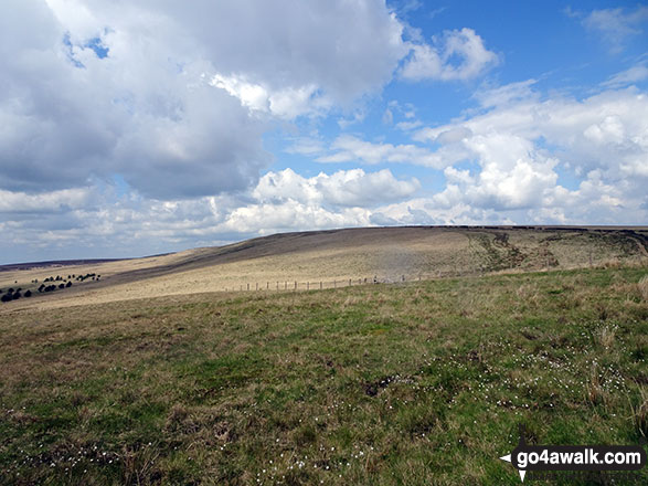
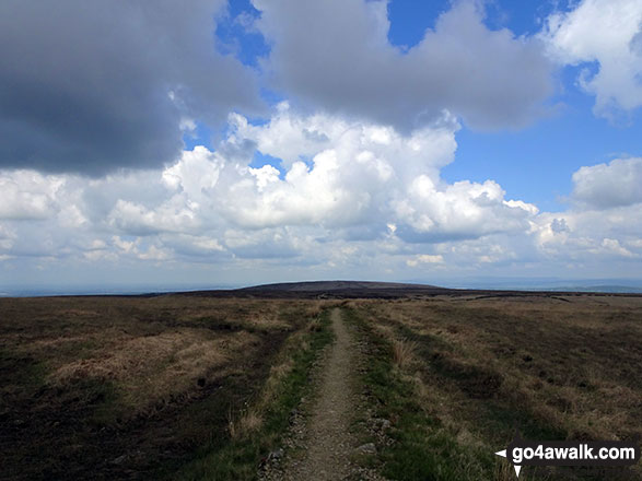
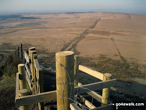
Spitlers Edge
392m (1286ft)
The South Pennines and The Forest of Bowland, Lancashire, England
Not familiar with this top?
You can walk/hike to the top of Spitlers Edge by using this easy‑to‑follow route map:
Walk l176 Great Hill from White Coppice
Good views and clear paths
   |
|---|
Vital Statistics:
| Length: | 8.25ml (13km) |
|---|---|
| Ascent: | 1,230ft (375m) |
| Time: | 4 hrs |
| Grade: |  (Moderate) (Moderate) |
Route Summary:
White Coppice - Wheelton Moor - Withnell Moor - Great Hill - Redmonds Edge - Spitlers Edge - Horden Pasture - Lead Mines Clough - Anglezarke Reservoir - White Coppice
See Spitlers Edge and the surrounding tops on our free-to-access 'Google Style' Peak Bagging Map:
The Forest of Bowland and The South Pennines
Less data - quicker to download
See Spitlers Edge and the surrounding tops on our unique, downloadable, PDF Peak Bagging Map:

NB: Whether you print off a copy or download it to your phone, this PDF Peak Baggers' Map might prove incredibly useful when your are up there on the tops and you cannot get a phone signal.
You can find Spitlers Edge & all the walks that climb it on these unique free-to-access Interactive Walk Planning Maps:
1:25,000 scale OS Explorer Map (orange/yellow covers):
1:50,000 scale OS Landranger Map (pink/magenta covers):
 Fellow go4awalkers who have already walked, climbed, scaled, summited, hiked & bagged Spitlers Edge
Mark Davidson walked up Spitlers Edge on March 5th, 2006 [from/via/route] White Coppice using walk l176 Great Hill from White Coppice [with] Theresa [weather] Dry & quite nice - Another quiet day on the hills with few people about
Adrian Howard climbed it on January 30th, 2023 [from/via/route] From the car park just off Belmont Road, cross main road to start of path up to Great Hill, then on stone pavement across to Spitlers Edge.
Claire Kirk bagged it on March 20th, 2021 [from/via/route] Rivington [with] Phil [weather] Dull
Gill Bates hiked Spitlers Edge on July 26th, 2013 [from/via/route] from White Coppice
Christine Shepherd summited on May 11th, 2019 [from/via/route] Walked from White Coppice l117 [with] Jenny [weather] Fine & dry. - A walk with familiar views having grown up only a few miles from this fell.
Margaret Richards has conquered it [from/via/route] Belmont Reservoir & Spitler's Edge 8 miles [with] Don
Leon Harvey scaled it on February 1st, 2015 [from/via/route] Great Hill/Spitlers Edge [with] Solo [weather] Cold/windy ice & Snow (knee deep in places) clear day so Sun out :)
To add (or remove) your name and experiences on this page - Log On and edit your Personal Mountain Bagging Record
More Photographs & Pictures of views from, on, or of, Spitlers Edge

Send us your photographs and pictures on, of, or from Spitlers Edge
If you would like to add your walk photographs and pictures to this page, please send them as email attachments (configured for any computer) along with your name to:
and we shall do our best to publish them.
(Guide Resolution = 300dpi. At least = 660pixels (wide) x 440 pixels (high).)

You can also submit photos via our Facebook Page.
NB. Please indicate where each photo was taken and whether you wish us to credit your photos with a Username or your First Name/Last Name.


