
![]()
Back Tor (Hollins Cross)
438m (1438ft)
The Dark Peak Area, The Peak District, Derbyshire, England

Not familiar with this top?
You can walk/hike to the top of Back Tor (Hollins Cross) by using either of these 2 easy‑to‑follow route maps:
Walk d224 Lose Hill from Edale
Easy ascent to superb ridge walk
   |
|---|
Vital Statistics:
| Length: | 8.25ml (13km) |
|---|---|
| Ascent: | 1,532ft (467m) |
| Time: | 4½ hrs |
| Grade: |  (Moderate) (Moderate) |
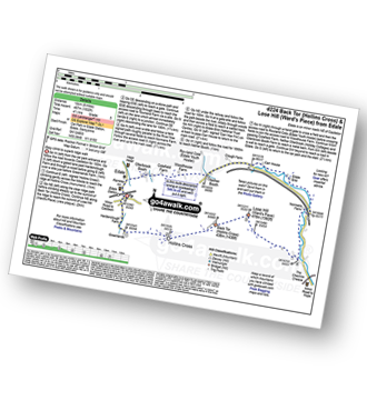
Route Summary:
Edale - Small Clough - Hardenclough Farm - Greenlands - Hollins Cross - Back Tor (Hollins Cross) - Lose Hill (Ward's Piece) - Hope - The River Noe - Normans Farm - Edale End - Carr House - Nether Booth - Ollerbrook Booth - The Vale of Edale - Edale
Walk d118 Lose Hill (Ward's Piece), Back Tor (Hollins Cross) and Castleton from Hope
Superb views of the Vale of Edale
|
|---|
Vital Statistics:
| Length: | 9.5mls (15km) |
|---|---|
| Ascent: | 1,588ft (484m) |
| Time: | 5 hrs |
| Grade: | (Moderate) |
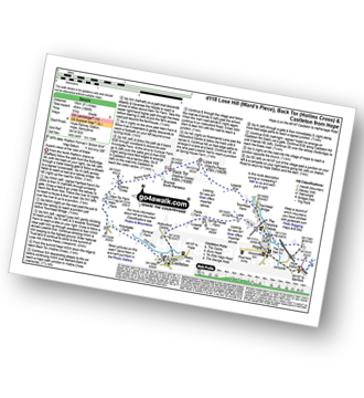
Route Summary:
Hope - Townhead Bridge - Losehill End - Lose Hill (Ward's Piece) - Back Tor (Hollins Cross) - Barker Bank - Hollins Cross - Mam Tor Farm - Knowlgate Farm - Odin Sitch - Castleton - Hollowford Centre - Spring House Farm - Hope
See Back Tor (Hollins Cross) and the surrounding tops on our free-to-access 'Google Style' Peak Bagging Maps:
The Dark Peak Area of The Peak District National Park
Less data - quicker to download
See Back Tor (Hollins Cross) and the surrounding tops on our unique, downloadable, PDF Peak Bagging Map:

NB: Whether you print off a copy or download it to your phone, this PDF Peak Baggers' Map might prove incredibly useful when your are up there on the tops and you cannot get a phone signal.
You can find Back Tor (Hollins Cross) & all the walks that climb it on these unique free-to-access Interactive Walk Planning Maps:
1:25,000 scale OS Explorer Map (orange/yellow covers):
1:50,000 scale OS Landranger Map (pink/magenta covers):
 Fellow go4awalkers who have already walked, climbed, scaled, summited, hiked & bagged Back Tor (Hollins Cross)
David Peebles walked up Back Tor (Hollins Cross) on March 30th, 2024 [from/via/route] In layby [with] Solo [weather] Great sunny evening walk - Great walk.
hannah1507 climbed it on February 25th, 2024 [from/via/route] From Castleton club campsite [with] Dan
Ruth Mcfarlane bagged it during June, 2023 [from/via/route] Edale to Hope [with] myself
Patrick Molloy hiked Back Tor (Hollins Cross) on November 17th, 2020 [from/via/route] Parked at Mam Tor Car Park. via Mam Tor on to Lose Hill [with] With Nadia [weather] Cool, Cloudy, Drizzle
Mark Hazelton summited on July 12th, 2020 [from/via/route] Nice walk up from Castletown to Hollins Cross [with] Family and Pepper [weather] Sunny
To add (or remove) your name and experiences on this page - Log On and edit your Personal Mountain Bagging Record
. . . [see more walk reports]
More Photographs & Pictures of views from, on, or of, Back Tor (Hollins Cross)

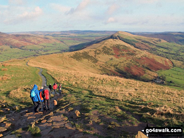
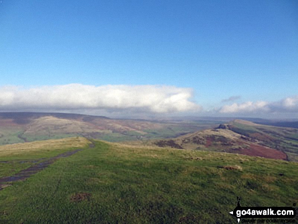
The High Peak District, Eldon Hill, Chapel-en-le-Frith, Rushup Edge, Kinder Scout, The Vale of Edale, Edale, Mam Tor, Hollins Cross, Back Tor (Hollins Cross) and Lose Hill (Ward's Piece) from Lord's Seat (Rushup Edge)

Walking the ridge towards Mam Tor in deep snow between Back Tor (Hollins Cross) and Hollins Cross

Mam Tor, Hollins Cross, Back Tor (Hollins Cross) in deep snow on the Lose Hill (Ward's Piece) ridge
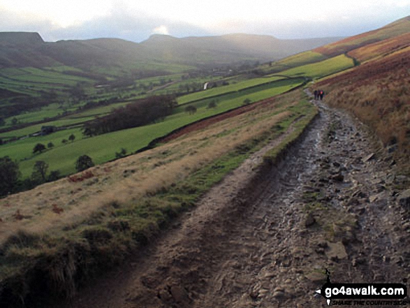
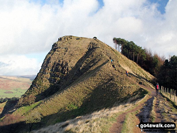
Heading towards Hollins Cross, Back Tor (Hollins Cross) and Lose Hill (Ward's Piece)
Mam Tor, Hollins Cross and Back Tor (Hollins Cross) from Nether Booth in The Vale of Edale
Alport Moor (left) and Hollins Cross, Back Tor (Hollins Cross) and Lose Hill (Ward's Piece) (right) from the summit of Mam Tor


. . . see all 38 walk photographs & pictures of views from, on, or of, Back Tor (Hollins Cross)
Send us your photographs and pictures on, of, or from Back Tor (Hollins Cross)
If you would like to add your walk photographs and pictures to this page, please send them as email attachments (configured for any computer) along with your name to:
and we shall do our best to publish them.
(Guide Resolution = 300dpi. At least = 660pixels (wide) x 440 pixels (high).)

You can also submit photos via our Facebook Page.
NB. Please indicate where each photo was taken and whether you wish us to credit your photos with a Username or your First Name/Last Name.


