
![]()
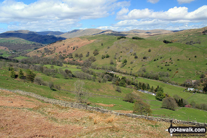
Hugill Fell
256m (840ft)
The South Eastern Marches, The Lake District, Cumbria, England
The summit of Hugill Fell is on private land and not accessible to the public

You can find Hugill Fell & all the walks that climb it on these unique free-to-access Interactive Walk Planning Maps: (click/TAP to select)
1:25,000 scale OS Explorer Map (the ones with orange/yellow covers):
1:50,000 scale OS Landranger Map (the ones with pink/magenta covers):
See Hugill Fell and the surrounding tops on our free-to-access 'Google Style' Peak Bagging Maps:
A go4awalk.com downloadable PDF Peak Bagging Map featuring Hugill Fell should be available soon.
 Fellow go4awalkers who have already walked, climbed, summited & bagged Hugill Fell
Trevor Williams walked up Hugill Fell on March 28th, 2017 [with] HF
Dave Gay climbed Hugill Fell on February 18th, 2015 [from/via/route] Staveley Station - Hugill Fell - Reston Scar - Staveley Station. [with] JC [weather] Misty - 09.11 Oxenholme to Staveley (07.45 from Manchester)....back on the 11.52 from Staveley
Mark Davidson bagged Hugill Fell on May 7th, 2015 [with] Theresa [weather] Clear & sunny - but with a biting cold wind
Charlie Housley hiked Hugill Fell on April 14th, 2013 [from/via/route] Parked up in Staveley & did a clockwise route to this fell & then Reston Scar. Somehow managed to completely miss Williamson`s monument, so will have to call back for that. [with] Solo. [weather] Better than it was this morning in Langdale. - Decided to do some outlying fells after being weathered off this morning in Langdale. Great views, lovely location.
Christine Shepherd summited Hugill Fell on September 15th, 2012 [from/via/route] Staveley [with] On my own, apart from a dog from Hillside bungalow whose owner asked if I fancied taking her for a walk. [weather] Fine but a little cloudy. - This was my first fell after a fairly major foot operation in July. Jess, the little dog from the bungalow showed me to the top of the fell but I was very confused as there was no cairn. After a brief ramble around to see if there was any other' top', me & Jess made our way back down. I asked the owner about the cairn & he told me that it has been demolished & the stones used to make a path through the boggy ground surrounding the fell. So be aware of this if you are looking for the impressive cairn of the Wainwright book.
Peter Thwaites, Louise Sandwith and David Preston have all walked, climbed & bagged Hugill Fell.
To add (or remove) your name and experiences on this page - Log On and edit your Personal Mountain Bagging Record
Send us your photographs and pictures on, of, or from Hugill Fell
If you would like to add your walk photographs and pictures featuring views from, on or of Hugill Fell to this page, please send them as email attachments (configured for any computer) along with your name to:
and we shall do our best to publish them.
(Guide Resolution = 300dpi. At least = 660pixels (wide) x 440 pixels (high).)

You can also submit photos via our Facebook Page.
NB. Please indicate where each photo was taken.


