
![]()
Harper Hills
420m (1378ft)
The Far Eastern Marches, The Lake District, Cumbria, England
You can find Harper Hills & all the walks that climb it on these unique free-to-access Interactive Walk Planning Maps: (click/TAP to select)
1:25,000 scale OS Explorer Map (the ones with orange/yellow covers):
1:50,000 scale OS Landranger Map (the ones with pink/magenta covers):
See Harper Hills and the surrounding tops on our free-to-access 'Google Style' Peak Bagging Maps:
A go4awalk.com downloadable PDF Peak Bagging Map featuring Harper Hills should be available soon.
   |
|---|
Vital Statistics:
| Length: | 7.75mls (12.5km) |
|---|---|
| Ascent: | 1,483ft (452m) |
| Time: | 4½ hrs |
| Grade: |  (Moderate) (Moderate) |
Route Summary:
Hazel Shaw Parking Area - Rosgill Moor - Scalebarrow Knott - Harper Hills - Low Goat Gill - Long Rigg - Powley's Hill - Hare Shaw - Woodhowe Moss - Kit Crag (Naddle Forest) - Wallow Crag (Naddle Forest) - Hugh's Laithes Pike - Hugh's Laithes Pike (North East Top) - Highfield Crag - Naddle Farm - Naddle Beck - Mirkside Wood - Scalebarrow Knott - Hazel Shaw Parking Area
 Fellow go4awalkers who have already walked, climbed, summited & bagged Harper Hills
Angeline Grieveson walked up Harper Hills on November 12th, 2022 [with] Dotty
Trevor Williams climbed Harper Hills on November 18th, 2021 [from/via/route] Bampton Grange [with] paul [weather] overcast & windy
Christine Shepherd bagged Harper Hills on May 30th, 2016 [from/via/route] Tope of the Swindale Road [with] On my own [weather] Warm & Sunny
Mark Davidson hiked Harper Hills on March 10th, 2015 [with] Alone [weather] Bright & sunny but quite cold with a cold wind
Ray O'hara summited Harper Hills on February 23rd, 2012 [weather] Stayed below the cloud base throughout, didn't rain.
Paul Booth, Peter Thwaites, Louise Sandwith, David Preston and Paul Woodburn have all walked, climbed & bagged Harper Hills.
To add (or remove) your name and experiences on this page - Log On and edit your Personal Mountain Bagging Record
More Photographs & Pictures of views from, on or of Harper Hills
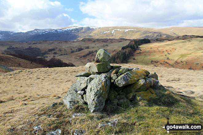
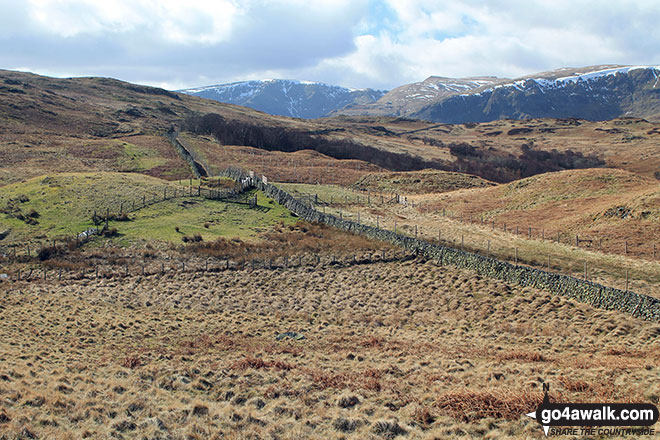
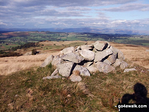
High Street, Kidsty Pike and High Raise (Mardale) from the summit cairn on Harper Hills
Send us your photographs and pictures on, of, or from Harper Hills
If you would like to add your walk photographs and pictures featuring views from, on or of Harper Hills to this page, please send them as email attachments (configured for any computer) along with your name to:
and we shall do our best to publish them.
(Guide Resolution = 300dpi. At least = 660pixels (wide) x 440 pixels (high).)

You can also submit photos via our Facebook Page.
NB. Please indicate where each photo was taken.


