
![]()
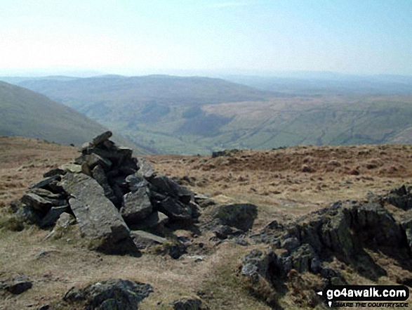
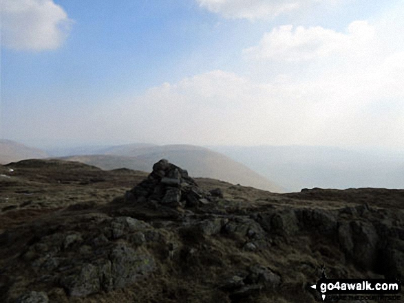
Grey Crag (Sleddale)
638m (2094ft)
The Far Eastern Fells, The Lake District, Cumbria, England
You can find Grey Crag (Sleddale) & all the walks that climb it on these unique free-to-access Interactive Walk Planning Maps: (click/TAP to select)
1:25,000 scale OS Explorer Map (the ones with orange/yellow covers):
1:50,000 scale OS Landranger Map (the ones with pink/magenta covers):
See Grey Crag (Sleddale) and the surrounding tops on our free-to-access 'Google Style' Peak Bagging Maps:
See Grey Crag (Sleddale) and the surrounding tops on our downloadable PDF Peak Bagging Maps:
*Walk & bag all 36 Wainwrights in The Far Eastern Fells area of The Lake District in just 8 easy-to-follow circular walks.
*This version is marked with the walk routes you need to follow to Walk all 214 Wainwrights in just 59 walks. Click here for more information.
NB: Whether you print off a copy on to paper or download it to your phone, these PDF Peak Baggers Maps will prove incredibly useful when your are up there on the tops and you cannot get a phone signal!
   |
|---|
Vital Statistics:
| Length: | 9.5ml (15km) |
|---|---|
| Ascent: | 2,050ft (625m) |
| Time: | 5½ hrs |
| Grade: |  (Moderate) (Moderate) |
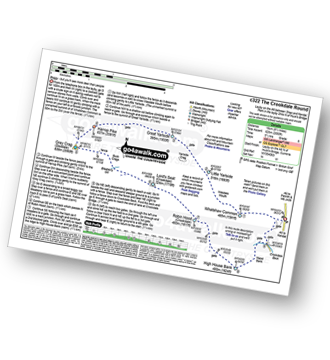
Route Summary:
Demings Moss - Shap - Whatshaw Common - Little Yarlside - Great Yarlside - Harrop Pike - Grey Crag (Sleddale) - Lord's Seat (Crookdale) - Robin Hood (Crookdale) - High House Bank - Demings Moss - Shap.
|
|---|
Vital Statistics:
| Length: | 10.5ml (17km) |
|---|---|
| Ascent: | 3,417ft (1,041m) |
| Time: | 7.25hrs |
| Grade: |  (Hard) (Hard) |
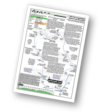
Route Summary:
Stockdale - Sadgill Bridge - Stockdale Beck - Great Howe - Grey Crag (Sleddale) - Tarn Crag (Sleddale) - Sleddale Fell - Selside Brow - Branstree (Artlecrag Pike) - Gatescarth Pass - Adam Seat - Harter Fell (Mardale) - Kentmere Pike - Goat Scar - Shipman Knotts - Wray Crag - Stockdale
 Fellow go4awalkers who have already walked, climbed, summited & bagged Grey Crag (Sleddale)
Tim Winn walked up Grey Crag (Sleddale) on March 22nd, 2024 [with] Barry, Roger, Andy and Paul [weather] Bright.
Christine Shepherd climbed Grey Crag (Sleddale) on March 15th, 2009 [from/via/route] Climbed from Stockdale as part of the Longsleddale Horizon. Reached this summit again when i was doing the Crookdale Round from Wainwright's Outlying Fells on 19.03.15. Finally did walk c204 in glorious sunshine on 24.05.23 [with] On my own [weather] Fine but overcast at times - Climbed again 16.7.20 with the same route. Finally did walk c204 in sunshine on 24.5.23 Such much easier when you can see the paths & the ground is dry.
Paul Macey bagged Grey Crag (Sleddale) on July 24th, 2018 [from/via/route] From Brothers Water using walks c251 & c204
Angeline Grieveson hiked Grey Crag (Sleddale) on November 20th, 2022 [with] Dotty
Richard Fulcher summited Grey Crag (Sleddale) on August 29th, 2022 [from/via/route] Parked at Sadgill after negotiating the 5 mile single track road down Longsleddale. The path starts just behind the parking area & we followed it up through a few smaller crags to Grey Crag. We decided to walk across to Harrop Pike & then traversed back across the lower boggy ground & up to Tarn Crag. The descent was easy (NNW) to Brownhowe Bottom & we then followed the Gatescarth Pass track back down to the car, passing some delightful waterfalls along the way. [with] Jen [weather] Overcast grey skies with a light breeze from the East. - Fairly straightforward walk, but tricky to drive to! A good one for August Bank Holiday Monday .. not many people about.
Sarah Moore conquered Grey Crag (Sleddale) on August 6th, 2022 [from/via/route] c204 [with] On my own [weather] Great day for it - cool & windy but views for miles
Richard Marchant scaled Grey Crag (Sleddale) on April 17th, 2022 [from/via/route] Parked at Sadgill walked down the road to Stockdale Bridge & followed a path Ne up to Great Howe & Brock Crag. from here I proceeded up to Grey Crag then on to Harrop Pike before turning Westward & on to Tarn Crag. From here I walked across to Banstree then down & up on to Harter Fell. Ridged walked around to Kentmere Pike down to Shipman Knott & eventually back to the car. [with] On my own [weather] Dry Day with Hazy views early doors but did become sunny & clear in the afternoon
Geoff Hand walked up Grey Crag (Sleddale) on September 21st, 2021 [from/via/route] c204 Longsleddale Horizon from Stockdale [with] Alone [weather] Generally Dry & warm with a bit of mist Kentmere Pike - Haweswater was quite low. Very quiet.
Simon Boddy climbed Grey Crag (Sleddale) on July 15th, 2021 [from/via/route] Sadgill [with] My girlfriend [weather] Sunny & clear
Jeremy Torrance bagged Grey Crag (Sleddale) on August 24th, 2019 [with] solo [weather] Sunny - glorious
To add (or remove) your name and experiences on this page - Log On and edit your Personal Mountain Bagging Record
. . . [see more walk reports]
Send us your photographs and pictures on, of, or from Grey Crag (Sleddale)
If you would like to add your walk photographs and pictures featuring views from, on or of Grey Crag (Sleddale) to this page, please send them as email attachments (configured for any computer) along with your name to:
and we shall do our best to publish them.
(Guide Resolution = 300dpi. At least = 660pixels (wide) x 440 pixels (high).)

You can also submit photos via our Facebook Page.
NB. Please indicate where each photo was taken.


