
![]()
Long Man Hill
658m (2159ft)
The North Pennines, Cumbria, England
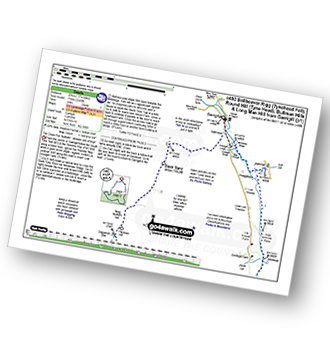
You can find Long Man Hill & all the walks that climb it on these unique free-to-access Interactive Walk Planning Maps: (click/TAP to select)
1:25,000 scale OS Explorer Map (the ones with orange/yellow covers):
1:50,000 scale OS Landranger Map (the ones with pink/magenta covers):
Long Man Hill on our free-to-access 'Google Style' Peak Bagging Map:
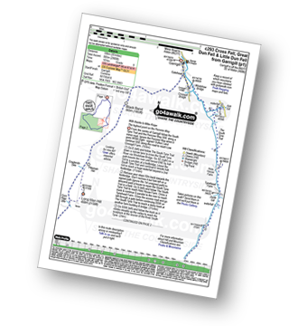
See Long Man Hill and the surrounding tops on our downloadable PDF Peak Bagging Map:
   |
|---|
Vital Statistics:
| Length: | 15.75mls (25km) |
|---|---|
| Ascent: | 2,343ft (714m) |
| Time: | 8 hrs |
| Grade: |  (Hard) (Hard) |
Route Summary:
Garrigill - The Pennine Way - The South Tyne Trail - Low Crossgill - Ash Gill - Ashgill Force - Waterfall - Hole House Farm - Tynehead Farm - Allan's Clough - Bellbeaver Rigg (Tynehead Fell) - Tyne Head - Round Hill (Tyne Head) - Crossgill Head - Crossgill Pants - Rake End - Lambgreen Hills - Bullman Hills - Bullman Hills (North Top) - Bullman Sike - Cash Burn - Long Man Hill - Craglands Sike - Pikeman Hill - Meg Moffat's Hill - Black Band - Garrigill
|
|---|
Vital Statistics:
| Length: | 20ml (32km) |
|---|---|
| Ascent: | 2,905ft (885m) |
| Time: | 10 hrs |
| Grade: |  (Hard) (Hard) |
Route Summary:
Garrigill - The Pennine Way - The South Tyne Trail - Low Crossgill - Ash Gill - Ashgill Force - Hole House Farm - Tynehead Farm - Tyne Head - River Tees - Dunfell Hush - Great Dun Fell - Little Dun Fell - Cross Fell - Skirwith Fell - Yad Stone - Greg's Hut (bothy) - Backstone Edge (Lambgreen Hills) - Long Man Hill - Meg Moffat's Hill - Black Band - Garrigill
 Fellow go4awalkers who have already walked, climbed, summited & bagged Long Man Hill
Mark Davidson walked up Long Man Hill on October 25th, 2012 [from/via/route] Extension to Walk c443 Round Hill & Bellbeaver Rigg from Garrigill when I went across Crossgill Pants. Very, very boggy & not recommended. Certainly not in late October! [with] Alone [weather] Wet & miserable - loved (most of) it!
Angela Moroney climbed Long Man Hill on May 18th, 2021 [from/via/route] kirkstone [with] Jane ludders [weather] sun wind
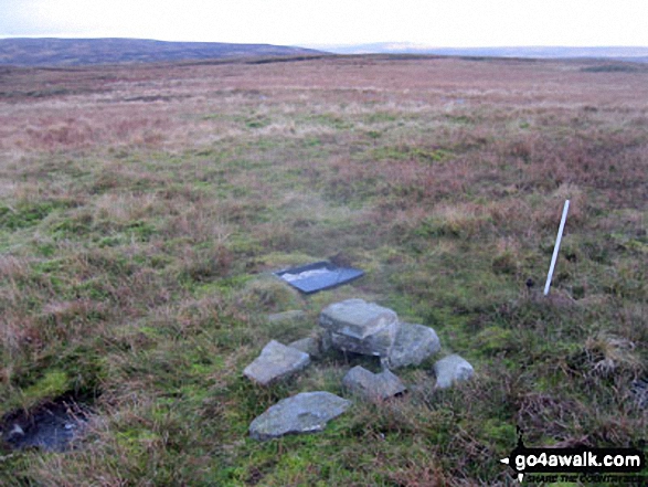
Kevin Foster bagged Long Man Hill on August 20th, 2018 [from/via/route] Garrigill. [with] Henry. [weather] cloudy with rain. - A straightforward ascent out of Garrigill began by following the Pennine Way for about 3 miles then taking a shooters track left to a gate before a pathless ascent over rough grass to a small cairn marking the summit of Long Man Hill. Grey clouds & intermittent rain showers limited most of the view except Cross Fell which dominated the view south.
Christine Shepherd hiked Long Man Hill on April 18th, 2017 [from/via/route] Walked from Garrigill on The Pennine Way then took detours to bag this & Bullman Hills [with] On my own [weather] Bright & clear
Ray O'hara summited Long Man Hill on February 19th, 2012 [from/via/route] C293 [weather] Cold, crisp, clear, perfect - Long Man Hill was below the freezing level so the route from the Pennine Way was fairly boggy. C293 in general is a magical walk though, the best I've done so far in the North Pennines.
Patrick Rogozinski and Matthew Thomas have both walked, climbed & bagged Long Man Hill.
To add (or remove) your name and experiences on this page - Log On and edit your Personal Mountain Bagging Record
More Photographs & Pictures of views from, on or of Long Man Hill
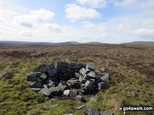
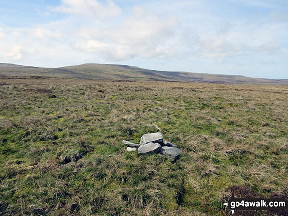
Small shelter on Long Man Hill with Great Dunn Fell, Little Dun Fell and Cross Fell in the background
Send us your photographs and pictures on, of, or from Long Man Hill
If you would like to add your walk photographs and pictures featuring views from, on or of Long Man Hill to this page, please send them as email attachments (configured for any computer) along with your name to:
and we shall do our best to publish them.
(Guide Resolution = 300dpi. At least = 660pixels (wide) x 440 pixels (high).)

You can also submit photos via our Facebook Page.
NB. Please indicate where each photo was taken.


