
![]()
Tyrrau Mawr (Craig-las)
661m (2169ft)
The Cadair Idris Area, Snowdonia, Gwynedd, Wales
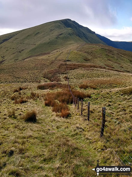
The summit of Tyrrau Mawr (Craig-las) is marked by a fence junction.

Not familiar with this top?
You can walk/hike to the top of Tyrrau Mawr (Craig-las) by using either of these 2 easy‑to‑follow route maps:
Walk gw132 Tyrrau Mawr (Craig-las) and Craig-y-llyn from Llynnau Cregennen
Fine cliff top views (and fewer crowds)
   |
|---|
Vital Statistics:
| Length: | 8.5ml (13.5km) |
|---|---|
| Ascent: | 2,406ft (733m) |
| Time: | 5½ hrs |
| Grade: |  (Moderate) (Moderate) |
Route Summary:
Llynnau Cregennen - Hafotty-fach - Craig-y-llyn - Tyrrau Mawr (Craig-las) - Tyrau Mawr (Craig-las) - Carnedd Lwyd - Rhiw Gwerdydd - Pony Path - Dyffr-ydan - Cefn-yr-Owen Isaf - Ty'n-llidiart - Llynnau Cregennen
Walk gw169 Tyrrau Mawr (Craig-las) and Craig-y-llyn from Llanfihangel -y-pennant
Fine cliff top views without the crowds
|
|---|
Vital Statistics:
| Length: | 10ml (16km) |
|---|---|
| Ascent: | 2,737ft (834m) |
| Time: | 6½ hrs |
| Grade: |  (Hard) (Hard) |

Route Summary:
Llanfihangel-y-pennant - Tynyfach - Gwastadfryn - Hafotty Gwastaffryn - Rhiw Gwerdydd - Carnedd Lwyd - Tyrrau Mawr (Craig-las) - Tyrau Mawr (Craig-las) - Craig-y-llyn - Twll y Ogof - Bodilan Fach - Afon Cadair - Llanfihangel-y-pennant
See Tyrrau Mawr (Craig-las) and the surrounding tops on our free-to-access 'Google Style' Peak Bagging Maps:
The Cadair Idris area of Snowdonia National Park
Less data - quicker to download
The Whole of Snowdonia National Park
More data - might take a little longer to download
See Tyrrau Mawr (Craig-las) and the surrounding tops on our unique, downloadable, PDF Peak Bagging Map:

NB: Whether you print off a copy or download it to your phone, this PDF Peak Baggers' Map might prove incredibly useful when your are up there on the tops and you cannot get a phone signal.
You can find Tyrrau Mawr (Craig-las) & all the walks that climb it on these unique free-to-access Interactive Walk Planning Maps:
1:25,000 scale OS Explorer Map (orange/yellow covers):
1:50,000 scale OS Landranger Map (pink/magenta covers):
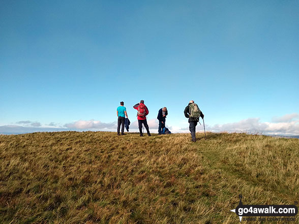
 Fellow go4awalkers who have already walked, climbed, scaled, summited, hiked & bagged Tyrrau Mawr (Craig-las)
Mark Davidson walked up Tyrrau Mawr (Craig-las) on July 1st, 2009 [from/via/route] Walk gw169 Tyrrau Mawr (Craig-las) & Craig-y-llyn from Llanfihangel -y-pennant [with] Alone [weather] Nice & sunny
Donovan Suddell climbed it on April 14th, 2021 [from/via/route] Llynnau Gregennen using gw132 [with] Father in Law [weather] Sunny & clear.
Bleddyn Rhys bagged it on February 26th, 2019 [from/via/route] Fynnu'r Pony path o ochr Dolgellau, troi ir dde a gwneud y grib i gyd hyd at Craig y llyn, cyn dod yn ol at CYfrwy ar Gadair ar hyd yr hen drac chwaral [with] Ar ben fy hyn [weather] Eithriadol o braf am fis Chwefror. Ond gwyn oer ar y top ac eira dal yn para yn gysgod haul o dan y grib Gogleddol. - Diwrnod hir - gorfod cerdded yn gyflym ac wedi blino'n lan erbyn y diwedd. Ddim wedi mynd a digon o ddwr hefo fi! Diwrnod gwych.
Marilyn Wadkin hiked Tyrrau Mawr (Craig-las) on May 28th, 2016 [from/via/route] Starting from Llanllwyda Camp Site in Tywyn. Walking to Hafotty Gwastadfryn & heading west when arriving at the pony path. Reaching Tyrrau Mawr then going onto Craig y llyn & coming down past Twll y Ogof & Nant Caw Fawr. [with] Rob. [weather] Sunny then a thunder storm then sunny again.
Christina Lander summited on May 23rd, 2015 [from/via/route] Llanfihangel-y-pennant - Tyrrau Mawr - Craig-y-Llyn - Twll yr Ogof - Llanfihangel-y-pennant [with] Dick [weather] Sunny & warm - A perfect day with amazing views
Richard Penney conquered it on February 24th, 2013 [from/via/route] lakes to the north [with] Solo
Paul Booth and Trevor Williams have both walked, climbed & bagged Tyrrau Mawr (Craig-las).
To add (or remove) your name and experiences on this page - Log On and edit your Personal Mountain Bagging Record
More Photographs & Pictures of views from, on, or of, Tyrrau Mawr (Craig-las)
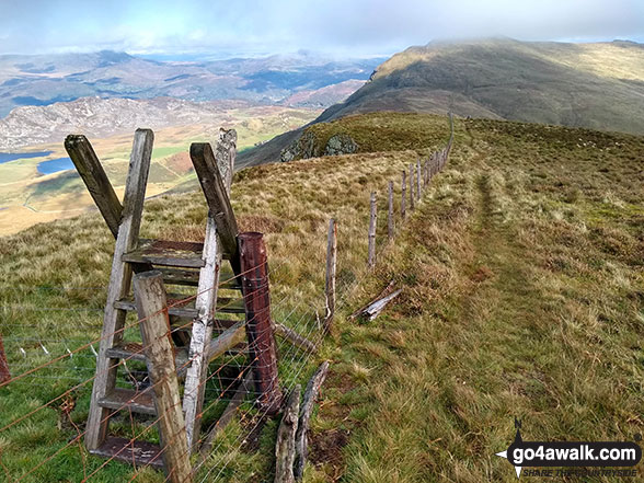
Ladder stile on the summit of Tyrrau Mawr (Craig-las) with Cyfrwy (The Saddle) and Cadair Idris (Penygadair) in the background

Barmouth and the Mawddach Estuary from the summit of Tyrrau Mawr (Craig-las)


Barmouth and the Mawddach Estuary from the summit of Tyrrau Mawr (Craig-las)
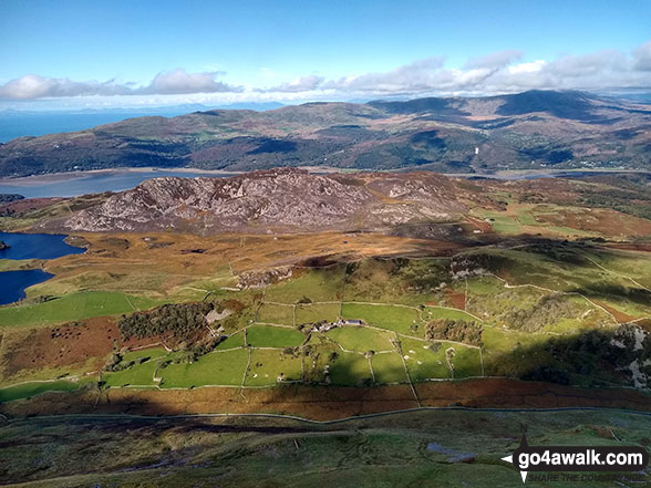
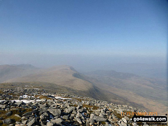
The Mawddach Estuary and the Y Garn (Rhinogs) massiff beyond from the summit of Tyrrau Mawr (Craig-las)
Send us your photographs and pictures on, of, or from Tyrrau Mawr (Craig-las)
If you would like to add your walk photographs and pictures to this page, please send them as email attachments (configured for any computer) along with your name to:
and we shall do our best to publish them.
(Guide Resolution = 300dpi. At least = 660pixels (wide) x 440 pixels (high).)

You can also submit photos via our Facebook Page.
NB. Please indicate where each photo was taken and whether you wish us to credit your photos with a Username or your First Name/Last Name.


