
![]()
Hindscarth
727m (2386ft)
The North Western Fells, The Lake District, Cumbria, England
You can find Hindscarth & all the walks that climb it on these unique free-to-access Interactive Walk Planning Maps: (click/TAP to select)
1:25,000 scale OS Explorer Map (the ones with orange/yellow covers):
1:50,000 scale OS Landranger Maps (the ones with pink/magenta covers):
See Hindscarth and the surrounding tops on our free-to-access 'Google Style' Peak Bagging Maps:
See Hindscarth and the surrounding tops on our downloadable PDF Peak Bagging Maps:
*Walk & bag all 29 Wainwrights in The North Western Fells area of The Lake District in just 7 easy-to-follow circular walks.
*This version is marked with the walk routes you need to follow to Walk all 214 Wainwrights in just 59 walks. Click here for more information.
NB: Whether you print off a copy on to paper or download it to your phone, these PDF Peak Baggers Maps will prove incredibly useful when your are up there on the tops and you cannot get a phone signal!
   |
|---|
Vital Statistics:
| Length: | 8.75ml (14km) |
|---|---|
| Ascent: | 3,073ft (937m) |
| Time: | 6.25hrs |
| Grade: |  (Hard) (Hard) |
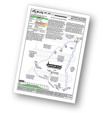
Route Summary:
Little Town - High Snab Bank - Blea Crags - Robinson - Littledale Edge - Hindscarth - Hindscarth Edge - Dale Head (Newlands) - Dalehead Tarn - Newlands Valley - Newlands Church - Little Town
|
|---|
Vital Statistics:
| Length: | 10.25ml (16.5km) |
|---|---|
| Ascent: | 3,585ft (1,093m) |
| Time: | 7½ hrs |
| Grade: | (Hard) |
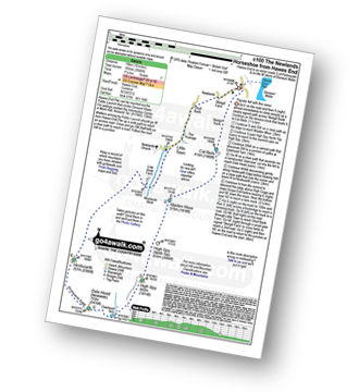
Route Summary:
Hawes End - Derwent Water - Skelgill Bank - Woodford's Path - Cat Bells (Catbells) - Maiden Moor - High Spy (North Top) - High Spy - Dalehead Tarn - Dale Head (Newlands) - Hindscarth - High Crags - Scope End - Low Snab Farm - Newlands Church - Little Town - Newlands Valley - Hawes End - Derwent Water.
|
|---|
Vital Statistics:
| Length: | 12mls (19km) |
|---|---|
| Ascent: | 4,152ft (1,266m) |
| Time: | 8½ hrs |
| Grade: |  (Hard) (Hard) |
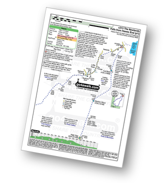
Route Summary:
Hawes End - Derwent Water - Skelgill Bank - Woodford's Path - Cat Bells (Catbells) - Maiden Moor - High Spy (North Top) - High Spy - Dale Head Tarn - Dale Head (Newlands) - Hindscarth Edge - Hindscarth - Littledale Edge - Robinson - High Snab Bank - Newlands Church - Little Town - Hawes End - Derwent Water.
|
|---|
Vital Statistics:
| Length: | 14.5ml (23km) |
|---|---|
| Ascent: | 5,409ft (1,648m) |
| Time: | 11 hrs |
| Grade: |  (Very Hard) (Very Hard) |
Route Summary:
Hawes End - Derwent Water - Skelgill Bank - Woodford's Path - Cat Bells (Catbells) - Maiden Moor - High Spy (North Top) - High Spy - Dalehead Tarn - Dale Head (Newlands) - Hindscarth - Littledale Edge - Robinson - High Snockrigg - Moss Force - Newlands Hause - Knott Rigg - Ard Crags - Birkrigg - Keskerdale Beck - Newlands Church - Newlands Beck - Little Town - Skelgill Farm - Hawes End Derwent Water.
 Fellow go4awalkers who have already walked, climbed, summited & bagged Hindscarth
David Higginbottom walked up Hindscarth on July 6th, 2023 [from/via/route] Route 142 & 345 combined 23k [with] Carolyn [weather] Good
Paul Macey climbed Hindscarth on June 11th, 2023 [from/via/route] Using walk c142 [with] Luke [weather] Sunny & hot some high cloud - Lots of biting bugs
Geoff Hand bagged Hindscarth on February 23rd, 2023 [from/via/route] From Newlands Valley as part of a recce of the Newlands Memorial Fell race. [with] Richard Macilwaine and Tess [weather] Cold & Sunny all day, beautiful - Race includes Robinson, Hindscarth, Dalehead, High Spy,Maiden Moor & Cat Bells
Kate Peacock hiked Hindscarth on September 24th, 2022 [from/via/route] Ascended via Robinson from Newlands [with] Me & Sheila [weather] No rain, low winds & not too hot. Pretty good walking weather - No energy - batteries were flat. Came down after 5 instead of 5
David Butterfield summited Hindscarth on July 20th, 2022 [from/via/route] Newlands Church [weather] Cloudy
Claire Murray conquered Hindscarth on November 21st, 2021 [from/via/route] Dale Head, Hindscarth & Robinson from near Buttermere [with] Vitor - E shaped walk. Hard going up but then easy going at the top.
Tom Mcbeath scaled Hindscarth on June 17th, 2022 [from/via/route] Walked from Robinson [with] Ursula [weather] Conditions started to deteriorate a little as the clouds became stronger & rain threatened. Tooged up with waterproofs before crossing from Robinson. - Views still good but rain & low cloud threatened. The walk from Robinson was not too strenuous & a quick lunch was at at the summit before moving on to Dale.
Richard Fulcher walked up Hindscarth on March 21st, 2022 [from/via/route] Parked at Little Town car park & ascended to Maiden Moor. Followed the ridge route to High Spy & then down to Dalehead Tarn. From the tarn up steep ascent to Dale Head, down & up to Hindscarth & down & up to Robinson. Tricky descent via Blea Crags & easier along High Snab Bank then ver steep down to Low High Snab! Gentle stroll then back to the car. [with] Jen [weather] Mostly gentle winds & a bright but hazy day. Cold on the tops especially when the sun disappeared behind the cloud. A great weather day overall. - Easier to ascend Robinson by the ridge route than to descend.
Neil Heywood climbed Hindscarth on May 29th, 2021 [from/via/route] Dale Head [with] logan Heywood [weather] Mixed
Karen Maguire bagged Hindscarth on September 18th, 2019 [from/via/route] New lands horseshoe
To add (or remove) your name and experiences on this page - Log On and edit your Personal Mountain Bagging Record
. . . [see more walk reports]
More Photographs & Pictures of views from, on or of Hindscarth
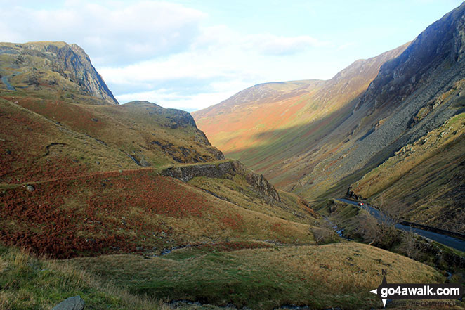
Looking down towards Buttermere from Honister Hause with Bell Crags (left) and Robinson (centre right), Hindscarth (right) & the shoulder of Dale Head (Newlands) far right)
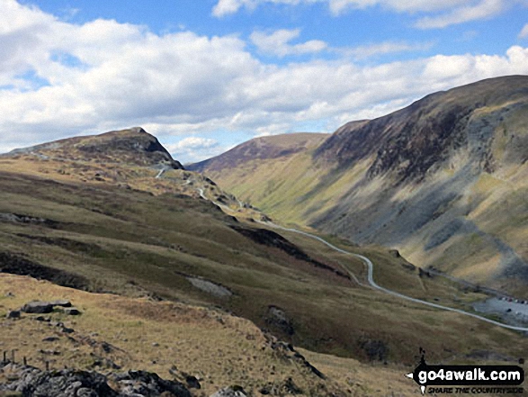
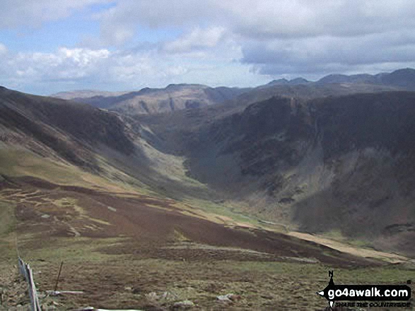
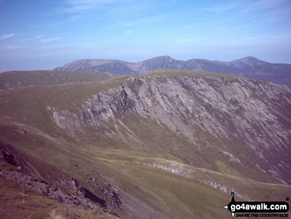
Looking NW from Grey Knotts above Honister Slate Mine to Fleetwith Pike (left) and Robinson, Littledale Edge, Hindscarth and Dale Head (Newlands) on the other side of the valley
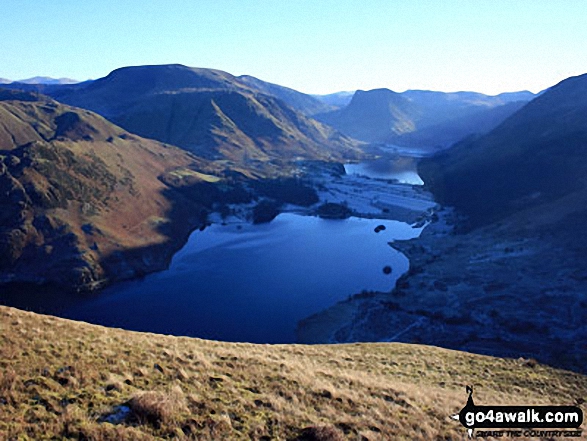
Crummock Water and Buttermere with Grasmoor (far left), Robinson, Hindscarth and Dale Head (left), Fleetwith Pike (centre) and Red Pike (Buttermere) (far right) from Mellbreak
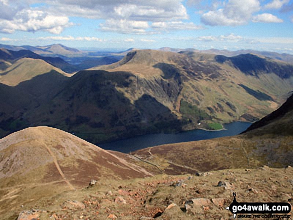
High Snockrigg, Robinson, Hindscarth and Dale Head (Newlands) above Dodd (Buttermere) and Buttermere Lake from Red Pike (Buttermere)

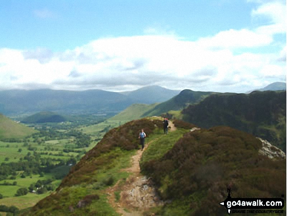
High Spy (North Top), High Spy, Maiden Moor, Hindscarth (left), Robinson, Crag Hill (Eel Crag), Causey Pike, Barrow (Newlands) (centre), Newlands, Bassenthwaite Lake, Swinside, Skiddaw, Derwent Water and Blencathra (right) beyond from Cat Bells (Catbells)
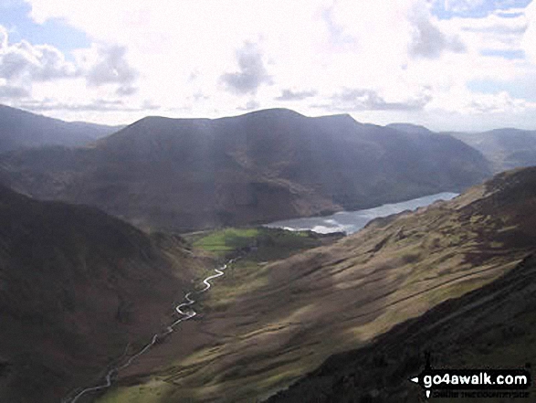
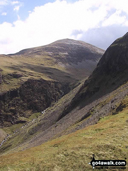
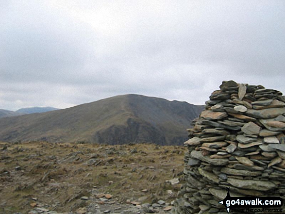
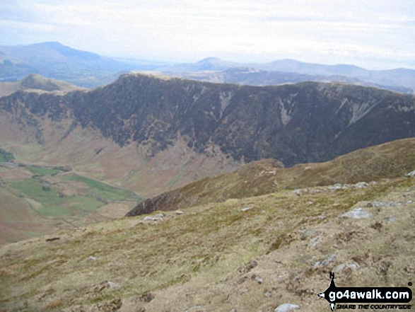
The High Stile Ridge (High Crag, High Stile and Red Pike) beyond Buttermere from Hindscarth Edge
The view from the summit of Swinside (Portinscale) featuring Derwent Water, Cat Bells , Maiden Moor, High Spy, Dale Head (Newlands), Hindscarth, Robinson, Causey Pike, Sail, Crag Hill (Eel Crag), Barrow and Gridedale Pike
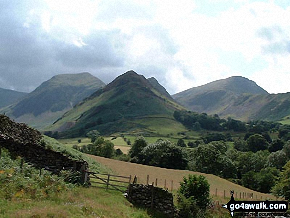
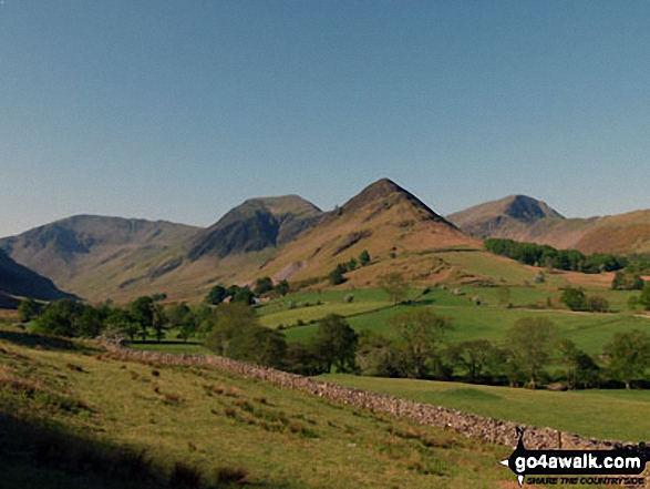
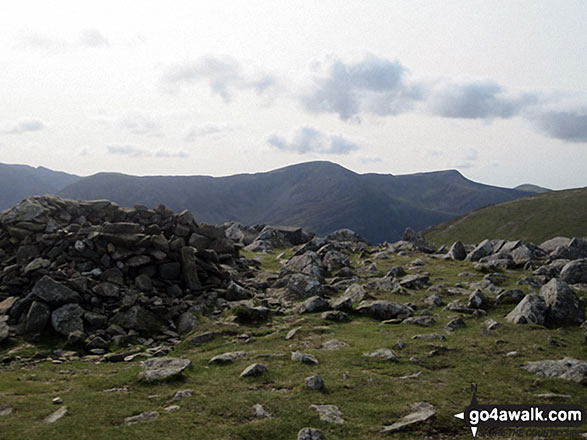
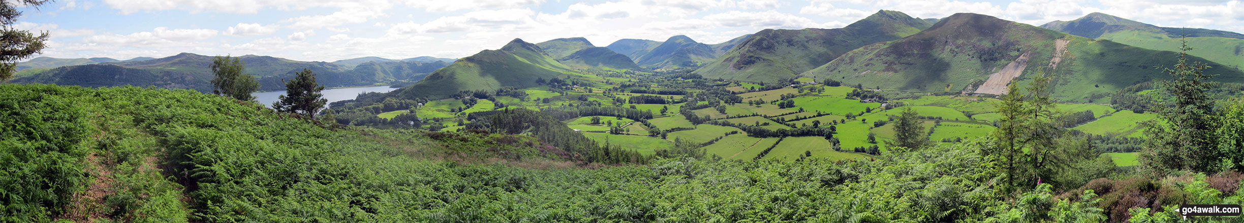
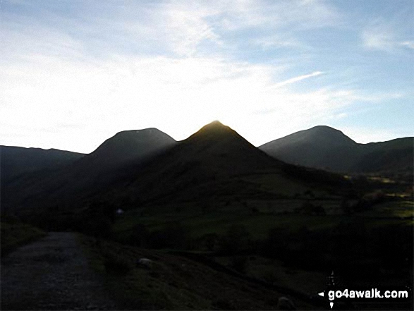
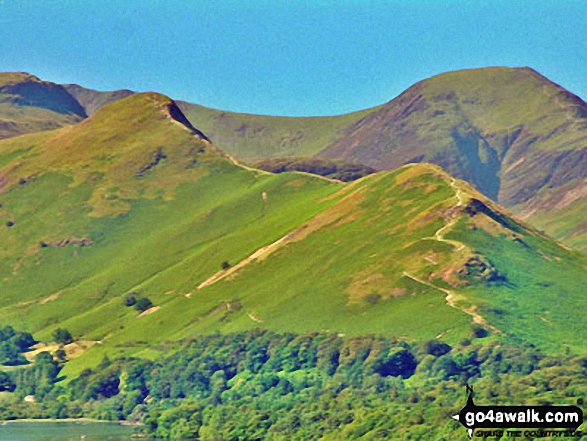
From left to right: Dale Head (Newlands), Hindscarth, High Crags and Robinson from just beyond Little Town
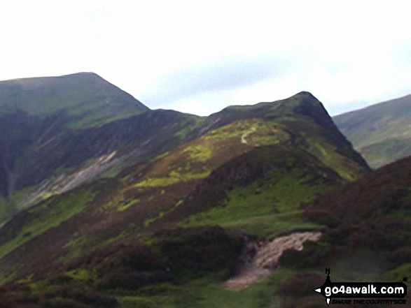
Cat Bells (Catbells) with Dale Head (Newlands) & Hindscarth beyond from Latrigg
. . . see all 24 walk photographs & pictures of views from, on or of Hindscarth
Send us your photographs and pictures on, of, or from Hindscarth
If you would like to add your walk photographs and pictures featuring views from, on or of Hindscarth to this page, please send them as email attachments (configured for any computer) along with your name to:
and we shall do our best to publish them.
(Guide Resolution = 300dpi. At least = 660pixels (wide) x 440 pixels (high).)

You can also submit photos via our Facebook Page.
NB. Please indicate where each photo was taken.


