
![]()
Great Gable
899m (2951ft)
The Western Fells, The Lake District, Cumbria, England
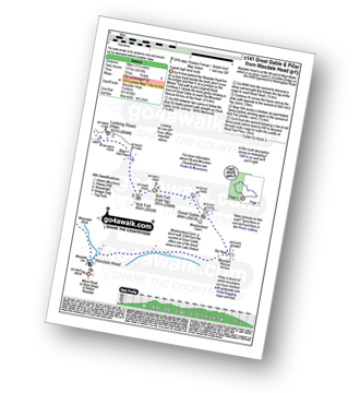
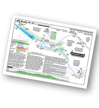
You can find Great Gable & all the walks that climb it on these unique free-to-access Interactive Walk Planning Maps: (click/TAP to select)
1:25,000 scale OS Explorer Map (the ones with orange/yellow covers):
1:50,000 scale OS Landranger Maps (the ones with pink/magenta covers):
See Great Gable and the surrounding tops on our free-to-access 'Google Style' Peak Bagging Maps:
See Great Gable and the surrounding tops on our downloadable PDF Peak Bagging Maps:
*Walk & bag all 33 Wainwrights in The Western Fells area of The Lake District in just 10 easy-to-follow circular walks.
*This version is marked with the walk routes you need to follow to Walk all 214 Wainwrights in just 59 walks. Click here for more information.
NB: Whether you print off a copy on to paper or download it to your phone, these PDF Peak Baggers Maps will prove incredibly useful when your are up there on the tops and you cannot get a phone signal!
   |
|---|
Vital Statistics:
| Length: | 5.75ml (9km) |
|---|---|
| Ascent: | 2,340ft (731m) |
| Time: | 4½ hrs |
| Grade: |  (Moderate) (Moderate) |
Route Summary:
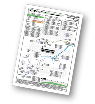
Honister Pass - Honister Hause - Grey Knotts - Brandreth - Green Gable - Windy Gap - Great Gable - Westmorland Cairn - Beck Head - Beckhead Tarn - Moses' Trod - Wainwright's Coast to Coast Walk - Honister Pass
|
|---|
Vital Statistics:
| Length: | 6ml (9.5km) |
|---|---|
| Ascent: | 2,845ft (867m) |
| Time: | 5 hrs |
| Grade: |  (Moderate) (Moderate) |
Route Summary:
Seathwaite - Stockley Bridge - Styhead Tarn - Sty Head - Great Gable - Westmorland Cairn - Windy Gap - Green Gable - Mitchell Cove - Blackmoor Pols - Base Brown - Gillercomb - Sour Milk Gill (Borrowdale) - Seathwaite
|
|---|
Vital Statistics:
| Length: | 7.5ml (12km) |
|---|---|
| Ascent: | 3,289ft (1,002m) |
| Time: | 6 hrs |
| Grade: | (Moderate) |
Route Summary:
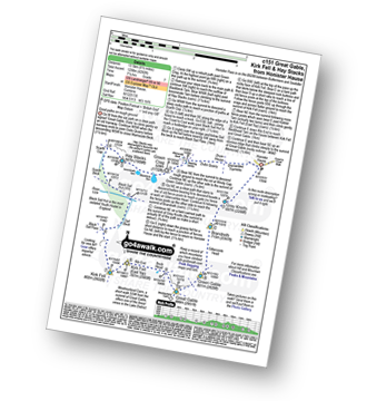
Honister Pass - Honister Hause - Grey Knotts - Brandreth - Green Gable - Windy Gap - Great Gable - Westmorland Cairn - Beck Head - Beckhead Tarn - Kirk Fell (East Top) - Kirk Fell - Moses' Trod - Wainwright's Coast to Coast Walk - Honister Pass
|
|---|
Vital Statistics:
| Length: | 8.25ml (13km) |
|---|---|
| Ascent: | 3,016ft (919m) |
| Time: | 6 hrs |
| Grade: | (Moderate) |
Route Summary:
Seatoller (Borrowdale) - Seathwaite - Sourmilk Gill (Seathwaite) - Gillercomb - Blackmoor Pols - Mitchell Cove - Green Gable - Windy Gap - Great Gable - Westmorland Cairn - Beck Head - Beckhead Tarn - Moses' Trod - Honister Pass - Honister Hause - Wainwright's Coast to Coast Walk - Seatoller (Borrowdale)
|
|---|
Vital Statistics:
| Length: | 8.5ml (13.5km) |
|---|---|
| Ascent: | 4,260ft (1,298m) |
| Time: | 7.25hrs |
| Grade: |  (Hard) (Hard) |
Route Summary:
Honister Pass - Honister Hause - Green Crag (Buttermere) - Black Beck - Blackbeck Tarn - Innominate Tarn - Hay Stacks (Haystacks) - Scarth Gap - Ennerdale - River Liza - Black Sail Hut (Youth Hostel) - Black Sail Path - Kirk Fell - Kirk Fell (East Top) - Beckhead Tarn - Beck Head - Great Gable - Westmorland Cairn - Windy Gap - Green Gable - Gillercomb Head - Brandreth - Grey Knotts - Honister Hause.
|
|---|
Vital Statistics:
| Length: | 9ml (14.5km) |
|---|---|
| Ascent: | 3,965ft (1,208m) |
| Time: | 7½ hrs |
| Grade: | (Hard) |
Route Summary:
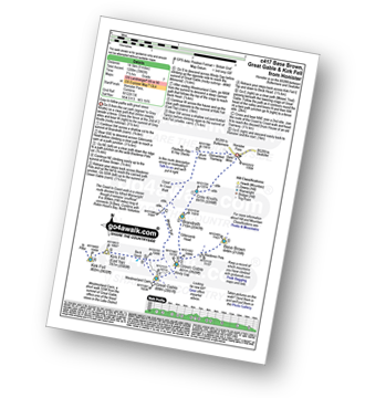
Honister Pass - Honister Hause - Grey Knotts - Brandreth - Blackmoor Pols - Base Brown - Mitchell Cove - Green Gable - Windy Gap - Great Gable - Westmorland Cairn - Beck Head - Beckhead Tarn - Kirk Fell (East Top) - Kirk Fell - Moses' Trod - Wainwright's Coast to Coast Walk - Honister Pass
|
|---|
Vital Statistics:
| Length: | 10.5ml (17km) |
|---|---|
| Ascent: | 4,693ft (1,430m) |
| Time: | 8½ hrs |
| Grade: |  (Hard) (Hard) |
Route Summary:
Seatoller (Borrowdale) - Strands Bridge - Borrowdale - The Combe - Thornythwaite Fell - Comb Head - Glaramara - Looking Steads (Glaramara) - Red Beck - Red Beck Top - Allen Gill - High House Tarn - High House Tarn Top - Allen Crags - Esk Hause - Ruddy Gill - Sprinkling Tarn - Sty Head - Great Gable - Westmorland Cairn - Windy Gap - Green Gable - Gillercomb Head - Brandreth - Grey Knotts - Honister Hause - Honister Pass - Wainwright's Coast to Coast Walk - Seatoller (Borrowdale)
|
|---|
Vital Statistics:
| Length: | 11.25ml (18km) |
|---|---|
| Ascent: | 5,819ft (1,773m) |
| Time: | 10 hrs |
| Grade: |  (Very Hard) (Very Hard) |
Route Summary:
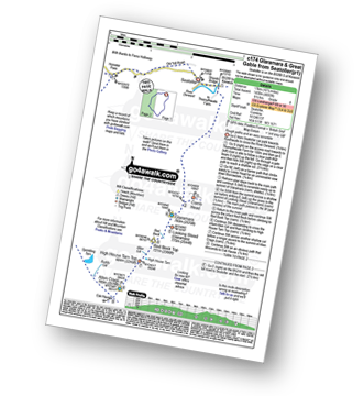
Wasdale Head - Moses' Trod - Lingmell Beck - Gable Beck Bridge - Sty Head - Great Gable - Westmorland Cairn - Beck Head - Beckhead Tarn - Kirk Fell (East Top) - Kirk Fell - Black Sail Pass - Looking Stead (Pillar) - High Level Route - Robinson's Cairn - Pillar - Wind Gap - Black Crag (Pillar) - Scoat Fell (Little Scoat Fell) - Steeple - Red Pike (Wasdale) - Dore Head - Mosedale Beck - Wasdale Head - Wast Water.
|
|---|
Vital Statistics:
| Length: | 18.75ml (30km) |
|---|---|
| Ascent: | 7,309ft (2,408m) |
| Time: | 14.75hrs |
| Grade: | (Very Hard) |
Route Summary:
Bowness Knott Car Park Ennerdale - Low Gillerthwaite Field Centre - High Gillerthwaite Yourth Hostel - Red Pike (Buttermere) - High Stile - High Crag (Buttermere) - Seat (Buttermere) - Scarth Gap - Hay Stacks (Haystacks) - Innominate Tarn - Blackbeck Tarn - Black Beck - Green Crag (Buttermere) - Great Round How - Brandreth - Gillercomb Head - Green Gable - Windy Gap - Great Gable - Westmorland Cairn - Beck Head - Beckhead Tarn - Kirk Fell (East Top) - Kirk Fell - Black Sail Pass - Looking Stead (Pillar) - High Level Route - Robinson's Cairn - Pillar - Wind Gap - Black Crag (Pillar) - High Beck - Low Beck - Ennerdale.
 Fellow go4awalkers who have already walked, climbed, summited & bagged Great Gable
Simon Myerscough walked up Great Gable on November 27th, 2023 [from/via/route] From Seathwaite dry to start then progressively colder & misty - some snoe above 2000ft. [with] Joanne [weather] Light winds & dull all day - Scramble coming down Sourmilk Ghyll was challenging but made it after change of line
Christine Shepherd climbed Great Gable on July 19th, 2003 [from/via/route] Walked from Honister via Brandreth. Second & Third times from Seathwaite Fourth & Fifth times from Honister again. [with] Andy, Miriam and Ishmay (aged 7) [weather] Sunny - Got half way up Gable again in July 07 but turned back in heavy rain. Reached the summit again twice in 2010. On 18.6.10 Jenny & I had a glorious walk from Seathwaite taking in Fleetwith Pike before a descent via Honister. I then led a church group to the top just over a week later on 26.6.10, in lovely sunshine. Climbed again 30.11.19. Had to walk back to Honister along Moses Trod in the dark! Climbed for a fifth time on 8.6.23 using walk c417, in gorgeous sunshine with a pleasant breeze.
John Ramsbottom bagged Great Gable on April 10th, 2023 [from/via/route] walk c442 parked at Honister slate mines [with] Lola [weather] misty/rainy/windy - solo walk with Lola, bad visibilty, glad i had digital mapping
Richard Fulcher hiked Great Gable on April 3rd, 2023 [from/via/route] Parked in the NT car park at Honister Slate Mine & walked up the steep path to Grey Knotts. We then traversed over the rock strewn ridge to Brandreth & across Gillercomb Head to Green Gable. Just before reaching the top of GG I diverted left down the fell & across to Base Brown. I then returned by the same route & we carried on up to the summit of GG after having some lunch. After a slippery descent from GG to Windy Gap we then started the rocky ascent to Great Gable. We returned to WG by the same route & then descended down another scree strewn path to join the Moses Trod path before branching off towards the dismantled tramway at Honister. The rocky paths continued pretty much all the way back. [with] Jen [weather] Sunny, blue skies, cold at times when in exposed sections, very good visibility. - Be prepared for some climbing over rocks in certain stretches esp. up Great Gable.
Martyn Atherton summited Great Gable on September 20th, 2020 [from/via/route] c338 Grey Knotts, Brandreth, Green Gable, Great Gable, Kirk Fell [with] Martyn and Paul [weather] Cloudy at first then very warm & sunny - Great view of the mines
Neall Garrad conquered Great Gable on June 25th, 2022 [from/via/route] Wasdale Head [weather] Sunny, hailstones, windy
Paul Macey scaled Great Gable on June 6th, 2022 [from/via/route] C417 in revert [with] Luke [weather] Cloudy but cloud above summits
Ian Ashton walked up Great Gable on September 4th, 2021 [from/via/route] Seathwaite & corridor route down [with] Solo
Andrew Flynn climbed Great Gable on August 1st, 2009 [with] Lads from work
Michael Austin bagged Great Gable on June 17th, 2021 [from/via/route] C417
To add (or remove) your name and experiences on this page - Log On and edit your Personal Mountain Bagging Record
. . . [see more walk reports]
More Photographs & Pictures of views from, on or of Great Gable
Yewbarrow, Great Gable, Lingmell and the shoulder of Scafell Pike from Wast Water
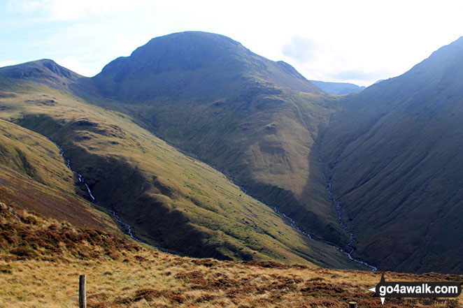
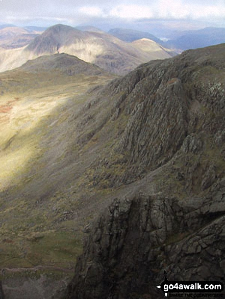
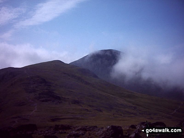
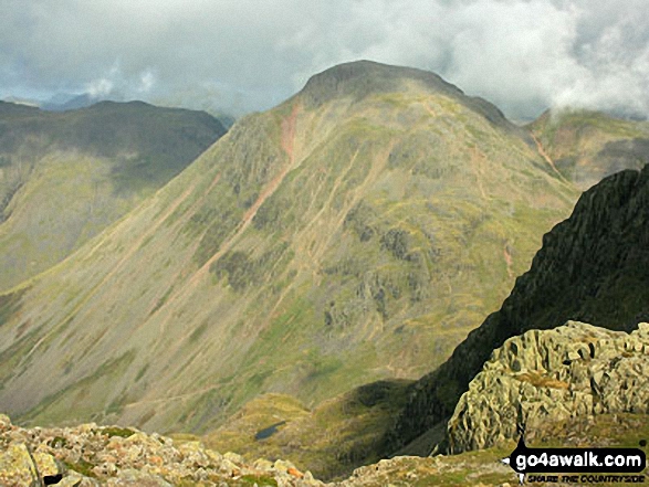
Green Gable (left) and Great Gable (centre left) and the shoulder of Kirk Fell from Loft Beck
Great Gable (back), Lingmell, the shoulder of Scafell Pike and Mickeldore from Symonds Knott
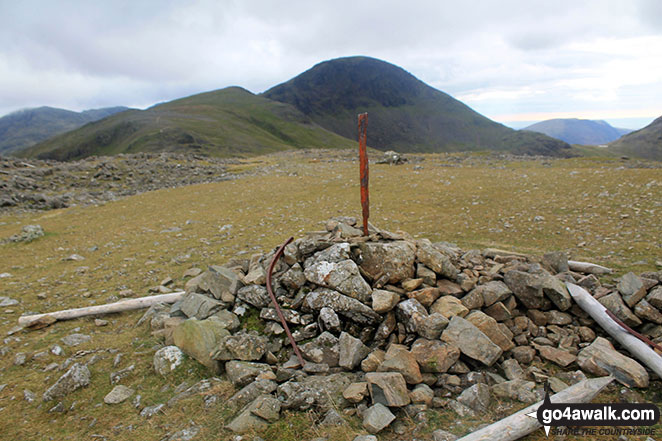
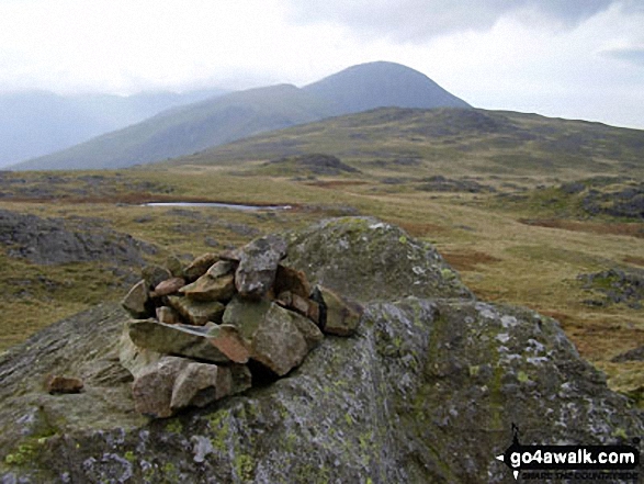
Green Gable (left) and Great Gable (centre left) from the summit of Brandreth
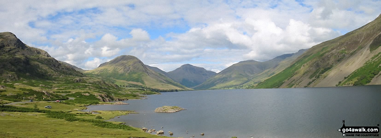
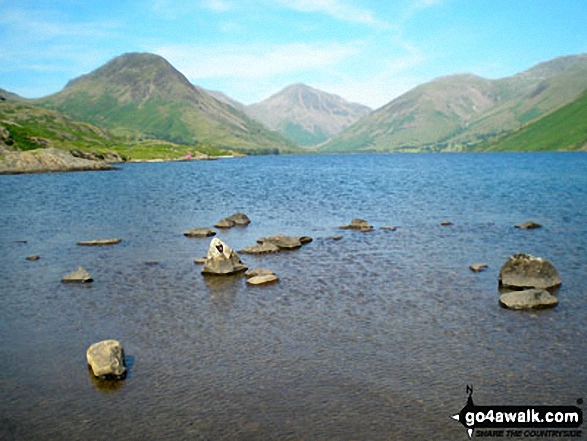
*Kirk Fell (left), Great Gable (centre) Lingmell, Scafell Pike (partially hidden) and Illgill Head across Wast Water
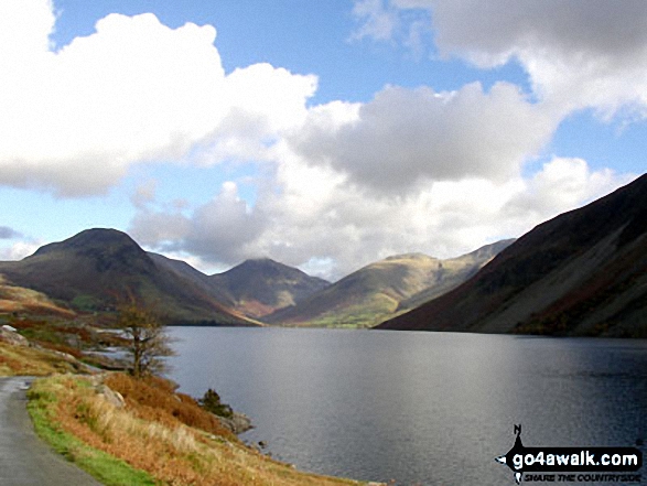
Yewbarrow (left), Kirk Fell (partially hidden), Great Gable (centre) Lingmell, Scafell Pike (partially hidden) and Illgill Head (right) from across Wast Water
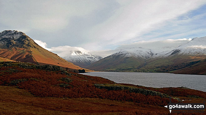
Snow capping Yewbarrow (left) Great Gable (centre) Lingmell and Scafell Pike surround Wast Water from near Overbeck Bridge, Wasdale
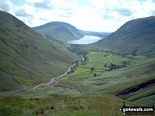
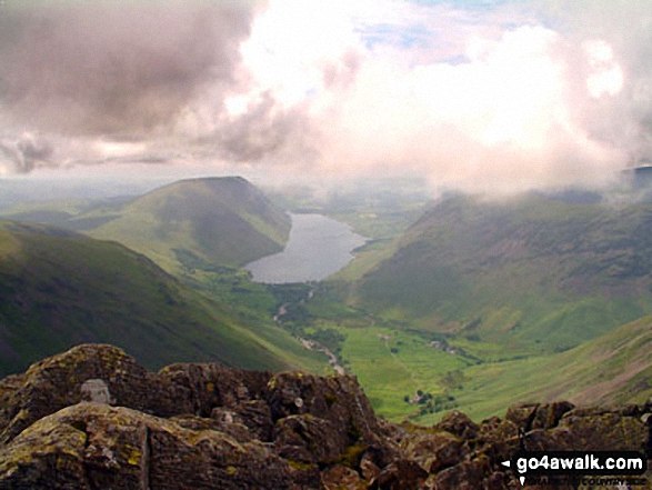
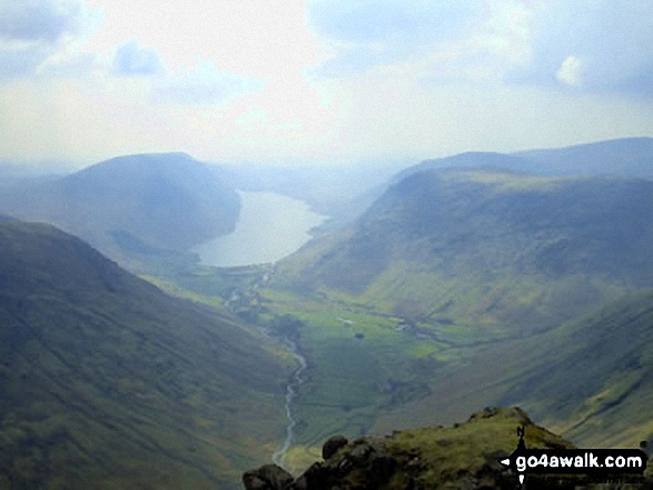
Wasdale Head and Wast Water from Gavel Neese on the lower slopes of Great Gable
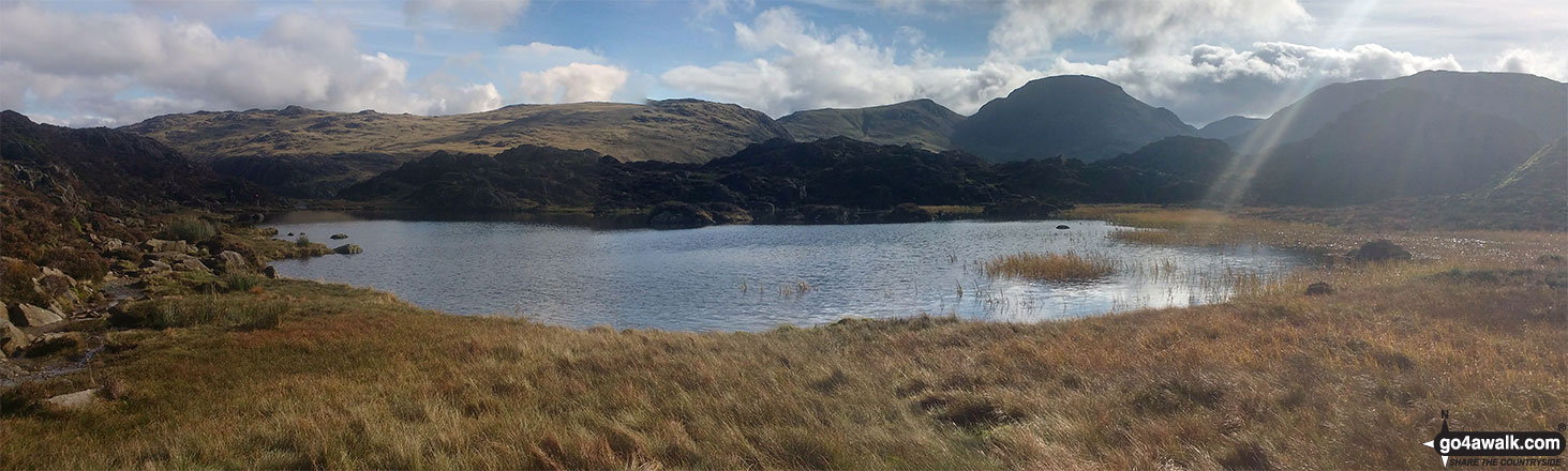
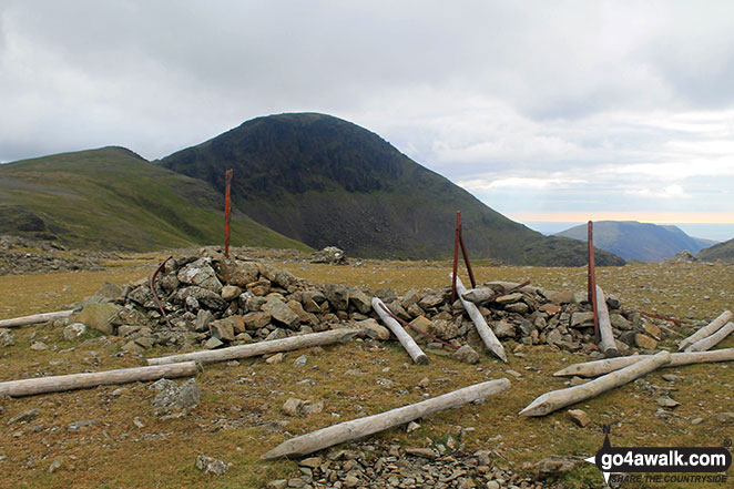
Innominate Tarn with Grey Knotts, Brandreth, Green Gable, Great Gable and Kirk Fell forming the backdrop
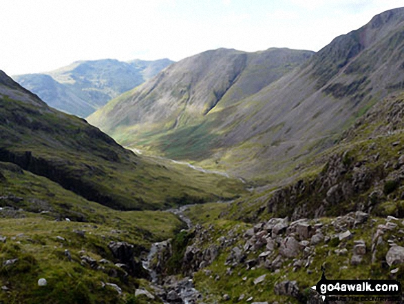
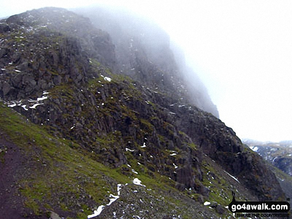
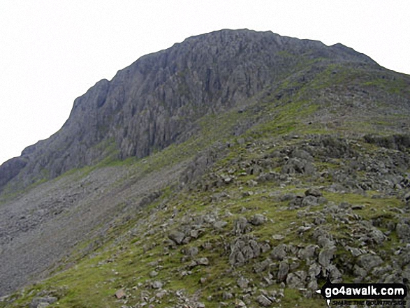
Kirk Fell and the shoulder of Great Gable (right) with the lower slopes of Great End (left) and Red Pike (Wasdale) in the distance from Sty Head
. . . see all 140 walk photographs & pictures of views from, on or of Great Gable
Send us your photographs and pictures on, of, or from Great Gable
If you would like to add your walk photographs and pictures featuring views from, on or of Great Gable to this page, please send them as email attachments (configured for any computer) along with your name to:
and we shall do our best to publish them.
(Guide Resolution = 300dpi. At least = 660pixels (wide) x 440 pixels (high).)

You can also submit photos via our Facebook Page.
NB. Please indicate where each photo was taken.


