
![]()
Y Garn (Moel Hebog)
633m (2078ft)
The Moel Hebog Area, Snowdonia, Gwynedd, Wales
Tap/mouse over a coloured circle (1-3 easy walks, 4-6 moderate walks, 7-9 hard walks) and click to select.
Y Garn (Moel Hebog) means 'The Cairn' in Welsh and is pronounced 'uh-gan'.
The summit of Y Garn (Moel Hebog) is marked by a cairn & a huge shelter.
Not familiar with this top?
You can walk/hike to the top of Y Garn (Moel Hebog) by using any of these 3 easy‑to‑follow route maps:
Walk gw188 The first part of the Nantlle Ridge from Rhyd-Ddu
The Nantlle Ridge is one of the finest ridge walks in Britain
   |
|---|
Vital Statistics:
| Length: | 6.5ml (10.5km) |
|---|---|
| Ascent: | 2,304ft (702m) |
| Time: | 4.75hrs |
| Grade: |  (Moderate) (Moderate) |

Route Summary:
Rhyd-Ddu - Y Garn (Moel Hebog) - The Nantlle Ridge - Mynydd Drws-y-coed - Trum y Ddysgl - The Hiatus - Bwlch-y-Ddwy-elor - Beddgelert Forest - Cwm Marchnad - Llyn-y-Gader - Rhyd-Ddu
Walk gw201 The Nantlle Ridge from Rhyd-Ddu
Classic Welsh Ridge Walk
|
|---|
Vital Statistics:
| Length: | 9.5mls (15.5km) |
|---|---|
| Ascent: | 4,017ft (1,224m) |
| Time: | 7.75hrs |
| Grade: |  (Hard) (Hard) |

Route Summary:
Rhyd-Ddu - Y Garn (Moel Hebog) - The Nantlle Ridge - Mynydd Drws-y-coed - Trum y Ddysgl - The Hiatus - Mynydd Tal-y-mignedd - Bwlch Dros-bern - Craig Cwm Silyn - Cwm Pennant - Bwlch y Ddwy Elor - Beddgelert Forest - Cwm Marchnad - Llyn-y-Gader - Rhyd-Ddu
Walk gw164 The full Nantlle Ridge and Craig Cwm Silyn from Rhyd-Ddu
Tough one for the Peak Baggers (see note)
|
|---|
Vital Statistics:
| Length: | 11.5ml (18.5km) |
|---|---|
| Ascent: | 4,496ft (1,370m) |
| Time: | 8.75hrs |
| Grade: |  (Hard) (Hard) |

Route Summary:
Rhyd-Ddu - Y Garn (Moel Hebog) - The Nantlle Ridge - Mynydd Drws-y-coed - Trum y Ddysgl - The Hiatus - Mynydd Tal-y-mignedd - Bwlch Dros-bern - Craig Cwm Silyn - Garnedd-goch - Craig Cwm Silyn - Cwm Pennant - Bwlch y Ddwy Elor - Beddgelert Forest - Cwm Marchnad - Llyn-y-Gader - Rhyd-Ddu
See Y Garn (Moel Hebog) and the surrounding tops on our free-to-access 'Google Style' Peak Bagging Maps:
The Moel Hebog area of Snowdonia National Park
Less data - quicker to download
The Whole of Snowdonia National Park
More data - might take a little longer to download
See Y Garn (Moel Hebog) and the surrounding tops on our unique, downloadable, PDF Peak Bagging Map:

NB: Whether you print off a copy or download it to your phone, this PDF Peak Baggers' Map might prove incredibly useful when your are up there on the tops and you cannot get a phone signal.
You can find Y Garn (Moel Hebog) & all the walks that climb it on these unique free-to-access Interactive Walk Planning Maps:
1:25,000 scale OS Explorer Map (orange/yellow covers):
1:50,000 scale OS Landranger Map (pink/magenta covers):
 Fellow go4awalkers who have already walked, climbed, scaled, summited, hiked & bagged Y Garn (Moel Hebog)
Donovan Suddell walked up Y Garn (Moel Hebog) on May 23rd, 2023 [with] wife [weather] beautiful bright day
Mark Davidson climbed it on August 5th, 2003 [from/via/route] Walk gw164 The full Nantlle Ridge & Craig Cwm Silyn from Rhyd-Ddu [with] Alone [weather] Nice & sunny - perfect conditions for top ridge walks in the UK
Melfyn Parry bagged it on March 20th, 2019 [from/via/route] Start & finish in lay-by at Rhyd Ddu 566526. Very steep incline to summit of Y Garn, low cloud until above 600m & then came out into sunshine. Great views over to Snowdon to the east & Nantlle & Anglesey to west & north west. Continued on ridge to scramble up Mynydd Drws y Coed, quite challenging in one or two sections. Walking in low cloud again, very wet, with limited visibility. Continued along Trym y Ddysgl & on up to the obelisk on Mynydd Tal y Mignedd. Had lunch in the shelter of a dry stone wall. Descent from here was quite a steep grassy bank crossing over streams & disused inclines. At 540502 the path was not evident & we through bogland & forest to find the forest track at 544498. From there easy route back to start. [with] ChW & CW [weather] Mostly cloudy, short spell of sunshine on Y Garn
Sion Britton hiked Y Garn (Moel Hebog) on August 2nd, 2020 [from/via/route] Nantlle Ridge Walk. Cerdded o Rhyd-Ddu. [with] Rhiannon [weather] Sunny
Andy Buxton summited during August, 1964 [from/via/route] Start of Nantlle Ridge [with] Dad
Chris Newham conquered it on February 18th, 2017 [from/via/route] gw201 [with] Craig [weather] Low cloud - Very steep decent at end the ladder style has gone & a new barbed wire fence installed as a result we had to go all the way down the very steep slope & climb a padlocked gate to get back on track then you have to walk across very boggy ground on a footpath not often used. However despite this a very good walk.
Christina Lander scaled it on August 16th, 2016 [from/via/route] Nantlle Ridge Rhyd-Ddu - Y Garth - Mynydd Drws Y Coed - Trum Y Ddysgl - Mynydd Tal Y Mignedd - Craig Cwm Silyn - Garnedd Goch - Mynydd Craig Goch - Llyn Cwm Dulyn - Nebo [with] Dick [weather] Perfect sunny day
Steve Lockett has walked up Y Garn (Moel Hebog) [with] Tony Dyche
Stephen Lewis climbed it on June 9th, 2013 [from/via/route] Rhyd-Ddu [with] Team Trail [weather] Hot & sunny
Patrick Rogozinski, Wendy Sockett, Louis Smith, Linda Mckeogh, Paul Booth, Trevor Williams and Kath Edwards have all walked, climbed & bagged Y Garn (Moel Hebog).
To add (or remove) your name and experiences on this page - Log On and edit your Personal Mountain Bagging Record
More Photographs & Pictures of views from, on, or of, Y Garn (Moel Hebog)
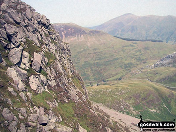
The Snowdon Massif - featuring Garnedd Ugain (Crib y Ddysgl), Snowdon (Yr Wyddfa), Bwlch Main, Llechog (Llanberis Path), Clogwyn Du and Y Lliwedd from Y Garn (Moel Hebog) with Llyn y Dywarchen and Rhyd Ddu in the valley below
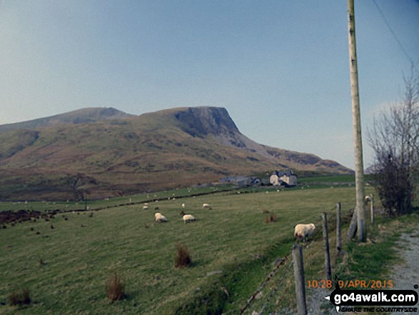
Mynydd Drws-y-coed (left) and Y Garn (Moel Hebog) from the Nantlle Road (B4418) near Rhyd Ddu

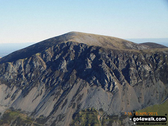
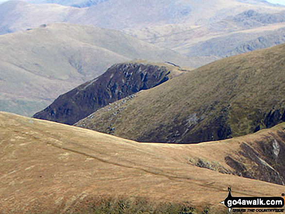
Mynydd Mawr (Llyn Cwellyn), Craig y Bera and Moel Eilio (Llanberis) from Y Garn (Moel Hebog)
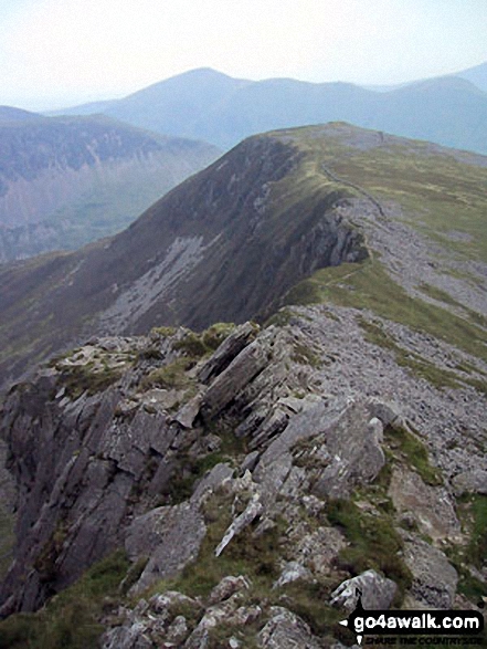
The Nantle Ridge - Mynydd Tal-y-mignedd (front left), The Hiatus (front right), Trum y Ddysgl (right) and Y Garn (Moel Hebog) (centre) from the summit of Craig Cwm Silyn

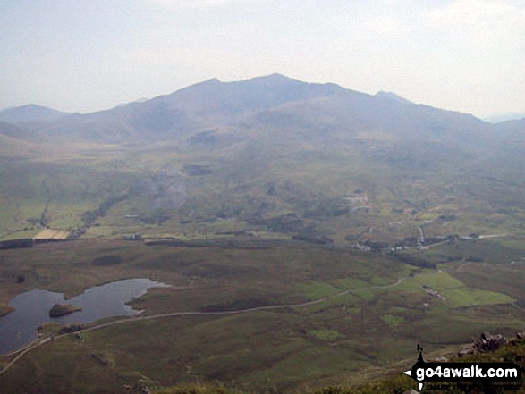
Llyn Nantlle Uchaf, Dyffryn Nantlle, Mynydd Mawr, Rhyd Ddu, Llyn y Dywarchen, The Snowdon Massif (Moel Eilio (Llanberis), Foel Gron, Moel Cynghorion, Garnedd Ugain (Crib y Ddysgl), Snowdon (Yr Wyddfa), Y Lliwedd and Yr Aran from Y Garn (Moel Hebog)
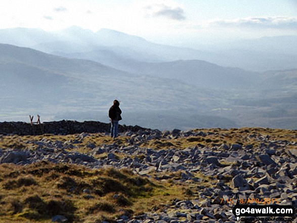
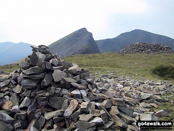
On the summit of Y Garn (Moel Hebog) with the Snowdon (Yr Wyddfa) group in the background
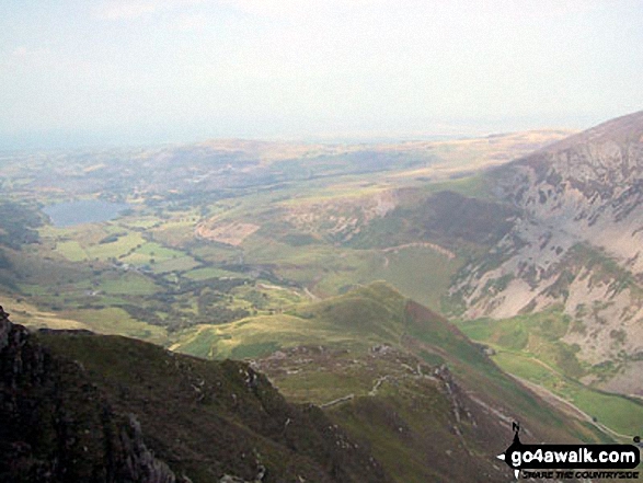
Llyn Nantlle Uchaf, Dyffryn Nantlle and the shoulder of Mynydd Mawr from Y Garn (Moel Hebog)
. . . see all 20 walk photographs & pictures of views from, on, or of, Y Garn (Moel Hebog)
Send us your photographs and pictures on, of, or from Y Garn (Moel Hebog)
If you would like to add your walk photographs and pictures to this page, please send them as email attachments (configured for any computer) along with your name to:
and we shall do our best to publish them.
(Guide Resolution = 300dpi. At least = 660pixels (wide) x 440 pixels (high).)

You can also submit photos via our Facebook Page.
NB. Please indicate where each photo was taken and whether you wish us to credit your photos with a Username or your First Name/Last Name.


