
![]()
Arenig Fach
689m (2261ft)
The Arenigs, Snowdonia, Gwynedd, Wales
Tap/mouse over a coloured circle (1-3 easy walks, 4-6 moderate walks, 7-9 hard walks) and click to select.
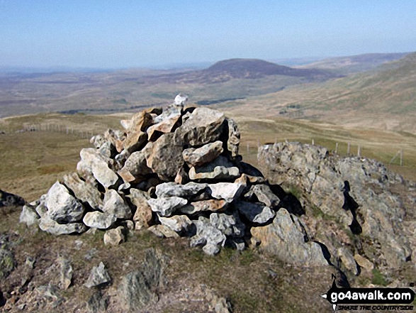
The summit of Arenig Fach is marked by an Ordnance Survey Trig Point.

Not familiar with this top?
You can walk/hike to the top of Arenig Fach by using this easy‑to‑follow route map:
Walk gw104 Carnedd y Filiast and Arenig Fach from Llyn Celyn
A fine hill walk with fine hill views
   |
|---|
Vital Statistics:
| Length: | 12.75ml (20.5km) |
|---|---|
| Ascent: | 2,939ft (896m) |
| Time: | 7.75hrs |
| Grade: |  (Hard) (Hard) |

Route Summary:
Llyn Celyn - Nant y Coed - Brottos - Carnedd y Filiast (Arenigs) - Waun Garnedd-y-Filiast - Carnedd y Filiast (Arenigs) - Carnedd Llechwedd-llyfn - Afon Celyn - Trinant - Arenig Fach - Capel Celyn - Llyn Celyn
See Arenig Fach and the surrounding tops on our free-to-access 'Google Style' Peak Bagging Maps:
The Arenigs of Snowdonia National Park
Less data - quicker to download
The Whole of Snowdonia National Park
More data - might take a little longer to download
See Arenig Fach and the surrounding tops on our unique, downloadable, PDF Peak Bagging Map:

NB: Whether you print off a copy or download it to your phone, this PDF Peak Baggers' Map might prove incredibly useful when your are up there on the tops and you cannot get a phone signal.
You can find Arenig Fach & all the walks that climb it on these unique free-to-access Interactive Walk Planning Maps:
1:25,000 scale OS Explorer Map (orange/yellow covers):
1:50,000 scale OS Landranger Maps (pink/magenta covers):
 Fellow go4awalkers who have already walked, climbed, scaled, summited, hiked & bagged Arenig Fach
Christina Lander walked up Arenig Fach on October 27th, 2024 [from/via/route] Lay-by on A4212 near Llyn Celyn - Y Foel - Arenig Fach - Y Foel - Retrace to lay-by [with] Dick [weather] Beautiful sunshine if a little windy especially at the top - A weekend away staying in Corris
Donovan Suddell climbed it on April 14th, 2023 [from/via/route] Llyn Celyn [with] solo [weather] Rain
Mark Davidson bagged it on May 11th, 2009 [with] Alone [weather] Lovely & sunny & warm - Fantastic Views
Louise Sandwith, Stephanie Doyle, Linda Mckeogh, Paul Booth, Trevor Williams and Stephen Hobdell have all walked, climbed & bagged Arenig Fach.
To add (or remove) your name and experiences on this page - Log On and edit your Personal Mountain Bagging Record
More Photographs & Pictures of views from, on, or of, Arenig Fach
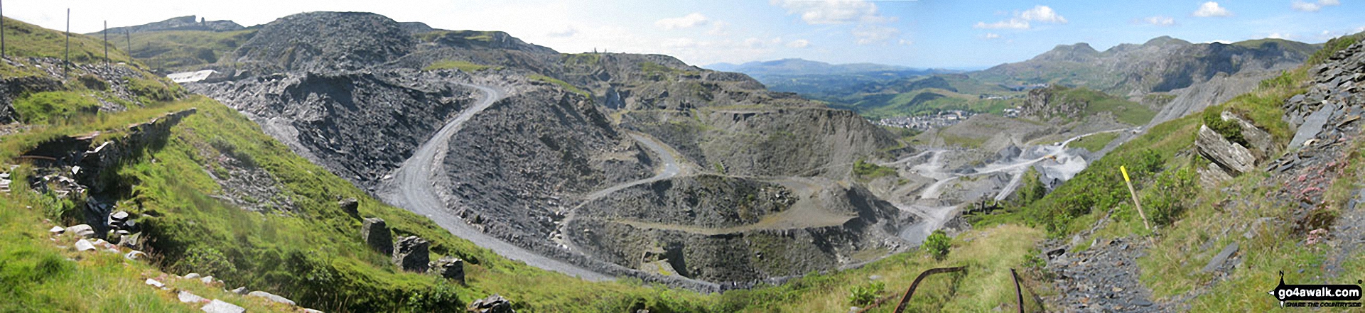
Maen-offeren Quarry from Drum House at the top of a disused incline with Arenig Fawr & Arenig Fach (on the horizon) and Moelwyn Bach, Craigysgafn and Moelwyn Mawr (mid-distance right)
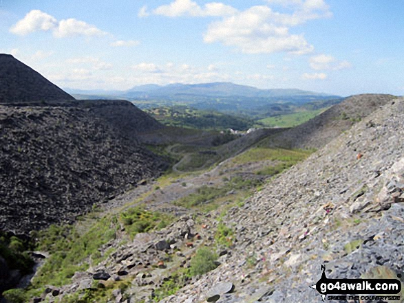
The Arenigs (Arenig Fawr & Arenig Fach) from Maen-offeren Quarry, Blaenau Ffestiniog

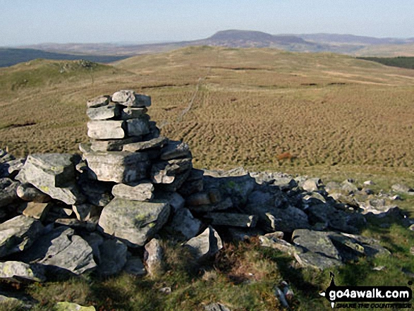
360 degree view from Moel Penamnen summit featuring (from left to right): The Moelwyns - Moelwyn Bach, Craigysgafn & Moelwyn Mawr, Allt-fawr, Moel Druman & Ysgafell Wen, Moel Farlwyd (foreground above/left of blue lake), Yr Aran (pointed peak above Moel Farlwyd), Mount Snowdon (Yr Wyddfa) & Y Lliwedd, The Glyderau - Glyder Fach, Glyder Fawr & Tryfan, Carnedd Moel Siabod, Y Ro Wen, Foel-fras (Moelwyns), Manod Mawr (above two light blue lakes) and The Arenigs - Arenig Fawr & Arenig Fach.
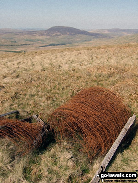
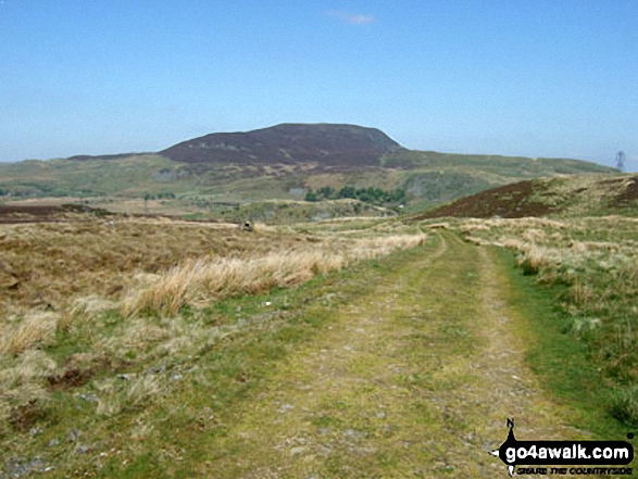
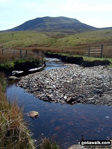
Arenig Fach from a rusting fence roll on the lower slopes of Moel Llyfnant
. . . see all 10 walk photographs & pictures of views from, on, or of, Arenig Fach
Send us your photographs and pictures on, of, or from Arenig Fach
If you would like to add your walk photographs and pictures to this page, please send them as email attachments (configured for any computer) along with your name to:
and we shall do our best to publish them.
(Guide Resolution = 300dpi. At least = 660pixels (wide) x 440 pixels (high).)

You can also submit photos via our Facebook Page.
NB. Please indicate where each photo was taken and whether you wish us to credit your photos with a Username or your First Name/Last Name.


