Walk Ben Nevis, The Aonachs & The Grey Corries area of Scottish Region 4: Fort William and Loch Linnhe to Loch Ericht, Scotland - 26 Mountains, Tops, Peaks and Hills
Ben Nevis, The Aonachs & The Grey Corries area of Fort William and Loch Linnhe to Loch Ericht region of Scotland is the area enclosed by an imaginary line connecting:
- Fort William to Gairlochy via the River Lochy to the North West
- Gairlochy to Tulloch Station via the B8004 to the Commando Memorial, the A82 to Spean Bridge and then the A86 through Roy Bridge to the North
- Tulloch Station to Corrour Station via the railway line & Loch Treig to the East
- Corrour Station to Achriabhach via Abhainn Rath and Water of Nevis to the South
- Achriabhach to Fort William via Glen Nevis to the South West
There are 26 'tops' to walk up, bag and conquer, the highest point is Ben Nevis and the area includes:
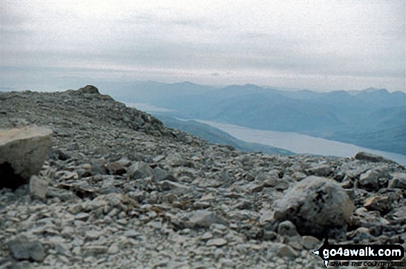 The summit of Ben Nevis
Photo: John Reed
| 10 | Munros | |
| 2 | Corbetts | |
| 2 | Grahams | |
| 0 | Donalds | |
| 21 | Murdos | |
| 11 | Marilyns | |
| 1 | Hill (aka Bridget) and | |
| 2 | Mountains, Tops, Peaks or Hills with a Trig Point on or near the top |
See these 26 Mountains, Tops, Peaks and Hills:-
- On a Special PDF Peak Baggers Map# you can download and print or save to your phone detailing all these tops.
- On an Interactive Google Map with a list of tops below it
- On a Detailed List in:
Alphabetical Order | Height Order - On one page with 'yet-to-be-bagged' listed 1st
& then 'already-bagged' tops listed 2nd in:
Alphabetical Order | Height Order - On one page with 'already-bagged' tops listed 1st
& then 'yet-to-be-bagged' tops listed 2nd in:
Alphabetical Order | Height Order
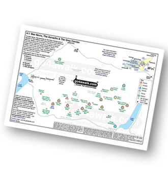 Peak Baggers Map you can Print or Save to your Phone detailing Ben Nevis, The Aonachs & The Grey Corries area of Section 4.1: Fort William and Loch Linnhe to Loch Ericht
# Whether you print a copy or download it to your phone, this Peak Baggers' Map will be essential if you want to know what's what when you are up in the hills and mountains and cannot get a phone signal.


