All the Mountains, Peaks, Tops and Hills in The Clwydian Hills area of Denbighshire and Flintshire, Wales as a detailed list
The Clwydian Hills area of Denbighshire and Flintshire is the area enclosed by the Irish Sea from the Snowdonia National Park boundary at Conwy to the River Dee to the North; the border between Wales and England from the River Dee to Chirk/Y Waun the the East; the A5 from Chirk/Y Waun to Druid and then the A494 to Bala to the South; and the Snowdonia National Park boundary from Bala to Conwy to the West. The area includes the The Clwydian Range of hills.
If you include just the Deweys and the Marilyns there are 18 tops to climb, bag & conquer and the highest point is Moel y Gamelin (Maesrychen Mountain) at 577m (1,893ft).
To see all Mountains, Peaks, Tops and Hills displayed in different ways - see the options in the left-hand column and towards the bottom of this page.
![]() Your Personal Bagging Record for The Clwydian Hills area of
Your Personal Bagging Record for The Clwydian Hills area of
LOG ON and RELOAD this page to show which Mountains, Peaks, Tops and Hills you have already climbed, bagged & conquered [. . . more]
See this list in: Alphabetical Order
| Height Order‡
To reverse the order select the link again.
Mountain, Peak, Top or Hill:
Bagged

![]()
1. Moel y Gamelin (Maesrychen Mountain)
577m (1,893ft)
Moel y Gamelin (Maesrychen Mountain) is on interactive maps:
A go4awalk.com Peak Bagging Map and Hill Tick List featuring Moel y Gamelin (Maesrychen Mountain) will be available soon. |
![]()
2. Cyrn-y-Brain
565m (1,854ft)
Cyrn-y-Brain is on interactive maps:
A go4awalk.com Peak Bagging Map and Hill Tick List featuring Cyrn-y-Brain will be available soon. |
![]()
3. Moel Famau
555m (1,821ft)
Moel Famau is on interactive maps:
A go4awalk.com Peak Bagging Map and Hill Tick List featuring Moel Famau will be available soon. |

![]()
4. Moel Morfydd (Llantysilio Mountain)
549m (1,801ft)
Moel Morfydd (Llantysilio Mountain) is on interactive maps:
A go4awalk.com Peak Bagging Map and Hill Tick List featuring Moel Morfydd (Llantysilio Mountain) will be available soon. |
![]()
5. Moel y Faen (Llantysilio Mountain)
548m (1,798ft)
Moel y Faen (Llantysilio Mountain) is on interactive maps:
A go4awalk.com Peak Bagging Map and Hill Tick List featuring Moel y Faen (Llantysilio Mountain) will be available soon. |
![]()
6. Mwdwl-eithin (Alwen Reservoir))
532m (1,746ft)
Mwdwl-eithin (Alwen Reservoir)) is on interactive maps:
A go4awalk.com Peak Bagging Map and Hill Tick List featuring Mwdwl-eithin (Alwen Reservoir)) will be available soon. |
![]()
7. Marial Gwyn (Foel Goch)
519m (1,703ft)
Marial Gwyn (Foel Goch) is on interactive maps:
A go4awalk.com Peak Bagging Map and Hill Tick List featuring Marial Gwyn (Foel Goch) will be available soon. |
![]()
8. Gorsedd Bran
518m (1,700ft)
Gorsedd Bran is on interactive maps:
A go4awalk.com Peak Bagging Map and Hill Tick List featuring Gorsedd Bran will be available soon. |
![]()
9. Eglwyseg Mountain
511m (1,677ft)
Eglwyseg Mountain is on interactive maps:
A go4awalk.com Peak Bagging Map and Hill Tick List featuring Eglwyseg Mountain will be available soon. |
![]()
10. Foel Fenlli
511m (1,677ft)
Foel Fenlli is on interactive maps:
A go4awalk.com Peak Bagging Map and Hill Tick List featuring Foel Fenlli will be available soon. |
![]()
11. Moel y Gaer (Llantysilio Mountain)
504m (1,654ft)
Moel y Gaer (Llantysilio Mountain) is on interactive maps:
A go4awalk.com Peak Bagging Map and Hill Tick List featuring Moel y Gaer (Llantysilio Mountain) will be available soon. |
![]()
12. Craig Bron-banog
502m (1,647ft)
Craig Bron-banog is on interactive maps:
A go4awalk.com Peak Bagging Map and Hill Tick List featuring Craig Bron-banog will be available soon. |

![]()
13. Moel Gyw
467m (1,532ft)
Moel Gyw is on interactive maps:
A go4awalk.com Peak Bagging Map and Hill Tick List featuring Moel Gyw will be available soon. |
![]()
14. Penycloddiau
440m (1,444ft)
Penycloddiau is on interactive maps:
A go4awalk.com Peak Bagging Map and Hill Tick List featuring Penycloddiau will be available soon. |
![]()
15. Mynydd Rhyd Ddu
389m (1,276ft)
Mynydd Rhyd Ddu is on interactive maps:
A go4awalk.com Peak Bagging Map and Hill Tick List featuring Mynydd Rhyd Ddu will be available soon. |
![]()
16. Hope Mountain
330m (1,083ft)
Hope Mountain is on interactive maps:
A go4awalk.com Peak Bagging Map and Hill Tick List featuring Hope Mountain will be available soon. |
![]()
17. Mynydd y Cwm (Coed Cwm)
305m (1,001ft)
Mynydd y Cwm (Coed Cwm) is on interactive maps:
A go4awalk.com Peak Bagging Map and Hill Tick List featuring Mynydd y Cwm (Coed Cwm) will be available soon. |
![]()
18. Great Orme (Great Ormes Head)
207m (679ft)
Great Orme (Great Ormes Head) is on interactive maps:
A go4awalk.com Peak Bagging Map and Hill Tick List featuring Great Orme (Great Ormes Head) will be available soon. |
View all 37 Mountains, Peaks, Tops and Hills in The Clwydian Hills area of Snowdonia:
- On an Interactive Google Map (loads faster)
- On an Interactive Google Map with a list of tops below it (makes it easier to locate a particular top)
- On a Detailed List in:
Alphabetical Order | Height Order - On one page with 'yet-to-be-bagged' listed 1st & then 'already-bagged' tops listed 2nd in:
Alphabetical Order | Height Order (must be logged on) - On one page with 'already-bagged' tops listed 1st & then 'yet-to-be-bagged' tops listed 2nd in:
Alphabetical Order | Height Order (must be logged on)
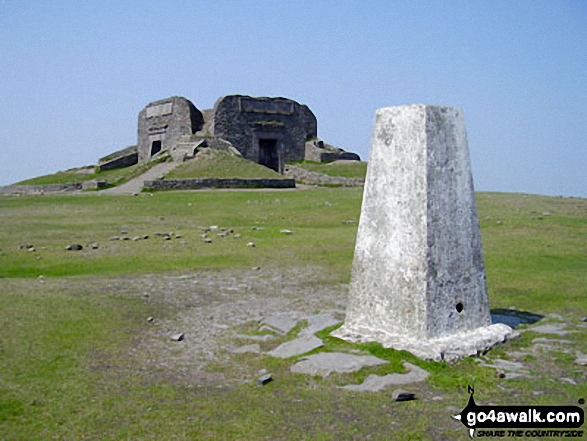
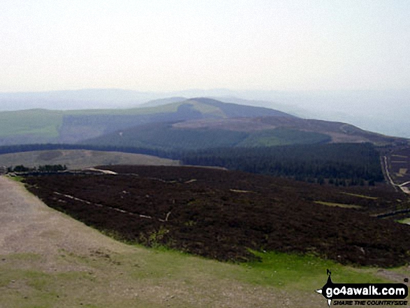
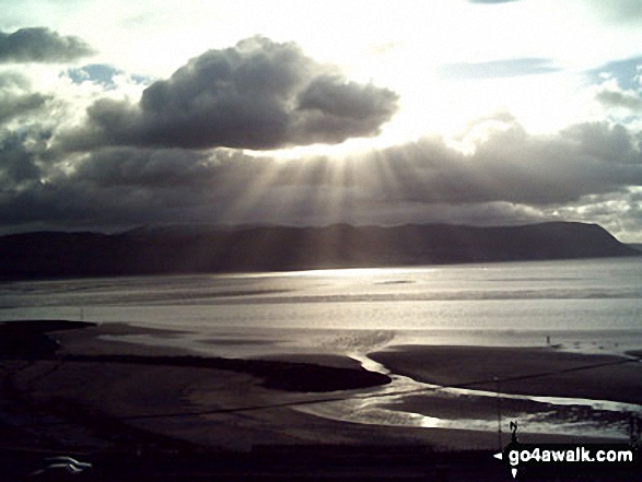 The view from Moel y Gamelin (Maesrychen Mountain), the highest point in The Clwydian Hills
Photo: Mike Jennings
Is there a Mountain, Peak, Top or Hill missing from the above google map or list?
Let us know an we will add it to our database.
To contribute to go4awalk.com or to contact us about anything at all - see Talk To Us.
For help see Help.
go4awalk.com and go4awalk.co.uk are registered trademarks of TMDH Limited.
Copyright © 2000-2024 TMDH Limited. All rights reserved.
Copyright | Terms & Conditions | Privacy Statement
A - Z
Walks
Home
Log On/Accounts
Photo Gallery
Walk Ideas and Collections
Fell Facts
Places to Stay
Hill Skills
Walking Questions and Answers
Your Stories
News
Competitions
Product Reviews/Gear Tests
Walking Gear Guides
Peaks and Mountains
Peak Bagging
Find New Walking Friends
Camping
GPS Waypoints for Walking
Walk Search
Talk to us
go4awalk.com Help
Free example walks
Newsletter


