All the Mountains, Peaks, Tops and Hills in Bannau Brycheiniog (The Brecon Beacons National Park), Carmarthenshire, Merthyr Tydfil, Monmouthshire, Powys, Rhondda Cynon Taff, Wales as a detailed list
Bannau Brycheiniog (The Brecon Beacons National Park), Carmarthenshire, Merthyr Tydfil, Monmouthshire, Powys, Rhondda Cynon Taff is located in South Wales covering part of the counties of Blaenau Gwent, Caerphilly, Carmarthenshire, Merthyr Tydfil, Monmouthshire, Powys, Rhondda Cynon Taf and Torfaen.
If you count only the Deweys there are 21 tops to climb, bag & conquer and the highest point is Mynydd Troed at 609m (1,999ft).
To see all Mountains, Peaks, Tops and Hills displayed in different ways - see the options in the left-hand column and towards the bottom of this page.
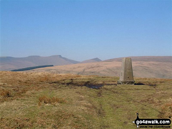
![]() Your Personal Bagging Record for Bannau Brycheiniog (The Brecon Beacons National Park)
Your Personal Bagging Record for Bannau Brycheiniog (The Brecon Beacons National Park)
LOG ON and RELOAD this page to show which Mountains, Peaks, Tops and Hills you have already climbed, bagged & conquered [. . . more]
See this list in: Alphabetical Order‡
| Height Order
To reverse the order select the link again.
Mountain, Peak, Top or Hill:
Bagged

![]()
1. Yr Allt (Forest Fawr)
604m (1,982ft)
Yr Allt (Forest Fawr) is on interactive maps:
Yr Allt (Forest Fawr) is on Peak Bagging Map and Hill Tick List: |
![]()
2. Waun Leuci (Cefn Cul)
562m (1,844ft)
Waun Leuci (Cefn Cul) is on interactive maps:
Waun Leuci (Cefn Cul) is on Peak Bagging Map and Hill Tick List: |
![]()
3. Twr Pen-cyrn (Mynydd Llangattwg)
529m (1,736ft)
Twr Pen-cyrn (Mynydd Llangattwg) is on interactive maps:
Twr Pen-cyrn (Mynydd Llangattwg) is on Peak Bagging Map and Hill Tick List: |
![]()
4. Tor y Foel
551m (1,808ft)
Tor y Foel is on interactive maps:
Tor y Foel is on Peak Bagging Map and Hill Tick List: |
![]()
5. Sugar Loaf (Y Fal)
596m (1,956ft)
Sugar Loaf (Y Fal) is on interactive maps:
Sugar Loaf (Y Fal) is on Peak Bagging Map and Hill Tick List: |
![]()
6. Pant y Creigiau
565m (1,854ft)
Pant y Creigiau is on interactive maps:
Pant y Creigiau is on Peak Bagging Map and Hill Tick List: |
![]()
7. Mynydd Troed
609m (1,999ft)
Mynydd Troed is on interactive maps:
Mynydd Troed is on Peak Bagging Map and Hill Tick List: |
![]()
8. Mynydd Llangynidr
557m (1,828ft)
Mynydd Llangynidr is on interactive maps:
Mynydd Llangynidr is on Peak Bagging Map and Hill Tick List: |
![]()
9. Mynydd Llangorse
515m (1,690ft)
Mynydd Llangorse is on interactive maps:
Mynydd Llangorse is on Peak Bagging Map and Hill Tick List: |
![]()
10. Moel Feity
591m (1,939ft)
Moel Feity is on interactive maps:
Moel Feity is on Peak Bagging Map and Hill Tick List: |
![]()
11. Hatterrall Hill
531m (1,742ft)
Hatterrall Hill is on interactive maps:
Hatterrall Hill is on Peak Bagging Map and Hill Tick List: |
![]()
12. Foel Fraith
602m (1,975ft)
Foel Fraith is on interactive maps:
Foel Fraith is on Peak Bagging Map and Hill Tick List: |
![]()
13. Disgwylfa (Waun Fignen Felen)
544m (1,785ft)
Disgwylfa (Waun Fignen Felen) is on interactive maps:
Disgwylfa (Waun Fignen Felen) is on Peak Bagging Map and Hill Tick List: |
![]()
14. Cefn y Cylchau
556m (1,825ft)
Cefn y Cylchau is on interactive maps:
Cefn y Cylchau is on Peak Bagging Map and Hill Tick List: |
![]()
15. Carreg Goch
558m (1,831ft)
Carreg Goch is on interactive maps:
Carreg Goch is on Peak Bagging Map and Hill Tick List: |
![]()
16. Carreg Cadno
538m (1,765ft)
Carreg Cadno is on interactive maps:
Carreg Cadno is on Peak Bagging Map and Hill Tick List: |
![]()
17. Carn Pen-rhiw-ddu
534m (1,752ft)
Carn Pen-rhiw-ddu is on interactive maps:
Carn Pen-rhiw-ddu is on Peak Bagging Map and Hill Tick List: |
![]()
18. Bryniau Gleision (Talybont Reservoir)
538m (1,766ft)
Bryniau Gleision (Talybont Reservoir) is on interactive maps:
Bryniau Gleision (Talybont Reservoir) is on Peak Bagging Map and Hill Tick List: |
![]()
19. Bryn (Waun Rydd)
562m (1,844ft)
Bryn (Waun Rydd) is on interactive maps:
Bryn (Waun Rydd) is on Peak Bagging Map and Hill Tick List: |
![]()
20. Blorenge (Blorens)
561m (1,841ft)
Blorenge (Blorens) is on interactive maps:
Blorenge (Blorens) is on Peak Bagging Map and Hill Tick List: |
![]()
21. Allt Forgan
513m (1,684ft)
Allt Forgan is on interactive maps:
Allt Forgan is on Peak Bagging Map and Hill Tick List: |
View all 100 Mountains, Peaks, Tops and Hills in The Brecon Beacons National Park:
- On Two Downloadable PDFs you can print or save to your phone covering:
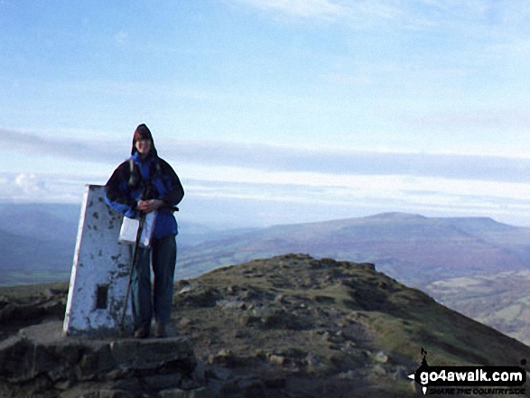
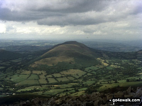
 Pen y Fan
Photo: Paul Holroyd
- On an Interactive Google Map (loads faster)
- On an Interactive Google Map with a list of tops below it (makes it easier to locate a particular top)
- On a Detailed List in:
Alphabetical Order | Height Order - On one page with 'yet-to-be-bagged' listed 1st & then 'already-bagged' tops listed 2nd in:
Alphabetical Order | Height Order (must be logged on) - On one page with 'already-bagged' tops listed 1st & then 'yet-to-be-bagged' tops listed 2nd in:
Alphabetical Order | Height Order (must be logged on)
Is there a Mountain, Peak, Top or Hill missing from the above google map or list?
Let us know an we will add it to our database.

To contribute to go4awalk.com or to contact us about anything at all - see Talk To Us.
For help see Help.
go4awalk.com and go4awalk.co.uk are registered trademarks of TMDH Limited.
Copyright © 2000-2024 TMDH Limited. All rights reserved.
Copyright | Terms & Conditions | Privacy Statement
A - Z
Walks
Home
Log On/Accounts
Photo Gallery
Walk Ideas and Collections
Fell Facts
Places to Stay
Hill Skills
Walking Questions and Answers
Your Stories
News
Competitions
Product Reviews/Gear Tests
Walking Gear Guides
Peaks and Mountains
Peak Bagging
Find New Walking Friends
Camping
GPS Waypoints for Walking
Walk Search
Talk to us
go4awalk.com Help
Free example walks
Newsletter


