The Mountains, Peaks, Tops and Hills in Scotland as a detailed list
If you count only the Grahams there are 219 tops to climb, bag & conquer and the highest point is Sgurr a' Chaorainn at 761m (2,498ft).
To see all Mountains, Peaks, Tops and Hills displayed in different ways - see the options in the left-hand column and towards the bottom of this page.
![]() Your Personal Bagging Record for Scottish Region : Scotland
Your Personal Bagging Record for Scottish Region : Scotland
LOG ON and RELOAD this page to show which Mountains, Peaks, Tops and Hills you have already climbed, bagged & conquered [. . . more]
See this list in: Alphabetical Order‡
| Height Order
To reverse the order select the link again.
Mountain, Peak, Top or Hill:
Bagged

![]()
1. An Cruachan (Loch Monar)
705m (2,313ft)
An Cruachan (Loch Monar) is on interactive maps:
A go4awalk.com Peak Bagging Map and Hill Tick List featuring An Cruachan (Loch Monar) will be available soon. |
![]()
2. An Ruadh-mheallan
672m (2,206ft)
An Ruadh-mheallan is on interactive maps:
A go4awalk.com Peak Bagging Map and Hill Tick List featuring An Ruadh-mheallan will be available soon. |
![]()
3. An Stac (South Morar)
718m (2,356ft)
An Stac (South Morar) is on interactive maps:
A go4awalk.com Peak Bagging Map and Hill Tick List featuring An Stac (South Morar) will be available soon. |
![]()
4. Andrewhinney Hill
677m (2,222ft)
Andrewhinney Hill is on interactive maps:
A go4awalk.com Peak Bagging Map and Hill Tick List featuring Andrewhinney Hill will be available soon. |
![]()
5. Aodann Chleireig
663m (2,176ft)
Aodann Chleireig is on interactive maps:
A go4awalk.com Peak Bagging Map and Hill Tick List featuring Aodann Chleireig will be available soon. |
![]()
6. Badandun Hill
740m (2,429ft)
Badandun Hill is on interactive maps:
A go4awalk.com Peak Bagging Map and Hill Tick List featuring Badandun Hill will be available soon. |
![]()
7. Ballencleuch Law
689m (2,261ft)
Ballencleuch Law is on interactive maps:
A go4awalk.com Peak Bagging Map and Hill Tick List featuring Ballencleuch Law will be available soon. |
![]()
8. Beinn a' Chaisgein Beag
682m (2,238ft)
Beinn a' Chaisgein Beag is on interactive maps:
A go4awalk.com Peak Bagging Map and Hill Tick List featuring Beinn a' Chaisgein Beag will be available soon. |
![]()
9. Beinn a' Chaolais
733m (2,406ft)
Beinn a' Chaolais is on interactive maps:
A go4awalk.com Peak Bagging Map and Hill Tick List featuring Beinn a' Chaolais will be available soon. |
![]()
10. Beinn a' Chapuill
759m (2,491ft)
Beinn a' Chapuill is on interactive maps:
A go4awalk.com Peak Bagging Map and Hill Tick List featuring Beinn a' Chapuill will be available soon. |
![]()
11. Beinn a' Chearcaill
725m (2,379ft)
Beinn a' Chearcaill is on interactive maps:
A go4awalk.com Peak Bagging Map and Hill Tick List featuring Beinn a' Chearcaill will be available soon. |
![]()
12. Beinn a' Chlachain (Meall an Doireachain)
626m (2,055ft)
Beinn a' Chlachain (Meall an Doireachain) is on interactive maps:
A go4awalk.com Peak Bagging Map and Hill Tick List featuring Beinn a' Chlachain (Meall an Doireachain) will be available soon. |
![]()
13. Beinn a' Mhanaich
709m (2,327ft)
Beinn a' Mhanaich is on interactive maps:
A go4awalk.com Peak Bagging Map and Hill Tick List featuring Beinn a' Mhanaich will be available soon. |
![]()
14. Beinn a' Mheadhoin (Loch Beinn a' Mhea
613m (2,012ft)
Beinn a' Mheadhoin (Loch Beinn a' Mhea is on interactive maps:
A go4awalk.com Peak Bagging Map and Hill Tick List featuring Beinn a' Mheadhoin (Loch Beinn a' Mhea will be available soon. |
![]()
15. Beinn a' Mhuinidh
692m (2,271ft)
Beinn a' Mhuinidh is on interactive maps:
A go4awalk.com Peak Bagging Map and Hill Tick List featuring Beinn a' Mhuinidh will be available soon. |
![]()
16. Beinn an Eoin (Coigach)
619m (2,032ft)
Beinn an Eoin (Coigach) is on interactive maps:
A go4awalk.com Peak Bagging Map and Hill Tick List featuring Beinn an Eoin (Coigach) will be available soon. |
![]()
17. Beinn Bhalgairean
636m (2,087ft)
Beinn Bhalgairean is on interactive maps:
A go4awalk.com Peak Bagging Map and Hill Tick List featuring Beinn Bhalgairean will be available soon. |
![]()
18. Beinn Bheag (Glen Gour)
736m (2,416ft)
Beinn Bheag (Glen Gour) is on interactive maps:
A go4awalk.com Peak Bagging Map and Hill Tick List featuring Beinn Bheag (Glen Gour) will be available soon. |
![]()
19. Beinn Bheag (Loch Eck)
618m (2,028ft)
Beinn Bheag (Loch Eck) is on interactive maps:
A go4awalk.com Peak Bagging Map and Hill Tick List featuring Beinn Bheag (Loch Eck) will be available soon. |
![]()
20. Beinn Bheag (Wester Ross)
668m (2,192ft)
Beinn Bheag (Wester Ross) is on interactive maps:
A go4awalk.com Peak Bagging Map and Hill Tick List featuring Beinn Bheag (Wester Ross) will be available soon. |
![]()
21. Beinn Bhreac (Invergroin)
681m (2,233ft)
Beinn Bhreac (Invergroin) is on interactive maps:
A go4awalk.com Peak Bagging Map and Hill Tick List featuring Beinn Bhreac (Invergroin) will be available soon. |
![]()
22. Beinn Bhreac (Meall Dubh)
667m (2,189ft)
Beinn Bhreac (Meall Dubh) is on interactive maps:
A go4awalk.com Peak Bagging Map and Hill Tick List featuring Beinn Bhreac (Meall Dubh) will be available soon. |
![]()
23. Beinn Chaorach (Glen Luss)
713m (2,340ft)
Beinn Chaorach (Glen Luss) is on interactive maps:
A go4awalk.com Peak Bagging Map and Hill Tick List featuring Beinn Chaorach (Glen Luss) will be available soon. |
![]()
24. Beinn Clachach
643m (2,110ft)
Beinn Clachach is on interactive maps:
A go4awalk.com Peak Bagging Map and Hill Tick List featuring Beinn Clachach will be available soon. |
![]()
25. Beinn Damhain
684m (2,245ft)
Beinn Damhain is on interactive maps:
A go4awalk.com Peak Bagging Map and Hill Tick List featuring Beinn Damhain will be available soon. |
![]()
26. Beinn Dearg Mhor (Glamaig)
731m (2,399ft)
Beinn Dearg Mhor (Glamaig) is on interactive maps:
A go4awalk.com Peak Bagging Map and Hill Tick List featuring Beinn Dearg Mhor (Glamaig) will be available soon. |
![]()
27. Beinn Dearg Mhor (Skye)
709m (2,327ft)
Beinn Dearg Mhor (Skye) is on interactive maps:
A go4awalk.com Peak Bagging Map and Hill Tick List featuring Beinn Dearg Mhor (Skye) will be available soon. |
![]()
28. Beinn Dhorain
628m (2,061ft)
Beinn Dhorain is on interactive maps:
A go4awalk.com Peak Bagging Map and Hill Tick List featuring Beinn Dhorain will be available soon. |
![]()
29. Beinn Direach
689m (2,260ft)
Beinn Direach is on interactive maps:
A go4awalk.com Peak Bagging Map and Hill Tick List featuring Beinn Direach will be available soon. |
![]()
30. Beinn Donachain
650m (2,133ft)
Beinn Donachain is on interactive maps:
A go4awalk.com Peak Bagging Map and Hill Tick List featuring Beinn Donachain will be available soon. |
View all 1674 Mountains, Peaks, Tops and Hills in Scottish Region : Loch Leven to Connel Bridge, Strath of Orchy and Glen Lochy:
- On an Interactive Google Map (loads faster)
- On an Interactive Google Map with a list of tops below it (makes it easier to locate a particular top)
- On a Detailed List in:
Alphabetical Order | Height Order - On one page with 'yet-to-be-bagged' listed 1st & then 'already-bagged' tops listed 2nd in:
Alphabetical Order | Height Order (must be logged on) - On one page with 'already-bagged' tops listed 1st & then 'yet-to-be-bagged' tops listed 2nd in:
Alphabetical Order | Height Order (must be logged on)
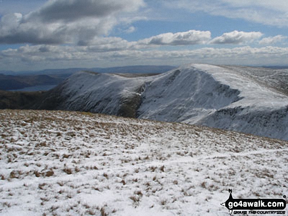
 The summit of Ben Nevis, the highest point in Loch Leven to Connel Bridge, Strath of Orchy and Glen LochyScotland
Photo: John Reed
Is there a Mountain, Peak, Top or Hill missing from the above google map or list?
Let us know an we will add it to our database.

To contribute to go4awalk.com or to contact us about anything at all - see Talk To Us.
For help see Help.
go4awalk.com and go4awalk.co.uk are registered trademarks of TMDH Limited.
Copyright © 2000-2024 TMDH Limited. All rights reserved.
Copyright | Terms & Conditions | Privacy Statement
A - Z
Walks
Home
Log On/Accounts
Photo Gallery
Walk Ideas and Collections
Fell Facts
Places to Stay
Hill Skills
Walking Questions and Answers
Your Stories
News
Competitions
Product Reviews/Gear Tests
Walking Gear Guides
Peaks and Mountains
Peak Bagging
Find New Walking Friends
Camping
GPS Waypoints for Walking
Walk Search
Talk to us
go4awalk.com Help
Free example walks
Newsletter


