All the Mountains, Peaks, Tops and Hills in England, England as a detailed list
England is defined as the whole of the country of England which includes the National Parks of Dartmoor, Exmoor, The Lake District, The Peak District, The North York Moors, Northumberland, The South Downs and The Yorkshire Dales, as well as The Chilterns, The Cotswolds, The Forest of Bowland, The North Peninnes, The Shropshire Hills and The South Peninnes.
If you count only the Mountains (Hewitts) there are 180 tops to climb, bag & conquer and the highest point is Scafell Pike at 978m (3,210ft).
To see all Mountains, Peaks, Tops and Hills displayed in different ways - see the options in the left-hand column and towards the bottom of this page.
LOG ON and RELOAD this page to show which Mountains, Peaks, Tops and Hills you have already climbed, bagged & conquered [. . . more]
Page 6 of 6 Go to page:
1 2 3 4 5 6 |
See this list in: Alphabetical Order‡
| Height Order
To reverse the order select the link again.
Mountain, Peak, Top or Hill:
Bagged
151. St Sunday Crag
841m (2,760ft)
Wainwright (No. 22)
Mountain (27th in England, 53rd in England & Wales)
Nuttall (33rd in England, 61st in England & Wales)
Marilyn (10th in England, 328th in GB)
To walk, climb & bag St Sunday Crag use any of these easy to follow walks:
See the location of St Sunday Crag and walks up it on a google MapSt Sunday Crag is on interactive maps:
OS Explorer (Orange Covers): OL5
OS Landranger (Pink Covers): 90
St Sunday Crag is on Peak Bagging Map and Hill Tick List:
*Version including the walk routes marked on it that you need to follow to Walk all 214 Wainwrights in just 59 walks. |
152. Starling Dodd
633m (2,077ft)
Wainwright (No. 122)
Mountain (158th in England, 270th in England & Wales)
Nuttall (213th in England, 365th in England & Wales)
To walk, climb & bag Starling Dodd use any of these easy to follow walks:
See the location of Starling Dodd and walks up it on a google MapStarling Dodd is on interactive maps:
OS Explorer (Orange Covers): OL4
OS Landranger (Pink Covers): 89
Starling Dodd is on Peak Bagging Map and Hill Tick List:
*Version including the walk routes marked on it that you need to follow to Walk all 214 Wainwrights in just 59 walks. |
153. Stony Cove Pike (Caudale Moor)
763m (2,504ft)
Wainwright (No. 55)
Mountain (63rd in England, 109th in England & Wales)
Nuttall (77th in England, 133rd in England & Wales)
Marilyn (19th in England, 465th in GB)
In Alfred Wainwright's 'Book Two - The Far Eastern Fells' the chapter for Stony Cove Pike (Caudale Moor) is entitled simply 'Caudale Moor'.
To walk, climb & bag Stony Cove Pike (Caudale Moor) use any of these easy to follow walks:
See the location of Stony Cove Pike (Caudale Moor) and walks up it on a google MapStony Cove Pike (Caudale Moor) is on interactive maps:
OS Explorer (Orange Covers): OL5 and
OL7
OS Landranger (Pink Covers): 90
Stony Cove Pike (Caudale Moor) is on Peak Bagging Map and Hill Tick List:
*Version including the walk routes marked on it that you need to follow to Walk all 214 Wainwrights in just 59 walks. |
154. Striding Edge
863m (2,831ft)
Mountain (19th in England, 42nd in England & Wales)
Nuttall (23rd in England, 49th in England & Wales)
Striding Edge (High Spying How) gained Mountain (Hewitt) status in September, 2018.
To walk, climb & bag Striding Edge use any of these easy to follow walks:
See the location of Striding Edge and walks up it on a google MapStriding Edge is on interactive maps:
OS Explorer (Orange Covers): OL5
OS Landranger (Pink Covers): 90
Striding Edge is on Peak Bagging Map and Hill Tick List:
*Version including the walk routes marked on it that you need to follow to Walk all 214 Wainwrights in just 59 walks. |
155. Stybarrow Dodd
843m (2,767ft)
Wainwright (No. 21)
Mountain (25th in England, 51st in England & Wales)
Nuttall (31st in England, 59th in England & Wales)
To walk, climb & bag Stybarrow Dodd use any of these easy to follow walks:
See the location of Stybarrow Dodd and walks up it on a google MapStybarrow Dodd is on interactive maps:
OS Explorer (Orange Covers): OL5
OS Landranger (Pink Covers): 90
Stybarrow Dodd is on Peak Bagging Map and Hill Tick List:
*Version including the walk routes marked on it that you need to follow to Walk all 214 Wainwrights in just 59 walks. |
156. Swarth Fell
681m (2,235ft)
Mountain (114th in England, 194th in England & Wales)
Nuttall (152nd in England, 257th in England & Wales)
To walk, climb & bag Swarth Fell use either of these easy to follow walks:
See the location of Swarth Fell and walks up it on a google MapSwarth Fell is on interactive maps:
OS Explorer (Orange Covers): OL19
OS Landranger (Pink Covers): 98
Swarth Fell is on Peak Bagging Map and Hill Tick List:
|
157. Swirl How
802m (2,633ft)
Wainwright (No. 32)
Mountain (40th in England, 74th in England & Wales)
Nuttall (47th in England, 89th in England & Wales)
To walk, climb & bag Swirl How use any of these easy to follow walks:
See the location of Swirl How and walks up it on a google MapSwirl How is on interactive maps:
OS Explorer (Orange Covers): OL6
OS Landranger (Pink Covers): 89 and
90
Swirl How is on Peak Bagging Map and Hill Tick List:
*Version including the walk routes marked on it that you need to follow to Walk all 214 Wainwrights in just 59 walks. |
158. Tarn Crag (Sleddale)
664m (2,179ft)
Wainwright (No. 104)
Mountain (132nd in England, 225th in England & Wales)
Nuttall (177th in England, 300th in England & Wales)
Marilyn (42nd in England, 667th in GB)
To walk, climb & bag Tarn Crag (Sleddale) use this easy to follow walk:
See the location of Tarn Crag (Sleddale) and walks up it on a google MapTarn Crag (Sleddale) is on interactive maps:
OS Explorer (Orange Covers): OL7
OS Landranger (Pink Covers): 90
Tarn Crag (Sleddale) is on Peak Bagging Map and Hill Tick List:
*Version including the walk routes marked on it that you need to follow to Walk all 214 Wainwrights in just 59 walks. |
159. The Calf
676m (2,218ft)
Mountain (118th in England, 201st in England & Wales)
Nuttall (157th in England, 268th in England & Wales)
Marilyn (37th in England, 642nd in GB)
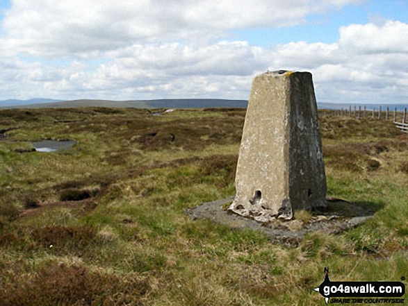
OS Trig Point
To walk, climb & bag The Calf use any of these easy to follow walks:
See the location of The Calf and walks up it on a google MapThe Calf is on interactive maps:
OS Explorer (Orange Covers): OL19
OS Landranger (Pink Covers): 98
The Calf is on Peak Bagging Map and Hill Tick List:
|
160. The Cheviot
815m (2,674ft)
Mountain (36th in England, 67th in England & Wales)
Nuttall (43rd in England, 80th in England & Wales)
Marilyn (12th in England, 360th in GB)
OS Trig Point
The Cheviot is the highest point in the county of Northumberland.
To walk, climb & bag The Cheviot use any of these easy to follow walks:
See the location of The Cheviot and walks up it on a google MapThe Cheviot is on interactive maps:
OS Explorer (Orange Covers): OL16
OS Landranger (Pink Covers): 74 and
75
A go4awalk.com Peak Bagging Map and Hill Tick List featuring The Cheviot will be available soon. |
161. The Dodd
614m (2,015ft)
Mountain (175th in England, 306th in England & Wales)
Nuttall (244th in England, 425th in England & Wales)
To walk, climb & bag The Dodd use this easy to follow walk:
See the location of The Dodd and walks up it on a google MapThe Dodd is on interactive maps:
OS Explorer (Orange Covers): OL31
OS Landranger (Pink Covers): 86 and
87
The Dodd is on Peak Bagging Map and Hill Tick List:
|
162. The Old Man of Coniston
802m (2,633ft)
Wainwright (No. 30)
Mountain (41st in England, 75th in England & Wales)
Nuttall (48th in England, 90th in England & Wales)
Marilyn (14th in England, 387th in GB)
OS Trig Point
To walk, climb & bag The Old Man of Coniston use any of these easy to follow walks:
See the location of The Old Man of Coniston and walks up it on a google MapThe Old Man of Coniston is on interactive maps:
OS Explorer (Orange Covers): OL6
OS Landranger (Pink Covers): 96 and
97
The Old Man of Coniston is on Peak Bagging Map and Hill Tick List:
*Version including the walk routes marked on it that you need to follow to Walk all 214 Wainwrights in just 59 walks. |
163. Thornthwaite Crag
784m (2,573ft)
Wainwright (No. 44)
Mountain (52nd in England, 91st in England & Wales)
Nuttall (62nd in England, 111th in England & Wales)
To walk, climb & bag Thornthwaite Crag use any of these easy to follow walks:
See the location of Thornthwaite Crag and walks up it on a google MapThornthwaite Crag is on interactive maps:
OS Explorer (Orange Covers): OL5 and
OL7
OS Landranger (Pink Covers): 90
Thornthwaite Crag is on Peak Bagging Map and Hill Tick List:
*Version including the walk routes marked on it that you need to follow to Walk all 214 Wainwrights in just 59 walks. |
164. Three Pikes
650m (2,134ft)
Mountain (144th in England, 247th in England & Wales)
Nuttall (192nd in England, 331st in England & Wales)
To walk, climb & bag Three Pikes use any of these easy to follow walks:
See the location of Three Pikes and walks up it on a google MapThree Pikes is on interactive maps:
OS Explorer (Orange Covers): OL31
OS Landranger (Pink Covers): 91 and
92
Three Pikes is on Peak Bagging Map and Hill Tick List:
|
165. Ullscarf
723m (2,372ft)
Wainwright (No. 74)
Mountain (84th in England, 145th in England & Wales)
Nuttall (106th in England, 180th in England & Wales)
To walk, climb & bag Ullscarf use any of these easy to follow walks:
See the location of Ullscarf and walks up it on a google MapUllscarf is on interactive maps:
OS Explorer (Orange Covers): OL4
OS Landranger (Pink Covers): 89 and
90
Ullscarf is on Peak Bagging Map and Hill Tick List:
*Version including the walk routes marked on it that you need to follow to Walk all 214 Wainwrights in just 59 walks. |
166. Viewing Hill
649m (2,130ft)
Mountain (146th in England, 250th in England & Wales)
Nuttall (194th in England, 334th in England & Wales)
To walk, climb & bag Viewing Hill use this easy to follow walk:
See the location of Viewing Hill and walks up it on a google MapViewing Hill is on interactive maps:
OS Explorer (Orange Covers): OL31
OS Landranger (Pink Covers): 91
Viewing Hill is on Peak Bagging Map and Hill Tick List:
|
167. Wandope
773m (2,539ft)
Wainwright (No. 51)
Mountain (57th in England, 99th in England & Wales)
Nuttall (71st in England, 123rd in England & Wales)
To walk, climb & bag Wandope use any of these easy to follow walks:
See the location of Wandope and walks up it on a google MapWandope is on interactive maps:
OS Explorer (Orange Covers): OL4
OS Landranger (Pink Covers): 89 and
90
Wandope is on Peak Bagging Map and Hill Tick List:
*Version including the walk routes marked on it that you need to follow to Walk all 214 Wainwrights in just 59 walks. |
168. Westernhope Moor
675m (2,215ft)
Mountain (120th in England, 203rd in England & Wales)
Nuttall (160th in England, 272nd in England & Wales)
OS Trig Point
To walk, climb & bag Westernhope Moor use this easy to follow walk:
See the location of Westernhope Moor and walks up it on a google MapWesternhope Moor is on interactive maps:
OS Explorer (Orange Covers): OL31
OS Landranger (Pink Covers): 91 and
92
Westernhope Moor is on Peak Bagging Map and Hill Tick List:
|
169. Wetherlam
763m (2,504ft)
Wainwright (No. 56)
Mountain (64th in England, 110th in England & Wales)
Nuttall (78th in England, 134th in England & Wales)
To walk, climb & bag Wetherlam use any of these easy to follow walks:
See the location of Wetherlam and walks up it on a google MapWetherlam is on interactive maps:
OS Explorer (Orange Covers): OL6
OS Landranger (Pink Covers): 89 and
90
Wetherlam is on Peak Bagging Map and Hill Tick List:
*Version including the walk routes marked on it that you need to follow to Walk all 214 Wainwrights in just 59 walks. |
170. Whernside
736m (2,416ft)
Mountain (76th in England, 131st in England & Wales)
Nuttall (95th in England, 162nd in England & Wales)
Marilyn (25th in England, 513th in GB)
OS Trig Point
Whernside is the highest point in The Yorkshire Dales National Park and the highest point in the county of North Yorkshire.
To walk, climb & bag Whernside use any of these easy to follow walks:
See the location of Whernside and walks up it on a google MapWhernside is on interactive maps:
OS Explorer (Orange Covers): OL2
OS Landranger (Pink Covers): 98
Whernside is on Peak Bagging Map and Hill Tick List:
|
171. White Side
863m (2,832ft)
Wainwright (No. 16)
Mountain (18th in England, 41st in England & Wales)
Nuttall (22nd in England, 48th in England & Wales)
To walk, climb & bag White Side use any of these easy to follow walks:
See the location of White Side and walks up it on a google MapWhite Side is on interactive maps:
OS Explorer (Orange Covers): OL5
OS Landranger (Pink Covers): 90
White Side is on Peak Bagging Map and Hill Tick List:
*Version including the walk routes marked on it that you need to follow to Walk all 214 Wainwrights in just 59 walks. |
172. Whiteless Pike
660m (2,166ft)
Wainwright (No. 105)
Mountain (135th in England, 234th in England & Wales)
Nuttall (181st in England, 310th in England & Wales)
To walk, climb & bag Whiteless Pike use any of these easy to follow walks:
See the location of Whiteless Pike and walks up it on a google MapWhiteless Pike is on interactive maps:
OS Explorer (Orange Covers): OL4
OS Landranger (Pink Covers): 89 and
90
Whiteless Pike is on Peak Bagging Map and Hill Tick List:
*Version including the walk routes marked on it that you need to follow to Walk all 214 Wainwrights in just 59 walks. |
173. Whiteside (Crummock)
719m (2,360ft)
Wainwright (No. 78)
Mountain (87th in England, 149th in England & Wales)
Nuttall (109th in England, 187th in England & Wales)
To walk, climb & bag Whiteside (Crummock) use any of these easy to follow walks:
See the location of Whiteside (Crummock) and walks up it on a google MapWhiteside (Crummock) is on interactive maps:
OS Explorer (Orange Covers): OL4
OS Landranger (Pink Covers): 89
Whiteside (Crummock) is on Peak Bagging Map and Hill Tick List:
*Version including the walk routes marked on it that you need to follow to Walk all 214 Wainwrights in just 59 walks. |
174. Wild Boar Fell
708m (2,323ft)
Mountain (99th in England, 165th in England & Wales)
Nuttall (123rd in England, 207th in England & Wales)
Marilyn (29th in England, 574th in GB)
OS Trig Point
To walk, climb & bag Wild Boar Fell use either of these easy to follow walks:
See the location of Wild Boar Fell and walks up it on a google MapWild Boar Fell is on interactive maps:
OS Explorer (Orange Covers): OL19
OS Landranger (Pink Covers): 98
Wild Boar Fell is on Peak Bagging Map and Hill Tick List:
|
175. Windy Gyle
619m (2,031ft)
Mountain (169th in England, 296th in England & Wales)
Nuttall (236th in England, 411th in England & Wales)
Donald (85th)
OS Trig Point
Since Windy Gyle lies on the border between England & Scotland it has the distinction of being classified as an English Mountain (Hewitt), an English Nuttall and a Scottish Donald.
To walk, climb & bag Windy Gyle use any of these easy to follow walks:
See the location of Windy Gyle and walks up it on a google MapWindy Gyle is on interactive maps:
OS Explorer (Orange Covers): OL16
OS Landranger (Pink Covers): 80
A go4awalk.com Peak Bagging Map and Hill Tick List featuring Windy Gyle will be available soon. |
176. Yarlside
639m (2,097ft)
Mountain (152nd in England, 260th in England & Wales)
Nuttall (201st in England, 349th in England & Wales)
Marilyn (46th in England, 704th in GB)
To walk, climb & bag Yarlside use any of these easy to follow walks:
See the location of Yarlside and walks up it on a google MapYarlside is on interactive maps:
OS Explorer (Orange Covers): OL19
OS Landranger (Pink Covers): 98
Yarlside is on Peak Bagging Map and Hill Tick List:
|
177. Yewbarrow
628m (2,062ft)
Wainwright (No. 124)
Mountain (161st in England, 279th in England & Wales)
Nuttall (216th in England, 378th in England & Wales)
To walk, climb & bag Yewbarrow use any of these easy to follow walks:
See the location of Yewbarrow and walks up it on a google MapYewbarrow is on interactive maps:
OS Explorer (Orange Covers): OL6
OS Landranger (Pink Covers): 89
Yewbarrow is on Peak Bagging Map and Hill Tick List:
*Version including the walk routes marked on it that you need to follow to Walk all 214 Wainwrights in just 59 walks. |
178. Yewbarrow (North Top)
616m (2,023ft)
Mountain (170th in England, 298th in England & Wales)
Nuttall (238th in England, 414th in England & Wales)
To walk, climb & bag Yewbarrow (North Top) use any of these easy to follow walks:
See the location of Yewbarrow (North Top) and walks up it on a google MapYewbarrow (North Top) is on interactive maps:
OS Explorer (Orange Covers): OL6
OS Landranger (Pink Covers): 89
Yewbarrow (North Top) is on Peak Bagging Map and Hill Tick List:
*Version including the walk routes marked on it that you need to follow to Walk all 214 Wainwrights in just 59 walks. |
179. Yockenthwaite Moor
643m (2,110ft)
Mountain (149th in England, 255th in England & Wales)
Nuttall (197th in England, 345th in England & Wales)
OS Trig Point
To walk, climb & bag Yockenthwaite Moor use this easy to follow walk:
See the location of Yockenthwaite Moor and walks up it on a google MapYockenthwaite Moor is on interactive maps:
OS Explorer (Orange Covers): OL30
OS Landranger (Pink Covers): 98
Yockenthwaite Moor is on Peak Bagging Map and Hill Tick List:
|
180. Yoke
706m (2,317ft)
Wainwright (No. 85)
Mountain (100th in England, 166th in England & Wales)
Nuttall (125th in England, 209th in England & Wales)
To walk, climb & bag Yoke use any of these easy to follow walks:
See the location of Yoke and walks up it on a google MapYoke is on interactive maps:
OS Explorer (Orange Covers): OL7
OS Landranger (Pink Covers): 90
Yoke is on Peak Bagging Map and Hill Tick List:
*Version including the walk routes marked on it that you need to follow to Walk all 214 Wainwrights in just 59 walks. |
Page 6 of 6 Go to page:
1 2 3 4 5 6 |
View all 1233 Mountains, Peaks, Tops and Hills in EnglandThe Lake District:
Is there a Mountain, Peak, Top or Hill missing from the above google map or list?
Let us know an we will add it to our database.

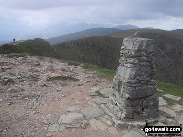
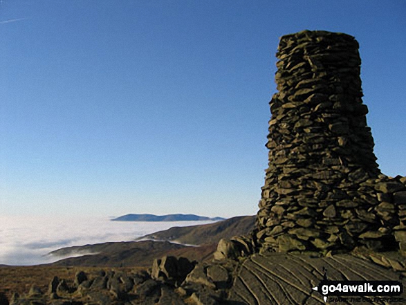

 The view from Scafell Pike, the highest point in England


